|
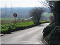
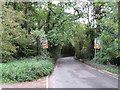
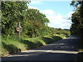
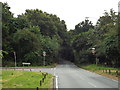
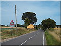
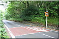
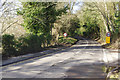
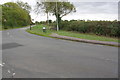
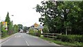
Dux Court Road, High Halstow
by Malc McDonald
geograph for square TQ7775
Dux Court Road, heading downhill out of the village of High Halstow. The speed... (more)
|
|
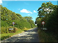
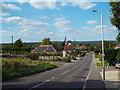
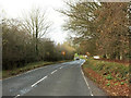
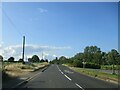
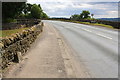
Rural road at Mawsley, Northamptonshire
by Malc McDonald
geograph for square SP8075
A rural road passing through Mawsley, in Northamptonshire.
|
|
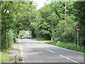
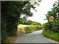
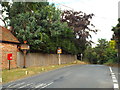
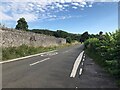
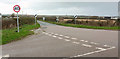
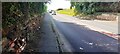
Abridge Road, near Abridge
by Malc McDonald
geograph for square TQ4596
Abridge Road forms part of the A113. Here, the speed limit changes to 40mph.
|
|
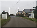
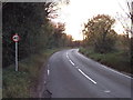
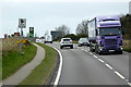
Farnham Road, near Bishop's Stortford
by Malc McDonald
geograph for square TL4823
Farnham Road is a minor road heading through Hertfordshire countryside towards... (more)
|
|
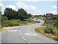
Layhams Road, near West Wickham
by Malc McDonald
geograph for square TQ3964
Layhams Road heading out of the built-up area of south east London. The road is... (more)
|
|
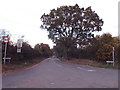
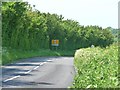
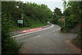
North End Lane, Downe
by Malc McDonald
geograph for square TQ4362
North End Lane, heading out of the village of Downe.
The signs show that the... (more)
|
|
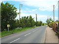
Lower Dunton Road, near Laindon
by Malc McDonald
geograph for square TQ6588
Signs indicate that a speed limit of 40mph applies to this road.
|
|
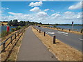
Causeway across Pitsford Water, Northamptonshire
by Malc McDonald
geograph for square SP7870
Pitsford Water is a reservoir in Northamptonshire. Brixworth Road crosses... (more)
|
|
Featherbed Lane, Addington
by Malc McDonald
geograph for square TQ3762
Here the speed limit changes from 30mph to 40mph as the road heads out of the... (more)
|
|
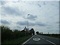
Crockenhill Road, Kevington, near Orpington
by Malc McDonald
geograph for square TQ4867
Crockenhill Road passing through the hamlet of Kevington, near Orpington. Some... (more)
|
|
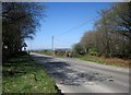
Crowborough Road, near Nutley
by Malc McDonald
geograph for square TQ4528
Crowborough Road near Nutley, in Ashdown Forest. The sign indicates a 40mph speed limit.
|
|
Dennises Lane, near South Ockendon
by Malc McDonald
geograph for square TQ5784
Dennises Lane is a country road on the eastern fringe of Greater London. A... (more)
|
|
Five Elms Road, Hayes Common
by Malc McDonald
geograph for square TQ4065
Five Elms Road on Hayes Common
|
|
The B6001
by David Lally
geograph for square SK2271
Between Bakewell and Calver. Here a 40 mph speed limit for the village of Hassop starts.
|
|
Stubbers Lane, near Upminster
by Malc McDonald
geograph for square TQ5783
Stubbers Lane, on the eastern fringe of Greater London.
This image was taken... (more)
|
|
Clay Tye Road, near North Ockendon
by Malc McDonald
geograph for square TQ5985
Clay Tye Road, looking north.
Despite the rural nature of this scene, it is... (more)
|
|
Chapel Road, Beaumont
by Malc McDonald
geograph for square TM1625
Chapel Road is a minor road passing scattered houses at Beaumont.
|
|
B4030 Bicester Road, Enstone
by Malc McDonald
geograph for square SP3825
A view of the B4030 leaving the village of Enstone in North Oxfordshire. The... (more)
|
|
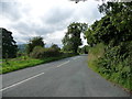
Ranmore Road
by Hugh Craddock
geograph for square TQ1650
Ranmore Road, leading from Dorking up to Ranmore Common. Footpath 68 Dorking,... (more)
|
|
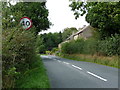
Baulk Lane, Berkswell
by Stephen McKay
geograph for square SP2477
The 40mph restriction sign may be a legal requirement, but it seems faintly... (more)
|
|
A6033 north heading towards Pecket Well
by Luke Shaw
geograph for square SD9928
|
|
Junction west of Padstow
by Derek Harper
geograph for square SW9074
The B3276 heads north from the junction with the A389 and Green Lane (left -... (more)
|
|
The road down into Morestead
by Christine Johnstone
geograph for square SU5125
Looking west.
|
|
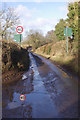
Speed limit, Low Lane, Wensley
by Christine Johnstone
geograph for square SE0989
Entering the village from the east.
|
|
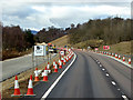
Road Improvement Work on the A9
by David Dixon
geograph for square NH8104
Ongoing work to convert this section of the A9 into dual carriageway.
|
|
Roadworks on the A9 at Dalraddy
by David Dixon
geograph for square NH8509
Work to convert the section of the A9 between Kincraig and Dalraddy into dual carriageway.
|
|
Cawston Lane, Dunchurch
by Stephen McKay
for square SP4872
Looking along Cawston Lane where it leaves the built-up area of Dunchurch and... (more)
|
|
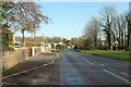
Houses on the north side of Low Lane, Wensley
by Christine Johnstone
geograph for square SE0989
At the eastern edge of the village.
|
|
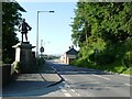
David Davies' statue, Llandinam
by Christine Johnstone
geograph for square SO0288
A local lad who went on develop railways, collieries and the docks at Barry, as... (more)
|
|
Leaving St Brides Major
by Stephen McKay
geograph for square SS8975
A cattle grid marks the exit from the village and an increase in the speed limit... (more)
|
|
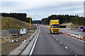
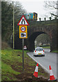
Temporary Speed Limit on the A9
by David Dixon
geograph for square NH8609
Approaching the roadworks to convert this section of the A9 into dual carriageway.
|
|
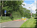
Junction of Throstle Nest View with New Road Side
by Roger Templeman
geograph for square SE2437
|
|
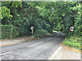
Ranmore Road, Dorking
by Stephen McKay
geograph for square TQ1650
Ranmore Road leaves the urban area with the 30mph speed limit raised to 40. The... (more)
|
|
A69 heading west in Warwick-on-Eden
by Luke Shaw
geograph for square NY4656
|
|
Bath Road passing Tracy Park
by Derek Harper
geograph for square ST7172
A 40mph zone coming up as the road approaches a succession of houses on the run... (more)
|

|
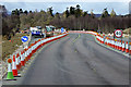
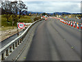
Upgrading the A9 (April 2017)
by David Dixon
geograph for square NH8204
Ongoing work to convert this section of the A9 into dual carriageway.
|
|
A9 Road Improvements near Kincraig
by David Dixon
geograph for square NH8205
Ongoing work to convert the section of the A9 between Kincraig and Dalraddy into... (more)
|
|
Dualling the A9
by David Dixon
geograph for square NH8306
Ongoing work to convert the section of the A9 between Kincraig and Dalraddy into... (more)
|
|
Scania G440 near Nairn
by David Dixon
geograph for square NH8956
Scania G440 (SK62 XWS) heading eastwards on the A96 out of Nairn.
|
|
Road at Hewas Water
by Derek Harper
geograph for square SW9649
And heading for Sticker. It is followed here by the parish boundary between St... (more)
|
|
Junction on the B3257
by Derek Harper
geograph for square SX3772
With a side road to Downgate on the right, the start of the Tamar Valley... (more)
|
|
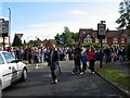
Next, the park
by E Gammie
geograph for square SP3176
Crowds dispersing at the junction of Woodside Avenue North with Kenpas Highway... (more)
|
|
Entering Parham on B1116
by Martin Dawes
geograph for square TM3059
Access to Garnetts Garden Centre is on the right
|
|
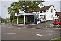
Approaching roadside cafe on A18
by Martin Dawes
geograph for square TA0510
|
|
A379 at Higher Commons
by Derek Harper
geograph for square SX9269
What must be the old road from Teignmouth to Torquay meets the current A379.
|
|
Seat at bend in Selby Lane opposite Willow Brook junction
by Roger Templeman
geograph for square SK6230
|
|
Ferry Lane, Pembroke Dock
by Stephen McKay
geograph for square SM9703
A Pembroke Dock - Swansea train has just started on its 2hour 10 minute journey,... (more)
|
|
A684 entering Harmby from Leyburn
by Roger Templeman
geograph for square SE1289
|
|
Hathern Car & Van Sales, Derby Road at Wide Lane junction
by Roger Templeman
geograph for square SK4922
|
|
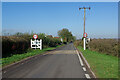
Entry to Errol Station hamlet from the south
by Stanley Howe
geograph for square NO2524
Access to Greycroft on the right.
|