About tags on Geograph

Public Tags

Related Tags | Coverage Map
Tag:  A113  
Other tags: near:A113    

Showing images tagged with A113 tag.

View all tagged images - In Browser
:

TQ4494 : A113 near Chigwell by Malc McDonald A113 near Chigwell by Malc McDonald
geograph for square TQ4494
The A113 road approaching the junction with Chigwell Lane, near Chigwell.
Tags: road:A Road   A113   near:Chigwell   near:Debden   county:Essex   type:Geograph   near:Loughton   subject:Road Junction   Road Junction   top:Roads, Road Transport   Traffic Light Junction   Traffic Lights  
TQ4493 : High Road, Chigwell by Malc McDonald High Road, Chigwell by Malc McDonald
geograph for square TQ4493
High Road in Chigwell forms part of the A113.
Tags: A113   place:Chigwell   county:Essex   type:Geograph   top:Roads, Road Transport   subject:Village   top:Village, Rural Settlement  
TQ5097 : M25 bridge over Romford Road, Passingford Bridge by Malc McDonald M25 bridge over Romford Road, Passingford Bridge by Malc McDonald
geograph for square TQ5097
A bridge carries the M25 motorway over the A113 at Passingford Bridge in Essex.
TQ5097 : Romford Road, Passingford Bridge by Malc McDonald Romford Road, Passingford Bridge by Malc McDonald
geograph for square TQ5097
Romford Road looking south east to the bridge carrying the M25 motorway over the... (more)
TQ5198 : London Road near Passingford Bridge by Malc McDonald London Road near Passingford Bridge by Malc McDonald
geograph for square TQ5198
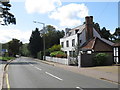
London Road forms part of the route of the A113 as it passes through Essex countryside.
Tags: road:A Road   A113   near:Chipping Ongar   Country Road   county:Essex   type:Geograph   near:Ongar   near:Passingford Bridge   subject:Road   top:Roads, Road Transport   Rural Road   near:Stanford Rivers  
TQ5399 : London Road near Stanford Rivers by Malc McDonald London Road near Stanford Rivers by Malc McDonald
geograph for square TQ5399
The A113 passing The Woodman pub in Essex countryside.
Tags: road:A Road   A113   near:Chipping Ongar   Country Pub   county:Essex   type:Geograph   near:Ongar   Pub Name Sign   subject:Road   top:Roads, Road Transport   near:Stanford Rivers  
TQ5399 : Former London Road, near Stanford Rivers by Malc McDonald Former London Road, near Stanford Rivers by Malc McDonald
geograph for square TQ5399
The road to the right of this image is the old alignment of London Road,... (more)
Tags: A113   near:Chipping Ongar   county:Essex   Former Main Road   type:Geograph   near:Ongar   subject:Road   top:Roads, Road Transport   near:Stanford Rivers  
TL5300 : New and old roads, Stanford Rivers, near Ongar by Malc McDonald New and old roads, Stanford Rivers, near Ongar by Malc McDonald
geograph for square TL5300
The old and new alignments of the A113 road just south of Stanford Rivers in... (more)
Tags: road:A Road   A113   near:Chipping Ongar   top:Derelict, Disused   Disused Road   Disused Road Alignment   county:Essex   type:Geograph   near:Ongar   subject:Road   top:Roads, Road Transport   near:Stanford Rivers  
TL5300 : London Road, Stanford Rivers, near Ongar by Malc McDonald London Road, Stanford Rivers, near Ongar by Malc McDonald
geograph for square TL5300
London Road forms part of the route of the A113 as it passes through Stanford... (more)
Tags: road:A Road   A113   near:Chipping Ongar   county:Essex   type:Geograph   near:Ongar   subject:Road   top:Roads, Road Transport   place:Stanford Rivers  
TL5400 : Romford Road, Stanford Rivers by Malc McDonald Romford Road, Stanford Rivers by Malc McDonald
geograph for square TL5400
Romford Road forms part of the route of the A113.
Tags: road:A Road   A113   near:Chipping Ongar   county:Essex   type:Geograph   near:Ongar   subject:Road   top:Roads, Road Transport   place:Stanford Rivers  
TL5400 : Romford Road at Stanford Rivers, near Ongar by Malc McDonald Romford Road at Stanford Rivers, near Ongar by Malc McDonald
geograph for square TL5400
Romford Road entering the small hamlet of Stanford Rivers, in Essex. The speed... (more)
TL5401 : Romford Road, near Ongar by Malc McDonald Romford Road, near Ongar by Malc McDonald
geograph for square TL5401
Romford Road forms part of the A113 road.
Tags: road:A Road   A113   near:Chipping Ongar   Country Road   county:Essex   type:Geograph   near:Ongar   subject:Road   top:Roads, Road Transport   Rural Road   near:Stanford Rivers   top:Village, Rural Settlement  
TL5501 : Stanford Rivers Road, approaching Ongar by Malc McDonald Stanford Rivers Road, approaching Ongar by Malc McDonald
geograph for square TL5501
Stanford Rivers Road approaching the town of Ongar in Essex. The speed limit is... (more)
TQ4696 : London Road, Abridge by Malc McDonald London Road, Abridge by Malc McDonald
geograph for square TQ4696
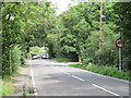
London Road, passing through the Essex village of Abridge, forms part of the A113.
Tags: road:A Road   A113   place:Abridge   near:Chigwell   county:Essex   type:Geograph   near:Loughton   subject:Village   top:Village, Rural Settlement  
TQ4696 : London Road, near Abridge by Malc McDonald London Road, near Abridge by Malc McDonald
geograph for square TQ4696
London Road, approaching the village of Abridge, forms part of the A113. The... (more)
TQ4596 : Abridge Road, near Abridge by Malc McDonald Abridge Road, near Abridge by Malc McDonald
geograph for square TQ4596
Abridge Road forms part of the A113. Here, the speed limit changes to 40mph.
TQ4495 : Abridge Road near Chigwell by Malc McDonald Abridge Road near Chigwell by Malc McDonald
geograph for square TQ4495
Abridge Road forms part of the A113. The sign indicates that a 40mph speed... (more)
Tags: 40mph   40mph Speed Limit Sign   road:A Road   A113   near:Chigwell   near:Debden   county:Essex   type:Geograph   near:Loughton   subject:Road   top:Roads, Road Transport   Rural Road   Speed Limit 40mph  
TQ4493 : St. Mary's Church and war memorial, Chigwell by Malc McDonald St. Mary's Church and war memorial, Chigwell by Malc McDonald
geograph for square TQ4493
St. Mary's Church in Chigwell, with a war memorial in the foreground.... (more)
Tags: A113   place:Chigwell   Church   subject:Church   Church with Spire   county:Essex   type:Geograph   top:Religious Sites   memorial:War Memorial   War Memorial  
TQ4393 : Shopping parade, Chigwell by Malc McDonald Shopping parade, Chigwell by Malc McDonald
geograph for square TQ4393
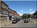
A parade of shops in Chigwell, in Essex. The village sign is visible to the... (more)
Tags: A113   top:Business, Retail, Services   place:Chigwell   county:Essex   type:Geograph   Parade of Shops   subject:Shop   building type:Shopping Parade   Shopping Parade   top:Village, Rural Settlement  
TQ4392 : High Road, Chigwell by Malc McDonald High Road, Chigwell by Malc McDonald
geograph for square TQ4392
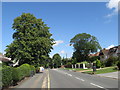
High Road, Chigwell, forms part of the A113.
Tags: road:A Road   A113   place:Chigwell   county:Essex   type:Geograph   Residential Area   subject:Suburb   top:Suburb, Urban Fringe   near:Woodford  
TQ4392 : High Road, Chigwell by Malc McDonald High Road, Chigwell by Malc McDonald
geograph for square TQ4392
High Road in Chigwell forms part of the A113.
Tags: road:A Road   A113   place:Chigwell   county:Essex   type:Geograph   subject:Road   top:Roads, Road Transport   near:Woodford  
TQ4292 : County boundary at Woodford Bridge by Malc McDonald County boundary at Woodford Bridge by Malc McDonald
geograph for square TQ4292
A sign denotes the boundary between the counties of Greater London and Essex, at... (more)
Tags: A113   subject:Boundary   top:Boundary, Barrier   County Boundary   County Boundary Sign   county:Essex   type:Geograph   place:North East London   Suburban Road   place:Woodford   place:Woodford Bridge  
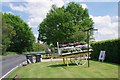
TQ4797 : Flower Cart at Oak Farm by Glyn Baker Flower Cart at Oak Farm by Glyn Baker
geograph for square TQ4797
Potted plants by the A113
TQ4493 : Chigwell: The former King's Head public house now Sheesh (2) by Nigel Cox Chigwell: The former King's Head public house now Sheesh (2) by Nigel Cox
geograph for square TQ4493
Please see TQ4493 : Chigwell: The former King's Head public house now Sheesh (1) for a description. This is the view along the A113... (more)
TL5300 : London Road, Stanford Rivers by Malc McDonald London Road, Stanford Rivers by Malc McDonald
geograph for square TL5300
London Road, part of the route of the A113, approaching Stanford Rivers in... (more)
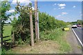
TQ4797 : Footpath PROW 194_1 by Glyn Baker Footpath PROW 194_1 by Glyn Baker
geograph for square TQ4797
The path runs for 325m to the junction with PROW 194_19 on the south bank of the... (more)
Tags: A113   Fingerpost   type:Geograph   top:Paths   Public Footpath   top:Roads, Road Transport   Stile  
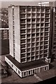
TQ4191 : Flats in Coopersale Close by Geographer Flats in Coopersale Close by Geographer
geograph for square TQ4191
Category: Flats
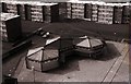
TQ4191 : Shops below flats by Geographer Shops below flats by Geographer
geograph for square TQ4191
Category: Shops
Taken from a flat in Coopersale Close
View more in the Image Search or in Browser
View images matching 'A113' anywhere in the tags
Don't click these: PotMel 1 PotMel 2