Geograph - photograph every grid square
About tags on Geograph
Tags
Geographical Context
Subjects
Types
Other Prefixes
Public Tags
Related Tags
|
Coverage Map
Tag:
A14·Bridge
Showing images tagged with
A14 Bridge
tag.
View all tagged images
-
In Browser
Search within these images
:
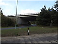
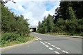
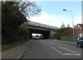
A14 bridge near Kelmarsh
by
Malc McDonald
geograph for square
SP7579
This bridge carries the trunk A14 road across the Brampton Valley Way near... (
more
)
Tags:
A14
road:
A14
A14 Bridge
Brampton Valley Way
subject:
Bridge
type:
Geograph
near:
Kelmarsh
National Cycle Network
National Cycle Network Route 6
National Cycle Route
NCN6
county:
Northamptonshire
top:
Paths
Road Bridge Over Cyclepath
bridge:
Road Over Cycle Route
top:
Roads, Road Transport
A14 Bridge Number
by
Geographer
for square
TM0856
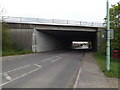
On Fen Lane Bridge No.17260
Tags:
A14
A14 Bridge
A14 Bridge Number
Bridge
at:
Creeting St Mary
on:
Fen Lane
bucket:
Informative
top:
Roads, Road Transport
subject:
Sign
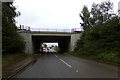
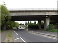
The A14 Bury Road near Rougham
by
Geographer
geograph for square
TL9163
Looking towards Stowmarket
Tags:
A Road (Classified A)
A14 Bridge
A14 Bury Road
A14 Eastbound
near:
Blackthorpe
Bridge
Bury Road
type:
Geograph
off:
New Road
subject:
Road
top:
Roads, Road Transport
at:
Rougham
looking towards:
Stowmarket
over:
The A14
top:
Village, Rural Settlement
A14 Bridge
by
Geographer
geograph for square
TL8663
At junction 44 Bury St.Edmunds East
Tags:
A14
A14 Bridge
Bridge
subject:
Bridge
at:
Bury St.Edmunds
Bury St.Edmunds East
Junction 44
top:
Roads, Road Transport
New Road, Rougham
by
Geographer
geograph for square
TL9163
Over the A14 looking towards Bury Road
Tags:
A14
A14 Bridge
near:
Blackthorpe
Blackthorpe
Bridge
looking towards:
Bury Road
Bury Road
type:
Geograph
New Road
New Road Bridge
subject:
Road
top:
Roads, Road Transport
Rougham
at:
Rougham
over:
The A14
top:
Village, Rural Settlement
The A14 Bury Road near Rougham
by
Geographer
geograph for square
TL9163
Looking towards Bury St.Edmunds off New Road
Tags:
A Road (Classified A)
A14
A14 Bridge
A14 Bury Road
A14 Trunk Road
A14 Westbound
near:
Blackthorpe
Bury Road
looking towards:
Bury St.Edmunds
type:
Geograph
off:
New Road
New Road
subject:
Road
top:
Roads, Road Transport
at:
Rougham
Trunk Road
top:
Village, Rural Settlement
Fen Lane & A14 Bridge
by
Geographer
geograph for square
TM0856
Bridge No.17260
Tags:
A14
A14 Bridge
subject:
Bridge
Bridge
at:
Creeting St Mary
Fen Lane
top:
Roads, Road Transport
New Road, Rougham
by
Geographer
geograph for square
TL9163
Over the A14
Tags:
A14
A14 Bridge
near:
Blackthorpe
subject:
Bridge
type:
Geograph
New Road
top:
Roads, Road Transport
at:
Rougham
over:
The A14
top:
Village, Rural Settlement
Blackthorpe Road, Rougham Heath
by
Geographer
geograph for square
TL8963
At the junction with the A14 slip road
Tags:
A14
A14 Bridge
A14 Slip Road Junction
Blackthorpe
near:
Blackthorpe
Blackthorpe Road
type:
Geograph
subject:
Road Junction
Road Junction
top:
Roads, Road Transport
Rougham Heath
at:
Rougham Heath
Slip Road
Slip Road Junction
in:
Suffolk
Suffolk
at:
The A14 Slip Road Junction
at:
The Junction with the A14 Slip Road
top:
Village, Rural Settlement
Fen Lane & A14 Bridge
by
Geographer
geograph for square
TM0856
Bridge No.17260
Tags:
A14
A14 Bridge
Bridge
at:
Creeting St Mary
Fen Lane
subject:
Lane
top:
Roads, Road Transport
Blackthorpe Road, Rougham Heath
by
Geographer
geograph for square
TL8963
At the A14 Bridge near Rookery Crossroads junction
Tags:
A14 Bridge
Blackthorpe Road
type:
Geograph
Junction No.45
top:
Roads, Road Transport
near:
Rookery Crossroads Junction
Rookery Crossroads Junction
Rougham Heath
at:
Rougham Heath
at:
The A14 Bridge
top:
Village, Rural Settlement
Gipping Road & A14 Bridge
by
Geographer
geograph for square
TM1250
Tags:
A14
A14 Bridge
Bridge
at:
Claydon
type:
Geograph
Gipping Road
subject:
Road
top:
Roads, Road Transport
top:
Village, Rural Settlement
Station Road & A14 Bridge
by
Geographer
geograph for square
TM1250
Tags:
A14
A14 Bridge
Bridge
at:
Claydon
type:
Geograph
subject:
Road
top:
Roads, Road Transport
Station Road
A14 Bridge
by
Geographer
geograph for square
TM2041
Taken from Nacton Road (Close up)
Tags:
A14
A14 Bridge
Bridge
at:
Nacton
taken from:
Nacton Road
Road Junction
subject:
Road Junction
top:
Roads, Road Transport
Roundabout
New Road, Rougham
by
Geographer
geograph for square
TL9163
Over the A14
Tags:
A14
A14 Bridge
near:
Blackthorpe
Bridge
type:
Geograph
New Road
subject:
Road
top:
Roads, Road Transport
at:
Rougham
top:
Village, Rural Settlement
Haughley Road & Haughley Road Bridge
by
Geographer
geograph for square
TM0261
Tags:
A14
A14 Bridge
subject:
Bridge
at:
Haughley
Haughley Road
Haughley Road Bridge
at:
Quarries Cross
top:
Roads, Road Transport
Haughley Road, Haughley
by
Geographer
geograph for square
TM0261
Looking towards Harleston Road Bridge at the junction with the Picnic Area
Tags:
A14
A14 Bridge
looking towards:
Harleston Road Bridge
Harleston Road Bridge
at:
Haughley
Haughley Road
Picnic Area
subject:
Road Junction
top:
Roads, Road Transport
Haughley Road, Haughley
by
Geographer
geograph for square
TM0261
Near Harleston Road Bridge
Tags:
A14
A14 Bridge
at:
Haughley
near:
Haughley Road
Haughley Road Bridge
at:
Quarries Cross
subject:
Road
top:
Roads, Road Transport
A1308 Tot Hill & A14 bridge
by
Geographer
geograph for square
TM0459
Tags:
A Road (Classified A)
A1308
A1308 Tot Hill
A14 Bridge
Bridge
type:
Geograph
at:
Haughley
subject:
Road
top:
Roads, Road Transport
Tot Hill
top:
Village, Rural Settlement
Nacton Road, Nacton
by
Geographer
geograph for square
TM2041
At the junction with the A14
Tags:
A14
A14 Bridge
at:
Nacton
Nacton Road
subject:
Road Junction
top:
Roads, Road Transport
Roundabout
Back where we belong
by
Rose and Trev Clough
geograph for square
TL4861
Posh graffiti - something to do with rowing. It has since been repainted (see... (
more
)
Tags:
A14 Bridge
China Shipping Container
Container Lorries
Graffiti
River Cam
top:
Rivers, Streams, Drainage
top:
Roads, Road Transport
View more in the Image Search
or
in Browser
View images matching 'A14 Bridge' anywhere
in
the tags
Don't click these:
PotMel 1
PotMel 2
☰
Home
View
Search
Marked Images
Maps
Browser
Explore
Showcase
New Images
Collections
Interact
Games
Discussions
Blog
Contributors
Submit
Statistics
Leaderboards
General
FAQ
Help Pages
Sitemap
Contact Us
Support Us
sponsored by
🔍︎
What to search:
Photos
Enter keywords or a location/postcode to search nearby images
Enter a Grid Reference
Placenames
Collections
Website Pages
Everything
Others:
Advanced Search
|
Image Browser
Or:
Coverage Map
|
Searchable Map
You are not logged in
|
login
|
register