Geograph - photograph every grid square
About tags on Geograph
Tags
Geographical Context
Subjects
Types
Other Prefixes
Public Tags
Related Tags
|
Coverage Map
Tag:
A417·Ledbury·-·Gloucester·Road
Showing images tagged with
A417 Ledbury - Gloucester Road
tag.
View all tagged images
-
In Browser
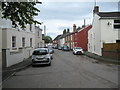
Westend Parade - Gloucester, Gloucestershire
by
Martin Richard Phelan
geograph for square
SO8219
Here on the right bank of the River Severn, on the other side of the river from... (
more
)
Tags:
A417 Ledbury - Gloucester Road
place:
Alney Terrace
top:
Flat Landscapes
Flood Risk Area
type:
Geograph
place:
Gloucester
Gloucestershire
top:
Housing, Dwellings
Nottingham - Cardiff Railway Line
River Severn
top:
Roads, Road Transport
place:
Showmans Winter Quarters
subject:
Street
top:
Suburb, Urban Fringe
Telfords Over Bridge
place:
Westend Parade
place:
Westend Terrace
Once here was a bridge - Gloucester, Gloucestershire
by
Martin Richard Phelan
geograph for square
SO8119
This is the point at which the former main road into Gloucester from the west... (
more
)
Tags:
A417 Ledbury - Gloucester Road
top:
Boundary, Barrier
type:
Geograph
type:
Geograph
place:
Gloucester
area:
Gloucestershire
top:
Grassland
top:
Lowlands
Nottingham - Cardiff Railway Line
place:
Over
top:
Railways
River Severn
top:
Roads, Road Transport
top:
Suburb, Urban Fringe
Telfords Over Bridge
subject:
View
Alney Island options - Gloucester, Gloucestershire
by
Martin Richard Phelan
geograph for square
SO8219
Here you have just crossed Westgate Bridge, between the dual carriageway of the... (
more
)
Tags:
A417 Ledbury - Gloucester Road
place:
Alney Island
place:
Chepstow
type:
Geograph
place:
Gloucester
place:
Gloucester Docks
area:
Gloucestershire
Gloucestershire Way
Herefordshire and Gloucestershire Canal Trust
place:
Lower Parting
top:
Lowlands
place:
Maisemore
top:
Paths
River Severn
area:
Severn Vale
subject:
Signpost
top:
Suburb, Urban Fringe
place:
Tewkesbury
place:
The Wharf House
Westgate Bridge
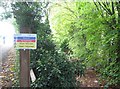
Alney Island warning - Gloucester, Gloucestershire
by
Martin Richard Phelan
geograph for square
SO8219
This notice standing beside the A417 at Over Causeway, near the junction of... (
more
)
Tags:
A417 Ledbury - Gloucester Road
place:
Alney Island
Alney Island Flood Alleviation Scheme
Environment Agency
Flooding
type:
Geograph
place:
Gloucester
area:
Gloucestershire
top:
Lowlands
subject:
Notice
place:
Over Causeway
River Severn
area:
Severn Vale
top:
Suburb, Urban Fringe
top:
Water Resources
place:
Westend Parade
place:
Westend Terrace
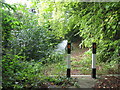
Alney Island hazard - Gloucester, Gloucestershire
by
Martin Richard Phelan
geograph for square
SO8219
Very definitely there is no way through here. Time photo taken 4.03 pm BST... (
more
)
Tags:
A417 Ledbury - Gloucester Road
place:
Alney Island
Alney Island Flood Alleviation Scheme
Environment Agency
subject:
Flood Defences
Flooding
type:
Geograph
place:
Gloucester
area:
Gloucestershire
top:
Lowlands
place:
Over Causeway
River Severn
area:
Severn Vale
top:
Suburb, Urban Fringe
top:
Water Resources
place:
Westend Parade
place:
Westend Terrace
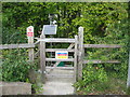
Alney Island telltale - Gloucester, Gloucestershire
by
Martin Richard Phelan
geograph for square
SO8219
A view of the equipment sited here for the Environment Agency's Alney... (
more
)
Tags:
A417 Ledbury - Gloucester Road
place:
Alney Island
Alney Island Flood Alleviation Scheme
Environment Agency
subject:
Flood Defences
Flooding
type:
Geograph
place:
Gloucester
area:
Gloucestershire
top:
Lowlands
place:
Over Causeway
River Severn
area:
Severn Vale
top:
Suburb, Urban Fringe
top:
Water Resources
place:
Westend Parade
place:
Westend Terrace
View more in the Image Search
or
in Browser
View images matching 'A417 Ledbury - Gloucester Road' anywhere
in
the tags
Don't click these:
PotMel 1
PotMel 2
☰
Home
View
Search
Marked Images
Maps
Browser
Explore
Showcase
New Images
Collections
Interact
Games
Discussions
Blog
Contributors
Submit
Statistics
Leaderboards
General
FAQ
Help Pages
Sitemap
Contact Us
Support Us
sponsored by
🔍︎
What to search:
Photos
Enter keywords or a location/postcode to search nearby images
Enter a Grid Reference
Placenames
Collections
Website Pages
Everything
Others:
Advanced Search
|
Image Browser
Or:
Coverage Map
|
Searchable Map
You are not logged in
|
login
|
register