Public Tags
Tag: A698
Showing images tagged with A698 tag.

|
Approaching West Longridge on the A698
by Barbara Carr geograph for square NT9549 The A698 is a fast and quite busy road, not good for walkers - for safety much... (more)
|

|
The SW end of Coldstream High Street (A698)
by Stanley Howe geograph for square NT8439 Below the Castle Hotel (first right). Where the road crosses Leet Water ahead,... (more)
|

|
The A698 southwest of Donaldson's Lodge
by Barbara Carr geograph for square NT8641 The A698 sweeps down over the bridge across the Oxendean Burn, to the far side... (more)
|

|
Layby on the A698
by Barbara Carr geograph for square NT9145 Looking southwest toward the road-junction to Norham.
|

|
Crailing Tofts
by Richard Webb geograph for square NT6925 A698 between Kelso and Hawick.
|

|
Footpath by the A698
by Barbara Carr geograph for square NT9650 Northeast of Longridge Towers, there is a footpath all the way to East Ord... (more)
|

|
Verging towards Velvet Hall
by Barbara Carr geograph for square NT9448 There is actually a tarmac path alongside the A698 beneath all the grass!... (more)
|

|
Newcastle Arms Hotel, Coldstream
by Stanley Howe geograph for square NT8439 At the junction of Market Street with High Street (A698).
|

|
Coldstream Parish Church
by Stanley Howe geograph for square NT8439 In High Street (A698).
|

|
Approach to junction of A6112 with A698 in Coldstream
by Stanley Howe geograph for square NT8440 |

|
Electric Blue
by Stanley Howe geograph for square NT8440 The spruce-looking Police Station in Coldstream High Street; at the junction of... (more)
Tags:
A698
top:City, Town Centre
place:Coldstream
Junction of A Roads
Police Station
top:Roads, Road Transport
|

|
Nun's Walk, Coldstream
by Stanley Howe for square NT8440 An information board on the wooden shelter at the entrance to Nun's Walk.... (more)
|

|
Northern end of Nun's Walk, Coldstream
by Stanley Howe geograph for square NT8440 By A698.
|

|
Upstream Leet Water
by Stanley Howe geograph for square NT8439 Looking from the Duke Street Bridge towards the A698 Road Bridge.
|

|
Upstream Leet Water
by Stanley Howe geograph for square NT8339 From the A698 road bridge in Coldstream.
|

|
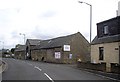
Bridgend Cottage, Coldstream
by Stanley Howe geograph for square NT8439 #2 High Street (A698).
|
|
A disused building on the A698 in Birgham
by Stanley Howe geograph for square NT7939 Lots of Danger-Keep Out notices; but no indication of what its former use might... (more)
|

|
Old pub; new name
by Stanley Howe geograph for square NT7939 Fisherman's Arms, Birgham; once called The Treaty NT7939 : The Treaty, Birgham. Still on... (more)
|

|
A road junction in Birgham
by Stanley Howe geograph for square NT7839 Where the minor road from Eccles joins the A698, from Coldstream (L) to Kelso (R).
|

|
Agricultural Machinery Dealers. Cornhill roundabout
by Martin Dawes geograph for square NT8639 The road to the left is the A698 to Berwick
Tags:
road:A698
Agricultural Machinery Dealership
top:Business, Retail, Services
type:Geograph
top:Lowlands
top:Roads, Road Transport
Roundabout Junction
top:Suburb, Urban Fringe
|

|
A698 toward Beacon Ridge junction
by Martin Dawes geograph for square NT8139 The bulk of Dundock Wood over to the left
Tags:
A698
type:Geograph
Hedgerow and Grass Verge
top:Lowlands
Metal Field Gate
top:Roads, Road Transport
Wood
top:Woodland, Forest
|

|
Exiting Birgham on A698 toward Coldstream
by Martin Dawes geograph for square NT7939 Tags:
A698
type:Geograph
top:Lowlands
top:Roads, Road Transport
Stone Walls
top:Village, Rural Settlement
top:Woodland, Forest
|

|
Entering Birgham on the A698 toward Coldstream
by Martin Dawes geograph for square NT7838 Tags:
A698
type:Geograph
Hedgerow and Grass Verge
top:Housing, Dwellings
top:Lowlands
top:Roads, Road Transport
Village Name Road Sign
top:Village, Rural Settlement
Wood
top:Woodland, Forest
|

|
Minor road junction to Lochton from A698
by Martin Dawes geograph for square NT7738 Tags:
A698
type:Geograph
top:Grassland
Hedgerow and Grass Verge
Junction of A-Road and Minor Road
top:Lowlands
top:Roads, Road Transport
top:Woodland, Forest
|

|
Lodge house for Eden Hall on A698
by Martin Dawes geograph for square NT7637 The estate road goes this side of the lodge
|
|
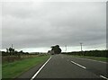
A698 toward Birgham at Highridgehall junction
by Martin Dawes geograph for square NT7637 Turn left for barn, holiday cottages or B & B. The River Tweed is one field... (more)
|

|
Hendersyde Park East Lodge entrance on A698
by Martin Dawes geograph for square NT7536 The East Lodge was built c1840 using stone from the Hendersyde quarry
Tags:
A698
top:Country Estates
Estate Boundary Wall
type:Geograph
top:Housing, Dwellings
Lodge House and Gateway
top:Lowlands
top:Roads, Road Transport
top:Woodland, Forest
|
|
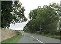
Minor road junction on A698 east of Kelso
by Martin Dawes geograph for square NT7536 The stone wall to the left is the Hendersyde Park Estate. The minor road goes up... (more)
|

|
Entering Coldstream from the west on the A698
by Martin Dawes geograph for square NT8339 Coldstream caravan park on the right
Tags:
road:A698
top:Business, Retail, Services
Caravan Park
type:Geograph
Hedgerows & Grass Verges
top:Lowlands
Pavement
top:Roads, Road Transport
top:Suburb, Urban Fringe
Town Name Roadsign
|

|
Walking the edge of the A698 on Borders Abbeys Way
by Martin Dawes geograph for square NT6624 Just a few yards then cross over to take the minor road on the left
Tags:
A698
long distance path:Borders Abbeys Way
type:Geograph
top:Lowlands
top:Paths
top:Roads, Road Transport
top:Woodland, Forest
|

|
Track out of wood onto A698 near Jedfoot Bridge
by Martin Dawes geograph for square NT6624 Tags:
A698
long distance path:Borders Abbeys Way
Finger Post
type:Geograph
top:Lowlands
top:Paths
Road and Track Junction
top:Roads, Road Transport
top:Woodland, Forest
|
|
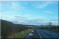
The A698 towards Berwick
by David Chatterton for square NT9751 A rather misty view eastwards downhill towards the A1 and Berwick in the distance.
Tags:
A1
road:A698
near:Berwick-Upon-Tweed
top:City, Town Centre
top:Lowlands
subject:Road
top:Roads, Road Transport
|

|
Tillmouth Park junction
by Barbara Carr geograph for square NT8842 A minor road from Crookham joins the A698 (along which the car is travelling) at... (more)
Tags:
road:A698
top:Business, Retail, Services
top:Housing, Dwellings
Junction of A-Road and Minor Road
top:Roads, Road Transport
hotel:Tillmouth Park
top:Village, Rural Settlement
|

|
The Connect Cafe, Coldstream
by Stanley Howe for square NT8439 An 'internet cafe' (for youths) in the Community Centre (a former... (more)
|

|
War Memorial, Coldstream
by Stanley Howe geograph for square NT8439 In the High Street, adjacent to the Community Centre.
|

|
Scotland Sign on Coldstream Bridge
by Geographer for square NT8440 Category: Signs |

|
England Sign on Coldstream Bridge
by Geographer for square NT8440 Category: Signs |
