Public Tags
Tag: Albion·Street
Showing images tagged with Albion Street tag.

|
Albion Street, Saxmundham
by Geographer geograph for square TM3863 Looking towards the Albion Street Level Crossing
Road No.U2526
Tags:
Albion Street
Level Crossing
subject:Road
top:Roads, Road Transport
at:Saxmundham
looking towards:The Albion Street Level Crossing
U Road (Classified U)
|

|
Albion Street Level Crossing Control Room
by Geographer geograph for square TM3863 Off Albion Street
Tags:
off:Albion Street
Albion Street Level Crossing Control Room
top:City, Town Centre
bucket:Closeup
Level Crossing Control Room
subject:Railway Infrastructure
top:Railways
at:Saxmundham
in:Suffolk
|
|
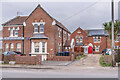
279 & 281 and 295 & 297 Albion Street
by Ian Capper geograph for square TQ2405 Nos 295 & 297 are part of a row of early 20th Century former coastguard... (more)
Tags:
road:Albion Street
Coastguard Cottages
type:Geograph
top:Housing, Dwellings
place:Southwick
top:Suburb, Urban Fringe
|
|
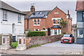
307 & 309 Albion Street
by Ian Capper geograph for square TQ2405 Part of a row of early 20th Century former coastguard cottages, now largely... (more)
Tags:
road:Albion Street
Coastguard Cottages
type:Geograph
top:Housing, Dwellings
place:Southwick
top:Suburb, Urban Fringe
|

|
Albion Street sign
by Geographer for square TM3863 On Albion Street at the junction with the B1119 Rendham Road
Road No.U2526
Tags:
on:Albion Street
B1119
B1119 Rendham Road
Road Junction
top:Roads, Road Transport
at:Saxmundham
subject:Sign
U Road (Classified U)
|

|
Albion Street Level Crossing, Saxmundham
by Geographer geograph for square TM3863 Category: Level crossing Taken from the Platform of Saxmundham Railway Station
Tags:
Albion Street
Albion Street Level Crossing
Platform
subject:Railway Level Crossing
Railway Station
top:Railways
top:Roads, Road Transport
at:Saxmundham
at:Saxmundham Railway Station
looking towards:The Level Crossing
|
|
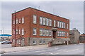
Albion Wharf
by Ian Capper for square TQ2404 Offices of aggregates group Dudman on Albion Street, alongside Shoreham Harbour.
Tags:
road:Albion Street
top:Business, Retail, Services
top:Coastal
type:Cross Grid
top:Docks, Harbours
business:Dudman
place:Shoreham Harbour
place:Southwick
|
|
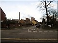
Heron Street, Rugeley
by Tricia Neal geograph for square SK0417 Taken outside a house called Heron's Nest, at the end of Albion Street.... (more)
|

|
Albion Street, Rugeley
by Tricia Neal geograph for square SK0417 On Christmas Eve, I expected the town to be full of last-minute shoppers, but... (more)
|

|
Shaldon Newsagents, Albion Street
by Robin Stott geograph for square SX9372 15 September 2011: The blue Western Morning News placard shouts "Dartington... (more)
Tags:
road:Albion Street
top:Business, Retail, Services
Newsagent
Parish Signboard
place:Shaldon
top:Village, Rural Settlement
|

|
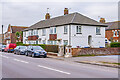
Ex Service & Social Club, Albion Street ,Saxmundham
by Geographer geograph for square TM3863 Category: Social clubs This is the former Baptist Chapel, and now serves as the Saxmundham Ex-Service... (more)
|
|
283 - 295 Albion Street
by Ian Capper geograph for square TQ2405 c.1920s maisonettes in front of a row of former coastguard cottages (seen... (more)
Tags:
road:Albion Street
type:Geograph
top:Housing, Dwellings
place:Southwick
top:Suburb, Urban Fringe
|

|
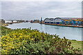
Shoreham Power Station
by Ian Capper for square TQ2404 Looking across Shoreham Harbour from Albion Street to Shoreham Power Station on... (more)
Tags:
road:Albion Street
top:Coastal
type:Cross Grid
top:Docks, Harbours
top:Energy Infrastructure
place:Fishersgate
place:Shoreham Harbour
building:Shoreham Power Station
place:Southwick
|
|
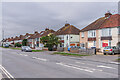
Along Shoreham Harbour
by Ian Capper geograph for square TQ2405 Looking along Shoreham Harbour from Albion Street with the warehouse of Barrett... (more)
Tags:
road:Albion Street
top:Coastal
top:Docks, Harbours
place:Fishersgate
type:Geograph
place:Shoreham Harbour
place:Southwick
|
|
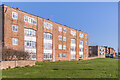
Seaview Estate
by Ian Capper geograph for square TQ2405 c.1920s housing on Albion Street.
Tags:
road:Albion Street
place:Fishersgate
type:Geograph
road:Seaview Estate
place:Southwick
top:Suburb, Urban Fringe
|
|
Coates Court
by Ian Capper geograph for square TQ2405 Housing on Butts Road, facing on to Albion Street, part of the redevelopment of... (more)
Tags:
road:Albion Street
road:Butts Road
building:Coates Court
type:Geograph
top:Housing, Dwellings
place:Southwick
top:Suburb, Urban Fringe
|

|
Terraced houses, Albion Street
by Robin Stott geograph for square SX9372 Looking north from the junction with School Lane.
Tags:
road:Albion Street
top:Coastal
road:School Lane
place:Shaldon
Terraced Houses
top:Village, Rural Settlement
|

|
Albion Street, Saxmundham
by Geographer geograph for square TM3863 At the junction with the B1119 Rendham Road
Road No.U2526
|

|
B1119 Rendham Road, Saxmundham
by Geographer geograph for square TM3863 At the junction with Albion Street
Tags:
Albion Street
B Road (Classified B)
B1119
B1119 Rendham Road
subject:Road Junction
top:Roads, Road Transport
at:Saxmundham
|

|
The Coopers Dip Public House & Albion Street
by Geographer geograph for square TM3863 Category: Public house |

|
The Coopers Dip Public House
by Geographer geograph for square TM3863 Category: Public house On Albion Street
Tags:
on:Albion Street
top:Business, Retail, Services
subject:Public House
at:Saxmundham
The Coopers Dip
The Coopers Dip Public House
|

|
Platform at Saxmundham Railway Station
by Geographer geograph for square TM3863 Category: Railway station platforms Looking towards the Level Crossing
Tags:
Albion Street
Platform
subject:Railway Station
Railway Station
top:Railways
at:Saxmundham
at:Saxmundham Railway Station
looking towards:The Level Crossing
|
