Public Tags
Tag: Ancient·Trackway
Showing latest 50 of 51 images tagged with Ancient Trackway tag.
|
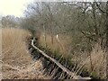
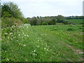
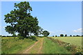
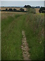
The Sweet Track recreation
by Neil Owen geograph for square ST4240 Ancient people lived in the marshy lands of central Somerset, and to navigate... (more)
Tags:
Ancient Trackway
top:Flat LandscapesX
type:GeographX
top:Historic Sites and ArtefactsX
top:Lakes, Wetland, BogX
Nature ReserveX
subject:TrackX
|
|
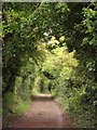
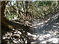
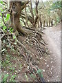
Ancient yews in Boxley Warren
by Marathon geograph for square TQ7660 Boxley Warren, on the slope of the North Downs, has internationally rare yew... (more)
|
|
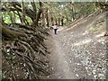
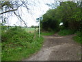
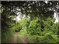
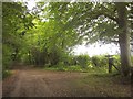
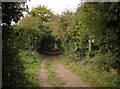
Kingsbridge Lane
by Marathon geograph for square TQ1421 Kingsbridge Lane is clearly an ancient trackway which leads from Countryman Lane... (more)
|
|
Kingsbridge Lane
by Marathon geograph for square TQ1421 Kingsbridge Lane is clearly an ancient trackway which leads from Countryman Lane... (more)
|
|
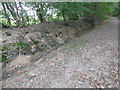
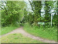
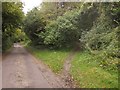
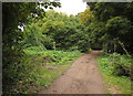
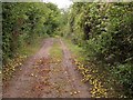
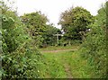
Bogey Lane
by Marathon geograph for square TQ4363 Bogey Lane is an ancient sunken trackway which is followed here by the London... (more)
|
|
The London LOOP leaving Farthing Street to follow Bogey Lane
by Marathon geograph for square TQ4262 Bogey Lane is an ancient sunken trackway which is followed here by the London... (more)
|
|
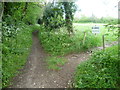
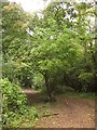
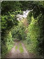
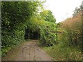
The entrance to Bogey Lane
by Marathon geograph for square TQ4262 Bogey Lane is an ancient sunken trackway which is followed here by the London... (more)
|
|
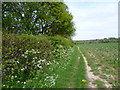
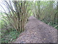
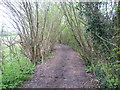
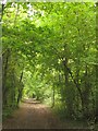
Path alongside Bogey Lane
by Marathon geograph for square TQ4363 Bogey Lane is an ancient sunken trackway which is followed here by the London... (more)
|
|
Path alongside Bogey Lane
by Marathon geograph for square TQ4363 Bogey Lane is an ancient sunken trackway which is followed here by the London... (more)
|
|
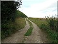
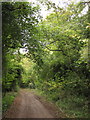
The view up Snag Lane
by Marathon geograph for square TQ4562 Snag Lane is an ancient trackway leading away from the busy A21 (Sevenoaks... (more)
Tags:
Ancient Trackway
top:PathsX
|
|
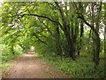
Snag Lane
by Marathon geograph for square TQ4562 Snag Lane is an ancient trackway leading away from the busy A21 (Sevenoaks... (more)
Tags:
Ancient Trackway
top:PathsX
|
|
Meare Heath track
by Neil Owen geograph for square ST4240 Among the discoveries in ancient Somerset's marshy past, the wooden... (more)
Tags:
Ancient Trackway
top:Flat LandscapesX
type:GeographX
top:Historic Sites and ArtefactsX
top:Lakes, Wetland, BogX
Nature ReserveX
subject:TrackX
|
|
Trackway off Dean Lane
by Anthony Vosper geograph for square SU0017 Crossing open chalk fields. There are many ancient earthworks and sites in this area.
Tags:
Ancient Trackway
type:GeographX
top:Historic Sites and ArtefactsX
top:PathsX
top:Roads, Road TransportX
|
|
The Chariot Mine and the Chariot Way
by Ian Calderwood geograph for square SK2555 The Chariot Mine was a lead mine which operated between about 1700 and 1900. The... (more)
Tags:
Ancient Trackway
name:Chariot MineX
name:Chariot WayX
type:GeographX
former:Lead MineX
subject:MineX
top:PathsX
name:PortwayX
top:Quarrying, MiningX
top:Roads, Road TransportX
|
|
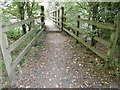
Footbridge over the River Adur
by Marathon geograph for square TQ1421 Kingsbridge Lane is an ancient trackway which leads from Countryman Lane to... (more)
Tags:
Ancient Trackway
FootbridgeX
top:Historic Sites and ArtefactsX
top:PathsX
top:Rivers, Streams, DrainageX
|
|
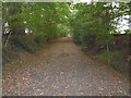
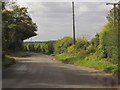
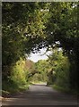
Harrow Way
by Derek Harper geograph for square SU4550 The lane follows the line of the ancient trackway across the downs. Just past... (more)
Tags:
Country RoadX
ancient trackway:Harrow WayX
tree:LarchX
top:LowlandsX
top:Roads, Road TransportX
Roadside HedgesX
Roadside TreesX
|
|
Harrow Way near Ash Bed Plantation
by Derek Harper geograph for square SU4849 The lane has been following the line of the Harrow Way, an ancient trackway, for... (more)
Tags:
ancient trackway:Harrow WayX
LaneX
top:LowlandsX
top:PathsX
top:Roads, Road TransportX
Route with Public AccessX
TreesX
top:Woodland, ForestX
|
|
Harrow Way
by Derek Harper geograph for square SU4950 Whitchurch BOAT 715 follows the ancient trackway through Harroway Belt, a strip... (more)
Tags:
Byway Open to All TrafficX
ancient trackway:Harrow WayX
top:LowlandsX
top:PathsX
TreesX
Woodland PathX
top:Woodland, ForestX
|
|
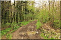
The Harrow Way
by Derek Harper geograph for square SU5051 The ancient trackway is following Overton BOAT 23 through a belt of trees about... (more)
Tags:
Byway Open to All TrafficX
ancient trackway:Harrow WayX
top:LowlandsX
top:PathsX
TreesX
top:Woodland, ForestX
|
|
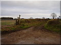
Harrow Way crosses Court Drove
by Derek Harper geograph for square SU5051 The ancient trackway, following Overton BOAT 23, crosses Court Drove, which is a... (more)
Tags:
Byway Open to All TrafficX
Footpath SignpostX
ancient trackway:Harrow WayX
top:LowlandsX
Other Route with Public AccessX
top:PathsX
TreesX
top:Woodland, ForestX
|
|
Harrow Way north of Overton
by Derek Harper geograph for square SU5252 The ancient trackway, followed by Overton BOAT 23, runs through an intermittent... (more)
|
|
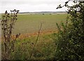
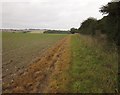
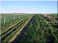
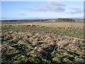
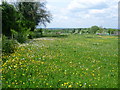
Field beside Harrow Way
by Derek Harper geograph for square SU5252 Looking out from the ancient trackway across arable lane towards dry valleys on the downs.
Tags:
Arable LandX
Dry ValleyX
top:Farm, Fishery, Market GardeningX
FieldX
ancient trackway:Harrow WayX
top:LowlandsX
|
|
Field beside Harrow Way
by Derek Harper geograph for square SU5252 The ancient trackway runs beside an expanse of arable land.
Tags:
Arable LandX
top:Farm, Fishery, Market GardeningX
FieldX
ancient trackway:Harrow WayX
top:LowlandsX
top:PathsX
|
|
Old yews in Boxley Warren
by Marathon geograph for square TQ7660 Boxley Warren, on the slope of the North Downs, has internationally rare yew... (more)
|
|
Twisted yew roots in Boxley Warren
by Marathon geograph for square TQ7660 Boxley Warren, on the slope of the North Downs, has internationally rare yew... (more)
|
|
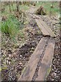
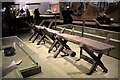
Oak causeway from the Somerset levels
by Bob Harvey for square TQ2981 Dendrochronolically dated to 3807-3806 BCE, these oak boards formed part of a... (more)
Tags:
date:3807BCEX
Ancient Trackway
subject:ArchaeologyX
type:Close LookX
top:Educational SitesX
type:InsideX
top:LowlandsX
period:NeolithicX
|
|
The Herepath, approaching the Ridgeway, near Avebury
by Vieve Forward geograph for square SU1270 The Herepath, also known as Green Street and now part of the Wessex Ridgeway... (more)
|
|
View north-west from the Herepath, near Avebury
by Vieve Forward geograph for square SU1170 The Herepath, also known as Green Street and now part of the Wessex Ridgeway... (more)
|
|
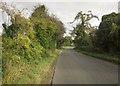
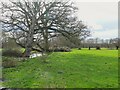
Winters mud
by Anthony Vosper geograph for square SY0884 Lea's Lane, near Otterton.
|
|
The old road to the Hog's Back
by Stephen Craven geograph for square SU9848 Category: Minor road The principal road over the Hog's Back nowadays in the A31 trunk road, but... (more)
|
|
Where ancient Somerset's people walked
by Neil Owen geograph for square ST4241 A few thousand years ago this area of Somerset comprised an extensive range of... (more)
Tags:
Ancient Trackway
top:Flat LandscapesX
type:GeographX
top:Lakes, Wetland, BogX
top:PathsX
Sweet TrackX
subject:TrackX
|
|
Harrow Way
by Derek Harper geograph for square SU4549 The road following the old trackway crosses Whitchurch bridleway 1b at this... (more)
Tags:
Country RoadX
ancient trackway:Harrow WayX
top:LowlandsX
top:Roads, Road TransportX
Roadside HedgesX
Telegraph PolesX
TreesX
|
|
Harrow Way
by Derek Harper geograph for square SU4850 The Harrow Way follows Whitchurch BOAT 715 towards Ash Bed Plantation. Taken... (more)
|
|
Apples on the Harrow Way
by Derek Harper geograph for square SU5151 Fallen apples on Overton BOAT 23 as it follows the old trackway west of the... (more)
|
|
Harrow Way north of Overton
by Derek Harper geograph for square SU5151 An intermittent tunnel of trees forms over the old trackway, here followed by... (more)
Tags:
Byway Open to All TrafficX
ancient trackway:Harrow WayX
top:Historic Sites and ArtefactsX
top:LowlandsX
top:PathsX
TrackX
TreesX
|
|
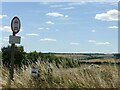
Ridgeway above Overton Hill
by Alan Murray-Rust geograph for square SU1168 The restrictive sign is a reminder that this ancient track is still open to all... (more)
Tags:
Ancient Trackway
Byway Open to All TrafficX
type:GeographX
top:PathsX
Road SignX
long distance path:The RidgewayX
|
|
Gun's Lane
by Rob Noble geograph for square TL4265 Gun's Lane is now a public bridleway and farm track, but historically was... (more)
Tags:
Ancient Trackway
BridlewayX
top:Farm, Fishery, Market GardeningX
top:Flat LandscapesX
top:Historic Sites and ArtefactsX
top:PathsX
top:People, EventsX
|
|
The Ridgeway near Nuffield, July 1979
by Jeff Buck geograph for square SU6788 After passing through the village of Nuffield the Ridgeway heads north towards... (more)
Tags:
Ancient Trackway
country:EnglandX
top:Farm, Fishery, Market GardeningX
FieldX
type:GeographX
top:LowlandsX
place:Near NuffieldX
county:OxfordshireX
top:PathsX
long distance path:The RidgewayX
The RidgewayX
|
|
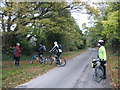
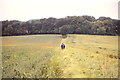
View from Grove Lane
by Marathon geograph for square TQ2860 Grove Lane is a bridleway connecting Coulsdon to Oaks Park. It is a very old... (more)
|
|
Mare Way through The Belts
by Rob Noble geograph for square TL3352 Mare Way is a prehistoric ridgeway route. The water retention of the compacted... (more)
Tags:
Ancient Trackway
Boulder ClayX
top:LowlandsX
top:PathsX
top:Sport, LeisureX
WoodlandX
top:Woodland, ForestX
|
|
On Peddars Way near Shernborne Covert
by Colin Park geograph for square TF7432 Tags:
Ancient Trackway
top:Farm, Fishery, Market GardeningX
top:Flat LandscapesX
top:Historic Sites and ArtefactsX
top:LowlandsX
|
|
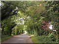
Harrow Way
by Derek Harper geograph for square SU4550 Another view along the stretch of road shown in SU4550 : Harrow Way, with trees... (more)
Tags:
Country RoadX
ancient trackway:Harrow WayX
top:LowlandsX
top:Roads, Road TransportX
Roadside TreesX
|
|
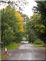
Harrow Way
by Derek Harper geograph for square SU4550 From the same spot as SU4550 : Field beside Harrow Way looking along the road in the opposite... (more)
Tags:
Country RoadX
ancient trackway:Harrow WayX
top:LowlandsX
top:Roads, Road TransportX
Roadside TreesX
|
|
Harroway
by Derek Harper geograph for square SU4650 The Harrow Way follows the lane west of the road from Whitchurch to Kingsclere.... (more)
Tags:
ancient trackway:Harrow WayX
LaneX
top:LowlandsX
top:Roads, Road TransportX
Traffic ConesX
TreesX
|
|
Byway junction on Harrow Way
by Derek Harper geograph for square SU4950 The Harrow Way (Whitchurch BOAT 715) runs through Harroway Belt past the... (more)
Tags:
Byway JunctionX
Byway Open to All TrafficX
ancient trackway:Harrow WayX
HedgeX
top:LowlandsX
top:PathsX
TreesX
Woodland PathX
top:Woodland, ForestX
|
|
Harrow Way crossing Jack Mills Lane
by Derek Harper geograph for square SU4950 Overton BOAT 23 follows the Harrow Way as it crosses a track named Jack Mills... (more)
Tags:
Byway Open to All TrafficX
Footpath SignpostX
ancient trackway:Harrow WayX
top:LowlandsX
top:PathsX
Track JunctionX
TreesX
top:Woodland, ForestX
|
|
Harrow Way near New Barn
by Derek Harper geograph for square SU4951 The way, following Overton BOAT 23, crosses the very southeast corner of the square.
Tags:
Byway Open to All TrafficX
ancient trackway:Harrow WayX
top:LowlandsX
top:PathsX
TreesX
top:Woodland, ForestX
|
|
Trees along Harrow Way
by Derek Harper geograph for square SU5051 Overton BOAT 23 close to the crossing of Overton footpath 2, following the... (more)
|
|
Byway junction on Harrow Way
by Derek Harper geograph for square SU5151 The junction is seen from the byway on the left (Overton BOAT 21) in... (more)
Tags:
BushesX
Byway JunctionX
Byway Open to All TrafficX
Footpath SignpostX
ancient trackway:Harrow WayX
HedgesX
top:LowlandsX
top:PathsX
TreesX
|
|
Junction on Harrow Way
by Derek Harper geograph for square SU5151 Overton BOAT 21 meets BOAT 23 at this T-junction. The Harrow Way follows BOAT 23... (more)
Tags:
BushesX
Byway JunctionX
Byway Open to All TrafficX
Footpath SignpostX
ancient trackway:Harrow WayX
HedgesX
top:LowlandsX
top:PathsX
TrackX
TreesX
|