
|
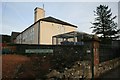
Peppe's fish, chip and pizza shop in Kilwinning, North Ayrshire, Scotland
by Garry Cornes
geograph for square NS2943
Peppe's fish and chip shop takeaway in Kilwinning, North Ayrshire,... (more)
|
|
Elliots bar and restaurant on Main Street, Prestwick in Ayrshire
by Garry Cornes
geograph for square NS3525
Elliots bar and restaurant in Prestwick. This glass fronted building is located... (more)
|
|
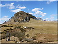
Loudoun Hill
by Alan O'Dowd
for square NS6037
Loudoun Hill is a volcanic plug rising out of the Ayrshire farmland. This view... (more)
|
|
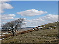
Tree and trig pillar, Loudoun Hill
by Alan O'Dowd
geograph for square NS6037
This is the highest of the trees growing on the northern flank of this volcanic... (more)
|
|
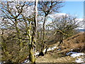
Trees on northern slope of Loudoun Hill
by Alan O'Dowd
geograph for square NS6037
What I didn't notice at the time is that someone has disposed of a plastic... (more)
|
|
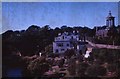
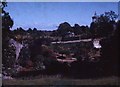
Burns Monument & Gardens, Alloway, Ayrshire.
by S.C.C.Bate
geograph for square NS3317
|
|
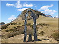
The Spirit of Scotland
by Alan O'Dowd
geograph for square NS6137
The Spirit of Scotland is the name of this sculpture by Richard Price erected... (more)
|
|
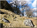
Eastern flank of Loudoun Hill
by Alan O'Dowd
geograph for square NS6037
Beech trees and boulders below the volcanic plug of Loudoun Hill.
|
|
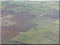
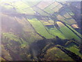
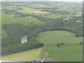
Bennal farm, near Mossblown
by M J Richardson
for square NS4026
Ayrshire farmland
|
|
Burns Monument & Gardens
by S.C.C.Bate
geograph for square NS3317
|
|
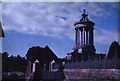
Burns Monument
by S.C.C.Bate
geograph for square NS3317
|
|
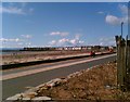
South Sands, Troon
by Alan O'Dowd
geograph for square NS3230
Taken on a bright but cold spring day with snow still visible on the distant... (more)
|
|
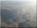
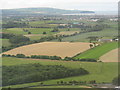
Opencast mining in Nithsdale
by M J Richardson
for square NS5513
In the upper reaches of the River Nith, about 7 km west of New Cumnock.
|
|
Ochiltree and the valley of the Lugar Water
by M J Richardson
for square NS5021
With the fall-out from an active factory on Barony Road in NS5222 drifting downwind.
|
|
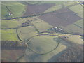
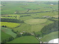
Burn farm near Stair
by M J Richardson
for square NS4224
With Enterkine Wood nature reserve at lower right.
|
|
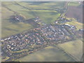
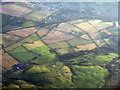
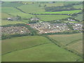
Mossblown Roadend and Townhead
by M J Richardson
for square NS4125
Recent eastern expansion of the village.
|
|
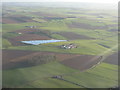
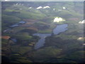
Raith Farm and reservoir
by M J Richardson
for square NS3926
|
|
Auchincally Hill
by M J Richardson
for square NS6006
Category: Aerial photo
The edge of a large area of forestry plantations in the Kyle area of East... (more)
|
|
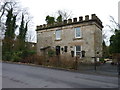
Former gatehouse
by James Allan
geograph for square NS4145
This building was once a gatehouse to Lainshaw Estate in Stewarton
|
|
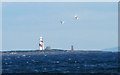
A distant Lady Isle lighthouse
by Steve Fareham
for square NS2729
Taken from the South Pier at Ayr.
|
|
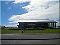
Ayr Audi showroom
by Steve Fareham
geograph for square NS3623
|
|
Ayr seafront car parking
by Steve Fareham
geograph for square NS3220
|
|
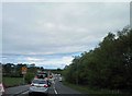
Roadworks on the A713 near Ayr hospital
by Steve Fareham
geograph for square NS3618
|
|
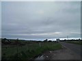
Rough layby on the A713
by Steve Fareham
geograph for square NS4112
Ayr 8 miles ahead.
|
|
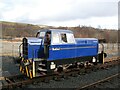
Sentinel at Dunaskin Bridge
by Adrian Taylor
geograph for square NS4408
This Sentinel four wheel diesel hydraulic locomotive was built in 1959, works... (more)
|
|
Straiton Primary School
by Becky Williamson
geograph for square NS3804
|
|
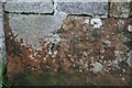
Benchmark on Straiton Primary School wall
by Becky Williamson
for square NS3804
Ordnance Survey benchmark, described on database at... (more)
|
|
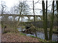
Railway viaduct
by James Allan
geograph for square NS4145
Crossing the Annick Water.
|
|
Martnaham Loch
by M J Richardson
for square NS3917
And, to the left, Snipe Loch [small] and Fergus Loch [with island]; taken from... (more)
|
|
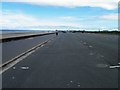
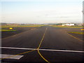
Taxiway at Prestwick Airport
by M J Richardson
geograph for square NS3726
For runway 03/21 and to the west of it, as seen from the threshold of Runway 31.
|
|
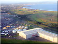
Prestwick Airport and station
by M J Richardson
for square NS3527
Buildings and fuel storage tanks at the western side of the airport, and the... (more)
|
|
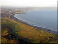
Prestwick Golf Club
by M J Richardson
for square NS3427
Between the sea and the railway passing Prestwick Airport. Looking south to Ayr.
|
|
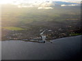
Ayr, divided by the River Ayr
by M J Richardson
for square NS3322
Looking southeast soon after leaving Prestwick and turning to head south.
|
|
The edge of Alloway from above Sauchrie
by M J Richardson
for square NS3117
With Newark Hill in the foreground and Burton farm near the centre.
|
|
Fields at Sauchrie catching the sunrise
by M J Richardson
for square NS3015
Looking east from above Brown Carrick Hill.
|
|
Annbank Community Centre and Football Ground
by M J Richardson
for square NS4023
With the main road [Weston Avenue, B744] and Goodwin Drive to its left.
|
|
Auchincruive Agricultural College
by M J Richardson
for square NS3923
Once the West of Scotland College of Agriculture, with particular specialism in... (more)
|
|
Brockle Wood
by M J Richardson
for square NS3923
From above Mossblown, with Brocklehill Farm buildings at the bottom, and the... (more)
|
|
Kirklandholm Farm
by M J Richardson
for square NS3824
Looking southwest on approach to Prestwick, with Ayr, the Heads of Ayr, and... (more)
|
|
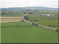
The A77 at St Quivox
by M J Richardson
for square NS3724
Looking southwest towards Ayr just before landing at Prestwick.
|
|
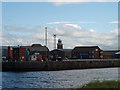
ABP's Ayr harbour lighthouses
by Steve Fareham
geograph for square NS3322
|
|
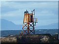
Ayr harbour's North breakwater lighthouse
by Steve Fareham
geograph for square NS3222
|
|
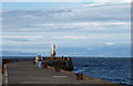
The South Pier Ayr harbour
by Steve Fareham
geograph for square NS3222
Complete with rusting light, compare with Gordon Brown's photo 6 years ago... (more)
|
|
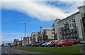
Seafront apartments Ayr
by Steve Fareham
geograph for square NS3322
|
|
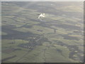
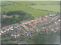
Mossblown
by M J Richardson
for square NS4024
With Drumley House in the trees to the left. As seen on approach to Prestwick Airport.
|
|
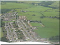
Roadhead at Mossblown
by M J Richardson
for square NS4125
New housebuilding at the east end of the village, with Townhead farm and Afton... (more)
|
|
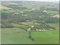
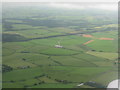
Round hayfield by Burn Farm
by M J Richardson
for square NS4224
Looking northeast on approach to Prestwick Airport.
|
|
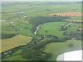
Stair and the River Ayr
by M J Richardson
for square NS4323
Looking northeast from a flight on approach to Prestwick Airport.
|
|
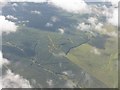
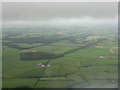
Lochhill and the tail of Pant Wood
by M J Richardson
for square NS4623
Looking northeast on approach to Prestwick.
|
|
Pant Wood in Summer
by M J Richardson
for square NS4623
For March view, from almost the same spot, see Thomas Nugent's picture from... (more)
|