Public Tags
Tag: Brewers·Fayre
Other tags: business:Brewers Fayre
Showing images tagged with Brewers Fayre tag.

|
Newcastle-under-Lyme: Premier Inn and Brewers Fayre on A34
by Jonathan Hutchins geograph for square SJ8350 The Redwood Brewers Fayre was formerly a Taybarns restaurant until all Taybarns... (more)
Tags:
road:A34
Brewers Fayre
top:Business, Retail, Services
type:Geograph
subject:Hotel
near:Newcastle-Under-Lyme
hotel:Premier Inn
Premier Inn
Premier Inn Motel
top:Suburb, Urban Fringe
former:Taybarns Restaurant
|

|
Brewers Fayre restaurant, Minehead
by David Hillas geograph for square SS9845 Situated in Luttrell Way TA24 6DF, this Brewers Fayre restaurant is one of... (more)
Tags:
business:Brewers Fayre
Brewers Fayre
top:Coastal
type:Geograph
place:Minehead
Minehead
top:Suburb, Urban Fringe
|

|
Brewers Fayre, Caerphilly
by Jaggery geograph for square ST1688 Located in Crossways Business Park alongside a Premier Inn.
|

|
The Brocklebank, Weston Road, Crewe
by Jaggery geograph for square SJ7154 The Brewers Fayre bar & restaurant is part of the Premier Inn Crewe Central site.
|

|
Brewers Fayre on A34 north of Newcastle-under-Lyme
by Jonathan Hutchins geograph for square SJ8350 Formerly a Taybarns, in which guise it can be seen in... (more)
Tags:
A34
Brewers Fayre
top:Business, Retail, Services
type:Geograph
near:Newcastle-Under-Lyme
subject:Restaurant
top:Roads, Road Transport
top:Suburb, Urban Fringe
former:Taybarns Restaurant
|

|
"Brewers fayre" and "Premier Inn" signs, Carrickfergus (April 2015)
by Albert Bridge for square J4187 “Brewers fayre” and “Premier Inn” signs at Rodgers Quay. Both chains are part... (more)
Tags:
Brewers Fayre
top:Business, Retail, Services
place:Carrickfergus
Hotel
Premier Inn
Public House
Public House Sign
subject:Sign
Signs
brewer:Whitbread
|

|
The Cepen Park Brewers Fayre Restaurant
by David Dixon geograph for square ST9075 The Brewers Fayre pub/restaurant sited off the A350, just to the north of Chippenham.
Tags:
Brewers Fayre
top:Business, Retail, Services
type:Geograph
camera:IPhone SE
Pub and Restaurant
top:Suburb, Urban Fringe
|

|
Premier Inn / Brewers Fayre, Drighlington
by Stephen Craven geograph for square SE2328 The building is named on the map as a "motel" - a somewhat archaic... (more)
|

|
Brewery Fayre, Hinckley
by Anthony Vosper geograph for square SP4093 A waterside attraction on the Ashby-de-la-Zouch canal.
It also serves the... (more)
Tags:
Ashby De La Zouch Canal
business:Brewers Fayre
Brewers Fayre
top:Business, Retail, Services
top:Canals
type:Geograph
top:Suburb, Urban Fringe
|

|
Brewers Fayre, Snow Hill retail park, Wakefield
by Stephen Craven geograph for square SE3222 As often, the pub is in partnership with the adjacent Premier Inn, for which it... (more)
|
|
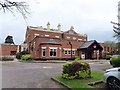
The Brewers Fayre Burleydam
by Steve Daniels geograph for square SJ3677 |
|
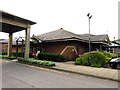
The Weather Vane on Wokingham Road
by Steve Daniels geograph for square SU8669 The Weather Vane is owned by Brewer's Fayre.
Tags:
place:Bracknell
Brewers Fayre
top:Business, Retail, Services
type:Geograph
Public House & Restaurant
|

|
The Inn on the Quay at Goodrington
by Steve Daniels geograph for square SX8959 The Inn on the Quay is a Brewers Fayre pub.
|

|
Brewers Fayre Minehead
by Anthony Vosper geograph for square SS9845 Attached to the near-by Premier Inn.
What appears to be a small moat is... (more)
Tags:
Brewers Fayre
top:Business, Retail, Services
Drainage Ditch
type:Geograph
top:Suburb, Urban Fringe
|

|
Exeter Premier Inn and Brewers Fayre
by Anthony Vosper geograph for square SX9692 Located at the junction of Honiton Road and Fitzroy Road.
Both establishments... (more)
|

|
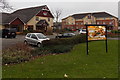
Pub and hotel, Newhaven Harbour, Edinburgh
by Graham Robson geograph for square NT2577 A Brewer's Fayre pub and Premier Inn hotel face onto the harbour at Newhaven.
|
|
Kembrey Inn and Premier Inn, Swindon
by Jaggery geograph for square SU1586 Built on the site of an old factory building to the north of Kembrey Street,... (more)
|

|
Brewers Fayre and Premier Inn, Ebbw Vale
by Jaggery geograph for square SO1707 Located in Victoria Business Park, on the south side of the A4046.
Tags:
Brewers Fayre
top:Business, Retail, Services
Premier Inn
top:Sport, Leisure
top:Suburb, Urban Fringe
|

|
Brewers Fayre and Premier Inn, Barry
by Jaggery geograph for square ST1167 Viewed across Ffordd y Mileniwm. Officially opened in the autumn of 2012, the... (more)
|

|
Brewers Fayre and Premier Inn, Southport
by Stephen Craven geograph for square SD3317 Part of the Ocean Plaza development, which was built in the early 21st century... (more)
Tags:
Brewers Fayre
top:Business, Retail, Services
top:City, Town Centre
type:Geograph
Hotel
Premier Inn
Restaurant
|

|
February dawn
by Anthony Vosper geograph for square ST4776 Signs for Brewers Fayre, Premier Inn and Sainsbury's greet a gloomy February morning.
|

|
The Watermill pub-restaurant, Halifax
by Humphrey Bolton geograph for square SE0922 This view is from Bankhouse Lane. The pub is a Brewers Fayre house.
Tags:
Brewers Fayre
top:Business, Retail, Services
type:Geograph
top:Lowlands
Pub Restaurant
subject:Restaurant
top:Suburb, Urban Fringe
View Across Valley
|
|
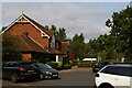
The Clock Tower restaurant, Telford
by Christopher Hilton geograph for square SJ7014 Tags:
Brewers Fayre
business:Brewers Fayre
top:Business, Retail, Services
Car Park
Car Parking
type:Geograph
Parked Cars
subject:Restaurant
Restaurant
|

|
Barrow-in-Furness Brewers Fayre and Premier Inn
by David Dixon geograph for square SD1969 Tags:
Brewers Fayre
top:Business, Retail, Services
top:City, Town Centre
type:Geograph
Hotel
Motel
camera:Panasonic DC-G9
Premier Inn
Restaurant
|

|
Seaward Way
by Ian Capper geograph for square SS9845 Looking along Seaward Way with the Brewers Fayre restaurant on the right.
Tags:
business:Brewers Fayre
top:Business, Retail, Services
type:Geograph
place:Minehead
top:Roads, Road Transport
road:Seaward Way
top:Suburb, Urban Fringe
|
|
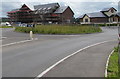
Grassy roundabout, Westgate, Llanfoist
by Jaggery geograph for square SO2913 Brewers Fayre is on the right. The Premier Inn on the left is being built in July 2017.
Tags:
Brewers Fayre
top:Business, Retail, Services
type:Geograph
Grassy Roundabout
hotel:Premier Inn
Premier Inn
top:Roads, Road Transport
top:Village, Rural Settlement
|

|
Brewer's Fayre restaurant and car park, Brampton Hut service area
by Christopher Hilton geograph for square TL1971 |

|
Denton island
by Gerald England geograph for square SJ9195 The Coldmove lorry on the right is exiting the M60 motorway underneath a... (more)
Tags:
road:A57
Brewers Fayre
Cyclepath
Footpath
KFC
motorway:M60
motorway:M67
Motorway Junction
top:Roads, Road Transport
Roundabout
|

|
Brewers Fayre and Premier Inn, Glastonbury
by David Dixon geograph for square ST4838 |

|
Old Nelson, Stroud
by David Dixon geograph for square SO8405 Brewers Fayre restaurant and Premier Inn, Stratford Road, Stroud.
|

|
The Old Nelson on Stratford Road
by Steve Daniels geograph for square SO8405 |

|
The Farrier, Harlaxton Road
by David Dixon geograph for square SK8934 Pub/restaurant attached to the Grantham Premier Inn.
|
|
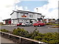
The Buffet Place
by David Dixon geograph for square SJ5185 Carvery restaurant on the corner of The Hive leisure complex at Widnes.
|
|
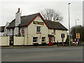
The Swan, Bucklow Hill
by David Dixon geograph for square SJ7383 The Swan Hotel; a large pub/restaurant at Bucklow Hill.
|

|
The A629 at the bottom of Salterhebble Hill
by Martin Dawes geograph for square SE0922 Over the road is Premier Inn and its attendant pub/ restaurant. The canal... (more)
Tags:
road:A629
business:Brewers Fayre
top:Business, Retail, Services
type:Geograph
Premier Inn Motel
top:Rivers, Streams, Drainage
top:Roads, Road Transport
top:Suburb, Urban Fringe
top:Uplands
|

|
The Farrier and Grantham Premier Inn
by David Dixon geograph for square SK8934 |

|
Bucklow Hill, The Swan Hotel
by David Dixon geograph for square SJ7383 The Swan Hotel, a large pub/restaurant on the A556 (Chester Road) at the Bucklow... (more)
|
