|
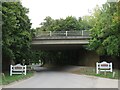
Bridge over Aspenden Road, near Buntingford
by Malc McDonald
geograph for square TL3628
A bridge carries the Buntingford By-Pass across Aspenden Road, on the outskirts... (more)
|
|
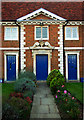
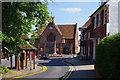
Pedimented centrepiece, almshouses, Buntingford
by Jim Osley
for square TL3629
17th century almshouses, Buntingford: Grade II listed... (more)
|
|
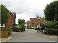
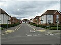
Station Yard, Buntingford
by Malc McDonald
geograph for square TL3628
Station Yard is a small residential development on the outskirts of Buntingford,... (more)
|
|
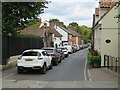
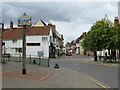
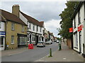
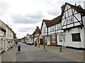
Buntingford High Street
by Malc McDonald
geograph for square TL3629
The road in the foreground, as far as the side turning on the right, is Ermine... (more)
|
|
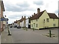
Church Street, Buntingford
by Malc McDonald
geograph for square TL3629
Church Street in the market town of Buntingford, in north Hertfordshire. The... (more)
|
|
Ermine Street, Buntingford
by Malc McDonald
geograph for square TL3629
Ermine Street, entering the town of Buntingford in north Hertfordshire.
|
|
Town lock-up, Buntingford
by Jim Osley
geograph for square TL3629
Grade II listed building, also known as the Cage.... (more)
|
|
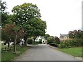
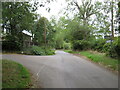
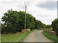
Lane near Buntingford
by Malc McDonald
geograph for square TL3627
An unnamed minor lane through north Hertfordshire countryside, near the town of... (more)
|
|
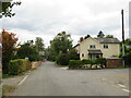
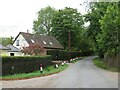
Aspnden, near Buntingford
by Malc McDonald
geograph for square TL3628
Aspenden is a small village close to the town of Buntingford in north... (more)
|
|
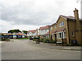
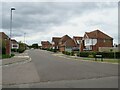
Abrahams Drive, Buntingford
by Malc McDonald
geograph for square TL3628
Abrahams Drive forms part of a newly-built housing development on the outskirts... (more)
|
|
Nutslip, Buntingford
by Malc McDonald
geograph for square TL3628
Nutslip is a small residential cul-de-sac on the outskirts of Buntingford, a... (more)
|
|
Buntingford Market Place and High Street
by Malc McDonald
geograph for square TL3629
This image was taken at the north end of Buntingford's Market Place,... (more)
|
|
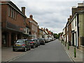
Buntingford High Street
by Malc McDonald
geograph for square TL3629
The high street in Buntingford, a market town in north Hertfordshire. This road... (more)
|
|
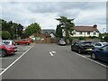
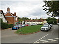
Car park in Buntingford
by Malc McDonald
geograph for square TL3629
A public car park in the centre of Buntingford, a market town in north Hertfordshire.
|
|
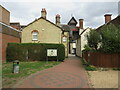
Passageway in Buntingford
by Malc McDonald
geograph for square TL3629
A passageway leading from a car park into Buntingford's High Street.
|
|
Buntingford High Street
by Malc McDonald
geograph for square TL3629
The high street in Buntingford, a market town in north Hertfordshire. This road... (more)
|
|
Buntingford High Street
by Malc McDonald
geograph for square TL3629
The high street in Buntingford, a market town in north Hertfordshire. This road... (more)
|
|
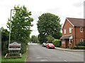
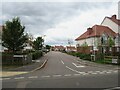
Seymour Road, Buntingford
by Malc McDonald
geograph for square TL3530
Seymour Road is a private road in a modern housing development on the outskirts... (more)
|
|
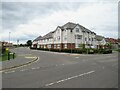
Apartment block on Norris Way, Buntingford
by Malc McDonald
geograph for square TL3530
A modern apartment block on the corner of Norris Way and Ermine Street on the... (more)
|
|
Hensby Avenue, Buntingford
by Malc McDonald
geograph for square TL3530
Hensby Avenue forms part of a modern housing development on the outskirts of... (more)
|
|
Neale Drive, Buntingford
by Malc McDonald
geograph for square TL3530
Neale Drive forms part of a modern housing development on the outskirts of... (more)
|
|
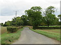
Ermine Street, near Buntingford
by Malc McDonald
geograph for square TL3531
This section of Ermine Street, which follows the route of a Roman Road, used to... (more)
|
|
A10 Buntingford By-Pass
by Malc McDonald
geograph for square TL3531
Buntingford By-Pass is on the route of the trunk A10 road.
|
|
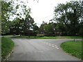
Westmill, near Buntingford
by Malc McDonald
geograph for square TL3627
Westmill is a small village in the north Hertfordshire countryside.
|
|
Westmill, near Buntingford
by Malc McDonald
geograph for square TL3627
Westmill is a small village in the north Hertfordshire countryside.
|
|
Green End, near Buntingford
by Malc McDonald
geograph for square TL3233
Green End is a small hamlet in the north Hertfordshire countryside.
|
|
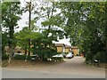
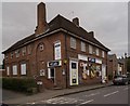
Buntingford Post Office
by Jim Osley
geograph for square TL3629
|
|
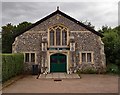
Benson Hall, Buntingford
by Jim Osley
geograph for square TL3629
Benson Hall is dedicated to the memory of Robert Hugh Benson, preacher, novelist... (more)
|
|
St Peter's Church, Buntingford
by Jim Osley
geograph for square TL3629
|
|
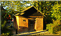
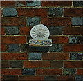
Sun Fire Insurance mark, Buntingford
by Jim Osley
for square TL3629
For a comprehensive history of British fire insurance marks follow this... (more)
|
|
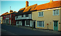
Historic buildings, Buntingford High Street
by Jim Osley
geograph for square TL3629
|
|
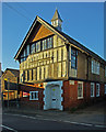
Former Technical Institute, Buntingford
by Jim Osley
geograph for square TL3629
Currently in use as a youth club.
|
|
Lane near Buntingford
by Malc McDonald
geograph for square TL3525
An un-named minor lane through countryside in north Hertfordshire.
|
|
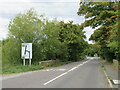
Lane near Buntingford
by Malc McDonald
geograph for square TL3524
An un-named minor lane through countryside in north Hertfordshire. The signpost... (more)
|
|
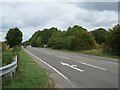
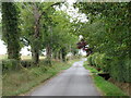
Westmill Road near Buntingford
by Malc McDonald
geograph for square TL3525
Westmill Road is a minor road through countryside in north Hertfordshire.
|
|
Westmill Road near Buntingford
by Malc McDonald
geograph for square TL3525
Westmill Road is a minor road through north Hertfordshire countryside.
|
|
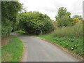
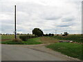
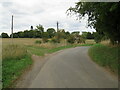
Road junction near Buntingford
by Malc McDonald
geograph for square TL3625
A junction of minor roads in north Hertfordshire countryside.
|
|
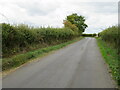
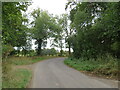
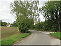
Westmill Road near Buntingford
by Malc McDonald
geograph for square TL3625
Westmill Road is a minor lane through north Hertfordshire countryside.
|
|
Westmill Road near Buntingford
by Malc McDonald
geograph for square TL3625
Westmill Road is a minor lane through north Hertfordshire countryside.
|
|
Westmill Road near Buntingford
by Malc McDonald
geograph for square TL3625
Westmill Road is a minor lane through north Hertfordshire countryside.
|
|
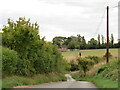
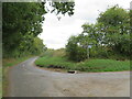
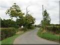
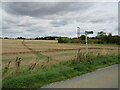
Field near Buntingford
by Malc McDonald
geograph for square TL3625
An entrance to a field in north Hertfordshire countryside.
A sign, leaning at... (more)
|
|
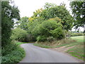
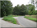
Westmill Road near Buntingford
by Malc McDonald
geograph for square TL3626
A bend in Westmill Road, a minor lane through north Hertfordshire countryside.
|
|
Westmill Road near Buntingford
by Malc McDonald
geograph for square TL3626
Westmill Road is a minor lane through north Hertfordshire countryside.
|
|
Westmill Road near Buntingford
by Malc McDonald
geograph for square TL3626
Westmill Road is a minor lane through north Hertfordshire countryside.
|
|
Westmill Road near Buntingford
by Malc McDonald
geograph for square TL3626
Westmill Road is a minor lane through north Hertfordshire countryside.
|
|
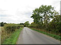
Westmill Road near Buntingford
by Malc McDonald
geograph for square TL3726
Westmill Road is a minor lane through countryside in north Hertfordshire. Here... (more)
|
|
Westmill Road near Buntingford
by Malc McDonald
geograph for square TL3726
Westmill Road is a minor lane through north Hertfordshire countryside.
|
|
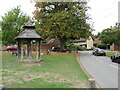
Village green, Westmill, near Buntingford
by Malc McDonald
geograph for square TL3627
Westmill is a small village in the north Hertfordshire countryside.
|
|
Throcking Lane near Buntingford
by Malc McDonald
geograph for square TL3531
Throcking Lane is a minor lane through north Hertfordshire countryside.
|
|
Public footpath near Buntingford
by Malc McDonald
geograph for square TL3531
A public footpath across a field in the countryside of north Hertfordshire.
|