|
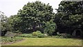
Castle Hill
by Ian Capper
geograph for square SZ4887
Castle Hill rounding the Northwest Bastion of Carisbrooke Castle.
|
|
Castle Hill, Kendal
by Rude Health
geograph for square SD5292
A grey morning in Kendal with Chris Watson for this lovely historic little hill.... (more)
|
|
Castle Hill
by Rude Health
geograph for square NS9422
Park car in Abington car park as minor roads very icy. Ascended Tewsgill Hill... (more)
|

|
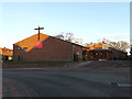
St.Luke's Church & Rigbourne Hill Community Centre sign
by Geographer
for square TM4389
Off Rigbourne Hill at the junction with Castle Hill & Coney Hill... (more)
|
|
St.Luke's Church & Rigbourne Hill Community Centre
by Geographer
geograph for square TM4389
Off Rigbourne Hill at the junction with Castle Hill & Coney Hill... (more)
|
|
Tout Hill or Mount Thorold / Turold (Peterborough Castle)
by Julian Dowse
geograph for square TL1998
Tout Hill (Touthill) was a medieval motte and bailey castle in Peterborough,... (more)
|
|
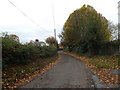
Barric Lane, Occold
by Geographer
geograph for square TM1470
At the junction with the B1077 Castle Hill
|
|
Barric Lane, Occold
by Geographer
geograph for square TM1470
At the junction with the B1077 Castle Hill
|
|
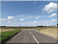
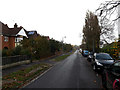
B1077 Castle Hill, Thorndon
by Geographer
geograph for square TM1469
At the junction with Rishangles Road
|
|
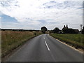
B1077 Castle Hill, Occold
by Geographer
geograph for square TM1470
|
|
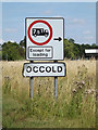
Occold Village Name sign
by Geographer
for square TM1470
On the B1077 Castle Hill
|
|
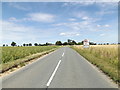
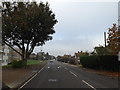
Entering Occold on the B1077 Castle Hill
by Geographer
geograph for square TM1470
|
|
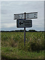
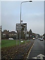
Roadsign on the B1077 Castle Hill
by Geographer
geograph for square TM1470
At the junction with Barric Lane
|
|
Barric Lane, Occold
by Geographer
geograph for square TM1470
At the junction with the B1077 Castle Hill... (more)
|
|
Castle Hill sign
by Geographer
for square TM4389
On Castle Hill at the junction with Coney & Rigbourne Hills near The Beccles Centre
|
|
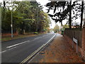
Constitution Hill, Castle Hill, Ipswich
by Geographer
geograph for square TM1645
At the junction with Henley Road & Elsmere Road
|
|
Elsmere Road, Castle Hill Ipswich
by Geographer
geograph for square TM1645
At the junction with Henley Road & Constitution Hill
|
|
Henley Road, Castle Hill, Ipswich
by Geographer
geograph for square TM1645
At the junction with Elsmere Road & Constitution Hill
|
|
Henley Road, Castle Hill, Ipswich
by Geographer
geograph for square TM1645
At the junction with Elsmere Road & Constitution Hill
|
|
Elsmere Road, Castle Hill Ipswich
by Geographer
geograph for square TM1645
At the junction with Henley Road & Constitution Hill
|
|
Elsmere Road, Castle Hill Ipswich
by Geographer
geograph for square TM1645
Approaching the junction with Henley Road & Constitution Hill
|
|
Castle Hill
by Rude Health
geograph for square SE1513
Up the steps from the lower car park with my local guide, Martin Richardson.... (more)
|
|
Castle Hill sign
by Geographer
for square TM3977
On Castle Hill at the junction with Hill Farm Road
|
|
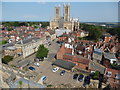
View of Lincoln Cathedral from the Observatory Tower
by David Hillas
geograph for square SK9771
This photo shows Lincoln Cathedral in Minster Yard LN2 1PX, taken from the... (more)
|
|
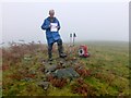
Castle Hill Phil Proves We Have Summited
by Rude Health
geograph for square SO0068
Sixth HuMP of the day with Phil Cooper from a NE direction. Parked near gateway... (more)
|
|
St.Luke's Church & Rigbourne Hill Community Centre
by Geographer
geograph for square TM4389
Off Rigbourne Hill at the junction with Castle Hill & Coney Hill... (more)
|
|
Bench on Castle Hill
by Colin Smith
geograph for square ST8032
Viewpoint on the historic Castle Hill above Mere with sweeping vistas to the... (more)
|
|
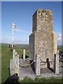
Memorial on Castle Hill
by Colin Smith
geograph for square ST8032
Memorial to the Wessex Regiment sited on top of Mere's Castle Hill.
The... (more)
|
|
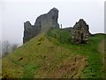
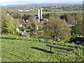
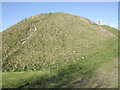
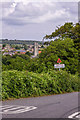
Castle Hill
by Colin Smith
geograph for square ST8032
This high grassy hill on the northern side of Mere village once was topped by a... (more)
|
|
Castle Hill, Mere
by Colin Smith
for square ST8032
The hill dominates the Wiltshire village of Mere. Today there is no sign of the... (more)
|
|
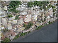
Wall, Castle Hill Walk
by Adrian Taylor
for square SO7192
Old sandstone wall beside Castle Hill Walk. There is a worn Ordnance Survey cut... (more)
|
|
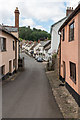
Castle Hill
by Ian Capper
geograph for square SS9943
Looking along Castle Hill towards High Street. On the skyline is the top of the... (more)
|
|
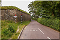
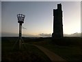
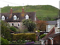
Castle Hill
by Ian Capper
geograph for square SZ4887
Road leading down from Carisbrooke Castle, with St Mary's Church,... (more)
|
|
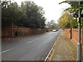
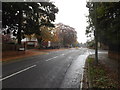
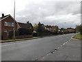
Henley Road, Castle Hill
by Geographer
geograph for square TM1646
Looking towards the junction with The Grove at the junction with Dales Road
|
|
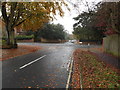
Henley Road, Castle Hill
by Geographer
geograph for square TM1646
At the junction with Dales Road
|
|
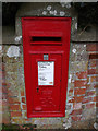
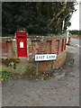
Castle Hill Postbox
by Geographer
for square TM0532
On East Lane at the junction with Castle Hill near The Munnings Museum
Postbox... (more)
|
|
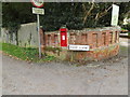
Castle Hill & Castle Hill Postbox
by Geographer
geograph for square TM0532
At the junction with East Lane near The Munnings Museum
Postbox No.CO7 94D
|
|
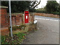
Castle Hill Postbox
by Geographer
for square TM0532
On East Lane at the junction with Castle Hill near The Munnings Museum
Postbox No.CO7 94D
|
|
Castle Hill Postbox
by Geographer
for square TM0532
On East Lane at the junction with Castle Hill near The Munnings Museum
Postbox No.CO7 94D
|
|
Castle Hill Postbox
by Geographer
geograph for square TM0532
On East Lane at the junction with Castle Hill near The Munnings Museum
Postbox No.CO7 94D
|
|
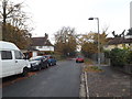
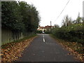
East Lane, Dedham
by Geographer
geograph for square TM0632
Approaching the junction with Castle Hill at the entrance to The Munnings Museum car Park
|
|
East Lane, Dedham
by Geographer
geograph for square TM0632
Near the junction with Castle Hill and The Munnings Museum
|
|
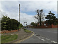
Elsmere Road, Castle Hill Ipswich
by Geographer
geograph for square TM1645
Near Elsmere Road Water Tower
|
|
Henley Road, Castle Hill, Ipswich
by Geographer
geograph for square TM1646
At the junction with the A1214 Valley Road
|
|
Henley Road, Castle Hill, Ipswich
by Geographer
geograph for square TM1646
Approaching the A1214 Valley Road
|
|
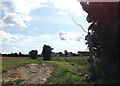
Footpath to the B1077 Castle Hill
by Geographer
geograph for square TM1471
Off Clint Road
|
|
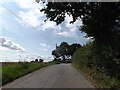
Clint Road, Occold
by Geographer
geograph for square TM1471
At the junction with the B1077 Castle Hill
|
|
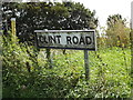
Clint Road sign
by Geographer
for square TM1571
On Clint Road at the junction with the B1077 Castle Hill
|
|
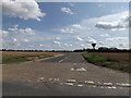
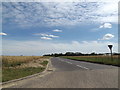
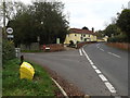
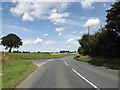
B1077 Castle Hill, Occold
by Geographer
geograph for square TM1571
At the junction with Clint Road
|
|
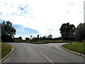
B1077 Castle Hill, Occold
by Geographer
geograph for square TM1571
At the junction with Church Street
|