Public Tags
Tag: Catchwater·Drain
Other tags: drain:Catchwater Drain
Showing latest 50 of 72 images tagged with Catchwater Drain tag.

|
Former lock chamber at Hagnaby Lock
by Christine Johnstone geograph for square TF3359 The West Fen Catchwater Drain is no longer navigable. Presumably it was once... (more)
|

|
West Fen Catchwater Drain
by Christine Johnstone geograph for square TF3359 Immediately south of the disused lock chamber.
|

|
West Fen Catchwater Drain
by Christine Johnstone geograph for square TF3260 South of, and parallel to, Kirkby Bank.
|

|
Burton Pumping Station
by Oliver Mills geograph for square SK9473 Built in 1965 (according to the commemoration plaque) between the Main Drain... (more)
Tags:
Bishops Bridge
subject:Bridleway
place:Burton by Lincoln
drain:Catchwater Drain
path:Footpath
type:Geograph
Lincoln
place:Lincoln
Main Drain
top:Paths
Pumping Station
top:Rivers, Streams, Drainage
|
|
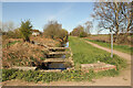
Catchwater Drain
by Richard Croft geograph for square SK9470 Catchwater Drain and adjacent footpath from the bridge on Fen Lane
Tags:
drain:Catchwater Drain
Drain
type:Geograph
top:Paths
Public Footpath
top:Rivers, Streams, Drainage
|
|
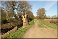
Footpath and Catchwater Drain
by Richard Croft geograph for square SK9370 Path alongside Catchwater Drain
Tags:
drain:Catchwater Drain
Drain
type:Geograph
top:Paths
Public Footpath
top:Rivers, Streams, Drainage
|
|
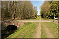
Catchwater Drain
by Richard Croft geograph for square SK9371 Catchwater Drain and footpath near Decoy Farm
Tags:
drain:Catchwater Drain
Drain
type:Geograph
top:Paths
Public Footpath
top:Rivers, Streams, Drainage
|

|
Catchwater Drain
by Richard Croft geograph for square SK9371 Path beside the Catchwater Drain with a heron fishing upstream
Tags:
drain:Catchwater Drain
Drain
type:Geograph
Heron
top:Paths
Public Footpath
top:Rivers, Streams, Drainage
place:Skellingthorpe
|

|
Catchwater Drain
by Graham Robson for square SK9572 Looking along the Catchwater Drain from a footbridge crossing it at its... (more)
|

|
Path alongside the catchwater
by Stephen Craven geograph for square SD9415 The catchwater drain (labelled on maps as 'canal drain') starts near... (more)
|

|
Main Drain, near North Carlton
by Oliver Mills geograph for square SK9277 The start of the public bridleway. Public access eventually passes to the... (more)
Tags:
subject:Bridleway
drain:Catchwater Drain
type:Geograph
place:Lincoln
Main Drain
near:North Carlton
place:North Carlton
top:Paths
top:Rivers, Streams, Drainage
|

|
Catchwater drain
by Julian P Guffogg geograph for square SK9376 The drain runs all the way into Lincoln.
|

|
Catchwater drain along the River Slea near Anwick
by Julian P Guffogg geograph for square TF1249 The river is on the right in the undergrowth.
|

|
Catchwater drain from Occupation Bridge
by Julian P Guffogg geograph for square SK9375 |

|
Cold Laughton Drain
by Stephen Craven geograph for square SD9718 Although starting close to Blackstone Edge reservoir, this 4.8km catchwater... (more)
|

|
Catchwater drain alongside Altham Terrace, Lincoln
by Christine Johnstone geograph for square SK9669 Part of a drainage system managed by the Upper Witham Internal Drainage Board.
|

|
Catchwater Drain after the winter flood level
by Martin Dawes geograph for square TA0345 Over the winter the floodwater had remained against the flood banks long enough... (more)
Tags:
Catchwater Drain
top:Flat Landscapes
Floodbanks
type:Geograph
Minster Way
top:Paths
top:Rivers, Streams, Drainage
Road Bridge Over Drain
top:Roads, Road Transport
|

|
Rishworth Drain entering Blackstone Edge Reservoir
by Stephen Craven geograph for square SD9718 The catchwater drain runs from about 5km on the east side of the watershed,... (more)
|

|
Bridge over catchwater drain for Green Withens reservoir
by Christine Johnstone geograph for square SD9916 Wakefield Corporation built this reservoir between 1893 and 1903. They also... (more)
Tags:
Bridge Over Drain
Catchwater Drain
type:Geograph
Open Access Moorland
Wakefield and District Waterworks
subject:Water Infrastructure
top:Water Resources
company:Yorkshire Water
|

|
Bridleway by the Catchwater Drain, Burton-by-Lincoln
by Oliver Mills geograph for square SK9474 This bridleway connects Burton-by-Lincoln to South Carlton, and further to North Carlton.
Tags:
subject:Bridleway
place:Burton by Lincoln
drain:Catchwater Drain
path:Footpath
type:Geograph
place:Lincoln
place:North Carlton
top:Paths
top:Rivers, Streams, Drainage
near:South Carlton
place:South Carlton
|
|
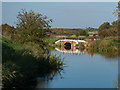
Catchwater Drain Bridge
by Oliver Mills geograph for square SK9571 The bridge carries a footpath and cycle track running West out of Lincoln. Taken... (more)
Tags:
Brayford Belle
subject:Bridge
top:Canals
drain:Catchwater Drain
Fossdyke Navigation
Fossdyke Navigation Canal
type:Geograph
place:Lincoln
top:Paths
|

|
Footbridge Spanning the Overflow on Spa Clough
by Chris Heaton geograph for square SE0231 Crossing a spillway that drains excess water from the catchwater drain into Spa Clough.
|

|
Footbridge over Catchwater Drain
by Julian P Guffogg geograph for square SK9669 The concrete bridge is dated 1964.
|

|
Catchwater Drain
by J.Hannan-Briggs geograph for square TF2757 |
|
Catchwater Drain near Bridge Farm
by J.Hannan-Briggs geograph for square TF2556 |

|
Frozen Catchwater Drain
by J.Hannan-Briggs geograph for square SK9474 From Burton Bridge.
|

|
Tunnel portal on Broad Head Drain
by Stephen Craven geograph for square SD9718 One of the catchwater channels for Blackstone Edge reservoir, here taken under a... (more)
|

|
Broad Head Drain
by Stephen Craven for square SD9616 One of the catchwater channels for Blackstone Edge reservoir. The gradient of... (more)
|

|
Catchwater Drain from Low Grounds Bridge
by J.Hannan-Briggs geograph for square TF2860 Near Mareham le Fen
Tags:
Catchwater Drain
top:Rivers, Streams, Drainage
|

|
Catchwater drain, off Middlemarch road
by J.Hannan-Briggs geograph for square TF5163 |

|
Bridge over catchwater (2)
by Stephen Craven geograph for square SE0233 Category: Bridge The evening sun shines through one of the several access bridges over the... (more)
Tags:
Catchwater Drain
top:Water Resources
|

|
Thornton Moor reservoir catchwater
by Stephen Craven geograph for square SE0433 The catchwater intercepts water coming down the steep northern scarp slope of... (more)
|

|
Strip the willow – 3
by Alan Murray-Rust geograph for square SK6542 Someone has been leading a merry dance in respect of the willow trees along the... (more)
|

|
Strip the willow – 2
by Alan Murray-Rust geograph for square SK6542 Someone has been leading a merry dance in respect of the willow trees along the... (more)
|

|
Boultham Glebe allotments, Lincoln
by Christine Johnstone geograph for square SK9669 Created between 1904 and 1930, on the west side of a catchwater drain.
Tags:
subject:Allotment
Catchwater Drain
top:Farm, Fishery, Market Gardening
type:Geograph
Glebe
place:Lincoln
|

|
Sluices, Green Withens catchwater drain
by Christine Johnstone geograph for square SD9916 To let excess water out, when necessary. Wakefield Corporation built this... (more)
Tags:
Catchwater Drain
type:Geograph
Sluice Mechanism
Wakefield and District Waterworks
subject:Water Infrastructure
top:Water Resources
company:Yorkshire Water
|

|
Catchwater drain for Green Withens reservoir [2]
by Christine Johnstone geograph for square SD9916 Looking upstream, away from the reservoir. Wakefield Corporation built this... (more)
Tags:
Catchwater Drain
type:Geograph
Wakefield and District Waterworks
subject:Water Infrastructure
top:Water Resources
company:Yorkshire Water
|

|
Catchwater drain for Green Withens reservoir [1]
by Christine Johnstone geograph for square SD9916 Looking downstream, towards the reservoir. Wakefield Corporation built this... (more)
Tags:
Catchwater Drain
type:Geograph
Wakefield and District Waterworks
subject:Water Infrastructure
top:Water Resources
company:Yorkshire Water
|

|
A useless kissing gate, Lincoln
by Oliver Mills geograph for square SK9572 Located just off the Fossdyke Navigation, at the beginning of a new footpath... (more)
Tags:
Catchwater Drain
path:Footpath
Fossdyke Navigation
type:Geograph
gate:Kissing Gate
place:Lincoln
top:Paths
top:Rivers, Streams, Drainage
|

|
Catchwater Drain above Bare Clough
by Chris Heaton geograph for square SE0131 |

|
Stone Bridge over the Catchwater Drain on Midgley Moor
by Chris Heaton geograph for square SE0231 One of several such bridges that span this long water channel
|

|
Catchwater Drain on Midgley Moor
by Chris Heaton geograph for square SE0231 The channel heading towards Warley Moor Reservoir
|

|
The head of the catchwater drain
by Humphrey Bolton geograph for square SE0016 There is a strip of masonry marking the end. A footpath, not shown on the OS... (more)
Tags:
Catchwater Drain
subject:Channel
CRoW Access Land
top:Moorland
Moorland Path
top:Paths
top:Uplands
top:Water Resources
|

|
Bridge over the catchwater drain
by Humphrey Bolton geograph for square SE0016 I had not intended to photograph so many of the bridges, but the appearance of... (more)
Tags:
Catchwater Drain
subject:Channel
CRoW Access Land
top:Moorland
Path Alongside Water Conduit
top:Paths
top:Uplands
top:Water Resources
|

|
Concrete structure across catchwater drain
by Humphrey Bolton geograph for square SE0016 This has vertical slots that suggest that stop boards could be inserted to dam... (more)
|

|
Bridge over the catchwater drain
by Humphrey Bolton geograph for square SE0016 Another ruined maintenance hut is near to the bridge.
Tags:
bridge:Access Track Over Water Channel
Catchwater Drain
subject:Channel
CRoW Access Land
ruin:Maintenance Hut
top:Moorland
top:Uplands
top:Water Resources
|

|
Stone rib across the catchwater drain
by Humphrey Bolton geograph for square SE0016 Also two Canada geese.
Tags:
Catchwater Drain
subject:Channel
CRoW Access Land
top:Uplands
top:Water Resources
top:Wild Animals, Plants and Mushrooms
|

|
Old Washfold Clough entering the catchwater drain
by Humphrey Bolton geograph for square SD9916 Tags:
Catchwater Drain
CRoW Access Land
Moorland Stream
top:Rivers, Streams, Drainage
subject:Stream
top:Uplands
top:Water Resources
|

|
Pondweed in the catchwater drain
by Humphrey Bolton geograph for square SD9916 Although the weather has been mostly dry for a while, there have been heavy... (more)
Tags:
Catchwater Drain
subject:Channel
CRoW Access Land
Path
top:Paths
plant:Pondweed
top:Uplands
top:Water Resources
top:Wild Animals, Plants and Mushrooms
|

|
Bridge carrying footpath over catchwater drain
by Humphrey Bolton geograph for square SD9916 The path going up the hillside is named Blackwood Edge Road on the OS map.
Tags:
bridge:Access Track Over Water Channel
Catchwater Drain
CRoW Access Land
subject:Path
top:Paths
Permissive Path
top:Uplands
top:Water Resources
|
