|
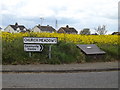
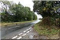
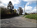
Church Meadow sign & grit bin
by Geographer
for square TM1551
On Church Meadow at the junction with Ashbocking Road
|
|
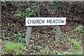
Church Meadow sign
by Geographer
for square TL8439
On Church Meadow at the junction with Church Road & Sandy Lane near Bulmer... (more)
|
|
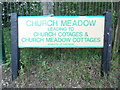
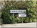
Street Name Plate in Great Gaddesden
by David Hillas
for square TL0211
Located in Great Gaddesden, this street name plate refers to Church Meadow, a... (more)
|
|
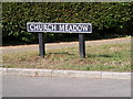
Church Meadow sign
by Geographer
for square TG2902
On Church Meadow at the junction with Church Road
|
|
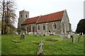
St. Andrew's Church, Bulmer
by Geographer
geograph for square TL8440
Off Church Meadow at the junction with Church Road & Sandy Lane... (more)
|
|
St. Andrew's Church, Bulmer
by Geographer
geograph for square TL8440
Off Church Meadow at the junction with Church Road & Sandy Lane... (more)
|
|
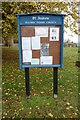
St. Andrew's Church Notice Board
by Geographer
for square TL8440
At the entrance of St. Andrew's Church off Church Meadow at the junction... (more)
|
|
St. Andrew's Church, Bulmer
by Geographer
geograph for square TL8440
Off Church Meadow at the junction with Church Road & Sandy Lane... (more)
|
|
Church Meadow nature reserve
by Adam Lack
geograph for square TM0557
A path leading west through Church Meadow nature reserve.
|
|
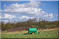
Farm equipment at Church Meadow nature reserve
by Adam Lack
for square TM0557
Farm equipment sitting in a field on the south east side of Church Meadow nature reserve.
|
|
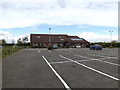
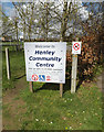
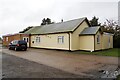
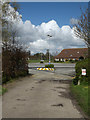
Henley Community Centre, Henley
by Geographer
geograph for square TM1551
Off Church Meadow
|
|
Henley Community Centre
by Geographer
geograph for square TM1551
Off Church Meadows
|
|
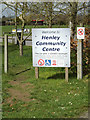
Henley Community Centre sign
by Geographer
for square TM1551
At the entrance to Henley Community Centre off Church Meadows
|
|
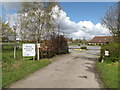
Entrance to Henley Community Centre
by Geographer
geograph for square TM1551
Off Church Meadows
|
|
Church Meadows sign
by Geographer
for square TM1551
On Church Meadows at the junction with Ashbocking Road
|
|
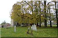
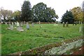
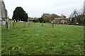
St. Andrew's Churchyard
by Geographer
geograph for square TL8440
Off Church Meadow at the junction with Church Road & Sandy Lane... (more)
|
|
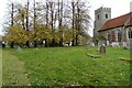
St. Andrew's Churchyard
by Geographer
geograph for square TL8440
Off Church Meadow at the junction with Church Road & Sandy Lane... (more)
|
|
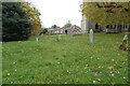
St. Andrew's Churchyard
by Geographer
geograph for square TL8440
Off Church Meadow at the junction with Church Road & Sandy Lane... (more)
|
|
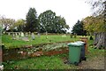
St. Andrew's Churchyard
by Geographer
geograph for square TL8440
Off Church Meadow at the junction with Church Road & Sandy Lane... (more)
|
|
St. Andrew's Churchyard
by Geographer
geograph for square TL8440
Off Church Meadow at the junction with Church Road & Sandy Lane... (more)
|
|
Entrance road of St. Andrew's Church
by Geographer
geograph for square TL8440
Off Church Meadow at the junction with Church Road & Sandy Lane
Bulmer... (more)
|
|
St.Peter's Church, Henley
by Geographer
geograph for square TM1551
Taken from Church Meadow
Link |
|
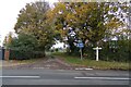
Sandy Lane, Bulmer
by Geographer
geograph for square TL8439
At the junction with Church Road & Church Meadow near Bulmer Village Hall... (more)
|
|
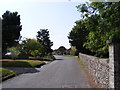
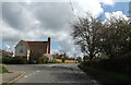
Church Meadow, Bulmer
by Geographer
geograph for square TL8439
Off Church Road at the junction with Sandy Lane near Bulmer Village Hall &... (more)
|
|
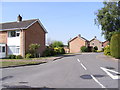
Church Road, Yelverton
by Geographer
geograph for square TG2902
Looking towards St.Mary's Church at the junction with Church Meadow
|
|
Church Road, Yelverton
by Geographer
geograph for square TG2902
Looking towards Church Meadow near St.Mary's Church
|
|
Church Meadow, Yelverton
by Geographer
geograph for square TG2902
At the junction with Church Road
|

|
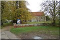
Entrance of Bulmer Village Hall
by Geographer
geograph for square TL8439
Off Church Meadow at the junction with Church Road & Sandy Lane
|
|
Church Meadow, Bulmer
by Geographer
geograph for square TL8439
At the junction with Church Road & Sandy Lane near Bulmer Village Hall
|
|
Church Road, Bulmer
by Geographer
geograph for square TL8439
At the junction with Church Meadow & Sandy Lane near Bulmer Village Hall
|
|
Entrance of Bulmer Village Hall
by Geographer
geograph for square TL8439
Off Church Meadow at the junction with Church Road & Sandy Lane
|
|
Church Road, Bulmer
by Geographer
geograph for square TL8439
At the junction with Church Meadow & Sandy Lane near Bulmer Village Hall
|
|
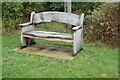
Bench at Bulmer Village Hall
by Geographer
for square TL8439
Off Church Meadow
|
|
Bulmer Village Hall
by Geographer
geograph for square TL8439
Off Church Meadow
Link |
|
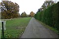
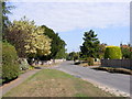
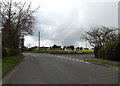
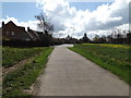
Church Meadow, Henley
by Geographer
geograph for square TM1551
At the junction with Ashbocking Road
|
|
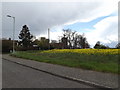
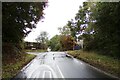
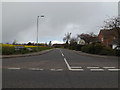
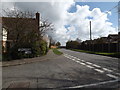
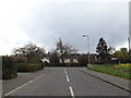
Ashbocking Road, Henley
by Geographer
geograph for square TM1551
At the junction with Church Meadow
|
|
Henley Community Centre sign
by Geographer
for square TM1551
At the entrance to Henley Community Centre off Church Meadows
|
|
Entrance to Henley Community Centre
by Geographer
geograph for square TM1551
Off Church Meadows
|
|
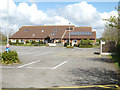
Henley Community Centre
by Geographer
geograph for square TM1551
Off Church Meadows
|
|
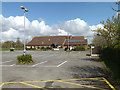
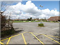
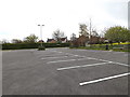
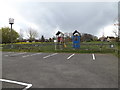
Henley Community Centre Car Park
by Geographer
geograph for square TM1551
Off Church Meadows
|
|
Entrance of Henley Community Centre
by Geographer
geograph for square TM1551
Looking towards Church Meadows
|
|
Ashbocking Road, Henley
by Geographer
geograph for square TM1551
At the junction with Church Meadows
|
|
Ashbocking Road, Henley
by Geographer
geograph for square TM1551
At the junction with Church Meadows
|
|
Ashbocking Road, Henley
by Geographer
geograph for square TM1551
At the junction with Church Meadows
|
|
Greenhill Close looking West
by Sofia
geograph for square ST3663
Greenhill Close was built in 1977 as part of Church Meadows Estate.
|
|
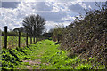
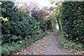
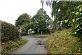
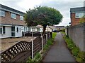
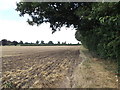
Footpath to Church Meadow
by Geographer
geograph for square TM0375
Off Hinderclay Road
|
|
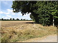
Footpath to Church Meadow
by Geographer
geograph for square TM0375
Off Hinderclay Road
|
|
Church Meadow, Henley
by Geographer
geograph for square TM1551
At the junction with Ashbocking Road near Henley Community Centre
|
|
Henley Community Centre Car Park
by Geographer
geograph for square TM1551
Looking towards the entrance
|
|
Henley Children's Play area & Beacon
by Geographer
geograph for square TM1551
|