
|
B1116 College Road, Framlingham
by Geographer
geograph for square TM2863
Category: B road (Classified B)
Looking towards Framlingham College at the junction with the B1119 Mount Pleasant
|

|
Central Sussex College, College Road, Crawley
by PAUL FARMER
geograph for square TQ2736
|
|
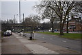
On College Road - Perry Barr, Birmingham
by Martin Richard Phelan
geograph for square SP0792
This view is looking south-west on College Road, North Birmingham. Ahead is the... (more)
|

|
Epsom College
by Ian Capper
geograph for square TQ2260
The main building of Epsom College from the entrance off College Road.
|
|
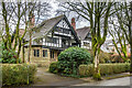
Seven Ways and Somersby
by Ian Capper
geograph for square SK0572
Semi-detached pair of late 19th Century houses at 1 & 3 College Road, built... (more)
|
|
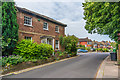
32 College Road
by Ian Capper
geograph for square TQ2160
c1850 house in College Road at its junction with Lynwood Road. Grade II listed... (more)
|
|
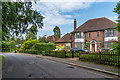
91 College Road
by Ian Capper
geograph for square TQ2260
Early 20th Century house on College Road.
|

|
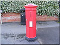
College Road Victorian Postbox
by Geographer
for square TM2863
Category: Postbox
On the B1119 Mount Pleasant at the junction with the B1116 College Road... (more)
|
|
College Road Victorian Postbox
by Geographer
for square TM2863
Category: Postbox
On the B1119 Mount Pleasant at the junction with the B1116 College Road... (more)
|

|
College Road Victorian Postbox
by Geographer
geograph for square TM2863
Category: Postbox
On the B1119 Mount Pleasant at the junction with the B1116 College Road... (more)
|

|
North Lodge
by Ian Capper
geograph for square TQ2260
Building at entrance to Epsom College off College Road.
|
|
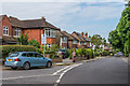
College Road
by Ian Capper
geograph for square TQ2160
Houses in College Road at its junction with Lynwood Road. Most of these date... (more)
|
|
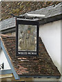
White Horse Public House sign
by Geographer
for square TM2863
At Well Close Square off the B1116 College Road at the junction with the B1116... (more)
|
|
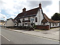
White Horse Public House, Well Close Square, Framlingham
by Geographer
geograph for square TM2863
Off the B1116 College Road at the junction with the B1116 Station Road, Bridge... (more)
|
|
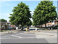
South west of the island - Perry Common, Birmingham
by Martin Richard Phelan
geograph for square SP0893
Witton Lodge Road, from the western end of The Ring island, from where it leads... (more)
|
|
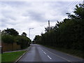
B1119 Mount Pleasant, Framlingham
by Geographer
geograph for square TM2763
Category: B road (Classified B)
Looking towards the junction with College Road near the junction with Danforth Drive
|
|
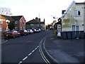
B1116 College Road, Framlingham
by Geographer
geograph for square TM2863
Category: B road (Classified B)
Looking towards Bridge Street & Albert Place at the junction with the B1119... (more)
|
|
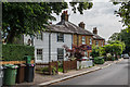
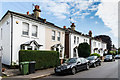
25 - 35 College Road
by Ian Capper
geograph for square TQ2160
Houses in College Road. Nos 25-27 (the weather-boarded building) date from... (more)
|
|
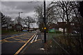
61 - 73 College Road
by Ian Capper
geograph for square TQ2160
Lat Victorian villas in College Road.
|
|
Jockey Road east - New Oscott, Birmingham
by Martin Richard Phelan
geograph for square SP0994
A view taken looking eastwards along Jockey Road. The entrance to the Homebase... (more)
|

|
Kingstanding Road eastern side - North Birmingham
by Martin Richard Phelan
geograph for square SP0795
A view uphill on the eastern side of Kingstanding Road. This is the B4138 road... (more)
|

|
Across Kingstanding Road - Kingstanding, North Birmingham
by Martin Richard Phelan
for square SP0795
A view across the dual carriageway that is Kingstanding Road, more formally the... (more)
|

|
Beccles Road, Thurlton
by Geographer
geograph for square TM4197
Road blocked for works concerning new development near the junction with College Road
|

|
Beccles Road, Thurlton
by Geographer
geograph for square TM4197
At the junction with College Road
|

|
Beccles Road, Thurlton
by Geographer
geograph for square TM4197
At the junction with College Road
Road No.C516
|

|
College Road, Thurlton
by Geographer
geograph for square TM4197
At the junction with Beccles Road
Road No.U76482
|

|
College Road
by Ian Capper
geograph for square TQ2260
The A2022 connecting the A240 Reigate Road with Epsom town centre.
|

|
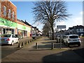
Drift Bridge roundabout
by Ian Capper
geograph for square TQ2360
Roundabout at the junction of College Road and Reigate Road.
|
|
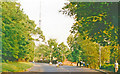
Hawthorn Road Co-op, Hawthorn Road - Kingstanding, North Birmingham
by Martin Richard Phelan
geograph for square SP0893
View taken outside Hawthorn Road Cooperative Store, Kingstanding, looking... (more)
|
|
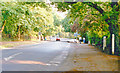
Dulwich, College Road 1989
by Ben Brooksbank
geograph for square TQ3371
View southward at the junction (on left) with Fountain Drive. Ahead is the BBC... (more)
|
|
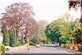
Dulwich, College Road 1989
by Ben Brooksbank
geograph for square TQ3371
View southward towards Dulwich Wood Park - and 'home' - near Kingswood... (more)
|
|
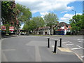
Dulwich, College Road 1989
by Ben Brooksbank
geograph for square TQ3371
View northward towards Dulwich Village and eventually London, from corner of... (more)
|
|
North on Aldridge Road - Perry Barr, Birmingham
by Martin Richard Phelan
geograph for square SP0792
A view north along the A453 Aldridge Road at Perry Barr, Birmingham taken from... (more)
|

|
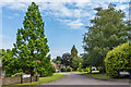
New Development off Beccles Road
by Geographer
geograph for square TM4197
At the junction with College Road
|
|
Kilcorral Close
by Ian Capper
geograph for square TQ2260
c1970s cul-de-sac built on the site of nos 93 and 95 College Road.
|

|
The Chalk Pit
by Ian Capper
geograph for square TQ2260
Former chalk pit off College Road, now housing a variety of businesses.
|

|
The Chalk Pit
by Ian Capper
geograph for square TQ2260
Former chalk pit off College Road, now housing a variety of businesses.
|

|
Field
by Ian Capper
geograph for square TQ2260
Field off College Road.
|
|
Laggan House
by Ian Capper
geograph for square ST7466
Large Victorian house in College Road now divided into seven flats. It was... (more)
|

|
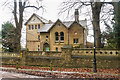
Beaconfield Lodge
by Ian Capper
geograph for square ST7466
Former Lodge to Beaconfield, a large house on College Road, now housing a... (more)
|
|
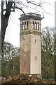
Blaine's Folly
by Ian Capper
for square ST7466
Belvedere tower built in around 1870 by Sir Robert Blaine, later MP for Bath,... (more)
|
