
|
County Galway, River Clare
by David Dixon
geograph for square M3232
The River Clare is a 93‑km waterway flowing through counties Mayo and... (more)
|
|
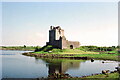
Dunguaire Castle, County Galway
by Jeff Buck
geograph for square M3810
Dunguaire Castle is a 16th-century tower house on the shore of Galway Bay.... (more)
|

|
Old farm building west of the N84 in County Galway
by David Dixon
geograph for square M3235
A weathered agricultural shed set in open grassland. The structure, with its... (more)
|

|
R345 near to Cornamona, Co Galway
by David Dixon
geograph for square M0351
|

|
Bend on the R345 near Cornamona, Co Galway
by David Dixon
geograph for square M0251
|

|
R345, County Galway
by David Dixon
geograph for square L9752
The road winds through the hilly Connemara landscape, with grassy slopes and... (more)
|

|
Open grassland west of the N84
by David Dixon
geograph for square M3237
Looking west from the N84 across a wide expanse of rough grassland. The... (more)
|

|
Small cluster of buildings west of the N84 in County Galway
by David Dixon
geograph for square M3239
Looking west from the N84 across improved pasture. A small cluster of modern... (more)
|

|
Main Street, Oughterard
by David Dixon
geograph for square M1242
Oughterard is a small town (population approximately 1,300) in County Galway. It... (more)
|

|
River Cong east of the village
by David Dixon
geograph for square M1455
The River Cong emerges from the karst springs beneath the village and flows... (more)
|

|
Galway Bay, Black Rock buoy
by David Dixon
geograph for square M2520
The main channel into Galway Harbour from the west lies between Black Rock on... (more)
|

|
Cregg River (Abhainn na Creige), County Galway
by David Dixon
geograph for square M3234
|

|
Hillside View from the R345, Maam Valley
by David Dixon
geograph for square M0050
Looking south from the R345, this scene captures a lush hillside in County... (more)
|

|
Black Rock marker buoy
by David Dixon
geograph for square M2520
The main channel into Galway Harbour from the west lies between Black Rock on... (more)
|

|
Southbound N84 at Carrowbrowne, Co Galway
by David Dixon
geograph for square M3130
|

|
N84, Co Galway
by David Dixon
geograph for square M3238
|

|
Horse‑grazed pasture west of the N84
by David Dixon
geograph for square M3239
Looking west from the N84 across a field used for horse grazing. Several animals... (more)
|

|
R345, Cornamona
by David Dixon
geograph for square M0352
Corr na Móna (anglicised as Cornamona) is a village and townland in County... (more)
|

|
Countryside Scene South of the R345, Maam Valley
by David Dixon
geograph for square M0150
A view looking south across the peaceful rural landscape typical of County... (more)
|

|
County Galway, Lough Corrib
by David Dixon
geograph for square L9951
Lough Corrib is the largest lake within the Republic of Ireland and the second... (more)
|

|
Lough Corrib, County Galway
by David Dixon
geograph for square L9951
Lough Corrib is the largest lake within the Republic of Ireland and the second... (more)
|

|
Lough Corrib, County Galway
by David Dixon
geograph for square L9851
Lough Corrib is the largest lake within the Republic of Ireland and the second... (more)
|

|
Bus stop on Headford Road
by David Dixon
geograph for square M3027
|

|
N84, Headford Road
by David Dixon
geograph for square M3128
|

|
Headford Road near Ballindooley Castle
by David Dixon
geograph for square M3129
|

|
Carrowbrowne, Emo filling station on Headford Road
by David Dixon
geograph for square M3129
|

|
Commersial yard; The Galway Truck Centre
by David Dixon
geograph for square M3231
|

|
Yard and fields west of the N84
by David Dixon
geograph for square M3231
Looking west from the N84 near the Galway Truck Centre across roadside pasture... (more)
|

|
Ballindooley Stores
by David Dixon
geograph for square M3129
|

|
Southbound N84, Clonboo (Cluain Bú))
by David Dixon
geograph for square M3236
|

|
Grazing land south of Glencorrib
by David Dixon
geograph for square M2450
|

|
Cattle grazing south of Glencorrib
by David Dixon
geograph for square M2350
|

|
Farm at Glencorrib
by David Dixon
geograph for square M2251
|

|
Farm entrance at Glencorrib
by David Dixon
geograph for square M2251
A traditional farm entrance marked by stone pillars, an older boundary wall and... (more)
|

|
House and agricultural sheds south of the R334 near Cross
by David Dixon
geograph for square M2152
Rgus view from the R334 takes in a contrast typical of the Corrib basin fringe:... (more)
|

|
Freshly cut pasture south‑west of the R334 near Cross
by David Dixon
geograph for square M2052
Looking from the R334, the view opens across a recently mown field enclosed by a... (more)
|

|
Field next to the R334 near Cross
by David Dixon
geograph for square M2053
|

|
Tractor turning off the R334 near Cross
by David Dixon
for square M2053
A farm tractor towing hay‑making equipment has just left the R334, turning... (more)
|

|
Pasture and farmhouse between Cross and Glencorrib
by David Dixon
geograph for square M2054
Looking south from the R334.
|

|
Local road off the R334, south of Cross
by David Dixon
geograph for square M1954
|

|
View from the R334, east of Cross
by David Dixon
geograph for square M1955
|

|
Field boundary next to the R346, near Cross
by David Dixon
geograph for square M1855
|

|
R346 between Cong and Cross
by David Dixon
geograph for square M1655
|

|
The road between Cong and Cross
by David Dixon
geograph for square M1555
Travelling east on the R346 from Cong towards Cross, the view looks across... (more)
|

|
Road through Cong Woods
by David Dixon
geograph for square M1355
|

|
Rural road west of the R345 in the Maam Valley
by David Dixon
geograph for square M1154
|

|
Pastoral Scene in the Maam Valley near Clonbur
by David Dixon
geograph for square M1054
Looking south from the roadside, the view opens across rough pasture framed by a... (more)
|

|
Cornamona Bridge and House on the R345
by David Dixon
geograph for square M0352
The historic Cornamona Bridge, which spans the Abhainn Chorr na Móna (Cornamona... (more)
|

|
R345, near Cornamona
by David Dixon
geograph for square M0150
A winding stretch of the R345, travelling eastwards towards Cornamona.
|

|
Deforested Slope with Mountain Backdrop
by David Dixon
geograph for square L9752
Looking south from the R345, this view shows a recently logged area with tree... (more)
|
