
|
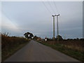
Cromwell Road Control Box
by Geographer
geograph for square TM4188
At Cromwell Road Crossing off Cromwell Road
|
|
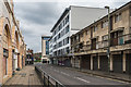
Cromwell Road
by Ian Capper
geograph for square TQ2750
Looking along Cromwell Road, with part of the Belfry shopping centre on the... (more)
|

|
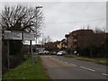
Cromwell Road sign
by Geographer
for square TM4288
On Cromwell Road at the junction with the A145 London Road
|
|
Cromwell Road
by Geographer
geograph for square TM4187
Approaching Cromwell Road Crossing looking towards the A145 London Road
|

|
Looking down the railway line to Weston Crossing & Brampton
by Geographer
geograph for square TM4188
At Cromwell Road Crossing off Cromwell Road
|
|
B1046 Potton Road, Eynesbury
by Geographer
geograph for square TL1859
At the junction with the B1046 Cromwell Road
|

|
Polls Lane, Ringsfield
by Geographer
geograph for square TM4087
Looking towards Grove Farm & Cromwell Road at the junction with Church Road
|

|
Cromwell Road Crossing
by Geographer
geograph for square TM4188
Looking towards the A145 London Road
|
|
Wash Lane Bridleway to the A145 & Ringsfield Road
by Geographer
geograph for square TM4187
Off Cromwell Road
|

|
Ringsfield Village sign
by Geographer
geograph for square TM4087
At the junction with Church & Cromwell Roads
|

|
Cromwell Road sign
by Geographer
for square TM4087
On Cromwell Road at the junction with Church Road
|

|
Roadsign on Cromwell Road
by Geographer
for square TM4087
At the junction with Church Road
|

|
Church Road & Ringsfield Village sign
by Geographer
geograph for square TM4087
At the junction with Church & Cromwell Roads
|
|
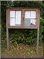
Ringsfield Village Notice Board
by Geographer
for square TM4087
On Redisham Road at the junction with Church,School & Cromwell Roads
|

|
Redisham Road sign
by Geographer
for square TM4087
On Redisham Road at the junction with Church,School & Cromwell Roads near Long Close
|

|
Church Road, Ringsfield Corner
by Geographer
geograph for square TM4087
At the junction with Redisham,School & Cromwell Roads
|

|
Cromwell Road
by Ian Capper
for square TL1899
19th Century terraced housing on Cromwell Road.
|

|
Cromwell Road
by Ian Capper
geograph for square TL1899
19th Century terraced housing on Cromwell Road.
|

|
Cromwell Road
by Ian Capper
geograph for square TL1899
Late 19th Century terraced housing on Cromwell Road.
|
|
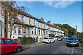
Cromwell Road
by Ian Capper
geograph for square TQ3256
Turn of the 19th/20th Century terrace on Cromwell Road. Compare its immediate... (more)
|
|
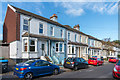
Cromwell Road
by Ian Capper
geograph for square TQ3256
Turn of the 19th/20th Century terrace of villas on Cromwell Road. A plaque in... (more)
|
|
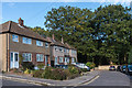
Cromwell Road
by Ian Capper
geograph for square TQ3256
c1950s housing on a cul-de-sac ending at the border of Surrey and the London... (more)
|
|
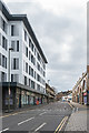
Queensgate
by Ian Capper
geograph for square TQ2750
Redevelopment completed in 2017 of the former Knowles House on the corner of... (more)
|
|
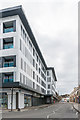
Queensgate
by Ian Capper
geograph for square TQ2750
Redevelopment completed in 2017 of the former Knowles House on the corner of... (more)
|

|
Cromwell Road Crossing
by Geographer
geograph for square TM4188
Looking towards Polls Lane & Ringsfield Corner
|

|
Ringsfield Village sign
by Geographer
for square TM4087
At the junction with Church & Cromwell Roads
(Very close up)
|

|
Ringsfield Village sign
by Geographer
geograph for square TM4087
At the junction with Church & Cromwell Roads
(Close up)
|

|
Ringsfield Village sign
by Geographer
geograph for square TM4087
At the junction with Church & Cromwell Roads
|

|
Ringsfield Village sign
by Geographer
geograph for square TM4087
At the junction with Church & Cromwell Roads
|

|
Redisham Road sign
by Geographer
for square TM4087
On Redisham Road at the junction with Church,School & Cromwell Roads
|

|
Primrose Lane & bridleway to Cromwell Road
by Geographer
geograph for square TM4188
Off Ringsfield Road near Dowe Cottage
|

|
Polls Lane, Ringsfield
by Geographer
geograph for square TM4187
Looking towards Grove Farm at the junction with Cromwell Road
|

|
Polls Lane sign
by Geographer
for square TM4187
On Polls Lane at the junction with Cromwell Road
|

|
Polls Lane, Ringsfield
by Geographer
geograph for square TM4187
At the junction with Cromwell Road
|
|
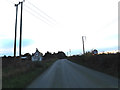
Entering Ringsfield on Cromwell Road
by Geographer
geograph for square TM4188
Looking towards Polls Lane & Ringsfield Corner
|

|
Cromwell Road, Ringsfield
by Geographer
geograph for square TM4288
At the junction with the A145 London Road
|

|
Weston Village sign
by Geographer
for square TM4288
On the A145 London Road at the junction with Cromwell Road
|

|
Footpath to Cromwell Road and entrance to Evergreens Garden Centre
by Geographer
geograph for square TM4287
Off the A145 London Road
|

|
A145 London Road entering Weston
by Geographer
geograph for square TM4288
At the junction with Cromwell Road
|

|
A145 London Road entering Beccles
by Geographer
geograph for square TM4288
At the junction with Cromwell Road
|

|
Roadsign on the A145 London Road
by Geographer
for square TM4288
At the junction with Cromwell Road
|

|
Cromwell Road, Ringsfield
by Geographer
geograph for square TM4288
At the junction with the A145 London Road
|
|
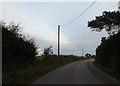
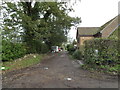
Cromwell Road & bridleway
by Geographer
geograph for square TM4187
Looking towards the A145 London Road
|
|
Footpath to the A145 London Road
by Geographer
geograph for square TM4187
Off Cromwell Road
|

|
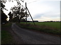
Cromwell Road & footpath
by Geographer
geograph for square TM4187
Looking towards the A145 London Road
|
|
Polls Lane, Ringsfield
by Geographer
geograph for square TM4187
At the junction with Cromwell Road
|

|
Roadsign on Cromwell Road
by Geographer
for square TM4187
At the junction with Polls Lane
|

|
Cromwell Road. Ringsfield
by Geographer
geograph for square TM4187
Looking towards the A145 London Road at the junction with Polls Lane
|

|
Cromwell Road & The Horseshoes Public House
by Geographer
geograph for square TM4187
|

|
Cromwell Road & footpath
by Geographer
geograph for square TM4187
|
