
|
A428 Cambridge Road, Croxton
by Geographer
geograph for square TL2460
Looking towards St.Neots at the former Croxton Services near Croxton Hand Car Wash
|

|
Former Ponda Rosa steakhouse & bar
by Geographer
geograph for square TL2460
Off the A428 Cambridge Road near Croxton Hand Car Wash
Other photos:... (more)
|

|
A428 Cambridge Road, Croxton
by Geographer
geograph for square TL2460
Looking towards Cambridge at Croxton Hand Car Wash approaching the crossroads
|

|
Village notice board, telephone kiosk & Croxton village postbox
by Geographer
geograph for square TL2460
On Abbottsley Road
Postbox No.PE19 140
|

|
Croxton Village Notice Board & Croxton Village Postbox
by Geographer
for square TL2459
Postbox No.PE19 128
|

|
Croxton Village Notice Board & Croxton Village Postbox
by Geographer
for square TL2459
Postbox No.PE19 128
|

|
Croxton village sign
by Adrian S Pye
geograph for square TL8787
Croxton church with its recognisable spire is in the background. In the... (more)
|

|
Croxton village sign
by Adrian S Pye
for square TL8787
Croxton church with its recognisable spire is in the background. In the... (more)
|

|
Croxton Hand Car Wash
by Geographer
geograph for square TL2460
On the A428 Cambridge Road at the junction with Toseland Road
|

|
Wind Turbines
by Geographer
geograph for square TL2460
Taken from the former Croxton Services off the A428 Cambridge Road.
|

|
Roadsigns on the A428 Cambridge Road
by Geographer
for square TL2460
At the junction with Toseland Road near Croxton Hand Car Wash
|

|
Croxton Hand Car Wash
by Geographer
geograph for square TL2460
On the A428 Cambridge Road at the crossroads
|

|
Croxton Village Postbox
by Geographer
for square TL2460
On Abbottsley Road
Postbox No.PE19 140
|

|
High Street, Croxton & Croxton Village Postbox
by Geographer
geograph for square TL2459
Looking towards the A428 Cambridge Road
Postbox No.PE19 128
|

|
Toseland Road, Croxton
by Geographer
geograph for square TL2460
Approaching the A428 Cambridge Road near Whitehall Farm Industrial Estate
|

|
Abbotsley Road, Croxton
by Geographer
geograph for square TL2460
Looking towards the A428 Cambridge Road
|

|
Abbotsley Road, Croxton
by Geographer
geograph for square TL2460
At the junction with the A428 Cambridge Road
|

|
A428 Cambridge Road, Croxton
by Geographer
geograph for square TL2460
At the junction with Abbotsley Road
|

|
Croxton Village Postbox
by Geographer
for square TL2459
Postbox No.PE19 128
(Close up)
|

|
Croxton Village Postbox
by Geographer
for square TL2459
Postbox No.PE19 128
|

|
Toseland Road, Croxton
by Geographer
geograph for square TL2460
Looking towards Whitehall Farm Industrial Estate at the junction with the A428... (more)
|

|
Entering Croxton on the A428 Cambridge Road
by Geographer
geograph for square TL2460
Looking towards Cambridge approaching the crossroads
|

|
Telephone kiosk & Croxton village postbox
by Geographer
geograph for square TL2460
On Abbottsley Road
Postbox No.PE19 140
|

|
Toseland Road Croxton
by Geographer
geograph for square TL2460
|

|
Path from St James's Church, Croxton
by Hugh Venables
geograph for square TL2559
A dead end path through Croxton Park to and from the church.
|

|
Path to St James's Church, Croxton
by Hugh Venables
geograph for square TL2559
A dead end path through Croxton Park to and from the church.
|

|
Path from St James's Church, Croxton
by Hugh Venables
geograph for square TL2559
A dead end path through Croxton Park to and from the church.
|

|
Picnic Area off the A134 Mundford Road
by Geographer
geograph for square TL8487
At entrance No.29
|

|
Entering Thetford on the A134 Mundford Road
by Geographer
geograph for square TL8487
At entrance No.29 picnic area
|

|
A134 Mundford Road, Thetford
by Geographer
geograph for square TL8487
At entrance No.29 picnic area
|

|
Roadsign on the A134 Mundford Road
by Geographer
geograph for square TL8685
Approaching the junction with the A11
|

|
Canal bank, near Croxton Hall Farm and bridge 175
by Christine Johnstone
geograph for square SJ6967
On the Trent & Mersey Canal, south of Croxton Flash.
|

|
Croxton Hall Farm and Croxton Flash
by Christine Johnstone
geograph for square SJ6967
On the east bank of the Trent & Mersey Canal, between bridges 175 and 176. A... (more)
|

|
Roadsign on Toseland Road at the crossroads
by Geographer
geograph for square TL2460
At the junction with the A428 Cambridge Road near Whitehall Farm Industrial... (more)
|

|
A428 Cambridge Road & the former Ponda Rosa steakhouse
by Geographer
geograph for square TL2460
Looking towards Cambridge
|

|
A428 Cambridge Road, Eynesbury Hardwicke
by Geographer
geograph for square TL2360
Looking towards Cambridge
|

|
Estate Agents Board at North Farm
by Geographer
for square TL2360
Off the A428 Cambridge Road
|

|
Entrance to North Farm
by Geographer
geograph for square TL2360
Off the A428 Cambridge Road
|

|
A428 Cambridge Road, Eynesbury Hardwicke
by Geographer
geograph for square TL2360
Looking towards Cambridge at the entrance to North Farm
|

|
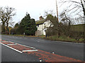
Eltisley Manor Nursing Home
by Geographer
geograph for square TL2359
Off the A428 Cambridge Road
Link |
|
Weald Farm Cottage
by Geographer
geograph for square TL2359
Off the A428 Cambridge Road near Eltisley Manor Nursing Home
|
|
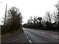
A428 Cambridge Road, Eynesbury Hardwicke
by Geographer
geograph for square TL2359
Looking towards Cambridge at the entrance to Weald Farm Cottage
|
|
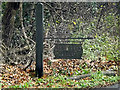
Weald Farm Cottage sign
by Geographer
for square TL2359
Off the A428 Cambridge Road at the entrance to Weald Farm Cottage
|

|
Eltisley Manor Nursing Home
by Geographer
geograph for square TL2359
Off the A428 Cambridge Road
Link |

|
Field entrance off the A428 Cambridge Road
by Geographer
geograph for square TL2259
Near the entrance to Caldecote Manor Farm
|

|
A428 Cambridge Road, Eynesbury Hardwicke
by Geographer
geograph for square TL2359
Looking towards Eltisley Manor Nursing Home near the entrance to Caldecote Manor Farm
|

|
Caldecote Manor Farm sign
by Geographer
for square TL2259
Off the A428 Cambridge Road at the entrance to Caldecote Manor Farm
(Close up)
|

|
Entrance to Caldecote Manor Farm
by Geographer
geograph for square TL2259
Off the A428 Cambridge Road
|

|
A428 Cambridge Road, Eynesbury Hardwicke
by Geographer
geograph for square TL2259
Looking towards Cambridge at the bridleway to Wayside Farm
|

|
Footpath & entrance to Wintringham Hall
by Geographer
geograph for square TL2159
Footpath to Little Wintringham
Off the A428 Cambridge Road
|
