Public Tags
Tag: Cut-Off·Channel
Showing images tagged with Cut-Off Channel tag.
|
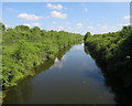
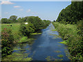
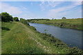
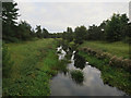
Cut off channel going under the Little Ouse River
by Hugh Venables geograph for square TL7286 The Cut-off Channel is a man-made drainage channel that goes around the eastern... (more)
|
|
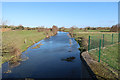
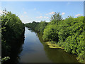
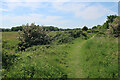
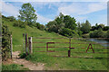
Permissive path by Cut-off Channel
by Hugh Venables geograph for square TL6199 The Cut-off Channel is a large man made channel that follows the eastern edge of the Fens.
|
|
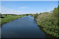
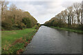
Cut-off Channel near Fordham
by Hugh Venables geograph for square TL6199 With permissive paths each side. The Cut-off Channel is a large man made channel... (more)
|
|
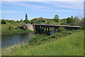
A10 over Cut-off Channel
by Hugh Venables geograph for square TL6299 The Cut-off Channel is a large man made channel that follows the eastern edge of the Fens.
|
|
Catchwater drain entering Cut-off Channel
by Hugh Venables geograph for square TL6099 Also linking the bridleway with the permissive path along the Cut-off Channel.
|
|
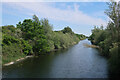
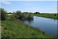
Cut-off Channel near Wretton
by Hugh Venables geograph for square TL6899 The Cut-off Channel is a low, man-made drain around the eastern side of the Fens.
|
|
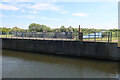
Bridge over the Cut-off Channel
by Hugh Venables geograph for square TL6899 The Cut-off Channel is a low, man-made drain around the eastern side of the Fens.
Tags:
Cut-Off Channel
FensX
type:GeographX
top:Rivers, Streams, DrainageX
top:Roads, Road TransportX
|
|
River Wissey aqueduct over the Cut-off Channel
by Hugh Venables geograph for square TL7098 The Cut-off Channel is a low, man-made drain around the eastern side of the Fens.
|
|
Cut-off Channel
by Hugh Venables geograph for square TL6989 A large man-made drainage channel that follows the eastern edge of the Fens.
Tags:
Cut-Off Channel
Drainage ChannelX
FensX
top:Flat LandscapesX
type:GeographX
top:Rivers, Streams, DrainageX
|
|
Cut-off Channel
by Hugh Venables geograph for square TL6989 A large man-made drainage channel that follows the eastern edge of the Fens.
Tags:
Cut-Off Channel
Drainage ChannelX
FensX
top:Flat LandscapesX
type:GeographX
top:Rivers, Streams, DrainageX
|
|
Cut-off Channel
by Hugh Venables geograph for square TL7098 From the aqueduct where the River Wissey passes over the drainage channel.
|
|
Cut-off Channel
by Hugh Venables geograph for square TL6799 Man-made drainage channel around the eastern edge of the Fens.
|
|
Cut-off Channel from Station Road
by Hugh Venables geograph for square TL7287 A large man-made drainage channel that follows the eastern edge of the Fens.
|
|
Cut-off Channel near Fordham
by Hugh Venables geograph for square TL6199 With permissive paths each side.
|
|
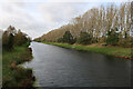
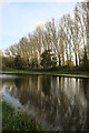
Poplars by the Cut-off Channel
by Hugh Venables geograph for square TL6299 Poplars used to be a commercial timber crop, as well as a useful windbreak. They... (more)
|
|
Cut-off Channel near Stoke Ferry
by Hugh Venables for square TL7098 With a spur connecting from the River Wissey.
|
|
Cut-off Channel
by Hugh Venables geograph for square TL6899 With permissive access along the bank.
|
|
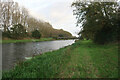
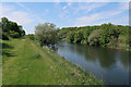
Bank of the Cut-off Channel
by Hugh Venables geograph for square TL6799 Permissive path along the top of the bank.
|
|
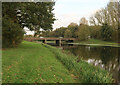
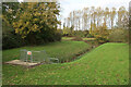
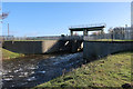
Sluice from Little Ouse River
by Hugh Venables geograph for square TL7387 Water dropping down from the Little Ouse River to a link to the Cut-off Channel.
|
|
Cut-off Channel
by Hugh Venables geograph for square TL7275 Drainage ditch between the River Lark and Denver Sluice, largely following the... (more)
|
|
Cut-off Channel
by Hugh Venables geograph for square TL7274 Drainage ditch that follows the eastern edge of the Fens from the River Lark.
|
|
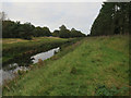
Permissive path by Cut-off Channel
by Hugh Venables geograph for square TL6899 |