|
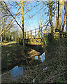
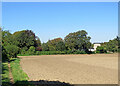
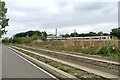
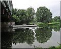
Sturmer: former Great Eastern Railway bridge
by John Sutton
geograph for square TL6944
This bridge over Stour Brook, a tributary of the River Stour, once carried the... (more)
|
|
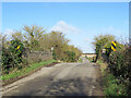
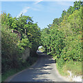
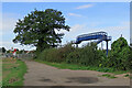
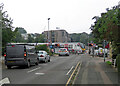
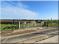
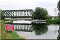
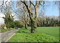
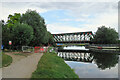
Swaffham Prior: over the railway once
by John Sutton
geograph for square TL5765
This bridge was built in 1883-4 to carry the road from Swaffham Prior to Reach... (more)
|
|
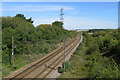
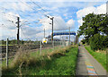
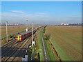
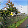
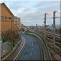
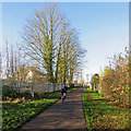
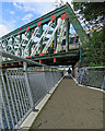
Littlebury: the line to Cambridge
by John Sutton
geograph for square TL5139
This is the former Great Eastern main line from Liverpool Street to Cambridge... (more)
|
|
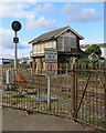
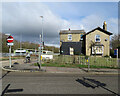
Thetford Signal Box
by John Sutton
geograph for square TL8683
Thetfords Grade II listed Signal Box is a standard Great Eastern Railway type,... (more)
|
|
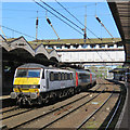
A Norwich train at Ipswich
by John Sutton
geograph for square TM1543
The 09.08 ready to depart on a bright May morning. Station canopy enthusiasts... (more)
|
|
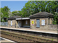
Darsham Station: waiting shelter
by John Sutton
geograph for square TM4069
On the Up platform, for passengers to Ipswich. The East Suffolk line opened in... (more)
|
|
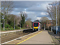
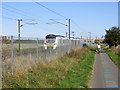
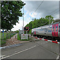
Thetford: a Stansted Airport train arriving
by John Sutton
geograph for square TL8683
A Stadler bi-modal four-coach set arriving from Norwich in good time to depart... (more)
|
|
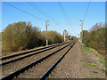
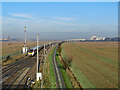
The Cambridge line
by John Sutton
geograph for square TL4748
A view from the foot crossing east of Whittlesford. This is the Great Eastern... (more)
|
|
Saffron Walden: where the railway once crossed
by John Sutton
geograph for square TL5538
A bridge once carried the Audley End to Bartlow branch line over Ashdon Road on... (more)
|
|
Southbound train and northbound cyclist
by John Sutton
geograph for square TL4553
The path (this section is the Genome Path) runs beside the railway from Great... (more)
|
|
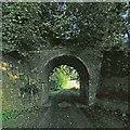
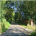
A bridge which carried the Stour Valley Railway
by John Sutton
geograph for square TL5944
Beyond the bridge the drive (which serves a house behind the camera) rises at a... (more)
|
|
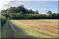
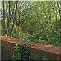
Stubble and the Stour Valley line
by John Sutton
geograph for square TL5945
The overgrown railway embankment and the bridge over this private farm track... (more)
|
|
Taking the King's Cross Line
by John Sutton
geograph for square TL4653
A Sunday-afternoon Thameslink train from Cambridge taking the King's Cross... (more)
|
|
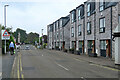
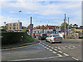
Great Shelford: on Station Road
by John Sutton
geograph for square TL4652
Approaching the level crossing and (offstage left) Shelford Station, the first... (more)
|
|
Mill Road railway bridge near Great Wilbraham
by John Sutton
geograph for square TL5556
|
|
Greater Anglia to Cambridge
by John Sutton
geograph for square TL4653
A Greater Anglia train hurrying towards Cambridge on a bright January morning... (more)
|
|
Taking the King's Cross line at Shepreth Branch Junction
by John Sutton
geograph for square TL4653
The 10.44 from Cambridge heads for King's Cross on a sunny January morning.... (more)
|
|
Great Shelford: track, tree and footbridge
by John Sutton
geograph for square TL4653
The footbridge at Shepreth Branch Junction replaced a foot crossing of the... (more)
|
|
Great Shelford: southbound at Granham's Road
by John Sutton
geograph for square TL4652
A Birmingham-Stansted train hurrying over Granham's Road level crossing. At... (more)
|
|
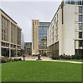
Towards Station Road
by John Sutton
geograph for square TL4657
The area around Cambridge railway station has changed out of all recognition in... (more)
|
|
Great Shelford: at Station Road level crossing
by John Sutton
geograph for square TL4652
Waiting for a southbound train to pass on an overcast Sunday morning. Shelford... (more)
|
|
Great Shelford: the Genome Path and a Cambridge train
by John Sutton
geograph for square TL4652
Late on a February morning a train from Liverpool Street was speeding towards... (more)
|
|
Great Shelford: next stop Cambridge
by John Sutton
geograph for square TL4652
A long train from Liverpool Street hurrying towards Cambridge on the last leg of... (more)
|
|
Great Shelford: waiting at the crossing
by John Sutton
geograph for square TL4652
A Stansted Airport train hurries through Shelford Station and over the Station... (more)
|
|
Drove Way farm crossing
by John Sutton
geograph for square TL5456
The footpath from Fulbourn to Great Wilbraham shares this farm track and... (more)
|
|
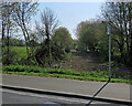
Linton: where the railway went
by John Sutton
geograph for square TL5646
This picture looks, in the Cambridge direction, over the parapet of what was a... (more)
|
|
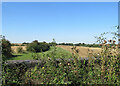
Sturmer: once a railway
by John Sutton
geograph for square TL6944
This path follows the trackbed of the Cambridge-Colchester Stour Valley railway... (more)
|
|
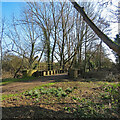
Sturmer: snowdrops and former railway bridge
by John Sutton
geograph for square TL6944
This bridge once carried the Cambridge-Colchester Stour Valley railway line. The... (more)
|
|
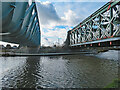
Busway and railway
by John Sutton
geograph for square TL4656
Looking over the guided busway towards Cambridge railway station. The large... (more)
|
|
Fen Ditton: where the railway ran
by John Sutton
geograph for square TL4859
The area ahead, recently cleared, was the trackbed of the Cambridge to... (more)
|
|
Railway bridge and work on The Jetty
by John Sutton
geograph for square TL4760
The riverside path from Fen Ditton to Stourbridge Common was carried on a... (more)
|
|
Coldham's Common railway footbridge in 1997
by John Sutton
geograph for square TL4758
This is the line from Ipswich, Bury St Edmunds and Newmarket. In the 1990s the... (more)
|
|
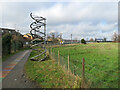
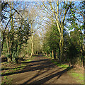
Near the Lynn end of the Sandringham Railway Path
by John Sutton
geograph for square TF6219
The Sandringham Railway Path, part of National Cycle Network Route 1, follows... (more)
|
|
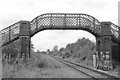
Railway bridge parapets on Butlers Lane
by John Sutton
geograph for square TL5639
This bridge carried Butlers Lane over the Audley End to Bartlow branch line. The... (more)
|
|
An overgrown railway cutting
by John Sutton
geograph for square TL5639
Looking over the parapet of a bridge which, until the railway closed in 1964,... (more)
|
|
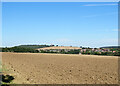
Across Linton to Rivey Hill
by John Sutton
geograph for square TL5645
A view from the track which links Bartlow Road on the edge of Hadstock to Long... (more)
|
|
Nearing Linton on a path from Hadstock
by John Sutton
geograph for square TL5645
It's hard to believe that the Stour Valley railway, which carried... (more)
|
|
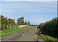
A dip in the road near The Wych
by John Sutton
geograph for square TL5049
Beyond the car the road from Pampisford to Babraham dips to where a railway... (more)
|
|
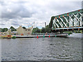
Across the Cam between the bridges
by John Sutton
geograph for square TL4760
A southbound train is crossing the railway bridge on its way to Cambridge... (more)
|
|
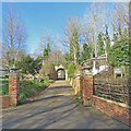
Wixoe: The Gate Lodge and a former railway bridge
by John Sutton
geograph for square TL7243
The Gate Lodge to Floriston Hall dates from the early 19th century, has pointed... (more)
|
|
Cycle path, busway and railway
by John Sutton
geograph for square TL4555
The Cambridgeshire Guided Busway and the cycle track next to it run close to the... (more)
|
|
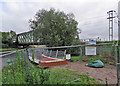
Chesterton: riverside path diverted
by John Sutton
geograph for square TL4760
While work continues on the approach to the new Abbey-Chesterton cycle bridge,... (more)
|
|
Under the bridges
by John Sutton
geograph for square TL4760
The Jetty carries the right-bank path from Stourbridge Common to Fen Ditton... (more)
|
|
Oakington: the former railway station
by John Sutton
geograph for square TL4165
The trackbed of the Cambridge to St Ives railway line is now occupied by the... (more)
|
|
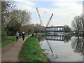
Chesterton: big crane and the railway bridge
by John Sutton
geograph for square TL4760
A good number of anglers, joggers, cyclists and walkers were out by the River... (more)
|
|
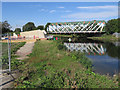
Abbey-Chesterton Bridge: The Jetty rebuilt
by John Sutton
geograph for square TL4760
The Jetty carries the right-bank path from Ditton Meadows to Stourbridge Common... (more)
|
|
Abbey-Chesterton Bridge: the renewed Jetty
by John Sutton
geograph for square TL4760
The new Jetty will carry the riverside path under the railway bridge and the new... (more)
|
|
Abbey-Chesterton Bridge: new Jetty nearer completion
by John Sutton
geograph for square TL4760
The Jetty will carry the path from Ditton Meadows to Stourbridge Common under... (more)
|
|
Abbey-Chesterton Bridge: reinstating The Jetty
by John Sutton
geograph for square TL4760
The riverside path from Fen Ditton to Stourbridge Common was carried on a... (more)
|
|
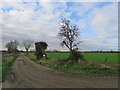
Stow-cum-Quy: a railway once
by John Sutton
geograph for square TL5161
Until 1964 this farm track was the course of the Mildenhall to Cambridge (ahead)... (more)
|