Public Tags
Tag: Field·Barn
Showing latest 50 of 301 images tagged with Field Barn tag.
|
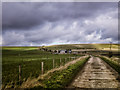
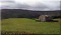
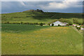
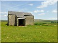
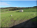
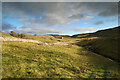
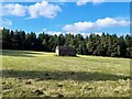
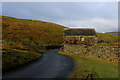
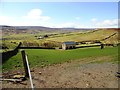
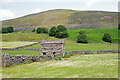
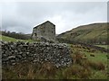
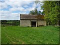
Field Barn on Horton Down
by Gillie Rhodes geograph for square SU0664 This track leads from the road from Alton Barns to the A361 about 2 miles East... (more)
Tags:
Easton HillX
top:Farm, Fishery, Market GardeningX
Field Barn
top:GrasslandX
place:HortonX
Horton DownX
top:LowlandsX
top:PathsX
|
|
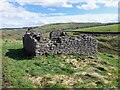
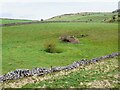
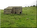
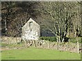
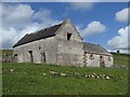
Ruined field barn
by Ian Calderwood geograph for square SK2859 Since SK2859 : Old barn and tree near Low Farm was taken, nearly ten years previously, something catastrophic... (more)
Tags:
subject:BarnX
Collapsed BarnX
Collapsed BuildingX
top:Derelict, DisusedX
top:Farm, Fishery, Market GardeningX
Field Barn
type:GeographX
Ruined Field BarnX
|
|
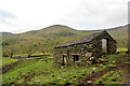
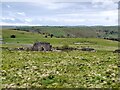
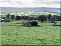
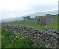
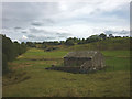
Swaledale field barn
by Andy Waddington geograph for square SD9197 Category: Field barns Swaledale is characterised by its many field barns, used to gather in cut hay... (more)
Tags:
top:Farm, Fishery, Market GardeningX
category:Field BarnsX
type:GeographX
top:GrasslandX
top:UplandsX
|
|
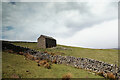
Field Barn on Cuckoo Hill
by Andy Waddington geograph for square NZ0400 Category: Field barns The footpath ascends from the bottomlands by the Arkle Beck, passing this barn... (more)
Tags:
top:Farm, Fishery, Market GardeningX
category:Field BarnsX
type:GeographX
top:GrasslandX
top:UplandsX
|
|
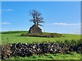
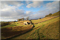
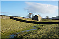
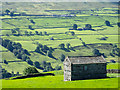
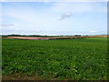
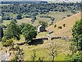
Field containing Knott Barn
by Trevor Littlewood geograph for square SD9179 Farmers will surely have names for their barns and some will be known locally... (more)
|
|
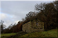
Ruined field barn above Tansley Dale
by Ian Calderwood geograph for square SK1674 A small ruined barn next to the permissive path along the edge of Tansley Dale.
Tags:
subject:BarnX
Field Barn
FootpathX
type:GeographX
top:GrasslandX
top:PathsX
Permissive PathX
Ruined BarnX
Ruined Field BarnX
top:UplandsX
|
|
Field barn at the foot of Dovedale
by Andy Waddington geograph for square NY3911 Category: Field barns The public footpath from Cow Bridge, past Hartsop Hall and on its way to the... (more)
Tags:
top:Farm, Fishery, Market GardeningX
category:Field BarnsX
type:GeographX
top:GrasslandX
top:UplandsX
|
|
Ruined field barn by the Centenary Way
by Ian Calderwood geograph for square SK2541 The Centenary Way was devised to celebrate the centenary of the Derbyshire... (more)
Tags:
subject:BarnX
former:BarnX
top:Derelict, DisusedX
top:Farm, Fishery, Market GardeningX
Field Barn
type:GeographX
top:PathsX
Ruined Field BarnX
|
|
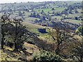
Field Barns seen from the Foot of Middle Hill
by Chris Heaton geograph for square ST9045 Field barns seen from the Wessex Ridgeway long distance footpath between Middle... (more)
|
|
A dry pond and a ruined field barn
by Ian Calderwood geograph for square SK1773 Tags:
subject:BarnX
Dew PondX
Dried Up Dew PondX
Dry PondX
top:Farm, Fishery, Market GardeningX
Field Barn
type:GeographX
top:GrasslandX
PondX
Ruined BarnX
Ruined Field BarnX
top:UplandsX
|
|
Ruined barn and pond at Middle Hay
by Ian Calderwood geograph for square SK1773 Tags:
subject:BarnX
Dew PondX
top:Farm, Fishery, Market GardeningX
Field Barn
type:GeographX
top:GrasslandX
PondX
Pond in FieldX
Ruined BarnX
Ruined Field BarnX
top:UplandsX
|
|
Field Barn below Angram
by Andy Waddington geograph for square SD8899 Category: Field barns The public footpath from Angram to Thwaite drops below Angram Lane, passing this... (more)
Tags:
top:Farm, Fishery, Market GardeningX
category:Field BarnsX
type:GeographX
top:GrasslandX
top:PathsX
category:Public FootpathX
top:UplandsX
|
|
Field Barn
by Rude Health geograph for square SD7157 These field barns are common in this local farming landscape. This morning the... (more)
|
|
Ruined field barn
by Ian Calderwood geograph for square SK0957 Tags:
subject:BarnX
top:Derelict, DisusedX
top:Farm, Fishery, Market GardeningX
Field Barn
type:GeographX
Ruined Field BarnX
top:UplandsX
|
|
Barn above Argill Beck
by Andy Waddington geograph for square NY8513 Category: Field barns Using older 1:50000 mapping (as found on my Garmin GPS) it appears that this... (more)
|
|
Barns below Cloggerby Rigg
by Andy Waddington geograph for square SD8998 Category: Field barns The public footpath from Angram to Thwaite passes close to Skeb Skeugh, the... (more)
Tags:
top:Farm, Fishery, Market GardeningX
category:Field BarnsX
type:GeographX
top:GrasslandX
top:PathsX
category:Public FootpathX
top:UplandsX
|
|
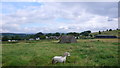
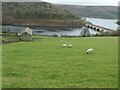
Far Thornber Barn
by Christine Johnstone geograph for square SD8162 In a sheepfield, just east of Hoyman Laithe.
Tags:
subject:BarnX
top:Farm, Fishery, Market GardeningX
Field Barn
type:GeographX
Sheep GrazingX
Sheep in FieldX
Sheep PastureX
Small Field BarnX
national park:Yorkshire DalesX
|
|
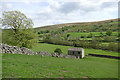
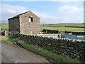
Field barn with stream
by Trevor Littlewood geograph for square SD9987 The barn is one of many in the complex of small fields south and south-west of... (more)
Tags:
subject:BarnX
top:Boundary, BarrierX
Dry Stone WallsX
top:Farm, Fishery, Market GardeningX
Field Barn
type:GeographX
top:Rivers, Streams, DrainageX
StreamletX
|
|
Stone barn in a field
by Graham Robson geograph for square SD9178 A traditional stone barn in a field to the east of Raisgill.
|
|
Ruined field barn near Cowstead Gill
by Christine Johnstone geograph for square NY7700 Seen from the open window of a southbound train on the Settle Carlisle line.
Tags:
ruin:BarnX
Cloud ShadowX
top:Derelict, DisusedX
Eden ValleyX
top:Farm, Fishery, Market GardeningX
FarmlandX
Field Barn
Rough GrasslandX
Ruined Field BarnX
subject:ValleyX
|
|
Field barn above Blackhause Sike
by Andy Waddington geograph for square NY8613 Category: Field barns The right of way from which this shot was taken is a public bridleway, so... (more)
Tags:
top:Farm, Fishery, Market GardeningX
category:Field BarnsX
type:GeographX
top:GrasslandX
top:UplandsX
|
|
Isolated field barn, south of Nether Hoff Farm
by Christine Johnstone geograph for square NY6619 Just below the summit of a ridge, where four fields meet.
Tags:
subject:BarnX
Dark CloudX
top:Farm, Fishery, Market GardeningX
Field Barn
type:GeographX
Grass FieldX
Rain CloudsX
|
|
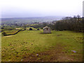
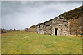
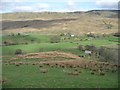
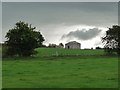
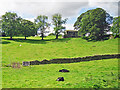
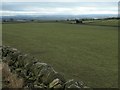
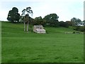
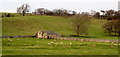
Bank Top Farm
by Nigel Mykura geograph for square SK2360 View across the rough pasture fields housing a shetland pony and a ruined field... (more)
|
|
Field Barn off Coalpit Lane
by Ian Calderwood geograph for square SK2164 |
|
Field barn
by Ian Calderwood geograph for square SK3055 |
|
Field barn
by Ian Calderwood geograph for square SK1161 |
|
Old field barn at Barn Farm
by Ian Calderwood geograph for square SK2462 Apparently in good repair but now in a camp site.
|
|
Stone Barn between Ramps Holme and Ivelet
by Chris Heaton geograph for square SD9297 One of several field barns on the footpath beside the River Swale - between... (more)
|
|
Stone Barn at Jenkin Gate
by Chris Heaton geograph for square SD9395 The moorland road descends into Swaledale above Oxnop Beck, passing this field... (more)
|
|
Barn in field near to Blades
by Trevor Littlewood geograph for square SD9798 Blades is a dispersed settlement on the north side of Swaledale on the... (more)
|
|
Field barn near Sharps Lane
by Rose and Trev Clough geograph for square SD5095 A traditional-looking Lakeland stone barn, built on a slope.
The view is from a... (more)
|
|
Drystone wall and field barns
by Russel Wills geograph for square SD8589 Limestone built field barns were used to store winter fodder.
|
|
Barn at Edmundbyers
by Robert Graham geograph for square NZ0050 This barn lies to the west of the village, on the edge of the moors. It appears... (more)
|
|
Twodale Barn
by Andrew Hill geograph for square SK1956 A lovely barn which is more obviously falling derelict when seen from other directions.
|
|
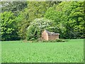
Field Barn near Anmer
by Nigel Mykura geograph for square TF7230 This large field of root crops is just off the Ling House Rd. In the distance... (more)
|
|
Field barn on Holme Road, Holme Next The Sea
by Richard Humphrey geograph for square TF7141 This former barn has been converted into a domestic dwelling
|
|
.Field barn, Simonstone
by Ian Taylor geograph for square SD8791 Stags Fell Quarries (old gritstone workings) can be seen in the background.
Tags:
subject:BarnX
top:Farm, Fishery, Market GardeningX
FellsideX
Field Barn
type:GeographX
Harvested Grass FieldX
|
|
Field barn on Aldery Cliff
by Ian Calderwood geograph for square SK0966 |
|
Toadhole Cote, on the eastern flanks of Crook Hill
by Christine Johnstone geograph for square SK1886 In this part of Derbyshire a 'cote' is a building to shelter animals.... (more)
Tags:
subject:BarnX
top:Farm, Fishery, Market GardeningX
Field Barn
type:GeographX
subject:HillsideX
national park:Peak DistrictX
Sheep GrazingX
Sheep in FieldX
Sheep PastureX
|
|
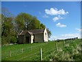
Field barn, east of High House, Marwood
by Christine Johnstone geograph for square NZ0320 At the junction of three fields.
|
![NY6851 : Field barn on Maiden Way [a Roman road] by Christine Johnstone](https://s0.geograph.org.uk/geophotos/06/20/86/6208636_9b2d9a80_120x120.jpg)
|
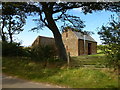
Field barn on Maiden Way [a Roman road]
by Christine Johnstone geograph for square NY6851 In the valley of the River South Tyne, south of Slaggyford.
Tags:
subject:BarnX
Corrugated Metal BarnX
top:Farm, Fishery, Market GardeningX
Field Barn
type:GeographX
Route of Roman RoadX
Valley FloorX
|
|
Field barn at Scar Gaps, west of Muker
by Christine Johnstone geograph for square SD9097 Locally known as a cow'us [cowhouse]. Where up to four cows were overwintered.
Tags:
subject:BarnX
Drystone WallsX
top:Farm, Fishery, Market GardeningX
Field Barn
Field BoundaryX
type:GeographX
national park:Yorkshire DalesX
|

|
Field barn
by Bill Harrison geograph for square SE0063 Unlike many field barns in the area, this one doesn't seem to have a name.
Tags:
top:Boundary, BarrierX
Dry Stone WallX
top:Farm, Fishery, Market GardeningX
Field Barn
type:GeographX
top:UplandsX
|
|
Extended field barn at the edge of a valley bottom
by Christine Johnstone geograph for square NY6215 Between Crosby Ravensworth and Maulds Meaburn.
Tags:
subject:BarnX
Building ExtensionX
top:Farm, Fishery, Market GardeningX
Field Barn
Field of GrassX
type:GeographX
top:LowlandsX
Valley SideX
national park:Yorkshire DalesX
|
|
Roadside barn and animal fold, near Tatterthorn
by Christine Johnstone geograph for square SD6870 In the corner of a field, on the east side of the road from Fowgill.
Tags:
subject:BarnX
top:Farm, Fishery, Market GardeningX
Field Barn
type:GeographX
RoadsideX
Stone Built BarnX
|
|
New Barn, Notgrove Estate, from the south
by Christine Johnstone geograph for square SP1119 A field barn at the southern end of Shrubs Coppice.
|
|
New Barn, Notgrove Estate, from the north-east
by Christine Johnstone geograph for square SP1119 A field barn at the southern end of Shrubs Coppice.
|
|
Field barns north of Coverham Lane
by Trevor Littlewood geograph for square SE1086 Coverham Lane runs along the south side of land rising to the modest height of... (more)
Tags:
subject:BarnX
Deciduous TreesX
top:Farm, Fishery, Market GardeningX
Field BarnsX
Fields with SheepX
type:GeographX
|
|
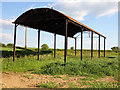
Dutch Barn Near Gussage St Andrew
by Jon Alexander geograph for square ST9714 In a field adjacent to the road between Sixpenny Handley and Gussage St Andrew.
|
|
Barn in the Clear Beck valley
by Karl and Ali geograph for square SD6268 Stone field barn in a secluded valley.
Tags:
top:Farm, Fishery, Market GardeningX
Field Barn
top:GrasslandX
Secluded ValleyX
Stone BarnX
top:UplandsX
|