|
Site of Merstone Station, Isle of Wight
by Malc McDonald
geograph for square SZ5284
The site of Merstone railway station on the Isle of Wight. The station closed... (more)
|
|
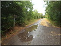
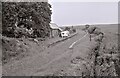
Site of Brixworth railway station
by Malc McDonald
geograph for square SP7371
It's hard to tell from the image, but a railway station once stood here.... (more)
|
|
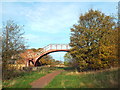
Easton Lodge Halt, near Great Dunmow
by Malc McDonald
geograph for square TL6021
Easton Lodge Halt was a station on the railway line which linked the towns of... (more)
|
|
Former Hornsea Town railway station
by Malc McDonald
geograph for square TA2047
Hornsea Town railway station closed in 1964. The main buildings survive,... (more)
|
|
Former railway tunnel, Cowes
by Malc McDonald
geograph for square SZ4995
This image was taken at the site of the former Mill Hill station in Cowes. The... (more)
|
|
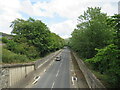
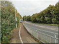
A470 road, Dolgellau
by Malc McDonald
geograph for square SH7218
The A470 road passing through Dolgellau, a town in Snowdonia National Park.... (more)
|
|
Former railway station, Robin Hood's Bay
by Malc McDonald
geograph for square NZ9405
The building in the foreground is the former railway station at Robin... (more)
|
|
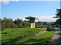
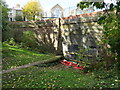
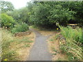
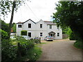
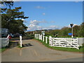
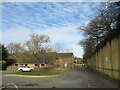
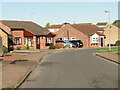
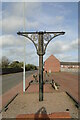
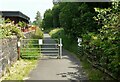
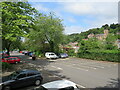
Site of Merstone Station, Isle of Wight
by Malc McDonald
geograph for square SZ5284
Merstone station closed in 1956, but its platform still survives. More... (more)
|
|
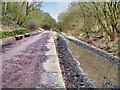
Site of Lamport railway station
by Malc McDonald
geograph for square SP7575
Brampton Valley Way at the site of Lamport railway station. The station closed... (more)
|
|
Brampton Valley Way at Lamport station site
by Malc McDonald
geograph for square SP7575
Brampton Valley Way at the site of Lamport station. The station closed in 1960.... (more)
|
|
Site of Kelmarsh railway station
by Malc McDonald
geograph for square SP7480
Kelmarsh was one of six railway stations on the route between Northampton and... (more)
|
|
Railway embankment and the site of Guyhirn Station at Ring's End
by Richard Humphrey
geograph for square TF3902
Looking along the route of the old railway line which once ran through Guyhirn... (more)
|
|
Houses at former railway station, Slinfold
by Malc McDonald
geograph for square TQ1130
The building in this image stands alongside the former railway station at... (more)
|
|
Cinder Track at Hawsker
by Malc McDonald
geograph for square NZ9208
The Cinder Track is a walking and cycling trail which follows the route of a... (more)
|
|
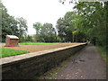
Winscombe former railway station
by Malc McDonald
geograph for square ST4157
The Strawberry Line path passing through the former railway station at Winscombe... (more)
|
|
Winscombe former railway station
by Malc McDonald
geograph for square ST4157
The Strawberry Line path passing through the former railway station at Winscombe... (more)
|
|
Site of Ryhope railway station
by Malc McDonald
geograph for square NZ4152
This image was taken on the site of Ryhope railway station. The footbridge is... (more)
|
|
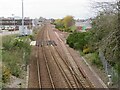
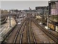
Site of Kittybrewster railway station, Aberdeen
by Malc McDonald
geograph for square NJ9307
Railway tracks passing through Kittybrewster, in the northern suburbs of... (more)
|
|
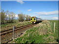
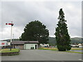
Site of Halkirk railway station
by Malc McDonald
geograph for square ND1358
A train on the Far North Line, passing the site of Halkirk railway station. The... (more)
|
|
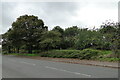
Takeley railway station
by Malc McDonald
geograph for square TL5621
The former railway station at Takeley, in north Essex. The station closed to... (more)
|
|
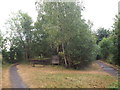
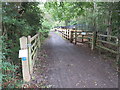
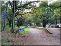
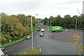
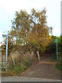
Red Squirrel Trail at Merstone
by Malc McDonald
geograph for square SZ5284
The Red Squirrel Trail at the site of Merstone railway station. More... (more)
|
|
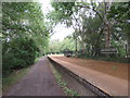
Strawberry Line path at Winscombe
by Malc McDonald
geograph for square ST4157
The Strawberry Line path at Winscombe in Somerset. The path forms part of... (more)
|
|
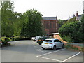
Site of Shrewsbury Abbey railway station
by Malc McDonald
geograph for square SJ4912
A car park now occupies the site which was Shrewsbury Abbey railway station.... (more)
|
|
Bowley Close, Crystal Palace
by Malc McDonald
geograph for square TQ3370
Bowley Close is a small development in Crystal Palace, in the south London... (more)
|
|
Bowley Close, Crystal Palace
by Malc McDonald
geograph for square TQ3370
Bowley Close is a small development in Crystal Palace, in the south London... (more)
|
|
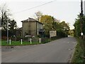
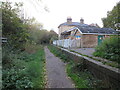
Former railway station at Cole Green, near Hertford
by Malc McDonald
geograph for square TL2811
Cole Green railway station closed to passengers in 1951. The route of the... (more)
|

|
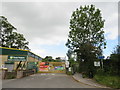
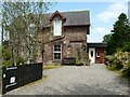
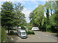
Station Yard, Buntingford
by Malc McDonald
geograph for square TL3628
Station Yard is a small residential development on the outskirts of Buntingford,... (more)
|
|
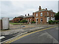
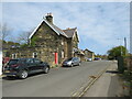
Ringley Road Station
by David Dixon
geograph for square SD7705
Ringley Road station opened on 31st May 1847. It was on the East Lancashire... (more)
|
|
Strawberry Line path, Cheddar
by Malc McDonald
geograph for square ST4553
A narrow section of the Strawberry Line path along the side of an industrial... (more)
|
|
Site of the Former Manchester Exchange Station
by David Dixon
geograph for square SJ8398
Looking to the west from the footbridge at the western end of Manchester... (more)
|
|
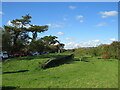
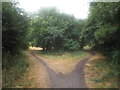
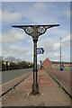
Site of Bala railway station
by Malc McDonald
geograph for square SH9236
A traditional semaphore railway signal stands in a car park in Bala, on the edge... (more)
|

|
Site of Spey Bay Station
by Richard Sutcliffe
geograph for square NJ3564
Cyclists pushing their bicycles along the old track bed of the Moray Coast... (more)
|
|
The site of Gorleston station from Victoria Road
by Adrian S Pye
geograph for square TG5203
The station platforms were a little lower than the road level.
|
|
The site of Gorleston Railway Station
by Adrian S Pye
geograph for square TG5203
Few people traversing this roundabout realise that this was once the site of... (more)
|
|
The site of the former Hopton-on-Sea railway station
by Adrian S Pye
geograph for square TG5200
The Station had two platforms, a loop, sidings, a goods yard, and a footbridge... (more)
|
|
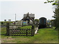
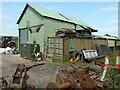
Former goods shed
by Richard Sutcliffe
geograph for square NS4786
This is the former goods shed from Drymen Station at Croftamie. The railway... (more)
|
|
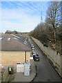
Bridleway on former railway at Cox Green, near Washington
by Malc McDonald
geograph for square NZ3354
This public bridleway follows the route of a dismantled railway line in Tyne... (more)
|

|
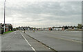
Blackpool Central car park
by Gerald England
geograph for square SD3035
Blackpool Central was the largest railway station in Blackpool but closed in... (more)
|
|
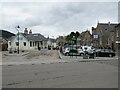
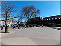
Station Square, Ballater
by Malc McDonald
geograph for square NO3695
Station Square in the town of Ballater, in Royal Deeside and within the... (more)
|
|
Eastern and Midlands Railway canopy support
by Adrian S Pye
geograph for square TG5208
Preserved at the site of the Great Yarmouth Beach Station.
Destinations of the... (more)
|
|
One of the canopy supports for the M&GN railway
by Adrian S Pye
geograph for square TG5208
Preserved at the site of the South Beach Station.
The Midland and Great... (more)
|
|
Former route of the railway line
by Adrian S Pye
geograph for square TG5203
The site of Gorleston Station was half in the trees at the roundabout and a... (more)
|
|
Station House, Croftamie
by Richard Sutcliffe
geograph for square NS4786
The original station building from Drymen Station on the Forth and Clyde... (more)
|
|
Cycle Way, Croftamie
by Richard Sutcliffe
geograph for square NS4786
National Cycle Network Route 7. The route follows the line of the former Forth... (more)
|
|
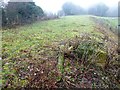
Former railway station, Troutbeck
by Richard Sutcliffe
for square NY3927
Troutbeck Station was a small station on the Cockermouth, Keswick and Penrith... (more)
|

|
Site of Ringley Road Station, The Outwood Trail
by David Dixon
geograph for square SD7705
Ringley Road station opened on 31st May 1847. It was on the East Lancashire... (more)
|
|
Queen's Square, the site of demolished Clevedon railway station
by Jaggery
geograph for square ST4071
Now an open space surrounded by shops, this was the site of
Clevedon railway... (more)
|
|
Car park, Ironbridge
by Malc McDonald
geograph for square SJ6703
A car park occupies the site which was formerly Iron Bridge & Broseley... (more)
|
|
Car park, Ironbridge
by Malc McDonald
geograph for square SJ6703
A car park occupies the site which was formerly Iron Bridge & Broseley... (more)
|
|
The former Yarmouth Beach Railway Station
by Adrian S Pye
geograph for square TG5208
Now cleared of all, bar a few pieces of railway memorabilia it is currently a... (more)
|