|
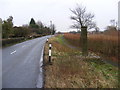
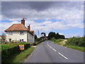
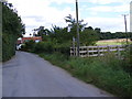
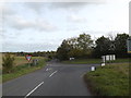
Framsden Village Pump & B1077
by Geographer
geograph for square TM1959
Category: B road (Classified B)
Looking towards Framsden
|
|
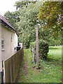
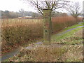
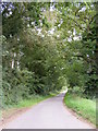
Footpath to Framsden Road
by Geographer
geograph for square TM2059
Off Church Road, Framsden
|

|
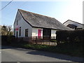
Framsden Baptist Church sign
by Geographer
for square TM1960
Off the B1077 Chapel Hill
Link |
|
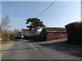
B1077 Chapel Hill, Framsden
by Geographer
geograph for square TM1960
At the entrance to Framsden Baptist Church
Link |

|
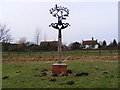
Framsden Village Sign
by Geographer
for square TM1959
Category: Village sign
On the B1077 Helmingham Road at the junction with The Street
(Close up)
|
|
Framsden Village Sign
by Geographer
geograph for square TM1959
Category: Village sign
On the B1077 Helmingham Road at the junction with The Street
|
|
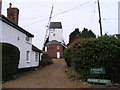
Framsden Windmill
by Geographer
geograph for square TM1959
Category: Windmill
Off the B1077 Helmingham Road
|
|
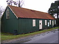
Framsden Village Hall
by Geographer
geograph for square TM2059
Category: Village hall
On The Street
|
|
Framsden Baptist Church
by Geographer
geograph for square TM1960
Off the B1077 Chapel Hill
Link |
|
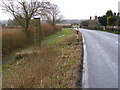
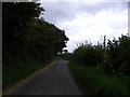
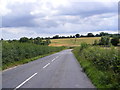
B1077 Helmingham Road
by Geographer
geograph for square TM1959
Looking towards Framsden Windmill near Hill Farm
|
|
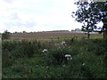
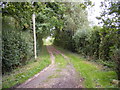
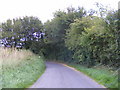
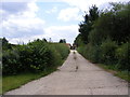
Footpath to the B1077
by Geographer
geograph for square TM1959
Off The Street, Framsden
Framsden Footpath No.7
|
|
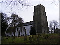
St.Marys Church, Framsden
by Geographer
geograph for square TM2059
Category: Church (Church of England)
|
|
St.Marys Church, Framsden
by Geographer
geograph for square TM2059
Category: Church
|
|
Framsden Village Pump & B1077 Helmingham Road
by Geographer
geograph for square TM1959
Category: B road (Classified B)
Looking towards Helmingham
|
|
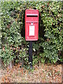
Framsden Village Pump
by Geographer
geograph for square TM1959
Category: Village pump
On the B1077 Helmingham Road
|

|
Framsden village sign
by Adrian S Pye
for square TM1959
An owl sits atop the sign which has a liberal spread of oak leaves on the... (more)
|
|
Church Road, Framsden
by Geographer
geograph for square TM2059
|
|
Footpath to Bastings Hall
by Geographer
geograph for square TM2059
Off Church Road, Framsden
|
|
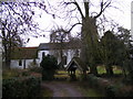
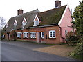
The Doberman Public House, Framsden
by Geographer
geograph for square TM1959
The Street
|
|
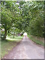
The Street, Framsden & the footpath to the B1077
by Geographer
geograph for square TM1959
|
|
New Road, Framsden
by Geographer
geograph for square TM1858
Category: Road
|
|
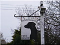
The Dobermann Inn, Framsden
by Geographer
geograph for square TM1959
Category: Public house
On the Street
|
|
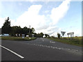
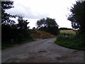
B1077 Chapel Hill, Framsden
by Geographer
geograph for square TM1960
At the junction with the A1120 New Road & Peats Corner
|
|
B1077 Vicarage Road, Framsden
by Geographer
geograph for square TM1860
At the junction with A1120 Boundary Corner
|
|
B1077 Vicarage Road, Framsden
by Geographer
geograph for square TM1860
At the junction with the A1120 Boundary Corner
|
|
A1120 New Road, Framsden
by Geographer
geograph for square TM1960
At the junction with the B1077 Chapel Hill & Peats Corner
|
|
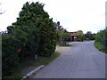
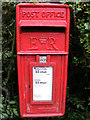
The Street, Framsden & The Street Postbox
by Geographer
geograph for square TM1959
Looking towards The Doberman Public House and the B1077
Road No.U4702
Postbox... (more)
|
|
New Road, Framsden
by Geographer
geograph for square TM1858
Category: Road
Near North Park Farm
|
|
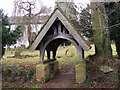
Lych Gate of St.Marys Church, Framsden
by Geographer
for square TM2059
Category: Lych Gate
Off The Street
|
|
The Dobermann Inn, Framsden Public House sign
by Geographer
for square TM1959
Category: Pub sign
On The Street
|
|
Framsden village sign
by Adrian S Pye
geograph for square TM1959
See a close up and more about the sign here
Link |
|
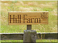
Hill Farm sign
by Geographer
for square TM1959
Off the B1077 Helmingham Road at the entrance to Hill Farm
|
|
New Road
by Geographer
geograph for square TM1858
Category: Road
Near the footpath to North Park Farm
|

|
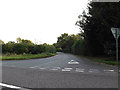
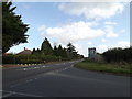
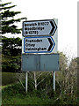
Roadsigns on the A1120 Boundary Corner
by Geographer
for square TM1860
At the junction with the B1077 Vicarage Road
|
|
Roadsigns on the B1077 Chapel Hill
by Geographer
for square TM1960
At the junction with the A1120 New Road
|
|
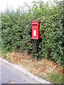
Tollgate Corner Postbox
by Geographer
for square TM1959
On the B1077 Helmingham Road near Hill Farm
Postbox No.IP14 8059
(Close up)
|
|
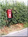
Tollgate Corner Postbox
by Geographer
geograph for square TM1959
On the B1077 Helmingham Road near Hill Farm
Postbox No.IP14 8059
|
|
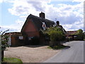
Entrance to Hill Farm
by Geographer
geograph for square TM1959
Off the B1077 Helmingham Road
|
|
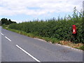
B1077 Helmingham Road
by Geographer
geograph for square TM1959
Looking towards Tollgate Corner near Hill Farm
|
|
Tollgate Corner Postbox
by Geographer
for square TM1959
On the B1077 Helmingham Road near Hill Farm
Postbox No.IP14 8059
|
|
Tollgate Corner Postbox
by Geographer
for square TM1959
On the B1077 Helmingham Road near Hill Farm
Postbox No.IP14 8059
|
|
Tollgate Corner Postbox
by Geographer
for square TM1959
On the B1077 Helmingham Road near Hill Farm
Postbox No.IP14 8059
|
|
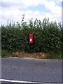
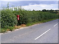
B1077 Helmingham Road & Tollgate Corner Postbox
by Geographer
geograph for square TM1959
Near Hill Farm
Postbox No.IP14 8059
|
|
B1077 Helmingham Road & Tollgate Corner Postbox
by Geographer
geograph for square TM1959
Near Hill Farm
Postbox No.IP14 8059
|
|
Entrance to North Park Farm
by Geographer
geograph for square TM1858
Category: Entrance
Off New Road
|
|
Footpath to North Park Farm, Helmingham Church & the A1120
by Geographer
geograph for square TM1858
Category: Footpath
Off New Road
|
|
The entrance to Bocking Hall
by Geographer
geograph for square TM1858
Category: Entrance
Off New Road
|
|
New Road junction with Bocking Hall entrance
by Geographer
geograph for square TM1858
Category: Road junction
|
|
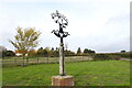
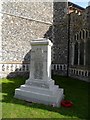
War memorial, Framsden
by Bikeboy
for square TM2059
In the churchyard
|
|
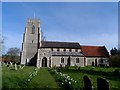
St Mary's church, Framsden
by Bikeboy
geograph for square TM2059
Mostly C14 and C15
|