
|
Station subway, Grange-over-Sands
by Adrian Taylor
geograph for square SD4178
|
|
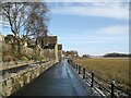
The Promenade, Grange-over-Sands
by Adrian Taylor
geograph for square SD4178
The Promenade behind Grange-over-Sands Station on a January morning with traces... (more)
|

|
A train entering Grange-over-Sands station
by Stephen Craven
geograph for square SD4178
Category: Railway station
A pair of two-car diesel multiple units of class 108 forming the long-distance... (more)
|

|
Grange-over-Sands Railway Station
by Adrian Taylor
geograph for square SD4178
The car park and gardens at the east end of Grange-over-Sands Railway Station... (more)
|

|
Train entering Grange-over-Sands station
by Stephen Craven
geograph for square SD4178
Northern diesel unit 195118 calls with the 11.53 Barrow to Lancaster service.... (more)
|
|
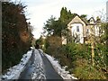
Eden Mount, Grange-over-Sands
by Adrian Taylor
geograph for square SD4078
An access road leading from Charney Well Lane to Ashmount Road in Grange-over-Sands.
|

|
Lindale Road, Grange-over-Sands
by Adrian Taylor
geograph for square SD4178
The ornamental gardens are to the left, ahead is the mini-roundabout at the... (more)
|

|
Windermere Road, Grange-over-Sands
by Adrian Taylor
geograph for square SD4178
The B5271 road from Grange-over-Sands to Lindale.
|

|
Ornamental Gardens, Grange-over-Sands - west end of the lake
by Stephen Craven
geograph for square SD4078
The lake is just over 200m long and forms the centrepiece of the gardens.
|

|
Benchmark, Main Street, Grange-over-Sands
by Adrian Taylor
for square SD4178
Detail of the Ordnance Survey cut benchmark on the stone wall below the post box... (more)
|
|
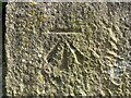
Benchmark, Grange-over-Sands Railway Station
by Adrian Taylor
for square SD4178
Detail of the Ordnance Survey cut benchmark on the north face of the northeast... (more)
|

|
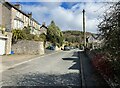
Main Street, Grange-over-Sands
by Adrian Taylor
geograph for square SD4077
|
|
Eden Mount Road, Grange-over-Sands
by Adrian Taylor
geograph for square SD4077
|

|
Eden Mount Road, Grange-over-Sands
by Adrian Taylor
geograph for square SD4077
The hill in the background is Yew Barrow.
|
|
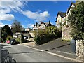
Eden Mount Road, Grange-over-Sands
by Adrian Taylor
geograph for square SD4077
|

|
Bailey's
by Steven Haslington
geograph for square SD4077
Bailey's chip shop in Grange-over-Sands, Cumbria, England.
|

|
Sunrise at entrance to Holme Island, Grange-over-Sands
by Nick Thorne - Bodian Photography
geograph for square SD4278
The locked gate to Holme Island Causeway by the level crossing, Grange-over-Sands
|
|
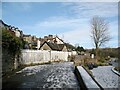
Bailey Lane Crossing approach
by Adrian Taylor
geograph for square SD4077
Originally a vehicular level crossing across the Carnforth to Barrow-in-Furness... (more)
|
|
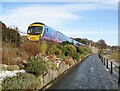
The Promenade, Grange-over-Sands
by Adrian Taylor
geograph for square SD4178
Class 185 number 185140 runs alongside The Promenade with a train for Barrow-in-Furness.
|
|
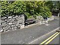
Seat, Grange Fell Road
by Adrian Taylor
geograph for square SD4077
Grange Fell Road climbs steeply from Grange town centre and this seat is... (more)
|

|
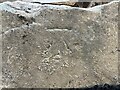
Benchmark, Grange Fell Road opposite Fernleigh Road
by Adrian Taylor
for square SD4077
Detail of an Ordnance Survey cut benchmark on Grange Fell Road opposite... (more)
|
|
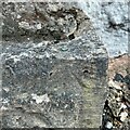
Benchmark, Grange Fell Road
by Adrian Taylor
for square SD4077
Detail of an Ordnance Survey cut benchmark on a stone at the bottom of the south... (more)
|
|
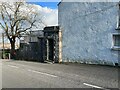
Benchmark, ‘Woodheads’, Grange Fell Road
by Adrian Taylor
for square SD4077
Detail of the Ordnance Survey rivet benchmark with (worn) arrow mark on the... (more)
|
|
Stone Doorway, ‘Woodheads’, Grange Fell Road
by Adrian Taylor
geograph for square SD4077
The substantial stone doorway of 'Woodheads' facing onto Grange Fell... (more)
|
|
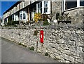
Postbox, Grange Fell Road
by Adrian Taylor
geograph for square SD4077
This postbox is on Grange Fell Road adjacent to Milton Terrace.
There is a... (more)
|
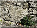
|
Benchmark, Milton Terrace, Grange Fell Road
by Adrian Taylor
for square SD4077
Detail of the weathered Ordnance Survey cut benchmark on Grange Fell Road... (more)
|
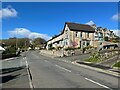
|
Grange Fell Road
by Adrian Taylor
geograph for square SD4077
Grange Fell Road at the junction of Fell Drive and Ashmount Road.
There is an... (more)
|

|
View from Mary Matthews' bench, Grange-over-Sands
by Christine Johnstone
geograph for square SD3977
Usefully placed at the top of climb on Grange Fell Road.
|

|
Meathop Road Drain
by Adrian Taylor
geograph for square SD4378
This drain, maintained by Network Rail and within the Lake District National... (more)
|

|
Grange Fell Road
by Adrian Taylor
geograph for square SD4077
There is an Ordnance Survey rivet benchmark on the plinth of the stone porch of... (more)
|

|
The edge of the saltmarsh, Grange-over-Sands
by Christine Johnstone
geograph for square SD4077
The western shore of Morecambe Bay, at low tide.
|

|
Below the Promenade, Grange-over-Sands
by Christine Johnstone
geograph for square SD4077
Some years ago a storm rearranged this coast. Grange lost its sandy beach and... (more)
|

|
Salt marsh, Grange-over-Sands
by Christine Johnstone
geograph for square SD4077
Some years ago a storm rearranged this coast. Grange lost its sandy beach and... (more)
|

|
Muddy tidal creek in the salt marsh, Grange-over-Sands
by Christine Johnstone
geograph for square SD4077
Some years ago a storm rearranged this coast. Grange lost its sandy beach and... (more)
|

|
What a place to get off a train ! - Grange-over-Sands Railway Station
by Nick Thorne - Bodian Photography
geograph for square SD4178
Every time I get off the train at Grange I'm struck by the view. This is... (more)
|

|
Bailey Lane, Grange-over-Sands
by Adrian Taylor
geograph for square SD4077
This narrow lane formerly led down to the shore from Crown Hill at the top of... (more)
|

|
Over the rooftops to Morecambe Bay
by James Allan
geograph for square SD4077
Seen from Grange over Sands.
|
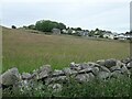
|
Urban fringe, Grange-over-Sands
by Christine Johnstone
geograph for square SD3977
Spring Bank Farm's barn was mapped here as early as 1847, but the houses... (more)
|

|
Grange-over-Sands: the Promenade café
by Jonathan Hutchins
geograph for square SD4077
|

|
Kniphofia or red hot poker
by Russel Wills
geograph for square SD4077
Beside the Promenade at Grange over Sands.
With salt mash and Morcambe Bay on the right.
|

|
Cumbrian Coast Line, Bailey Lane
by Adrian Taylor
geograph for square SD4077
The former Furness Railway main line northeast of Bailey Lane Level Crossing.... (more)
|

|
Hampsfell Road
by Adrian Taylor
geograph for square SD4078
|

|
Hampsfell Road
by Adrian Taylor
geograph for square SD4077
Tree clad Eden Mount is in the background.
|

|
Field edge near High Farm
by Adrian Taylor
geograph for square SD4078
A public footpath from Hampsfell to Grange-over-Sands follows the edge of the... (more)
|

|
Rough pasture on Hampsfell
by Adrian Taylor
geograph for square SD4079
At one time known as Hampsfield Fell this limestone upland northwest of... (more)
|

|
Bailey Lane Crossing
by Adrian Taylor
geograph for square SD4077
Originally a vehicular level crossing across the Carnforth to Barrow-in-Furness... (more)
|

|
View across Kent Estuary to Grange-over-Sands
by Rod Grealish
for square SD4077
The photograph was taken from Far Arnside. Owing to the narrowing of the estuary... (more)
|

|
Charney Well Lane
by Adrian Taylor
geograph for square SD4078
|

|
Charney Well
by Adrian Taylor
for square SD4078
The well is located a few feet behind the alcove in the limestone wall in what... (more)
|

|
Footpath beside Bailey Lane Crossing
by Adrian Taylor
geograph for square SD4077
The footpath from Bailey Lane to the car park, the bottom of Main Street and the... (more)
|
