Public Tags
Tag: Headland·(Coastal·Feature)
Other tags: category:Headland (Coastal Feature)
Showing images tagged with Headland (Coastal Feature) tag.

|
Passing Rubha na Reing, seen from the entrance of Garbh Phort
by Andy Waddington geograph for square NM3325 Category: Headland (coastal feature) Taken during a paddle from Bunessan round to Fidden Farm on the Ross of Mull,... (more)
Tags:
top:Coastal
top:Estuary, Marine
type:Geograph
category:Headland (Coastal Feature)
top:Rocks, Scree, Cliffs
category:Sea Kayaking
top:Sport, Leisure
|

|
Carraig Ghilliondrais
by Andy Waddington geograph for square NM3524 Category: Headland (coastal feature) The headland is just on the edge of the Ross of Mull pluton with the rock here... (more)
Tags:
top:Coastal
top:Estuary, Marine
type:Geograph
category:Headland (Coastal Feature)
top:Rocks, Scree, Cliffs
category:Sea Kayaking
|

|
Rubha nam Bràithrean
by Andy Waddington geograph for square NM4317 Category: Headland (coastal feature) Unusually, we were paddling into an easterly headwind, so were keeping well... (more)
Tags:
top:Coastal
top:Estuary, Marine
type:Geograph
category:Headland (Coastal Feature)
top:Rocks, Scree, Cliffs
top:Sport, Leisure
|

|
Qui Ness
by Andy Waddington geograph for square HU2965 Category: Cliffs The grassy headland of Qui Ness can be reached by a narrow, well-worn but rather... (more)
Tags:
category:Cliffs
top:Coastal
top:Estuary, Marine
category:Geodh or Geo
type:Geograph
category:Headland (Coastal Feature)
top:Islands
top:Rocks, Scree, Cliffs
category:Sea Stacks
|

|
Just about to round Rubha Hunish
by Andy Waddington geograph for square NG4077 Category: Tidal race As we approach the northernmost tip of Skye, the tide race separates from the... (more)
Tags:
category:Cliffs
top:Coastal
top:Estuary, Marine
category:Headland (Coastal Feature)
category:Sea Kayaking
top:Sport, Leisure
category:Tidal Race
|

|
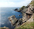
Rubh' Eilean an t-Santachaidh from the west, evening
by Andy Waddington geograph for square NM3425 Category: Headland (coastal feature) Taken during a paddle from Bunessan round to Fidden Farm on the Ross of Mull,... (more)
Tags:
top:Coastal
top:Estuary, Marine
type:Geograph
category:Headland (Coastal Feature)
top:Rocks, Scree, Cliffs
category:Sea Kayaking
top:Sport, Leisure
|
|
Ruggen - the end of Ness of Sound
by Andy Waddington geograph for square HU4738 Category: Headland (coastal feature) Although the sea looks calm from this height on the Ness of Sound circular path,... (more)
Tags:
top:Coastal
top:Estuary, Marine
type:Geograph
category:Headland (Coastal Feature)
top:Rocks, Scree, Cliffs
category:Skerry
|

|
Penmaen-bach Point
by Andy Waddington geograph for square SH7478 Category: Headland (coastal feature) With a strong westerly wind blowing, this is one of the few moments when we... (more)
Tags:
top:Coastal
top:Estuary, Marine
type:Geograph
category:Headland (Coastal Feature)
top:Roads, Road Transport
|

|
Ness of Hillswick lighthouse and Baa Taing
by Andy Waddington geograph for square HU2774 Category: Lighthouse Not obvious from the path to the lighthouse, but visible from the continuing... (more)
Tags:
top:Coastal
top:Estuary, Marine
type:Geograph
category:Headland (Coastal Feature)
category:Lighthouse
category:Natural Arch
top:Rocks, Scree, Cliffs
|

|
Heading west past Ardnoe Point
by Andy Waddington geograph for square NR7794 Category: Headland (coastal feature) It's rare that those on the sea feel threatened by low cloud, but it was a... (more)
Tags:
top:Coastal
top:Estuary, Marine
type:Geograph
category:Headland (Coastal Feature)
top:Sport, Leisure
top:Woodland, Forest
|

|
The southwestern tip of Ness of Sound
by Andy Waddington geograph for square HU4638 Category: Headland (coastal feature) Steeply dipping sandstones of Devonian age (Middle Old Red Sandstone) produce... (more)
Tags:
top:Coastal
top:Estuary, Marine
type:Geograph
category:Headland (Coastal Feature)
top:Rocks, Scree, Cliffs
|

|
Bogha na Lic of Gallan Head
by Andy Waddington geograph for square NB0539 Category: Headland (coastal feature) Bogha na Lic is the projecting point of An Gallan Uigeach - Gallan Head, and is... (more)
Tags:
top:Coastal
top:Estuary, Marine
type:Geograph
category:Headland (Coastal Feature)
top:Rocks, Scree, Cliffs
|

|
Corr Eilean
by Andy Waddington geograph for square NM2624 Category: Island Both the nearer headland and the two islands are prominent lumps of rock of the... (more)
Tags:
top:Coastal
top:Estuary, Marine
type:Geograph
top:Grassland
category:Headland (Coastal Feature)
category:Island
top:Islands
top:Rocks, Scree, Cliffs
|

|
Paddling past Gordi Stack and Hevda
by Andy Waddington geograph for square HU2774 Category: Sea kayaking The amount (and unpredictability) of swell kept us on the outside of Hevda, the... (more)
Tags:
top:Coastal
top:Estuary, Marine
type:Geograph
category:Headland (Coastal Feature)
top:Rocks, Scree, Cliffs
category:Sea Kayaking
category:Sea Stacks
category:Skerry
top:Sport, Leisure
|

|
Stack east of Rubha Hunish
by Andy Waddington geograph for square NG4076 Category: Tidal race The whole of the coast of northern Skye is broken into geos, caves and stacks,... (more)
Tags:
top:Coastal
top:Estuary, Marine
category:Headland (Coastal Feature)
category:Sea Kayaking
category:Sea Stacks
top:Sport, Leisure
category:Tidal Race
|

|
Paddling with the tide towards Rubha Hunish
by Andy Waddington geograph for square NG4176 Category: Tidal race Having left Staffin 45 minutes before HW Ullapool, and spent time exploring the... (more)
Tags:
category:Cliffs
top:Coastal
top:Estuary, Marine
category:Headland (Coastal Feature)
category:Sea Kayaking
top:Sport, Leisure
category:Tidal Race
|

|
Paddling towards Roe Ness
by Andy Waddington geograph for square HU3242 Category: Sea kayaking Paddling out from Ayre of Deepdale, there are a variety of skerries in the Old... (more)
Tags:
top:Coastal
top:Estuary, Marine
type:Geograph
category:Headland (Coastal Feature)
top:Rocks, Scree, Cliffs
category:Sea Kayaking
category:Skerry
top:Sport, Leisure
|

|
Heading toward the Deeps from Skelda Voe
by Andy Waddington geograph for square HU3143 Category: Sea kayaking Heading out south from Easter Skeld, Skelda Voe offers sheltered paddling, with... (more)
Tags:
top:Coastal
top:Estuary, Marine
type:Geograph
category:Headland (Coastal Feature)
category:Sea Kayaking
top:Sport, Leisure
|

|
Looking across the harbour at the mouth of the Tyne
by Robert Graham for square NZ3768 View over the harbour from South Shields pier to Tynemouth headland. From right... (more)
Tags:
Abbey (Ruined)
Castle
top:City, Town Centre
top:Coastal
type:Extra
Harbour
subject:Headland
Headland (Coastal Feature)
top:Historic Sites and Artefacts
Memorial
top:Rivers, Streams, Drainage
|

|
Porth Oer....Whistling Sands, Llyn Peninsula, Wales
by I Love Colour geograph for square SH1630 Close to the village of Methlem and just under 3 miles from Aberdaron on the... (more)
Tags:
place:Aberdaron
top:Air, Sky, Weather
Beach
subject:Beach
Beach Cove
Blue Sky
Bodyboard
Bodyboarding
Cafe
top:Coastal
Cove
top:Docks, Harbours
top:Estuary, Marine
top:Flat Landscapes
type:Geograph
Headland
Headland (Coastal Feature)
sea:Irish Sea
Irish Sea
place:Llyn Peninsula
place:Methlem
National Trust
National Trust Land
National Trust Site
National Trust Wales
place:North Wales
Port
former:Port
place:Porth Oer
Rocks
Rocks at Shore
top:Rocks, Scree, Cliffs
Rocky Beach
Sand
beach:Sand
Sand Beach
Scattered Rocks
Sea
Seascape
Sky
top:Sport, Leisure
Surfing
Waves
place:Whistling Sands
|
