Public Tags
Tag: Hereward·Way
Other tags: long distance footpath:Hereward Way
long distance path:Hereward Way
Showing latest 50 of 261 images tagged with Hereward Way tag.

|
The forgotten way
by Bob Harvey geograph for square TF0105 This well-established footpath, which crosses the Stamford-Oakham railway line... (more)
Tags:
top:Farm, Fishery, Market Gardening
type:Geograph
long distance path:Hereward Way
Hereward Way Footpath
long distance path:Jurassic Way
Long Distance Path
top:Lowlands
long distance path:Macmillan Way
subject:Path
top:Paths
county:Rutland
near:Stamford
season:Summer
near:Tinwell
crop:Wheat
|

|
Hereward Way beside the A606, Stamford Road
by Chris Heaton geograph for square SK8909 The trail alongside the northern shore of Rutland Water is obliged to follow the... (more)
Tags:
A Road (Classified A)
type:Geograph
Hedgerow
long distance footpath:Hereward Way
long distance footpath:Macmillan Way
top:Paths
Woodland
|

|
Hereward Way near Empingham
by Alan Murray-Rust geograph for square SK9508 At this point the Way leaves Mill Lane to cross fields towards the village... (more)
|
|
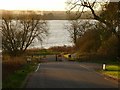
Former main road at Barnsdale
by Alan Murray-Rust geograph for square SK9008 The road ran straight to the clump of trees on the far shore of Rutland Water.... (more)
Tags:
A Road (Former)
Hereward Way
top:Lakes, Wetland, Bog
long distance path:Macmillan Way
top:Roads, Road Transport
place:Rutland Water
long distance path:Viking Way
|

|
Overlooking Lodge Inlet on the Hereward Way
by Chris Heaton geograph for square SK8909 From the trail along the northern shore of Rutland Water, adopted by long... (more)
Tags:
Cycle Route
type:Geograph
long distance footpath:Hereward Way
Inlet
long distance footpath:Macmillan Way
Reservoir
top:Water Resources
|

|
Hereward Way approaching Barnsdale Wood
by Chris Heaton geograph for square SK9108 Section of footpath that runs along the northern shore of Rutland Water, seen... (more)
Tags:
type:Geograph
long distance footpath:Hereward Way
long distance footpath:Macmillan Way
top:Paths
Woodland
|

|
Hereward Way approaching a Corner of New Wood
by Chris Heaton geograph for square SK9606 Crop of Rape bisected by a well defined footpath, adopted by three long distance... (more)
Tags:
type:Geograph
long distance footpath:Hereward Way
long distance footpath:Macmillan Way
top:Paths
Rape Crop
Woodland
|

|
Hereward Way heading through Meadows beside the River Nene
by Chris Heaton geograph for square TL0899 Footpath adopted by both the Nene Way and Hereward Way
Tags:
Fence
type:Geograph
long distance footpath:Hereward Way
Meadow
long distance footpath:Nene Way
top:Paths
Wild Flowers
|

|
Hereward Way heading North West away from Sutton Village
by Chris Heaton geograph for square TL0999 The Hereward Way long distance footpath shares the route with the Nene Way, as... (more)
Tags:
type:Geograph
long distance footpath:Hereward Way
High Hedge
long distance footpath:Nene Way
top:Paths
Solitary Tree
bridge:Track Over Canal
|

|
Hereward Way beside the Nene Valley Railway
by Chris Heaton geograph for square TL0998 Hereward Way and Nene Way long distance footpaths heading towards Wansford Station.
Tags:
type:Geograph
long distance footpath:Hereward Way
Heritage Railway
long distance footpath:Nene Way
top:Railways
Single Track Railway
|

|
Hereward Way upstream from Orton Lock
by Chris Heaton geograph for square TL1697 The Hereward Way and Nene Way long distance footpaths continue along the north... (more)
Tags:
type:Geograph
long distance footpath:Hereward Way
long distance footpath:Nene Way
top:Paths
River
Stand of Trees
|

|
Hereward Way on the North Bank beside the River Nene
by Chris Heaton geograph for square TL2197 Adopted by both the Hereward Way and Nene Way long distance footpaths, and cycle... (more)
Tags:
Cycle Route
Embankment
type:Geograph
long distance footpath:Hereward Way
long distance footpath:Nene Way
top:Paths
River
Trees
|

|
Hereward Way heading North West from Southorpe
by Chris Heaton geograph for square TF0702 Westward bound walkers along the Hereward Way have now joined the ancient Roman... (more)
Tags:
Bridleway
Gate
type:Geograph
Hedgerow
long distance footpath:Hereward Way
top:Paths
Roman Road
Soitary Tree
|

|
Hereward Way on Hake Drove (2)
by Chris Heaton geograph for square TL3495 Looking East.
Adopted by the Hereward Way long distance footpath, the drove is... (more)
Tags:
Cow Parsley
Drove
Fenland
top:Flat Landscapes
type:Geograph
long distance footpath:Hereward Way
Track
|

|
Hereward Way on Hake's Drove (1)
by Chris Heaton geograph for square TL3495 The view looks west.
Adopted by the Hereward Way long distance footpath, the... (more)
Tags:
Drove
Fenland
top:Flat Landscapes
type:Geograph
long distance footpath:Hereward Way
Telegraph Poles
Track
|

|
Hereward Way on West End, March (1)
by Chris Heaton geograph for square TL4096 Narrow way adopted by the Hereward Way long distance footpath, heading west out... (more)
Tags:
Cottages
Cycle Route
type:Geograph
Hedge
long distance footpath:Hereward Way
top:Paths
Walkway
|

|
Hereward Way leaves Padgetts Road
by Chris Heaton geograph for square TL4995 After much road walking, the Hereward Way abandons the B1100, following a green... (more)
Tags:
Big Sky
County Boundary
Dog Poo Bin
type:Geograph
Green Lane
long distance footpath:Hereward Way
No Through Road Sign
top:Paths
Track
|

|
Hereward Way on Hurst Lane
by Chris Heaton geograph for square TL5281 Heading north towards Little Downham, the Hereward Way long distance footpath is... (more)
|

|
Footpath beside the A606 heading for Stamford
by Chris Heaton for square SK8808 Tags:
A Road (Classified A)
type:Close Look
Footpath
Hedgerow
long distance footpath:Hereward Way
long distance footpath:Macmillan Way
top:Roads, Road Transport
Solitary Tree
long distance footpath:Viking Way
|

|
The A606 in Burley Wood
by Chris Heaton geograph for square SK8809 Heading towards Oakham, beside the A606 - the path adopted by several long distance trails
Tags:
A Road (Classified A)
Cycle Route
type:Geograph
Hedgerow
long distance footpath:Hereward Way
long distance footpath:Macmillan Way
top:Paths
long distance footpath:Viking Way
|

|
Hereward Way heading South West away from Empingham
by Chris Heaton geograph for square SK9408 The long distance footpath heading towards a small patch of woodland and beyond... (more)
Tags:
type:Geograph
long distance footpath:Hereward Way
long distance footpath:Macmillan Way
Pasture
top:Paths
Woodland
|

|
Hereward Way above the Ketton Quarries
by Chris Heaton geograph for square SK9705 The route stands at an elevated position screened by hedges on both sides. A... (more)
Tags:
type:Geograph
Hedgerow
long distance footpath:Hereward Way
long distance footpath:Macmillan Way
top:Paths
Quarry
|

|
Entering the Village of Ketton
by Chris Heaton geograph for square SK9803 Originally three settlements merged into one village - namely Ketton, Geeston... (more)
Tags:
Bend in the Road
type:Geograph
long distance footpath:Hereward Way
long distance footpath:Jurassic Way
long distance footpath:Macmillan Way
Road
Village Scene
top:Village, Rural Settlement
|

|
Footpath heading down to Ketton Road
by Chris Heaton geograph for square SK9903 Adopted by the Jurassic, Macmillan and Hereward Ways long distance footpaths... (more)
Tags:
Countryside
type:Geograph
long distance footpath:Hereward Way
long distance footpath:Jurassic Way
long distance footpath:Macmillan Way
Pasture
top:Paths
Public Footpath
|

|
Ketton Drift
by Chris Heaton geograph for square TF0004 Track heading west out of Easton-on-the-Hill, adopted by three long distance... (more)
Tags:
Bridleway
type:Geograph
long distance footpath:Hereward Way
long distance footpath:Jurassic Way
long distance footpath:Macmillan Way
Oil Drum
top:Paths
Sign
Track
|

|
Church Street, Easton-on-the-Hill
by Chris Heaton geograph for square TF0104 Attractive village located above the Welland Valley at the top end of... (more)
Tags:
type:Geograph
long distance footpath:Hereward Way
Houses
long distance footpath:Jurassic Way
long distance footpath:Macmillan Way
Main Street
Pavement
Village Scene
top:Village, Rural Settlement
|

|
Heading North up Church Street, Easton-on-the-Hill
by Chris Heaton geograph for square TF0104 Attractive village located above the Welland Valley at the top end of... (more)
Tags:
Dwellings
type:Geograph
long distance footpath:Hereward Way
long distance footpath:Jurassic Way
long distance footpath:Macmillan Way
Main Street
Village Scene
top:Village, Rural Settlement
Wisteria
|

|
All Saints Church, Easton-on-the-Hill
by Chris Heaton for square TF0104 Located above the Welland Valley on the northern extremity of the village.... (more)
Tags:
Church
Church Tower
type:Close Look
Grade I Listed Building
long distance footpath:Hereward Way
long distance footpath:Jurassic Way
long distance footpath:Macmillan Way
top:Religious Sites
|

|
Ascending towards Dottrell Hill Plantation
by Chris Heaton geograph for square TF0105 Well defined footpath adopted by three long distance footpaths - the Hereward,... (more)
Tags:
Arable Field
type:Geograph
long distance footpath:Hereward Way
Hill
long distance footpath:Jurassic Way
long distance footpath:Macmillan Way
top:Paths
Woodland
|

|
Crossing the Birmingham/Peterborough Line
by Chris Heaton geograph for square TF0105 The Hereward, Jurassic and Macmillan Ways long distance footpaths all follow the... (more)
Tags:
type:Geograph
long distance footpath:Hereward Way
long distance footpath:Jurassic Way
long distance footpath:Macmillan Way
Railway Lines
top:Railways
|

|
Footbridge over part of the River Welland Drainage System
by Chris Heaton geograph for square TF0105 The Jurassic, Macmillan and Hereward Ways all adopt this footbridge that spans... (more)
Tags:
Footbridge
type:Geograph
long distance footpath:Hereward Way
long distance footpath:Jurassic Way
long distance footpath:Macmillan Way
top:Paths
Public Footpath
River
|

|
Broadeng Bridge
by Chris Heaton geograph for square TF0206 Footbridge that crosses the River Welland, and adopted by no less than three... (more)
Tags:
Footbridge
type:Geograph
long distance footpath:Hereward Way
long distance footpath:Jurassic Way
long distance footpath:Macmillan Way
top:Paths
Public Footpath
|

|
River Nene between Sutton and Wansford
by Chris Heaton geograph for square TL0899 Following the river upstream on the footpath adopted by both the Nene Way and Hereward Way
Tags:
type:Geograph
long distance footpath:Hereward Way
long distance footpath:Nene Way
River Scene
top:Rivers, Streams, Drainage
|

|
Rutland Water Circular Route in Barnsdale Wood
by Mat Fascione geograph for square SK9108 Part of the 23 mile (37 km) footpath and cycleway that follows the shoreline of... (more)
Tags:
Cycleway and Footpath
type:Geograph
long distance path:Hereward Way
top:Lowlands
long distance path:Macmillan Way
top:Paths
place:Rutland Water
long distance path:Viking Way
subject:Woodland
Woodland
top:Woodland, Forest
|

|
The Lodge at Barnsdale
by Mat Fascione geograph for square SK9008 Part of the 23 mile (37 km) footpath and cycleway that follows the shoreline of... (more)
Tags:
Gate
type:Geograph
long distance path:Hereward Way
top:Housing, Dwellings
subject:Lodge
Lodge
long distance path:Macmillan Way
top:Paths
Road
top:Roads, Road Transport
place:Rutland Water
long distance path:Viking Way
|

|
Rutland Water Circular Route near the Barnsdale Hotel
by Mat Fascione geograph for square SK9009 Along the north shoreline of Rutland Water.
Part of the 23 mile (37 km)... (more)
Tags:
subject:Cycle Route
Cycleway and Footpath
type:Geograph
top:Grassland
Grassland
long distance path:Hereward Way
top:Lakes, Wetland, Bog
top:Lowlands
long distance path:Macmillan Way
top:Paths
place:Rutland Water
long distance path:Viking Way
top:Water Resources
|

|
Seat along the Rutland Water Circular Route
by Mat Fascione geograph for square SK9009 Part of the 23 mile (37 km) footpath and cycleway that follows the shoreline of... (more)
Tags:
Cycleway and Footpath
type:Geograph
long distance path:Hereward Way
top:Lowlands
long distance path:Macmillan Way
top:Paths
place:Rutland Water
Seat
subject:Seat
long distance path:Viking Way
|

|
Macmillan Way along the A606 Stamford Road
by Mat Fascione geograph for square SK8708 Also part of National Cycle Route 63 and the Rutland Water Circular Route.
Tags:
road:A606
type:Geograph
long distance path:Hereward Way
top:Lowlands
long distance path:Macmillan Way
top:Paths
top:Roads, Road Transport
national cycle network:Route 63
long distance path:Viking Way
|

|
Hereward Way on the Eastern Fringes of March
by Chris Heaton geograph for square TL4397 A carefully mown and manicured strip has been provided for riverside walkers, as... (more)
Tags:
Cow Parsley
type:Geograph
long distance footpath:Hereward Way
top:Paths
Trees
Wild Flower Area
|

|
Footbridge over the River Gwash
by Alan Murray-Rust geograph for square SK9508 A substantial structure, carrying the Hereward Way and Macmillan Way.
Tags:
bridge:Footbridge Over River
Hereward Way
long distance path:Macmillan Way
top:Paths
Public Footpath
|

|
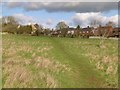
Footpath up to the dam
by Alan Murray-Rust geograph for square SK9408 Although now very much associated with Rutland Water access, and not formally... (more)
Tags:
path:Footpath
Hereward Way
long distance path:Macmillan Way
top:Paths
long distance path:Rutland Round
|
|
Footpath near Empingham
by Alan Murray-Rust geograph for square SK9408 At this point it is part of both the Macmillan Way and the Hereward Way.
|

|
Hereward Way in Barnsdale Wood
by Chris Heaton geograph for square SK9108 Woodland trail on the northern shore of Rutland Water, also adopted by other... (more)
Tags:
Cycle Route
type:Geograph
long distance footpath:Hereward Way
long distance footpath:Macmillan Way
Woodland
top:Woodland, Forest
|

|
St. Peter's Church, Empingham
by Chris Heaton geograph for square SK9508 Grade I listed Building located on Church Street in the village of Empingham.... (more)
Tags:
Church
Church Spire
type:Geograph
long distance footpath:Hereward Way
long distance footpath:Macmillan Way
top:Religious Sites
|

|
Narrow Ginnel off Crocket Lane, Empingham
by Chris Heaton geograph for square SK9508 Adopted by both the Hereward and MacMillan Ways long distance footpaths.
Tags:
type:Geograph
long distance footpath:Hereward Way
long distance footpath:Macmillan Way
No Through Road
Thatched Cottages
Village Scene
top:Village, Rural Settlement
|

|
Hereward Way heading for Mill Lane, Empingham
by Chris Heaton geograph for square SK9508 The long distance footpath is also joined by the Macmillan and E2 European Ways,... (more)
Tags:
type:Geograph
long distance footpath:Hereward Way
House
long distance footpath:Macmillan Way
Pasture
top:Paths
|

|
Carpet of Wild Flowers near Lings Spinney
by Chris Heaton geograph for square SK9507 The Hereward, Macmillan and E2 European Way long distance footpaths are joined... (more)
Tags:
type:Geograph
Hedgerow
long distance footpath:Hereward Way
long distance footpath:Macmillan Way
top:Paths
Wild Flowers
|

|
Hereward Way approaching Gates leading onto the Road to Empingham
by Chris Heaton for square SK9507 Tags:
type:Cross Grid
long distance footpath:Hereward Way
Large Metal Gatres
long distance footpath:Macmillan Way
top:Paths
Ploughed Field
|

|
Hereward Way approaching Woodside Farm
by Chris Heaton geograph for square SK9506 Tags:
Arable Field
top:Flat Landscapes
type:Geograph
long distance footpath:Hereward Way
Landscape
long distance footpath:Macmillan Way
View
|

|
Geeston Road, Ketton
by Chris Heaton geograph for square SK9803 Originally Ketton was three settlements that have merged to create one village.... (more)
Tags:
type:Geograph
long distance footpath:Hereward Way
Houses
long distance footpath:Jurassic Way
long distance footpath:Macmillan Way
Road
Telegraph Poles
Village Scene
top:Village, Rural Settlement
|
