|
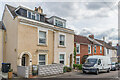
Highfield Road
by Ian Capper
geograph for square SU1330
Cul-de-sac off Devizes Road marked on the 1881 1:500 Plan (when it was named as... (more)
|
|
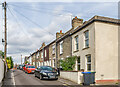
Highfield Road
by Ian Capper
geograph for square SU1330
Cul-de-sac off Devizes Road marked on the 1881 1:500 Plan (when it was named as... (more)
|

|
Part of Kerridge's Forecourt
by Geographer
geograph for square TM3876
Off the A144 London Road near Highfield Residential Home
|

|
Highfield Residential Home sign
by Geographer
for square TM3876
Off the A144 London Road
|

|
Highfield & Highfields Postbox
by Geographer
geograph for square TM4575
On Highfield at the junction with Dunwich Lane
Postbox No.IP19 8171
|
|
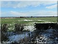
Highfields farmland, east of Roman Ridge
by Christine Johnstone
geograph for square SE5306
The area is called Highfields, the farm High Fields. The land is about 40 metres... (more)
|

|
Damson Tree at Highfield
by Geographer
geograph for square TM3876
|

|
Highfields sign
by Geographer
for square TM1136
On Highfields at the junction with Station Road
|
|
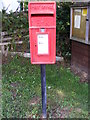
Highfields Postbox
by Geographer
for square TM4575
On Highfield at the junction with Dunwich Lane
Postbox No.IP19 8171
|

|
The King in Sheffield
by Gerald England
for square SK3485
Seen on the corner of a former guitar shop which shut down around 2017... (more)
|

|
Flats on Averill Road, Highfields, Stafford
by Rod Grealish
geograph for square SJ9121
These flats are on the north-west side of Averill road. There are identical... (more)
|

|
Windfall Damsons at Highfield
by Geographer
for square TM3876
|

|
The entrance to Highfield Residential Home
by Geographer
geograph for square TM3876
Off the A144 London Road
|

|
A144 London Road, Halesworth
by Geographer
geograph for square TM3876
Looking towards the A144 Bramford Road near Highfield Residential Home
|

|
A144 London Road, Halesworth
by Geographer
geograph for square TM3876
Looking towards Halesworth near Highfield Residential Home
|

|
Highfields Postbox, Bus Shelter & Notice Board
by Geographer
geograph for square TM4575
On Highfield at the junction with Dunwich Lane
Postbox No.IP19 8171
|

|
Highfields Postbox
by Geographer
for square TM4575
On Highfield at the junction with Dunwich Lane
Postbox No.IP19 8171
|

|
Highfields Postbox & Bus Shelter
by Geographer
geograph for square TM4575
On Highfield at the junction with Dunwich Lane
Postbox No.IP19 8171
|

|
1 - 2 Highfield
by Ian Capper
geograph for square SZ3195
Mid - late 19th Century building, split into two residences. Grade II listed -... (more)
|

|
3 - 6 Highfield
by Ian Capper
geograph for square SZ3195
Pair of early 19th Century buildings, both split into two residences. Both... (more)
|
|
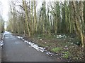
Fly-tipped rubbish in Hanging Woods
by Christine Johnstone
geograph for square SE5306
Part of Highfields Country Park, alongside Roman Ridge byway.
|
|
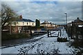
South Street, Highfields, from Roman Ridge
by Christine Johnstone
geograph for square SE5306
With a 43 metre spot height at the road junction. This village was built to... (more)
|

|
Highfields House from Minshull Lock
by Christine Johnstone
geograph for square SJ6558
The apple tree is in the garden of the lock cottage.
|
|
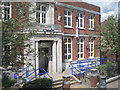
Burgess Road Library, Highfield, Southampton
by Robin Stott
for square SU4215
|

|
B1119 Saxtead Road, Saxtead
by Geographer
geograph for square TM2664
At the entrance to Wood Hall and Highfield
|

|
Highfields on Curds Road
by Geographer
geograph for square TL8527
|

|
Highfield Lane at Grove Wood
by Christine Johnstone
geograph for square SE5418
Heading south-east.
|

|
Large means this, slow means that
by Christine Johnstone
geograph for square SE5318
Very explicit warning sign, east of the level crossing on Highfield Lane, Womersley.
|

|
Highfield Lane, Womersley
by Christine Johnstone
geograph for square SE5318
Looking est, between the 8 and 7 metre spot heights.
|

|
Greystones Drive
by Ian Capper
geograph for square TQ2651
Mid 1960s - 1970s cul de sac of Gatton Road on the site of a Victorian house... (more)
|

|
Highfields, Bentley
by Geographer
geograph for square TM1136
At the junction with Station Road
|

|
Station Road, Bentley
by Geographer
geograph for square TM1136
At the junction with Highfields
|

|
Station Road, Bentley
by Geographer
geograph for square TM1136
At the junction with Highfields
|
|
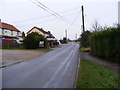
All Saints Road, Creeting St.Mary
by Geographer
geograph for square TM1057
Category: Road.
Looking towards Creeting Bottoms near Highfields
|

|
London Road, Highfield
by Gerald England
geograph for square SK3485
On the corner with Bennett Street is a garment printing shop. Next door used... (more)
|

|
Parade of shops on West Way, Stafford
by Rod Grealish
geograph for square SJ9121
The shops were built in the 1960's and serve the Highfields area originally... (more)
|

|
M5 crossing the River Brue
by Julian P Guffogg
geograph for square ST3246
The River originally took a different route from Glastonbury to the sea, but... (more)
|

|
Go Outdoors - A Sheffield Brand
by Andrew Tryon
for square SK3586
The 'Go Outdoors' shop in Sheffield, formerly known as CCC, is the... (more)
|

|
Saxtead Village Name sign on the B1119 Saxtead Road
by Geographer
for square TM2664
|

|
A428 St.Neots Road & St.Neots Road Bridge
by Geographer
geograph for square TL3559
|
