Public Tags
Tag: Kinder·Scout
Other tags: place:Kinder Scout
Showing latest 50 of 61 images tagged with Kinder Scout tag.

|
The Pennine Way below Kinder Scout
by Jeff Buck geograph for square SK0888 Heading north along the Pennine Way towards Kinder Downfall below Kinder Scout.
Tags:
county:Derbyshire
country:England
type:Geograph
Gritstone
Gritstone Edge
Kinder Scout
National Park
National Trust
National Trust Land
top:Paths
national park:Peak District
Peak District
Peak District National Park
Pennine Way
long distance footpath:Pennine Way
top:Uplands
|

|
Lantern Pike view to Kinder Scout
by Peter Turner geograph for square SK0287 From the shoulder of Lantern Pike across the fields above Cliffbank Farm, the... (more)
|

|
Gritstone rock formations near Kinder Scout
by Jeff Buck for square SK0787 The strange and fascinating gritstone rock formations next to the Pennine Way... (more)
Tags:
type:Close Look
county:Derbyshire
country:England
top:Geological Interest
Gritstone
Gritstone Crags
Gritstone Edge
Gritstone Outcrop
Gritstone Rocks
Kinder Scout
National Park
National Trust
National Trust Land
Peak District
national park:Peak District
Peak District National Park
Pennine Way
Rock Outcrop
top:Rocks, Scree, Cliffs
top:Uplands
|

|
Kinder Scout - Edale Moor
by Andy Stephenson geograph for square SK1187 The vegetation has been subject to a lot of renovation in recent years, and the... (more)
Tags:
top:Barren Plateaux
type:Geograph
plant:Heather
Heather
Heather and Grass Moorland
Heather Moorland
place:Kinder Scout
Kinder Scout
subject:Moorland
top:Moorland
top:Uplands
|

|
Kinder Scout (rock outcrop)
by Stephen Burton geograph for square SK1188 The kinder scout plateau is a relatively flat area at about 630m above sea level... (more)
Tags:
top:Geological Interest
Kinder Scout
Millstone Grit
Plateau
subject:Rock
top:Rocks, Scree, Cliffs
season:Summer
top:Uplands
|

|
Kinder Low
by Stephen Burton geograph for square SK0787 In recent years a lot of conservation work to try and preserve the peat bog on... (more)
|

|
Shooting cabin. Middle Moor
by Dave Dunford for square SK0588 Known locally simply as "The Shooting Cabin", this building (actually... (more)
|

|
On Kinder Scout plateau
by Andrew Hill geograph for square SK0887 To experience the plateau, I kept east of the path along the edge, heading... (more)
|

|
View from the Pennine Way
by Jeff Buck geograph for square SK0887 Looking northwest across the gritstone edge near Kinder Scout.
Tags:
county:Derbyshire
country:England
type:Geograph
Gritstone
Gritstone Crags
Gritstone Edge
Gritstone Outcrop
Gritstone Rocks
Kinder Low
Kinder Scout
National Park
National Trust Land
Peak District
national park:Peak District
Peak District National Park
Pennine Way
long distance footpath:Pennine Way
Rock Outcrop
top:Uplands
|

|
View from the Gritstone Edge
by Jeff Buck geograph for square SK0787 Gritstone boulders next to the Pennine Way near Kinder Scout. Kinder Reservoir... (more)
Tags:
county:Derbyshire
country:England
type:Geograph
top:Geological Interest
Gritstone
Gritstone Crags
Gritstone Edge
Gritstone Outcrop
Gritstone Rocks
Kinder Scout
National Park
National Trust
National Trust Land
Peak District
national park:Peak District
Peak District National Park
Rock Outcrop
top:Rocks, Scree, Cliffs
top:Uplands
|

|
View from the Gritstone Edge
by Jeff Buck geograph for square SK0787 The strange and fascinating gritstone rock formations next to the Pennine Way... (more)
Tags:
county:Derbyshire
country:England
type:Geograph
top:Geological Interest
Gritstone
Gritstone Crags
Gritstone Edge
Gritstone Outcrop
Gritstone Rocks
Kinder Scout
National Park
National Trust
National Trust Land
Peak District
national park:Peak District
Peak District National Park
Rock Outcrop
top:Rocks, Scree, Cliffs
top:Uplands
|

|
Exposed rock on the edge of Kinder Plateau
by Stephen Burton geograph for square SK0787 The Kinder Scout Plateau is dotted with hundreds of rocks of all sizes, over the... (more)
Tags:
place:Dark Peak
type:Geograph
Kinder Scout
Peak District
subject:Rock
top:Rocks, Scree, Cliffs
season:Summer
top:Uplands
|

|
Headwaters of Nether Red Brook
by Dave Dunford geograph for square SK0889 Provided pleasant walking after arduous clambering across the grain, but also an... (more)
|

|
Top of Gate Side Clough
by Dave Dunford geograph for square SK1188 This obscure and easily missed path drops down from the northern edge path to a... (more)
|

|
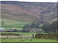
Head of Blackden Brook
by Dave Dunford geograph for square SK1188 Dramatic scenery on the northern edge of Kinder Scout.
|
|
Ollerbrook Booth
by Dave Dunford geograph for square SK1285 One of Edale's several "booths", or small hamlets, below the... (more)
Tags:
subject:Farm
top:Farm, Fishery, Market Gardening
place:Kinder Scout
top:Uplands
place:Vale of Edale
|

|
Kinder Downfall
by Stephen Burton geograph for square SK0888 Perfect weather conditions for viewing Kinder Downfall with a strong wind... (more)
Tags:
Kinder Downfall
Kinder Scout
Pennine Way
top:Rivers, Streams, Drainage
top:Rocks, Scree, Cliffs
season:Spring
top:Uplands
subject:Waterfall
|

|
Ruins of an old farm building
by Stephen Burton geograph for square SK0886 This old stone built ruin stands on the lower slopes of Brown Knoll. Kinder... (more)
Tags:
top:Derelict, Disused
Kinder Scout
top:Moorland
season:Spring
Stone-Built Structure (Ruined)
top:Uplands
|

|
Boxing Glove Stone
by Stephen Burton geograph for square SK0789 A large number of Millstone Grit rocks are spread around the Kinder Scout... (more)
|

|
View across Fairbrook Clough
by Dave Dunford geograph for square SK0989 Lingering snow on the northern edge of Kinder Scout.
|

|
Kinder Scout plateau scene
by Andrew Hill geograph for square SK0887 A picture showing how often the views are restricted because of the many... (more)
|
|
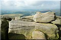
Gritstone Boulders in the Peak District
by Jeff Buck geograph for square SK0787 Gritstone boulders next to the Pennine Way near Kinder Scout.
Tags:
county:Derbyshire
country:England
type:Geograph
top:Geological Interest
Gritstone
Gritstone Crags
Gritstone Edge
Gritstone Outcrop
Gritstone Rocks
Kinder Scout
National Park
National Trust
National Trust Land
Peak District
national park:Peak District
Peak District National Park
Rock Outcrop
top:Rocks, Scree, Cliffs
top:Uplands
|

|
Kinder Scout
by Stephen Burton geograph for square SK0789 Millstone Grit rocks shaped by wind, rain, ice and sun over the centuries. This... (more)
Tags:
place:Dark Peak
type:Geograph
Kinder Scout
national park:Peak District
subject:Rock
top:Rocks, Scree, Cliffs
season:Spring
top:Uplands
|

|
View from the Pennine Bridleway
by Graham Hogg for square SK0685 Looking down Dimpus Clough to the River Sett and on to Oaken Clough and Kinder Scout
Tags:
place:Chinley Head
type:Cross Grid
Kinder Scout
top:Moorland
top:Paths
Pennine Bridleway
River Sett
top:Rivers, Streams, Drainage
subject:View
|

|
Noe Stool and Edale Head
by Andy Stephenson geograph for square SK0886 Panoramic view looking towards the Wool Packs and Grindslow Knoll.
Tags:
top:Barren Plateaux
type:Geograph
place:Kinder Scout
Kinder Scout
top:Moorland
Noe Stool
subject:Rock
top:Uplands
|

|
Wool Packs
by Andy Stephenson for square SK0987 The area here is littered with beautifully-weathered boulders of all shapes and... (more)
Tags:
type:Close Look
place:Kinder Scout
Kinder Scout
subject:Rock
top:Rocks, Scree, Cliffs
top:Uplands
Wool Packs
Woolpack
|

|
Edale Rocks
by Andy Stephenson geograph for square SK0786 A very mild winter morning, with no sign of snow. The flagstone path can be seen... (more)
Tags:
type:Geograph
place:Kinder Scout
Kinder Scout
top:Paths
subject:Rock
Rock Outcrop
Rock Outcrops
top:Rocks, Scree, Cliffs
Rocky Outcrops
top:Uplands
|

|
Blackden Edge and the Woodlands Valley
by Andy Stephenson geograph for square SK1288 With the massif of Bleaklow in the distance.
Tags:
Blackden
type:Geograph
top:Geological Interest
top:Grassland
Gritstone Boulders
Gritstone Outcrop
place:Kinder Scout
Kinder Scout
top:Moorland
top:Uplands
subject:View
|

|
Flagstones through the heather
by Andy Stephenson geograph for square SK1187 The footpath has been improved enormously over the years and is now a narrow,... (more)
Tags:
top:Barren Plateaux
Flagstone Path
Flagstones
type:Geograph
Heather
plant:Heather
subject:Heather
Heather and Grass Moorland
Heather Moor
Heather Moorland
Kinder Scout
place:Kinder Scout
top:Moorland
subject:Path
top:Paths
top:Rocks, Scree, Cliffs
top:Uplands
|
|
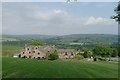
Roofs and rear of Pack Horse Inn
by Bob Harvey geograph for square SK0087 This is one of the component images of the panorama in SK0087 : The Pack Horse Inn, from the hillside behind.
In the... (more)
Tags:
type:Geograph
Hayfield
Hills
Kinder Scout
Peak District
Public House
top:Uplands
Valley
subject:View
|

|
View from Cown Edge
by Stephen Burton for square SK0290 Looking down from Cown Edge to a point where six dry stone walls converge,... (more)
Tags:
Dry Stones Walls
top:Grassland
Kinder Scout
top:Lowlands
weather:Snow
top:Uplands
season:Winter
|

|
Gully blocking on Kinder
by Dave Dunford geograph for square SK0889 Approximate position. This shows the recent work on Kinder to block peat gullies... (more)
|

|
Sandy Heys
by Graham Hogg geograph for square SK0789 A rock outcrop on the Kinder plateau above Kinder Reservoir
Tags:
top:Geological Interest
place:Kinder Scout
top:Moorland
Reservoir
subject:Rock
top:Rocks, Scree, Cliffs
top:Uplands
|

|
Kinder downfall frozen, March 1963
by David Hawgood geograph for square SK0888 Photo taken after much of the snow had melted but the waterfall was still... (more)
Tags:
type:Geograph
subject:Ice
Kinder Downfall
place:Kinder Scout
top:People, Events
top:Rivers, Streams, Drainage
top:Rocks, Scree, Cliffs
top:Uplands
Waterfall
|

|
Kinder Downfall
by Stephen Burton geograph for square SK0888 Tags:
Dark Peak
type:Geograph
Kinder Downfall
Kinder Scout
national park:Peak District
Peak District
top:Rivers, Streams, Drainage
season:Spring
top:Uplands
|

|
The greening of Kinder plateau
by Dave Dunford for square SK0988 Difficult to place exactly, but this picture contrasts with similar pictures in... (more)
|

|
Shaw Marsh, New Mills Golf Course
by David Dixon geograph for square SJ9986 New Mills Golf Club is a members club which was established in 1907. It has an... (more)
Tags:
Golf Club
Golf Course
Hills
Kinder Scout
camera:Panasonic Lumix TZ60
top:Sport, Leisure
top:Uplands
|

|
Stream above Kinder Downfall
by Graham Hogg geograph for square SK0888 |

|
Stream above Kinder Downfall
by Graham Hogg geograph for square SK0889 |

|
On Seal Edge
by Graham Hogg geograph for square SK0988 A fine walk on the northern edge of the Kinder plateau with extensive views... (more)
|

|
Rock outcrop on Seal Edge
by Graham Hogg geograph for square SK1088 On the northern edge of the Kinder plateau.
|

|
Looking down Blackden Brook
by Graham Hogg geograph for square SK1188 Extensive view along the Ashop Valley on this steep climb to the Kinder plateau.
|

|
Blackden Brook
by Graham Hogg geograph for square SK1288 A small waterfall on this very steep climb to the Kinder plateau.
|

|
Seal Edge
by Stephen Burton geograph for square SK1088 Gritstone outcrop on the northern edge of the Kinder Plateau.
|

|
Walkers on Kinder Low
by Andrew Hill geograph for square SK0787 Three walkers appearing out of the mist towards the camera. A full colour... (more)
|

|
Peaty plateau near Crowden Head
by Andrew Hill geograph for square SK0987 Looking across the plateau. The exact location and direction is very difficult... (more)
|

|
The view from Chinley Churn
by Graham Hogg for square SK0483 Looking NW over the Otter Brook valley towards Mount Famine and the Kinder plateau
Tags:
place:Chinley
type:Cross Grid
Kinder Scout
top:Moorland
Mount Famine
Otter Brook
top:Rivers, Streams, Drainage
top:Uplands
subject:View
|

|
Kinder Low Trig Point
by Stephen Burton geograph for square SK0787 Tags:
place:Dark Peak
Dark Peak
type:Geograph
place:Kinder Scout
rock:Millstone Grit
national park:Peak District
season:Spring
subject:Trig Point
top:Uplands
|

|
The Pennine Way
by Graham Hogg geograph for square SK0689 On the western edge of the Kinder plateau
|

|
Memorial crosses by the cotton grass
by Graham Hogg for square SK0888 The crosses may be in memory of victims of an aircraft crash, of which there... (more)
Tags:
Cotton Grass
place:Kinder Scout
subject:Memorial
top:Moorland
top:Uplands
top:Wild Animals, Plants and Mushrooms
|
