|
Kinneil House, from the south
by M J Richardson
geograph for square NS9880
|
|
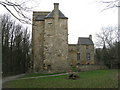
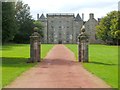
Kinneil House
by M J Richardson
geograph for square NS9880
The country home of the Dukes and Duchesses of Hamilton. The earliest part dates... (more)
|
|
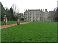
Kinneil House
by Lairich Rig
geograph for square NS9880
For earlier photos by other contributors (and for further information), see... (more)
|
|
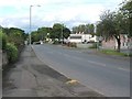
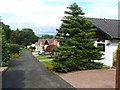
Snab Brae, Castleloan
by Lairich Rig
geograph for square NS9880
This area is part of the Castleloan housing estate in Kinneil.
This area is... (more)
|
|
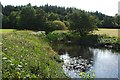
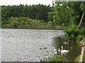
East Pond, Kinneil Estate
by Lairich Rig
geograph for square NS9780
|
|
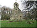
Kinneil Church and burial ground
by M J Richardson
geograph for square NS9880
Only the western gable and bell tower survive of this church which dates back to... (more)
|
|
Bo'ness and Kinneil Railway Line
by Lairich Rig
geograph for square NS9881
The Bo'ness and Kinneil Railway is run entirely by volunteers. A steam... (more)
|
|
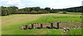
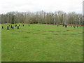
Kinneil Roman fortlet
by Lairich Rig
geograph for square NS9780
The line of the Antonine Wall can be seen as a raised area receding directly... (more)
|
|
West Pond of the Kinneil Estate
by M J Richardson
geograph for square NS9780
Just south of the line of the course of the Roman Antonine Wall, which is in the... (more)
|
|
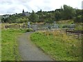
Deangate Gardens
by Lairich Rig
geograph for square NS9880
The photograph was taken from the southern end of the row of houses. That point... (more)
|
|
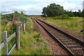
Level crossing near Kinneil Halt
by Lairich Rig
geograph for square NS9881
|
|
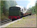
Steam train at Kinneil Halt
by Lairich Rig
for square NS9881
|
|
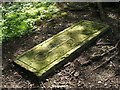
Bell pit in Kinneil Woods
by M J Richardson
geograph for square NS9780
Now filled in, bell pits were dug to extract coal from below the surface. There... (more)
|
|
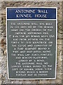
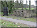
Antonine Wall at Kinneil House
by M J Richardson
for square NS9880
|
|
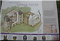
Kinneil House Information Board
by M J Richardson
for square NS9880
|
|
Roman Fortlet in Kinneil Wood
by M J Richardson
geograph for square NS9780
One of many built at 1-mile intervals on the line of the Antonine Wall, which... (more)
|
|
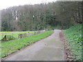
Woodland path in Kinneil Wood
by M J Richardson
geograph for square NS9780
|
|
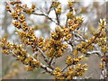
Bursting buckthorn buds
by M J Richardson
for square NS9881
Buds of Sea Buckthorn [Hippophae rhamnoides] just expanding, on the Kinneil... (more)
|
|
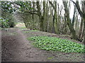
Path to Kinneil House
by M J Richardson
geograph for square NS9880
From Grangemouth Road, with a great growth of wild garlic/ramsons shortly to flower.
|
|
Gravestone near the ruined Kinneil Church
by Lairich Rig
for square NS9880
|
|
James Watt's Cottage
by M J Richardson
geograph for square NS9880
Built in 1769, when he worked at the collieries at Kinneil, and which he used as... (more)
|
|
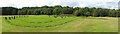
Kinneil Roman fortlet
by Lairich Rig
geograph for square NS9780
|
|
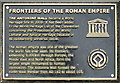
Frontiers of the Roman Empire
by M J Richardson
for square NS9880
Plaque indicating that in 2008 the Antonine Wall was designated as a UNESCO... (more)
|