Public Tags
Tag: Leacaan·Water
Showing images tagged with Leacaan Water tag.
|
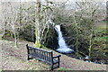
Miller's Falls
by Bill Kasman geograph for square NN0102 Under the bridge over the Leacaan Water on the minor road from the A83 known as... (more)
Tags:
type:Geograph
Leacaan Walk
Leacaan Water
Millers Falls
top:Paths
top:Rivers, Streams, Drainage
top:Roads, Road Transport
|
|
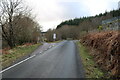
Leacaan Forest Drive
by Bill Kasman for square NN0102 After it leaves the A83 this minor road proceeds for some distance into the... (more)
Tags:
type:Cross Grid
Leacaan Forest Drive
Leacaan Water
Millers Falls
top:Roads, Road Transport
top:Woodland, Forest
|
|
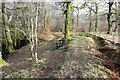
Leacaan Water path
by Bill Kasman for square NN0202 This path starts from the minor road known as the 'Leacaan Forest... (more)
Tags:
type:Cross Grid
Leacaan Water
Millers Falls
top:Paths
top:Rivers, Streams, Drainage
top:Woodland, Forest
|
|
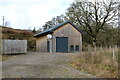
Water works?
by Bill Kasman geograph for square NN0202 This building has something to do with the nearby Leacaan Water but exactly what... (more)
|
|
Leacaan Water path
by Bill Kasman geograph for square NN0102 Starting from the old bridge in this image... (more)
Tags:
road:A83
Brenchoille
Bridge
type:Geograph
Leacaan Water
Millers Falls
top:Paths
top:Rivers, Streams, Drainage
top:Woodland, Forest
|
|
Old bridge
by Bill Kasman geograph for square NN0102 This old bridge over the Leacaan Water is still usable but it is narrow and has... (more)
Tags:
type:Geograph
top:Historic Sites and Artefacts
Leacaan Water
Millers Falls
top:Rivers, Streams, Drainage
top:Roads, Road Transport
top:Woodland, Forest
|
|
Mini double-arched bridge
by Bill Kasman geograph for square NN0202 Ok, describing this as a double-arched bridge is pushing it a little but it is... (more)
Tags:
type:Geograph
Leacaan Water
top:Paths
top:Rivers, Streams, Drainage
Tigh Na Struan
top:Woodland, Forest
|
|
Corn drying kiln
by Bill Kasman geograph for square NN0202 This medieval corn-drying kiln is unrecognisable as such being just a jumble of... (more)
Tags:
Brenchoille
Corn Drying Kiln
type:Geograph
top:Historic Sites and Artefacts
Leacaan Water
top:Paths
top:Rivers, Streams, Drainage
Tigh Na Struan
top:Woodland, Forest
|
|
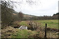
Footbridge over burn
by Bill Kasman geograph for square NN0201 This footbridge crosses one of the many apparently unnamed burns which flow into... (more)
|
|
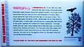
Information board
by Bill Kasman for square NN0102 A close look at the information board in this image... (more)
Tags:
type:Close Look
Leacaan Path
Leacaan Water
Millers Falls
top:Paths
top:Rivers, Streams, Drainage
top:Woodland, Forest
|
|
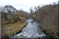
The Leacann Water
by Bill Kasman geograph for square NN0201 Seen here, in full flow after heavy rain, from the 18th-century Brenchoille Bridge.
Tags:
Brenchoille Bridge
type:Geograph
Leacaan Water
top:Rivers, Streams, Drainage
top:Woodland, Forest
|
|
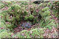
Inside of corn drying kiln
by Bill Kasman for square NN0202 A look at the inside of the medieval corn drying kiln in this image... (more)
Tags:
Brenchoille
type:Close Look
Corn Drying Kiln
top:Historic Sites and Artefacts
Leacaan Water
top:Paths
top:Rivers, Streams, Drainage
Tigh Na Struan
top:Woodland, Forest
|
|
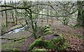
Location of cup-marked rock
by Bill Kasman geograph for square NN0202 This image gives some context as to the location of the cup-marked rock in this... (more)
Tags:
Cup Marked Rock
Cup Marked Stone
type:Geograph
top:Historic Sites and Artefacts
Leacaan Water
top:Paths
top:Rivers, Streams, Drainage
Tigh Na Struan
top:Woodland, Forest
|
|
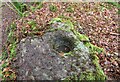
Cup mark on rock
by Bill Kasman for square NN0202 On a rocky outcrop close to an unnamed burn near Tigh-na-Struan is this... (more)
|
