Public Tags
Tag: Loch·Sloy
Showing images tagged with Loch Sloy tag.

|
Loch Sloy and power lines
by Jim Barton geograph for square NN2811 The Loch Sloy hydroelectric scheme was constructed between 1945 and 1950 and was... (more)
Tags:
Dam
top:Energy Infrastructure
type:Geograph
Hydroelectric Reservoir
top:Lakes, Wetland, Bog
Loch Sloy
Overhead Power Lines
Steep Hillside
top:Uplands
|

|
Loch Sloy dam
by Bill Kasman for square NN2811 This dam, opened in October 1950, holds the waters of Loch Sloy for use by the... (more)
|

|
Rocky shoreline of Loch Sloy 1981
by Jim Barton geograph for square NN2811 Traversing the rocks on the return from a winter walk over Ben Vane.
Tags:
type:Geograph
Hydroelectric Reservoir
top:Lakes, Wetland, Bog
Loch Sloy
top:Rocks, Scree, Cliffs
Rocky Shoreline
Walker
|
|
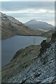
Loch Sloy from Beinn Dubh
by Jim Barton geograph for square NN2711 The steep east side of Beinn Dubh with Ben Lomond ahead beyond the dam.
|
