Public Tags
Tag: Lowland·Farming
Showing images tagged with Lowland Farming tag.

|
Lowland farming at Toberadur near Achonry, co. Sligo
by D Gore for square G5813 Category: Farmland Farm fields and bog at Toberadur (70 metres ASL). On the skyline 5 kms away is... (more)
|

|
Mackley's Farm, from the south
by Christine Johnstone geograph for square SK6732 Seen from the Grantham Canal towpath, just east of Mackley's Bridge [no... (more)
|

|
Tractor muck-spreading near Espber Farm
by Christine Johnstone geograph for square SD9155 It is a cattle farm.
|

|
Sheep at High Farm
by Christine Johnstone geograph for square SD4078 Just south of the farm buildings.
Tags:
top:Farm, Fishery, Market Gardening
type:Geograph
Lowland Farming
subject:Sheep
Sheep Grazing
Sheep in Field
Sheep Pasture
|

|
Farmland bisected by a drain and an access road
by Christine Johnstone geograph for square SE8632 West of Common Farm. The drained farmland is about 2 metres above sea level.
|

|
Field of flax, west of Common Farm
by Christine Johnstone geograph for square SE8632 Flax is much easier to recognise when it is flowering SP5164 : A purple slope of flax in flower. The flax... (more)
|

|
Arable field at Brook Farm
by Christine Johnstone geograph for square SE8731 Winter cereals, about 4 metres above sea level. The trees and bushes on the far... (more)
Tags:
Arable Field
top:Farm, Fishery, Market Gardening
type:Geograph
Lowland Farming
crop:Winter Cereal
|

|
Farmland drained by Wath Beck
by Christine Johnstone geograph for square SE3277 On the east side of Bedale Lane. About 35 metres above sea level.
|

|
View towards Blois Closes
by Christine Johnstone geograph for square SE3476 Grassy field on the south side of Underlands Lane. About 40 metres above sea level.
|

|
Arable field, south-west of Watery Lane Farm
by Christine Johnstone geograph for square SP1975 About 100 metres above sea level. On the east bank of the Grand Union canal,... (more)
|

|
Farmland south-east of Risehow
by Christine Johnstone geograph for square NY0234 About 20 metres above sea level and 500 metres from the sea.
|

|
Recently treated field, near Espber Farm
by Christine Johnstone geograph for square SD9155 The muck-spreader is still at work nearby.
|

|
Rough grassland, south of Woodside Farm
by Christine Johnstone geograph for square NY0434 About 95 metres above sea level.
|

|
Sheep on Aldcliffe's salt marsh
by Christine Johnstone geograph for square SD4561 Alongside the Lancashire Coastal Way.
|

|
Cereal fields, south-west of Woodmoor Farm
by Christine Johnstone geograph for square SE3214 The distant trees mark the route of a former railway line.
Tags:
Arable Farmland
Cereal Field
top:Farm, Fishery, Market Gardening
subject:Field
type:Geograph
Growing Cereal Crops
Lowland Farming
|

|
Arable field, Cliffe
by Christine Johnstone geograph for square NZ2115 On the south bank of the River Tees, about 55 metres above sea level.
|

|
Defaid yn pori / Sheep grazing, Llanfaglan
by Christine Johnstone geograph for square SH4760 The field is about 20 metres above sea level.
|

|
Hollingthorpe farmland
by Christine Johnstone geograph for square SE3115 West of Hollingthorpe Lane and about 85 metres above sea level.
|

|
Boundary between fields and woodland
by Christine Johnstone geograph for square SE3214 The northern boundary of Seckar Wood, following Lawns Dike. There is a public... (more)
Tags:
Arable Farmland
Cereal Field
public footpath:Field Edge
Field/woodland Boundary
path:Footpath
type:Geograph
Growing Cereal Crops
Lowland Farming
top:Lowlands
Public Footpath
|

|
Large stubble field, north bank of the Ashby Canal
by Christine Johnstone geograph for square SK3704 Between bridges 45 and 46, south of the Bosworth Road. The trees in the field... (more)
|

|
Stubble fields, south-east of Congerstone
by Christine Johnstone geograph for square SK3704 Cereal stubble between the Ashby Canal and Bosworth Road. About 93 metres above sea level.
|

|
Sheepfield south-east of Hayknowes Farm
by Christine Johnstone geograph for square NY1765 About 5 metres above sea level.
|

|
Cereal field, south of Cosgrove
by Christine Johnstone geograph for square SP7941 About 70 metres above sea level, in the wide valley of the River Great Ouse.... (more)
Tags:
Arable Farmland
Cereal Field
top:Farm, Fishery, Market Gardening
top:Flat Landscapes
type:Geograph
Lowland Farming
|

|
Farmland, 2 metres above sea level
by Christine Johnstone geograph for square SE8632 South of Common Farm. A former fen, drained in the early 1800s.
|

|
Drained arable fields, south of Common Farm
by Christine Johnstone geograph for square SE8632 The drained farmland is about 2 metres above sea level.
|

|
Cereal field drained by North Carr Drain
by Christine Johnstone geograph for square SE8632 The land is 2 metres above sea level. The distant white building is Stoney Carr Farm.
|

|
Large field of flax, west of Common Farm
by Christine Johnstone geograph for square SE8632 This field has been created from two smaller fields, which are shown on all the... (more)
|

|
Ploughed field at Brook Farm
by Christine Johnstone geograph for square SE8731 About 3 metres above sea level.
|

|
Open-sided field barn, east of Melmerby
by Christine Johnstone geograph for square SE3476 Fairly new, as it is not shown on the current version of Google Earth. About 45... (more)
Tags:
subject:Barn
top:Farm, Fishery, Market Gardening
Field Barn
type:Geograph
Lowland Farming
Open-Sided Barn
|

|
Back Field, sub-divided
by Christine Johnstone geograph for square SE4908 Both Back Field and North Field are shown divided into narrow strips on the... (more)
|

|
Tree on a former field boundary, north of Lound Hill
by Christine Johnstone geograph for square SE4908 Blah blah
Tags:
Arable Field
top:Farm, Fishery, Market Gardening
subject:Farmland
type:Geograph
Lowland Farming
Tree in Field
Trees on Field Boundary
|

|
Greening arable field, north of Brodsworth
by Christine Johnstone geograph for square SE5007 A few feral potatoes from last year's crop among the rows of smaller... (more)
|

|
Sheep between Well Head Hill and Bark Hill
by Christine Johnstone geograph for square SD9057 About 140 metres above sea level. Many of the low rounded hills in this area are... (more)
Tags:
top:Farm, Fishery, Market Gardening
type:Geograph
Lowland Farming
Sheep in Field
national park:Yorkshire Dales
|

|
Salt marsh with grazing sheep
by Christine Johnstone geograph for square SD4561 On the east bank of the tidal River Lune, near Aldcliffe.
Tags:
top:Farm, Fishery, Market Gardening
type:Geograph
Lowland Farming
subject:Salt Marsh
Sheep Grazing
|

|
Barley growing below Netherwood Coppice
by Christine Johnstone geograph for square SO5499 If it grows a 'beard' it's barley.
|

|
Field of wheat and barley, below Netherwood Coppice
by Christine Johnstone geograph for square SO5499 The public footpath goes diagonally across this field, but no-one has followed... (more)
Tags:
crop:Barley
Barley Field
Cereal Field
Coppice
top:Farm, Fishery, Market Gardening
type:Geograph
Lowland Farming
crop:Wheat
Wheatfield
|

|
Tree in a wheatfield, below Netherwood Coppice
by Christine Johnstone geograph for square SO5499 The public footpath from Langley to Parkstyle runs along the field edge. About... (more)
Tags:
top:Farm, Fishery, Market Gardening
type:Geograph
Lowland Farming
Tree in Field
crop:Wheat
Wheatfield
|

|
Barley field, between Langley and Parkgate
by Christine Johnstone geograph for square SO5499 In the valley of Bunhill Brook. About 140 metres above sea level.
|
|
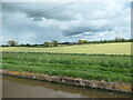
Dark clouds over mown fields, Adderley
by Christine Johnstone geograph for square SJ6640 On the east bank of the Shropshire Union canal.
|

|
Trees on field boundaries, Hotham Carrs
by Christine Johnstone geograph for square SE8533 Just north-west of South Carr Farm. The land is about one metre above sea level... (more)
|

|
Winter cereals, Hotham Carrs
by Christine Johnstone geograph for square SE8433 Between Wholsea Grange and Wholsea farm.
Tags:
Cereal Field
subject:Farmland
top:Flat Landscapes
type:Geograph
Lowland Farming
crop:Winter Cereal
|

|
Oilseed rape, coming into flower
by Christine Johnstone geograph for square SE3214 The distant trees are part of Shroggs Hill plantation.
Tags:
Arable Farmland
top:Farm, Fishery, Market Gardening
subject:Field
Field of Oilseed Rape
type:Geograph
Lowland Farming
Oil Seed Rape
|

|
Drain between arable fields, west of North Cave
by Christine Johnstone geograph for square SE8632 This fenland was drained in the early 1800s. It is 2 metres above sea level.
|

|
Dark clouds over low farmland
by Christine Johnstone geograph for square SE8632 The land is about 2 metres above sea level. The change in the land use marks the... (more)
|

|
Farmland, Hotham Carrs
by Christine Johnstone geograph for square SE8533 The fields are one metre above sea level and heavily drained.
Tags:
Arable Farmland
subject:Farmland
top:Flat Landscapes
type:Geograph
Long Plantation
Lowland Farming
New Drain
|

|
New Drain, Hotham Carrs
by Christine Johnstone geograph for square SE8433 Not new any more, but that's its name.
|
|
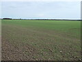
Emerging cereal crop, Hotham Carrs
by Christine Johnstone geograph for square SE8433 The land is 2 metres above sea level, and heavily drained.
|
