|
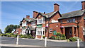
The Nags Head
by Steven Haslington
geograph for square SD3300
The Nags Head is a gastropub on Green Lane in Crosby, Merseyside, England. It is... (more)
|

|
Entrance to Knowsley Safari Park
by Steven Haslington
geograph for square SJ4694
The entrance gates to Knowsley Safari Park, in Merseyside, England.
|

|
Shoreline and Fort Perch Rock
by Steven Haslington
geograph for square SJ3094
The shoreline of New Brighton in Merseyside, England, looking out over the... (more)
|

|
Lever House
by Steven Haslington
geograph for square SJ3383
Lever House in Port Sunlight, Merseyside, England.
|

|
Houses at Port Sunlight
by Steven Haslington
geograph for square SJ3384
Houses on King George's Drive in Port Sunlight, in the Wirral borough of... (more)
|
|
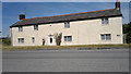
Cottage at the end of Chapel Lane
by Steven Haslington
geograph for square SD3500
A cottage located at the junction of Chapel Lane and Northern Perimeter Road in... (more)
|
|
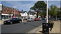
Chapel Lane, Formby
by Steven Haslington
geograph for square SD2907
Chapel Lane is the main thoroughfare of Formby, a suburban coastal town in... (more)
|

|
Formby beach
by Steven Haslington
geograph for square SD2606
The beach at Formby, Merseyside, England.
|

|
Wheel of Liverpool
by Steven Haslington
geograph for square SJ3489
The Wheel of Liverpool, a ferris wheel (or big wheel) positioned on the piazza... (more)
|

|
Crosby Beach
by Steven Haslington
geograph for square SJ3098
Crosby Beach with a slightly buried iron man of the "Another Place"... (more)
|

|
Albert Docks, Liverpool
by Steven Haslington
geograph for square SJ3489
A view of Albert Docks, in Liverpool, Merseyside, England.
|

|
End of Lifeboat Road
by Steven Haslington
geograph for square SD2706
Lifeboat Road in Formby, Merseyside, seen here at its western end at the Raven... (more)
|

|
Train at Bootle
by Malc McDonald
geograph for square SJ3495
A train of electric multiple units arriving at Bootle New Strand station.
The... (more)
|

|
Marine Lake, Southport
by Steven Haslington
geograph for square SD3318
Marine Lake in Southport, Merseyside, England. If you look very, very closely at... (more)
|

|
Regent Court, Southport
by Steven Haslington
geograph for square SD3417
Regent Court, a residential block of flats on Lord Street, in Southport,... (more)
|

|
St George's Church, Southport
by Steven Haslington
geograph for square SD3317
The Church of St George, on Lord Street, in Southport, Merseyside, England. This... (more)
|

|
Lord Street, Southport
by Steven Haslington
geograph for square SD3317
A view down Lord Street (from around about number 167), the principal... (more)
|

|
Southport Pier
by Steven Haslington
geograph for square SD3217
Southport Pier stands above the shores of the Irish Sea, in Southport,... (more)
|

|
The Triad
by Ian Greig
geograph for square SJ3495
The Triad in Bootle, home of the Inland Revenue on Merseyside is the tallest... (more)
|
|
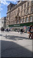
Marks & Spencer store, Liverpool
by Steven Haslington
geograph for square SJ3490
A Marks & Spencer store on Church Street in Liverpool city centre, on... (more)
|
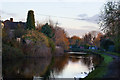
|
The Leeds and Liverpool Canal
by Ian Greig
geograph for square SJ3397
|
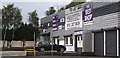
|
The sign on the forecourt (out of shot) says BEDS BEDS BEDS
by Ian Greig
geograph for square SJ4284
From the signage the beds seem to be moving in rather than out. Either that or... (more)
|
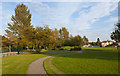
|
Jubilee Park
by Ian Greig
geograph for square SJ4391
|
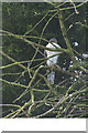
|
A sparrowhawk
by Ian Greig
for square SD5300
Saving me money on bird food?
|

|
The Trig Point on Billinge Hill
by Ian Greig
geograph for square SD5201
|
|
A playing field at Ridgewood Park
by Ian Greig
geograph for square SJ2683
|
|
Seagulls looking for a snack at Ridgewood Park
by Ian Greig
geograph for square SJ2683
While I was taking this their colleagues liberally decorated my car
|

|
Footpath towards Caldy Golf Club
by Ian Greig
geograph for square SJ2384
|

|
Sandy Lane, a public bridleway
by Ian Greig
geograph for square SJ2585
|

|
Mill Hill Road
by Ian Greig
geograph for square SJ2585
|
|
The Anchor Inn, Irby
by Ian Greig
geograph for square SJ2584
|

|
The river front at Caldy
by Ian Greig
geograph for square SJ2284
|

|
Track towards Storeton
by Ian Greig
geograph for square SJ3083
|

|
Avenue like footpath
by Ian Greig
geograph for square SJ3082
This shot looks away from the direction that the avenue and Levers Causeway to... (more)
|

|
Brimstage Lane
by Ian Greig
geograph for square SJ3083
|
|
A small patch of open space on the corner of Cross Lane and Stanton Road
by Ian Greig
geograph for square SJ3283
|

|
The beginning (or end) of Lever Causeway
by Ian Greig
geograph for square SJ3084
|

|
An oak tree on Station Road
by Ian Greig
geograph for square SJ2984
|

|
Storeton Lane
by Ian Greig
geograph for square SJ2883
|
|
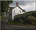
The fox and hounds
by Ian Greig
geograph for square SJ2783
|
|
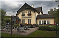
The Basset Hound
by Ian Greig
geograph for square SJ2884
|
|
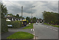
A bus stop on Barnston Road
by Ian Greig
geograph for square SJ2784
|
|
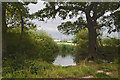
A pond by Landican Lane
by Ian Greig
geograph for square SJ2885
|

|
Landican Lane - a public bridleway
by Ian Greig
geograph for square SJ2885
|

|
Landican Lane - a public bridleway
by Ian Greig
geograph for square SJ2885
|
|
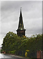
St Peter's Church, Rock Ferry
by Ian Greig
geograph for square SJ3386
St Peter's was built between 1841 and 1842, and designed by Hurst and... (more)
|
|
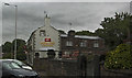
The Rose and Crown
by Ian Greig
geograph for square SJ3384
|
|
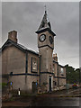
Bebington Centre For Voluntary Service
by Ian Greig
geograph for square SJ3384
This was founded in 2002 but doesn't appear to have survived
|
|
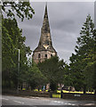
St Andrew's Church
by Ian Greig
geograph for square SJ3383
This is a Grade I listed building. The architectural historian Raymond Richards... (more)
|
|
Park and play area
by Ian Greig
geograph for square SJ3483
|
