|
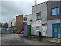
20 Mill Lane, Bedminster
by S
geograph for square ST5871
20 Mill Lane was built in the late 1870s as part of a terrace comprising of 4... (more)
|
|
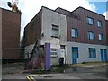
20 Mill Lane, Bedminster
by S
geograph for square ST5871
20 Mill Lane was built in the late 1870s as part of a terrace comprising of 4... (more)
|

|
Mill Lane sign
by Geographer
for square TL9890
On Mill Lane at the junction with South End, Sallow Lane & Lovers' Lane
|
|
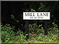
Mill Lane sign
by Geographer
for square TM1590
On Mill Lane at the junction with Wash Lane & Plantation Road
|
|
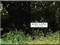
Mill Lane sign
by Geographer
for square TM1590
On Mill Lane at the junction with Wash Lane & Plantation Road
|

|
Mill Lane sign
by Geographer
for square TM2189
On Mill Lane at the junction with Anson's Lane
Road No.C359
|
|
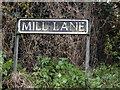
Mill Lane sign
by Geographer
for square TM2289
On Mill Lane at the junction with Mill Road
|

|
Mill Lane sign
by Geographer
for square TM3083
On Mill Lane at the junction with Hall Lane
|

|
Mill Lane, Withersdale Street
by Geographer
geograph for square TM2680
At the junction with Mill Lane
|

|
Mill Lane, Withersdale Street
by Geographer
geograph for square TM2680
At the junction with Mill Lane
|

|
Mill Lane sign
by Geographer
for square TM3887
On Mill Lane at the junction with Clarkes lane & Chapel Road at... (more)
|

|
Mill Lane
by Ian Capper
geograph for square SS9943
Houses in Mill Lane. On the left is no 7, dating from the late 18th Century and... (more)
|

|
Bulford Mill Lane sign
by Geographer
for square TL7720
On Bulford Mill Lane at the junction with Mill Lane
Road no.U4441
|

|
Mill Lane sign
by Geographer
for square TL7720
On Mill Lane at the junction with Bulford Mill Lane
Road No.U4444
|

|
Mill Lane sign
by Geographer
for square TM1451
On Mill Lane at the junction with Cooper's Road
|

|
Roadsign & Mill Lane signs on Mill Lane
by Geographer
for square TM1451
At the junction with Cooper's Lane
|

|
Roadsign on Mill Lane
by Geographer
for square TM1451
At the junction with Cooper's Road & Mill Lane
|

|
Roadsign on Mill Lane
by Geographer
geograph for square TM2680
At the junction with Mill Lane
|

|
Mill Lane sign
by Geographer
geograph for square TM2289
On Mill Lane at the junction with North Green Road
Road No.C359
|

|
Mill Lane, Mill Common, Snetterton
by Geographer
geograph for square TL9890
At the junction with South End, Sallow Lane & Lovers' Lane
|

|
South End, Mill Common, Snetterton
by Geographer
geograph for square TL9890
At the junction with Mill Lane, Sallow Lane & Lovers' Lane
Road No. U33045
|
|
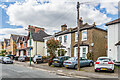
49 - 54 Mill Lane
by Ian Capper
geograph for square TQ2865
Two late 19th Century three house terraces in Mill Lane, first marked on the... (more)
|

|
Mill Lane, Creeting St.Mary
by Geographer
geograph for square TM0856
At Mill Lane Bridge
|

|
Mill Lane, Withersdale Street
by Geographer
geograph for square TM2680
At the junction with Mill Lane
|

|
Mill Lane, Withersdale Street
by Geographer
geograph for square TM2680
At the junction with Mill Lane
|

|
Littlebeck Lane, Kirstead
by Geographer
geograph for square TM2897
At the junction with Highfield Lane & Mill Lane near Mill Farm
|

|
Trees along Mill Lane
by Christine Johnstone
geograph for square SJ5984
The lane runs north from Hollyhedge Farm to the site of Grange Mill [a... (more)
|

|
Mill Lane, Barham
by Geographer
geograph for square TM1451
At the junction with Mill Lane & Cooper's Road
|

|
Mill Lane & Mill Lane Bridge over the A1120
by Geographer
geograph for square TM0658
|

|
Mill Lane, Creeting St.Mary
by Geographer
geograph for square TM0856
Approaching Mill Lane Bridge
|

|
Mill Lane junction with Rampton Lane
by Julian P Guffogg
geograph for square SK7881
Mill Lane continues as a track.
|

|
Crossroads on the south side of Hambleton
by Christine Johnstone
geograph for square SE5530
Mill Lane, Haugh Lane, Field Lane and Gateforth Lane meet at a 12 metre spot height.
|
|
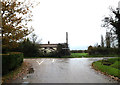
Mill Road, Hardwick
by Geographer
geograph for square TM2289
At the junction with Mill Lane
|
|
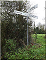
Roadsign on Mill Lane
by Geographer
for square TM2289
At the junction with Mill Road
|
|
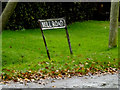
Mill Road sign
by Geographer
for square TM2289
On Mill Road at the junction with Mill Lane
|

|
Roadsign on Mill Lane
by Geographer
for square TM2680
|

|
Subscription Mill, Mill lane
by J.Hannan-Briggs
geograph for square SK8880
A tower mill from 1801. The white wooden cap is a modern fibreglass copy. Grade II listed.
|

|
Mill Lane, Marlesford
by Geographer
geograph for square TM3258
At the junction with Sandy Lane Mill House is in the distance
|

|
Shopping Precinct off Mill Lane, Bromsgrove
by Oliver Mills
geograph for square SO9670
A widened side street off the High Street, following the alignment of Mill Lane... (more)
|

|
Mill Mount
by Ian Capper
geograph for square SE5951
|

|
1 Mill Lane, Bedminster
by S
geograph for square ST5871
1 Mill Lane was built in the inter-war period in the garden of the General... (more)
|

|
Mill Lane sign
by Geographer
geograph for square TG1520
On Mill Lane at the junction with Haveringland Road
Road No.U57150
|

|
Bulford Mill Lane, Cressing
by Geographer
geograph for square TL7720
At the junction with Mill Lane
Road No.U4441
|

|
Roadsign on Bulford Mill Lane
by Geographer
geograph for square TL7720
At the junction with Mill Lane
|

|
Mill Lane, Cressing
by Geographer
geograph for square TL7720
At the junction with Bellway Avondale Homes & Bulford Mill Lane
Road No.U4444
|

|
Bulford Mill Lane, Cressing
by Geographer
geograph for square TL7720
At the junction with Mill Lane
Road No.U4441
|

|
Mill Lane, Cressing
by Geographer
geograph for square TL7720
At the junction with Bulford Mill Lane
Road No.U4444
|

|
Bulford Mill Lane, Cressing
by Geographer
geograph for square TL7720
At the junction with Mill Lane
Road No.U4441
|

|
3 metre spot height on Mill Lane
by Christine Johnstone
geograph for square SE8128
Looking north from the junction with Bennetland Lane.
|
|
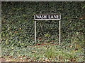
Wash Lane sign
by Geographer
for square TM1590
On Wash Lane at the junction with Plantation Road & Mill Lane
|
