Public Tags
Tag: Millisle
Other tags: place:Millisle
Showing latest 50 of 58 images tagged with Millisle tag.

|
Bench Mark, Millisle
by Rossographer geograph for square J5976 Rivet bench mark on the eastern side of the coast road on the Donaghadee side of... (more)
Tags:
Bench Mark
Bench Marks
Bench-Mark
subject:Benchmark
top:Coastal
type:Geograph
top:Historic Sites and Artefacts
Millisle
place:Millisle
OS Bench Mark Location
OS Benchmark
Rivet Bench Mark
top:Village, Rural Settlement
|

|
Bench Mark, Millisle
by Rossographer for square J5976 Rivet bench mark on the eastern side of the coast road on the Donaghadee side of... (more)
Tags:
Bench Mark
Bench Marks
Bench-Mark
subject:Benchmark
type:Close Look
top:Coastal
top:Historic Sites and Artefacts
Millisle
place:Millisle
OS Bench Mark Location
OS Benchmark
Rivet Bench Mark
top:Village, Rural Settlement
|

|
Religious message, Millisle
by Rossographer geograph for square J5975 "Prepare to meet thy God" on the A2 at Millisle.
Tags:
road:A2
A2
top:Coastal
type:Geograph
place:Millisle
Millisle
Religious Message
Religious Text
subject:Road
top:Roads, Road Transport
top:Village, Rural Settlement
|

|
Ballycopeland windmill, Millisle (1979)
by Albert Bridge for square J5776 Ballycopeland windmill Link at a... (more)
|

|
The Drumfad Road near Millisle
by Rossographer geograph for square J6073 Rural road south of Millisle.
|

|
The Woburn Road near Millisle
by Rossographer geograph for square J5974 Rural road running from Carrowdore to the sea south of Millisle.
|

|
Wind turbine, Killaghy near Millisle (May 2017)
by Albert Bridge for square J5676 A wind turbine visible from the Moss Road. The following information is taken... (more)
|
|
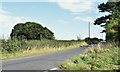
The Woburn Road, Millisle - August 2016(2)
by Albert Bridge geograph for square J5973 See J6074 : The Woburn Road, Millisle - August 2016(1). An open stretch of the same road, looking back towards... (more)
|
|
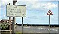
Faded and patched road sign, Millisle (July 2015)
by Albert Bridge geograph for square J5976 Back in the 1970’s a decision was made to abolish the statute mile... (more)
|

|
Ballycopeland windmill, Millisle (July 2015)
by Albert Bridge geograph for square J5776 The windmill seen from the southwest on the Windmill Road.
|

|
Masonic Hall, Millisle (detail)
by Albert Bridge for square J5975 Part of the front of Millisle Masonic Hall showing the date of building (1921)... (more)
|

|
Old UTA bus sign near Millisle
by Albert Bridge for square J5976 Category: Bus stop
The Northern Ireland Road Transport Board (1935-48) had a penchant for... (more)
|

|
Millisle Masonic Hall
by Martyn Boyd geograph for square J5975 The Masonic Hall in Millisle, County Down, Northern Ireland
Tags:
subject:Building
type:Geograph
Historic Building
top:Historic Sites and Artefacts
Masonic Hall
place:Millisle
top:Sport, Leisure
top:Village, Rural Settlement
|

|
Ballycopeland Windmill
by Rossographer geograph for square J5776 Ballycopeland Windmill near Millisle. The field in the foreground is planted with wheat.
Tags:
Ballycopeland
top:Farm, Fishery, Market Gardening
type:Geograph
top:Historic Sites and Artefacts
place:Millisle
crop:Wheat
Wheat
plant:Wheat
Wheat Field
subject:Windmill
Windmill
|
|
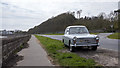
Austin A40 near Millisle
by Rossographer geograph for square J6074 1967 Austin A40 Farina parked up close to the sea wall south of Millisle.
Tags:
A40 Farina
Austin
car:Austina40
Car
type:Geograph
top:Historic Sites and Artefacts
Millisle
subject:Road
Road
top:Roads, Road Transport
subject:Vehicle
|

|
Austin A40 near Millisle
by Rossographer geograph for square J6074 1967 Austin A40 Farina parked up close to the sea wall south of Millisle.
Tags:
A40 Farina
Austin
car:Austina40
Car
type:Geograph
top:Historic Sites and Artefacts
Millisle
Road
top:Roads, Road Transport
subject:Vehicle
|

|
Ballycopeland Presbyterian Graveyard, Millisle
by Rossographer geograph for square J5976 Small graveyard close to the shore on the northern side of Millisle, County... (more)
Tags:
top:Burial Ground, Crematorium
Coast
top:Coastal
Coastline
type:Geograph
Grave
Grave Stone
Gravestones
subject:Graveyard
Graveyard
top:Historic Sites and Artefacts
Millisle
|
|
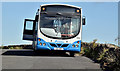
Bus, Millisle (August 2016)
by Albert Bridge for square J6075 An Ulsterbus Wright-bodied Scania (2456 OXI 518) parked, between turns, at the... (more)
|

|
Bus stop, Ballycopeland windmill, Millisle (July 2015)
by Albert Bridge for square J5775 The Ballycopeland windmill J5776 : Ballycopeland windmill, Millisle (July 2015) outward bus stop on the Moss Road.... (more)
|

|
Former "Windmill Grill", Millisle
by Albert Bridge geograph for square J5975 Possibly the best-known (non-licensed) business in Millisle. Originally offered... (more)
Tags:
top:Business, Retail, Services
Cafe (Closed)
top:Derelict, Disused
former:Fish and Chip Shop
place:Millisle
top:Village, Rural Settlement
|

|
Masonic Avenue, Millisle
by Albert Bridge geograph for square J5975 A narrow street running from the Shore Road to the Masonic Hall J5975 : Masonic Hall, Millisle (detail) at... (more)
|

|
The Barkley Rock, Millisle (August 2017)
by Albert Bridge geograph for square J6074 With my almost non-existent geological knowledge I’d have called this an island.... (more)
|

|
Car park, Ballyhaskin, Millisle (August 2017)
by Albert Bridge geograph for square J6174 An unsurfaced coastal car park on the Ballywalter Road (Whitechurch Road on the... (more)
|

|
Ballycopeland windmill (under renovation) (August 2016)
by Albert Bridge for square J5776 Ballycopeland windmill, surrounded by scaffolding, during renovation.
Tags:
Building Under Renovation
type:Cross Grid
top:Historic Sites and Artefacts
place:Millisle
subject:Windmill
Windmill
|

|
National Cycle Network (route 99) sign, Drumfad, Millisle/Carrowdore (August 2016)
by Albert Bridge for square J5973 National Cycle Network Route 99 sign at the Woburn Road J5973 : The Woburn Road, Millisle - August 2016(2) end of the... (more)
Tags:
place:Carrowdore
type:Close Look
place:Millisle
National Cycle Network
National Cycle Route
National Cycle Route 99
Road Sign
top:Roads, Road Transport
|

|
Drumfad Road name sign, Millisle/Carrowdore (August 2016)
by Albert Bridge for square J5973 The name sign, surrounded by tall grass, at the Woburn Road J5973 : The Woburn Road, Millisle - August 2016(2) end of... (more)
|

|
The Woburn Road, Millisle - August 2016(1)
by Albert Bridge geograph for square J6074 A minor road running south west off the Ballywalter Road (Whitechurch Road on... (more)
|
|
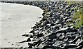
Sea defences, Millisle (August 2016)
by Albert Bridge geograph for square J6074 Minor defences, against the Irish Sea, along the Ballywalter Road (Whitechurch... (more)
Tags:
top:Coastal
type:Geograph
Irish Sea
place:Millisle
Sea Defences
subject:Sea Defences
Shoreline
|
|
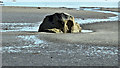
Coastal boulder, Millisle (August 2016)
by Albert Bridge geograph for square J6075 An isolated boulder, on an otherwise sandy beach, close to the Ballywalter Road... (more)
|
|
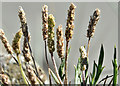
Navelwort, Millisle (August 2016)
by Albert Bridge for square J6075 Navelwort Link
 growing in the... (more) Tags:
type:Close Look
place:Millisle
Navelwort
Seawall
top:Wild Animals, Plants and Mushrooms
Wildflowers
|

|
Concrete UTA bus stop, Millisle (July 2015)
by Albert Bridge for square J5976 See J5976 : Old UTA bus sign near Millisle (August 2006) and J5976 : Old bus stop, Millisle (November 2009). This UTA concrete... (more)
Tags:
Bus Stop
building material:Concrete
place:Millisle
top:Roads, Road Transport
Translink
Ulsterbus
UTA (Ulster Transport Authority)
|

|
Glenfield drinking fountain, Millisle - July 2015 (2)
by Albert Bridge for square J5976 See J5976 : Glenfield drinking fountain, Millisle - July 2015 (1). The maker’s name – “Glenfield” is just about legible under... (more)
Tags:
Drinking Fountain
Foundry Product
subject:Fountain
Glenfield & Kennedy Ltd
top:Industry
Inscription
place:Millisle
top:Water Resources
|

|
Glenfield drinking fountain, Millisle - July 2015 (1)
by Albert Bridge for square J5976 See J5976 : Old water tap, Shore Road Millisle [2] (March 2008). More than seven years later, the same fountain now... (more)
Tags:
Drinking Fountain
Foundry Product
subject:Fountain
Glenfield & Kennedy Ltd
top:Industry
place:Millisle
top:Water Resources
|
|
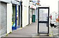
Telephone box, Millisle (July 2015)
by Albert Bridge for square J5976 A KX100 telephone box at Main Street.
Tags:
British Telecom
top:Business, Retail, Services
top:Communications
place:Millisle
subject:Telephone Box
Telephone Box
|
|
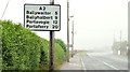
Route confirmatory sign, Millisle (July 2015)
by Albert Bridge geograph for square J5975 A route confirmatory sign, showing four destinations along the Ards Peninsula,... (more)
|

|
Ballybuttle Road name sign, Millisle (July 2015)
by Albert Bridge for square J5775 The Ballybuttle Road J5775 : Ballybuttle Road, near Millisle name sign at the Moss Road/Windmill Road... (more)
|

|
Windmill Road name sign, Millisle (July 2015)
by Albert Bridge for square J5775 The name sign at the Moss Road end of the Windmill Road. Ballycopeland windmill... (more)
Tags:
place:Millisle
subject:Nature Reserve
Road Name Explained
Road Name Sign
top:Roads, Road Transport
|

|
Cattle, Millisle - July 2015 (2)
by Albert Bridge geograph for square J6074 See J6074 : Cattle, Millisle - July 2015 (1). Another part of the herd in the same field.
|

|
Cattle, Millisle - July 2015 (1)
by Albert Bridge geograph for square J6074 Part of a Friesian herd in a misty field beside the Ballywalter Road... (more)
|

|
Postbox BT22 482, Ballyfrenis (June 2015)
by Albert Bridge geograph for square J5774 Post-mounted EIIR postbox (BT22 482), on the Abbey Road, Ballyfrenis, between... (more)
Tags:
place:Carrowdore
top:Communications
top:Construction, Development
place:Millisle
subject:Postbox
Postbox
|

|
Derelict building, Millisle (March 2014)
by Albert Bridge geograph for square J5976 Another long-term case of dereliction – at Main Street opposite the Shore Road.
|

|
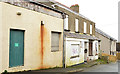
No 59 Main Street, Millisle
by Albert Bridge geograph for square J5976 A semi-derelict and vacant shop, at 59 Main Street, offered for sale and... (more)
Tags:
top:Construction, Development
top:Derelict, Disused
Development Site
place:Millisle
Shop (Derelict)
top:Village, Rural Settlement
|
|
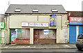
Vacant building, Strand Avenue, Millisle (March 2014)
by Albert Bridge geograph for square J5976 See J5976 : Development site, Millisle (2) (September 2011). The same building, untouched, with the... (more)
Tags:
Building (Vacant)
top:Construction, Development
top:Derelict, Disused
Development Site
place:Millisle
top:Village, Rural Settlement
|
|
Vacant shops, Millisle (March 2014)
by Albert Bridge geograph for square J5976 Two vacant shops, at Main Street, currently offered for sale. This photograph... (more)
|

|
Letter box, Millisle
by Albert Bridge geograph for square J5876 Post-mounted EIIR letter box (BT22 867) at the corner of Ashley Park and the... (more)
Tags:
top:Business, Retail, Services
top:Communications
Millisle
Postbox
top:Village, Rural Settlement
|

|
Letter box, Millisle
by Albert Bridge for square J6074 Post-mounted EIIR letter box (BT22 263), at Woburn, on the Ballywalter Road.
|

|
War memorial, Millisle
by Albert Bridge for square J5975 WW1 and WW2 memorial beside the road to Ballywalter.
|

|
Pillar box, Millisle
by Albert Bridge for square J5975 EIIR pillar box, outside the post office in Main Street, close to Seaview Avenue.
|

|
Union Foundry grating cover, Millisle
by Albert Bridge for square J5975 A grating cover, made by Wm Gregg, Sons & Phenix, the Union Foundry, Belfast... (more)
|

|
Lagoon, Millisle (2)
by Albert Bridge geograph for square J5976 See J5976 : Lagoon, Millisle (1). The outlet from the Lagoon to the Irish Sea. The Galloway... (more)
|
