
|
M6 motorway crossing the valley of the River Swift
by Christopher Hilton
geograph for square SP5079
Seen from the western edge of Rugby Services.
|

|
Rugby service station
by Christopher Hilton
geograph for square SP5179
When Britain's first motorways were built, provision was made for service... (more)
|

|
Northbound M6 at Selsmire
by Stephen Craven
geograph for square NY6006
This stretch of the motorway near Tebay services is one of the few on UK... (more)
|

|
M6 viaducts over Camsley Lane
by Stephen Craven
geograph for square SJ6687
At this point, the M6 is split in two on the approach to the Thelwall viaducts.... (more)
|
|
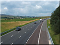
Southbound M6 at Selsmire
by Stephen Craven
geograph for square NY6006
This stretch of the motorway near Tebay services is one of the few on UK... (more)
|
|
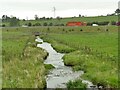
Shap Beck looking north
by Stephen Craven
geograph for square NY5518
The traffic in the background is on the M6.
|

|
M6 northbound at Beech
by Christopher Hilton
geograph for square SJ8538
|

|
M6 northbound at Beech
by Christopher Hilton
geograph for square SJ8538
|

|
M6 northbound, approaching Beech
by Christopher Hilton
geograph for square SJ8537
|

|
M6 northbound at the turn-off to Stafford Services
by Christopher Hilton
geograph for square SJ8831
|

|
M6 northbound, approaching Beech
by Christopher Hilton
geograph for square SJ8537
|

|
M6 northbound, west of Darlaston Park
by Christopher Hilton
geograph for square SJ8734
|

|
M6 northbound, west of Darlaston Park
by Christopher Hilton
geograph for square SJ8734
|

|
M6 northbound, north of Sandyford
by Christopher Hilton
geograph for square SJ8536
|

|
M6 northbound: approaching the A51 bridge at Sandyford
by Christopher Hilton
geograph for square SJ8636
|

|
M6 northbound, approaching Hanchurch
by Christopher Hilton
geograph for square SJ8539
|

|
Motorway glimpsed through trees
by Jonathan Hutchins
geograph for square SJ7370
"On one side lay the M6, and on one lay a great water, and the site was... (more)
|

|
M6 motorway
by Ian Taylor
for square SD5788
Viewed from the air. Looking south, with about 7.5km to Junction 36.
|

|
Track running south along east side of M6 approaching bridge over the motorway
by Luke Shaw
geograph for square NY4353
|
|
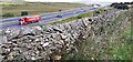
View over wall on west side of minor road towards M6
by Roger Templeman
geograph for square SD5993
Ordnance Survey records indicate that a benchmark levelled at 241.880m above... (more)
|
|
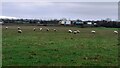
Sheep in field on north side of M6
by Roger Templeman
geograph for square NY4060
|

|
View over M6 from rural road T-junction NW of The Elephant
by Luke Shaw
geograph for square NY4542
|

|
Signpost at T-junction NW of The Elephant with M6 behind
by Roger Templeman
for square NY4542
|
|
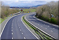
Essential Travel Only
by Ian Taylor
geograph for square SD5068
Essential Travel Only is the message on the matrix sign, due to coronavirus... (more)
|
|
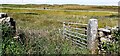
Field gateway on west side of road on west side of Firbank Fell
by Roger Templeman
geograph for square SD6093
|
