About tags on Geograph

Public Tags

Related Tags | Coverage Map
Tag:  NCN·7  

Showing latest 50 of 133 images tagged with NCN 7 tag.

View all tagged images - In Browser
:

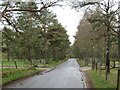
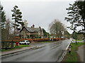
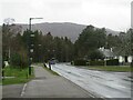
NH9010 : B970 at Inverdruie, near Aviemore by Malc McDonald B970 at Inverdruie, near Aviemore by Malc McDonald
geograph for square NH9010
A view of the B970 road at Inverdruie, close to Aviemore in the Ciarngorms... (more)
Tags: near:Aviemore   road:B970   place:Cairngorms National Park   type:Geograph   place:Inverdruie   National Cycle Network   National Cycle Route 7   NCN   NCN 7   national cycle network:Route 7   country:Scotland   place:Strathspey   Sustrans Route 7   subject:Village   top:Village, Rural Settlement  
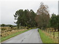
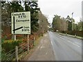
NH9010 : B970 at Inverdruie, near Aviemore by Malc McDonald B970 at Inverdruie, near Aviemore by Malc McDonald
geograph for square NH9010
A view of the B970 road heading out of the village of Inverdruie in the... (more)
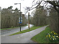
NH9010 : Old Logging Way, near Aviemore by Malc McDonald Old Logging Way, near Aviemore by Malc McDonald
geograph for square NH9010
Old Logging Way is a path in the Cairngorms National Park, open to people... (more)
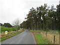
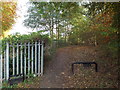
NH9010 : B970 near Aviemore by Malc McDonald B970 near Aviemore by Malc McDonald
geograph for square NH9010
A view of the B970 road in the Cairngorms National Park, taken on a wet April... (more)
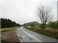
NH9110 : B970 at Coylumbridge, near Aviemore by Malc McDonald B970 at Coylumbridge, near Aviemore by Malc McDonald
geograph for square NH9110
A view of the B970 road at Coylumbridge in the Cairngorms National Park,... (more)
Tags: near:Aviemore   road:B Road   road:B970   place:Cairngorms National Park   place:Coylumbridge   Cycle Route 7   type:Geograph   National Cycle Network   National Cycle Network Route 7   National Cycle Route 7   NCN   NCN 7   subject:Road   top:Roads, Road Transport   national cycle network:Route 7   country:Scotland   place:Strathspey   Sustrans Route 7   Wet Road   Wet Weather  
NH9110 : B970 at Coylumbridge, near Aviemore by Malc McDonald B970 at Coylumbridge, near Aviemore by Malc McDonald
geograph for square NH9110
A view of the B970 road at Coylumbridge, in the Cairngorms National Park, taken... (more)
NH9111 : B970 at Coylumbridge, near Aviemore by Malc McDonald B970 at Coylumbridge, near Aviemore by Malc McDonald
geograph for square NH9111
A view of the B970 road entering the village of Coylumbridge in the Cairngorms... (more)
Tags: near:Aviemore   road:B Road   road:B970   place:Cairngorms National Park   place:Coylumbridge   Cycle Route 7   type:Geograph   National Cycle Network   National Cycle Network Route 7   National Cycle Route 7   NCN   NCN 7   subject:Road   top:Roads, Road Transport   national cycle network:Route 7   country:Scotland   place:Strathspey   Sustrans Route 7  
NH9111 : B970 near Aviemore by Malc McDonald B970 near Aviemore by Malc McDonald
geograph for square NH9111
A view of the B970 road in the Cairngorms National Park. This road is on route... (more)
Tags: near:Aviemore   road:B Road   road:B970   place:Cairngorms National Park   Cycle Route 7   type:Geograph   National Cycle Network   National Cycle Network Route 7   National Cycle Route 7   NCN   NCN 7   subject:Road   top:Roads, Road Transport   national cycle network:Route 7   country:Scotland   place:Strathspey   Sustrans Route 7  
NH9112 : B970 near Aviemore by Malc McDonald B970 near Aviemore by Malc McDonald
geograph for square NH9112
A view of the B970 road in the Cairngorms National Park. This road is on route... (more)
Tags: near:Aviemore   road:B Road   road:B970   place:Cairngorms National Park   Cycle Route 7   type:Geograph   National Cycle Network   National Cycle Network Route 7   National Cycle Route 7   NCN   NCN 7   subject:Road   top:Roads, Road Transport   national cycle network:Route 7   country:Scotland   place:Strathspey   Sustrans Route 7  
NH9011 : Inverdruie, near Aviemore by Malc McDonald Inverdruie, near Aviemore by Malc McDonald
geograph for square NH9011
A road junction at Inverdruie, near Aviemore in the Cairngorms National Park.... (more)
NH9011 : B970 at Inverdruie, near Aviemore by Malc McDonald B970 at Inverdruie, near Aviemore by Malc McDonald
geograph for square NH9011
The B970 road entering the village of Inverdruie, near Aviemore in the... (more)
Tags: near:Aviemore   road:B Road   road:B970   place:Cairngorms National Park   Cycle Route 7   type:Geograph   place:Inverdruie   National Cycle Network   National Cycle Network Route 7   National Cycle Route 7   NCN   NCN 7   subject:Road   top:Roads, Road Transport   national cycle network:Route 7   country:Scotland   place:Strathspey   Sustrans Route 7  
NH8911 : Road and path near Aviemore by Malc McDonald Road and path near Aviemore by Malc McDonald
geograph for square NH8911
A path leading away from a road near Aviemore in the Cairngorms National Park.... (more)
Tags: near:Aviemore   road:B Road   road:B970   place:Cairngorms National Park   Cycle Route 7   flower:Daffodil   plant:Daffodil   plant:Daffodils   Daffodils   type:Geograph   National Cycle Network   National Cycle Network Route 7   National Cycle Route 7   NCN   NCN 7   top:Paths   subject:Road   top:Roads, Road Transport   national cycle network:Route 7   country:Scotland   place:Strathspey   Sustrans Route 7  
NH8911 : Path near Aviemore by Malc McDonald Path near Aviemore by Malc McDonald
geograph for square NH8911
A path for walking and cycling in the Cairngorms National Park, heading onto a... (more)
Tags: place:Aviemore   Bridge Over River   place:Cairngorms National Park   Cycle Route 7   type:Geograph   National Cycle Network   National Cycle Network Route 7   National Cycle Route 7   NCN   NCN 7   subject:Path   top:Paths   national cycle network:Route 7   country:Scotland   place:Strathspey   Sustrans Route 7  
NH8911 : Bridge over the River Spey, Aviemore by Malc McDonald Bridge over the River Spey, Aviemore by Malc McDonald
geograph for square NH8911
A bridge taking a path over the River Spey at Aviemore, in the Cairngorms... (more)
Tags: place:Aviemore   subject:Bridge   Bridge Over River   place:Cairngorms National Park   Cycle Route 7   type:Geograph   National Cycle Network   National Cycle Network Route 7   National Cycle Route 7   NCN   NCN 7   top:Paths   national cycle network:Route 7   country:Scotland   place:Strathspey   Sustrans Route 7  
NH8911 : Dalfaber Road, Aviemore by Malc McDonald Dalfaber Road, Aviemore by Malc McDonald
geograph for square NH8911
Dalfaber Road is a minor road in Aviemore, in the Cairngorms National Park. It... (more)
NH8912 : Path junction, Aviemore by Malc McDonald Path junction, Aviemore by Malc McDonald
geograph for square NH8912
A junction of paths in Aviemore, in the Cairngorms National Park. This junction... (more)
NH8912 : National Cycle Network millennium milepost, Aviemore by Malc McDonald National Cycle Network millennium milepost, Aviemore by Malc McDonald
geograph for square NH8912
A millennium milepost on route 7 of the National Cycle Network at Aviemore, in... (more)
NZ3155 : C2C cycle route near Washington by Malc McDonald C2C cycle route near Washington by Malc McDonald
geograph for square NZ3155
This path, along a former railway route, forms part of the C2C long distance cycle route.
Tags: C2C Cycle Route   Coast to Coast Cycle Route   subject:Cycle Route   type:Geograph   National Cycle Network   NCN   NCN 7   top:Paths   national cycle network:Route 7   county:Tyne & Wear   near:Washington   place:Wearside  
NZ3658 : Shared use path along the River Wear, Sunderland by Malc McDonald Shared use path along the River Wear, Sunderland by Malc McDonald
geograph for square NZ3658
A shared path for walking and cycling, along the north bank of the River Wear in... (more)
Tags: season:Autumn   Autumn   Autumn Colour   Autumn Colours   Autumn Colours 2018   Autumn Tree Colour   Autumn Trees   C2C   C2C Cycle Route   type:Geograph   National Cycle Network   NCN 7   subject:Path   top:Paths   River Wear   river:River Wear   national cycle network:Route 7   place:Sunderland   county:Tyne & Wear   place:Wearside  
NS3978 : The River Leven: Dillichip Lade and a skimmer by Lairich Rig The River Leven: Dillichip Lade and a skimmer by Lairich Rig
geograph for square NS3978
Category: River
The cycle route (NCN Route 7) can be seen on the left, between the houses of the... (more)
NZ3658 : Riverside path and Northern Spire, Sunderland by Malc McDonald Riverside path and Northern Spire, Sunderland by Malc McDonald
geograph for square NZ3658
This path along the north bank of the River Wear is for use by pedestrians and... (more)
Tags: subject:Bridge   C2C   C2C Cycle Route   Cable Stayed Bridge   Cable-Stayed Bridge   type:Geograph   National Cycle Network   NCN 7   Northern Spire   subject:Path   top:Paths   River Wear   top:Rivers, Streams, Drainage   Road Bridge   national cycle network:Route 7   place:Sunderland   county:Tyne & Wear   place:Wearside  
NZ3155 : C2C cycle route, Washington by Malc McDonald C2C cycle route, Washington by Malc McDonald
geograph for square NZ3155
The blue signs show the route of the C2C cycle route, on the outskirts of Washington.
Tags: C2C Cycle Route   Coast to Coast Cycle Route   Cycle Path   subject:Cycle Route   type:Geograph   National Cycle Network   NCN   NCN 7   top:Paths   national cycle network:Route 7   county:Tyne & Wear   place:Washington   place:Wearside  
NZ3154 : C2C cycle route near Washington by Malc McDonald C2C cycle route near Washington by Malc McDonald
geograph for square NZ3154
The C2C (coast-to-coast) is a long-distance cycle route crossing the north of... (more)
Tags: C2C   C2C Cycle Route   subject:Cycle Route   type:Geograph   National Cycle Network   NCN   NCN 7   top:Paths   national cycle network:Route 7   county:Tyne & Wear   near:Washington   place:Wearside  
NS4373 : Decorative gateposts on NCN route 7 by Lairich Rig Decorative gateposts on NCN route 7 by Lairich Rig
for square NS4373
Category: Gateposts
These new gateposts, which were only recently installed (no more than six weeks... (more)
Tags: National Cycle Network   NCN 7   top:Paths  
NS4373 : NCN Route 7 by Lairich Rig NCN Route 7 by Lairich Rig
geograph for square NS4373
Category: National Cycle Network route
This path, between Milton and Dunglass Roundabout, is part of National Cycle... (more)
Tags: near:Milton   National Cycle Network   NCN 7   top:Paths  
NS4686 : A bend in the road by Lairich Rig A bend in the road by Lairich Rig
geograph for square NS4686
Cycle route NCN 7 follows this road. A private NS4686 : Driveway to Cattermuir Lodge branches off to the left.
Tags: long distance path:John Muir Way   National Cycle Network   NCN 7   top:Roads, Road Transport  
NS4786 : Cycle route near Croftamie by Lairich Rig Cycle route near Croftamie by Lairich Rig
geograph for square NS4786
The cycle route (NCN 7) leaves the road here, following the course of the old... (more)
Tags: long distance path:John Muir Way   National Cycle Network   NCN 7   top:Paths  
NS4563 : Cycle route at Elderslie by Lairich Rig Cycle route at Elderslie by Lairich Rig
geograph for square NS4563
Category: Cycle route
At this point, the cycle route (NCN7 and NCN75), which follows the former course... (more)
Tags: National Cycle Network   NCN 7   NCN 75   top:Paths  
NS4663 : Cycle route near Meikleriggs by Lairich Rig Cycle route near Meikleriggs by Lairich Rig
geograph for square NS4663
Category: Cycle route
Here, routes NCN7 and NCN75 follow the former course of a railway line; for more... (more)
Tags: National Cycle Network   NCN 7   NCN 75   top:Paths  
NS3975 : Cycle path, north of railway bridge by Lairich Rig Cycle path, north of railway bridge by Lairich Rig
geograph for square NS3975
Category: National Cycle Network route
This is part of NCN Route 7, just north of the point where it passes under... (more)
Tags: National Cycle Network   NCN 7   top:Paths   near:River Leven  
NS3977 : Footbridge on Cycle Route by Lairich Rig Footbridge on Cycle Route by Lairich Rig
geograph for square NS3977
Category: Footbridge
This footbridge, on NCN Route 7, crosses a little stream that rises about 500... (more)
NS4786 : Cycle route passing through Croftamie by Lairich Rig Cycle route passing through Croftamie by Lairich Rig
geograph for square NS4786
Following the line of the dismantled NS4786 : Forth and Clyde Junction Railway (see NS4786 : Cycle route near Croftamie), cycle route... (more)
Tags: place:Croftamie   long distance path:John Muir Way   National Cycle Network   NCN 7   top:Paths   top:Roads, Road Transport  
NS4786 : Cycle route near Croftamie by Lairich Rig Cycle route near Croftamie by Lairich Rig
geograph for square NS4786
This part of cycle route NCN 7 follows the line of the dismantled NS4786 : Forth and Clyde Junction Railway.... (more)
Tags: place:Croftamie   long distance path:John Muir Way   National Cycle Network   NCN 7   top:Paths  
NS3975 : NCN Route 7: Dumbarton Bridge to Artizan Bridge by Lairich Rig NCN Route 7: Dumbarton Bridge to Artizan Bridge by Lairich Rig
geograph for square NS3975
Category: National Cycle Network route
This part of the route runs from the western end of NS3975 : Dumbarton Bridge (shown in... (more)
Tags: place:Dumbarton   National Cycle Network   NCN 7   top:Paths   near:River Leven  
NS3976 : The approach to Mains of Cardross by Lairich Rig The approach to Mains of Cardross by Lairich Rig
geograph for square NS3976
Category: Footpath junction
The path that enters at the bottom of the image, and which continues along the... (more)
NS3981 : Fisherwood Pumping Station by Lairich Rig Fisherwood Pumping Station by Lairich Rig
geograph for square NS3981
Category: Pumping station
The pumping station, shown from a different angle in NS3981 : Fisherwood Pumping Station, is located at... (more)
NS5398 : A millennium milepost by Lairich Rig A millennium milepost by Lairich Rig
geograph for square NS5398
Category: Milepost
These mileposts, more than a thousand of which are located around the National... (more)
Tags: bucket:Closeup   near:Cobleland   sculptor:Iain McColl   Millennium Milepost   National Cycle Network   NCN 7   top:Sport, Leisure  
NS4986 : Cycle path meeting Gartness Road by Lairich Rig Cycle path meeting Gartness Road by Lairich Rig
geograph for square NS4986
At this point the John Muir Way, following the cycle path (NCN 7), meets up with... (more)
Tags: long distance path:John Muir Way   National Cycle Network   NCN 7   subject:Path Junction   top:Paths   top:Roads, Road Transport  
NS4886 : Bench beside cycle path by Lairich Rig Bench beside cycle path by Lairich Rig
geograph for square NS4886
The NS4886 : Croftamie Senior Citizens' Memorial Bench is shown here beside the cycle path (NCN 7); this part of the... (more)
Tags: Bench   long distance path:John Muir Way   National Cycle Network   NCN 7   top:Paths   subject:Seat  
NS4886 : Farm track crossing cycle route by Lairich Rig Farm track crossing cycle route by Lairich Rig
geograph for square NS4886
The path receding into the distance is part of a cycle route (NCN 7) and is also... (more)
Tags: Farm Track   subject:Gate   long distance path:John Muir Way   National Cycle Network   NCN 7   top:Paths  
NS4283 : Road junction near Lochend by Lairich Rig Road junction near Lochend by Lairich Rig
geograph for square NS4283
Branching off to the left is a short road leading to Lochend. The sign near the... (more)
Tags: long distance path:John Muir Way   National Cycle Network   NCN 7   subject:Road Junction   top:Roads, Road Transport   The Horseshoe  
NS4274 : Under the road bridge by Lairich Rig Under the road bridge by Lairich Rig
geograph for square NS4274
The cycle route (NCN 7) and footpath follow the course of a dismantled railway... (more)
NS4274 : Road bridge over NCN 7 by Lairich Rig Road bridge over NCN 7 by Lairich Rig
geograph for square NS4274
The bridge carries Glasgow Road over the cycle route; see NS4274 : Road bridge, Caledonian and Dunbartonshire Junction Railway and... (more)
NS4962 : Cycle route near Todholm Road by Lairich Rig Cycle route near Todholm Road by Lairich Rig
geograph for square NS4962
Category: National Cycle Network route
This section of NCN7 / NCN75 is overlooked by NS4962 : Derelict flats, Todholm Road.
Tags: National Cycle Network   NCN 7   NCN 75   place:Paisley   top:Paths  
NS5062 : Cycle route beside the White Cart by Lairich Rig Cycle route beside the White Cart by Lairich Rig
geograph for square NS5062
Category: National Cycle Network route
This is part of NCN7 and NCN75; between Cardonald and Hawkhead Hospital, the... (more)
Tags: near:Hawkhead   National Cycle Network   NCN 7   NCN 75   top:Paths   near:White Cart Water  
NZ0949 : NCN 7 signpost at Lydgett's Junction by M J Richardson NCN 7 signpost at Lydgett's Junction by M J Richardson
geograph for square NZ0949
Category: National Cycle Network route
Where the Waskerley Way, the Consett and Sunderland Path, the Derwent Valley... (more)
NS3878 : Cycle Route 7 at Renton by Lairich Rig Cycle Route 7 at Renton by Lairich Rig
geograph for square NS3878
Category: National Cycle Network route
In the distance, a NS3878 : Renton Bridge is visible. At the link just cited, some... (more)
Tags: river:Leven   National Cycle Network   NCN 7   top:Paths   place:Renton  
View more in the Image Search or in Browser
View images matching 'NCN 7' anywhere in the tags
Don't click these: PotMel 1 PotMel 2