
|
National Cycle Network Route 47 direction signs, Crindau, Newport
by Jaggery
for square ST3089
The sign on a pole on the left shows Continue over footbridge (for Route 47).... (more)
|

|
Cycle route 47 direction sign, Park Road, Hengoed
by Jaggery
geograph for square ST1594
Showing a quarter of a mile to Maesycwmmer (over viaduct) and 8 miles to Risca... (more)
|

|
Footpath and cycleway, Ystrad Mynach
by Jaggery
geograph for square ST1494
Part of National Cycle Network Route 47 on the west side of Penallta Road. Route... (more)
|

|
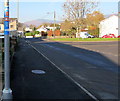
Across a footbridge over the Rhymney Line, Hengoed
by Jaggery
geograph for square ST1594
Across this Link bridge a few metres south... ( more) |
|
Cycle route 47 direction sign, Channel View, Risca
by Jaggery
geograph for square ST2490
The sign is below the humps sign here. Link... ( more) |

|
Cycle route 47 direction sign, Henfaes Road, Tonna
by Jaggery
geograph for square SS7798
The small blue white and red sign showing 47 indicates National Cycle Network... (more)
|

|
NCN Route 47 directions and distances, Crindau, Newport
by Jaggery
for square ST3089
National Cycle Network Route 47 here follows the towpath... (more)
|

|
Kutaisi Walk towards Newport City Footbridge
by Jaggery
geograph for square ST3188
Footpath and cycleway on the west bank of the River Usk, part of National Cycle... (more)
|

|
Kutaisi Walk, Newport
by Jaggery
geograph for square ST3188
Footpath and cycleway on the west bank of the River Usk, part of National Cycle... (more)
|

|
NCN Route 47 direction sign, Kutaisi Walk, Newport
by Jaggery
geograph for square ST3188
NCN (National Cycle Network) Route 47 is a mainly inland route
in Wales from... (more)
|

|
Metal barriers across a footpath and cycleway, Ystrad Mynach
by Jaggery
geograph for square ST1494
On the east side of Penallta Road, this is a continuation of National Cycle... (more)
|

|
Eastern Approach to Hengoed Viaduct
by M J Roscoe
geograph for square ST1594
National Cycle Route 47, on a dismantled railway track bed, about to pass the... (more)
|

|
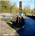
Celtic Trail signpost on a Quakers Yard corner
by Jaggery
for square ST0996
Located here Link between the phonebox and... ( more) |
|
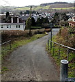
Warning signs, Mill Street, Quakers Yard
by Jaggery
geograph for square ST0996
Warning of a hump (twmpath in Welsh) in the road ahead, and cyclists.
Mill... (more)
|
|
Groes Road descends to Cefn Road, Rogerstone, Newport
by Jaggery
geograph for square ST2788
Viewed from near this Link bridge. Groes... ( more) |

|
National Cycle Network Route 47, Ynysybwl
by Jaggery
geograph for square ST0694
The cycleway and footpath here uses the trackbed of a dismantled railway
on... (more)
|

|
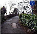
Canalside cycle route, Rogerstone, Newport
by Jaggery
geograph for square ST2788
The brown sign shows that the canalside path is part of National Cycle Network... (more)
|
|
Groes Road approaches a canal bridge, Rogerstone, Newport
by Jaggery
geograph for square ST2788
Formerly a through road for motor vehicles, Groes Road is now a footpath and... (more)
|

|
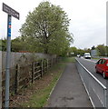
National Cycle Network junction, Malpas
by M J Roscoe
geograph for square ST3089
Junction of canal towpaths carrying NCR 49 going to the left under the M4 and... (more)
|
|
Cynon Trail, Trecynon
by Jaggery
geograph for square SN9904
For about 20 metres, the route of the Cynon Trail (and National Cycle Network... (more)
|
|
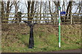
Signposts on eastern approach to Hengoed Viaduct
by M J Roscoe
geograph for square ST1594
On the left is one of a thousand millennium mileposts to mark the creation of... (more)
|

|
Quakers Yard footbridge over the River Taff
by Jaggery
geograph for square ST0996
Extending over the Taff for 40 metres from Rodericks Terrace to the A4054, this... (more)
|

|
Cycle route next to Penallta Country Park
by M J Roscoe
geograph for square ST1295
National cycle route 47 and Rhymney Valley Ridgeway Walk run between a mineral... (more)
|

|
Cycle route crossing Penallta Road
by M J Roscoe
geograph for square ST1494
|

|
Cycle route crosses Penallta Road
by M J Roscoe
geograph for square ST1494
National cycle route 47 and the Rhymney Valley Ridgeway Walk cross a suburban... (more)
|

|
The City Bridge from Riverside Park, Newport
by Robin Drayton
geograph for square ST3286
This is the southern end of the park.
National Cycle Route 47.
|
|
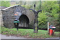
Green Meadow Bridge 17 Monmouthshire & Brecon Canal
by M J Roscoe
geograph for square ST2391
The arched bridge carries part of the Raven Walk over to Cwm Bir. the diamond... (more)
|

|
Cycle track, Penallta Country Park
by M J Roscoe
geograph for square ST1295
Tandem heading west on National cycle route 47 and Rhymney Valley Ridgeway Walk,... (more)
|

|
Pond near cycle route, Penallta Country Park
by M J Roscoe
geograph for square ST1295
Pond with dead great reed mace stems and inlet alongside national cycle route 47... (more)
|

|
Cycle route zigzags up into Penallta Park
by M J Roscoe
geograph for square ST1394
National cycle route 47 and the Rhymney Valley Ridgeway Walk come up into the... (more)
|
|
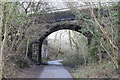
Road bridge over cycle route
by M J Roscoe
geograph for square ST1494
|

|
National Cycle Route 47 passing the Hoffman brick kiln, Horeb
by Humphrey Bolton
geograph for square SN5005
Most people using this former railway route probably have no idea that they are... (more)
|

|
Canal side path at Ruskin Avenue, Rogerstone
by M J Roscoe
geograph for square ST2788
Sirhowy Valley Walk and National cycle route 47 about to continue across the... (more)
|

|
Angling pond & cycle route, Penallta Country Park
by M J Roscoe
geograph for square ST1395
Western pond next to national cycle route 47 and Rhymney Valley Ridgeway Walk (right).
|
|
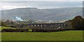
Maesycwmmer - Hengoed Viaduct
by Robin Drayton
geograph for square ST1595
The viaduct was built in the 1850s to carry the Taff Vale Extension of the... (more)
|
|
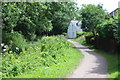
Canal side house, Monmouthshire & Brecon Canal, Cefn
by M J Roscoe
geograph for square ST2788
House next to the former towpath, now part of the Sirhowy Valley Walk and... (more)
|

|
Monmouthshire & Brecon Canal at Groes Road bridge
by M J Roscoe
geograph for square ST2788
Viewed from the bridge, the disused canal and former towpath, now part of the... (more)
|

|
Walkers on canal side path approaching Ruskin Avenue
by M J Roscoe
geograph for square ST2788
The path is part of the Sirhowy Valley Walk and National Cycle Route 47. The... (more)
|
|
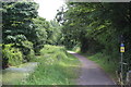
Monmouthshire & Brecon Canal (Crumlin Arm) at Ruskin Avenue
by M J Roscoe
geograph for square ST2788
The disused canal and old towpath, now part of the Sirhowy Valley Walk and... (more)
|
|
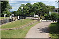
Track by Lock 21 at Cwm Lane
by M J Roscoe
geograph for square ST2788
Combined Sirhowy Valley Walk path and National cycle route 47 at junction with... (more)
|
|
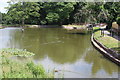
Canal pound, Fourteen Locks Canal Centre
by M J Roscoe
geograph for square ST2788
Pound between locks 21 and 20, just visible on the right. The path alongside the... (more)
|
|
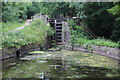
Pound below Lock 17, Monmouthshire & Brecon Canal
by M J Roscoe
geograph for square ST2888
Viewed from the bund below the restored lock. The track on the left is part of... (more)
|

|
Canal bridge, Pensarn
by M J Roscoe
geograph for square ST2888
The old towpath, part of the Sirhow Valley Walk and National Cycle Route 47,... (more)
|

|
Cycles for hire, Fourteen Locks
by Robin Drayton
geograph for square ST2788
National Cycle Route 47 passes the visitor centre at Fourteen Locks, Newport.... (more)
|
|
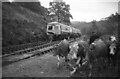
Railtour at Lady Windsor Colliery sidings (with cows)
by Martin Tester
geograph for square ST0692
The Taff Vale Railway's Ynysybwl branch of about 4 miles was opened to... (more)
|

|
Canal bridge at Malpas Junction
by M J Roscoe
geograph for square ST3089
The main Monmouthshire & Brecon Canal goes under the bridge and the M4... (more)
|

|
Crindau Bridge, Monmouthshire & Brecon Canal
by M J Roscoe
geograph for square ST3089
Bridge No 1; the towpath is part of National Cycle Route 47.
|
|
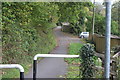
Track near Monmouthshire & Brecon Canal
by M J Roscoe
geograph for square ST2391
Track alongside the canal (just out of sight to left) is part of National Cycle... (more)
|

|
View of the River Usk from Riverside Park, Newport
by Robin Drayton
geograph for square ST3287
|

|
River Usk and George Street Bridge, Newport
by Robin Drayton
geograph for square ST3287
Viewed from Riverside Park.
|
