|
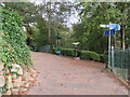
National Cycle Network signposts, Avenham Park, Preston
by Malc McDonald
geograph for square SD5428
The signpost in the foreground indicates several routes of the National Cycle... (more)
|
|
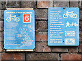
National Cycle Network Signs
by David Dixon
for square SJ8894
|
|
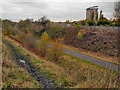
National Cycle Route 6, Fallowfield Loop Line
by David Dixon
geograph for square SJ8894
National Cycle Route 6 enters Manchester from Reddish via the traffic-free... (more)
|
|
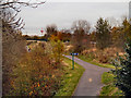
Fallowfield Loop Line
by David Dixon
geograph for square SJ8894
The disused railway line, now part of the National Cycle Network Route 6,... (more)
|
|
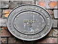
Bridge 13 plaque
by David Dixon
for square SJ8894
|
|
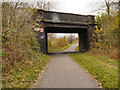
Fallowfield Loop Line, Bridge at Longford Road East
by David Dixon
geograph for square SJ8894
Bridge 13 on the former Fallowfield Loop Line (disused railway) now part of the... (more)
|
|
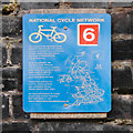
National Cycle Network Sign
by David Dixon
for square SJ8894
|
|
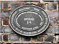
Bridge 14 plaque
by David Dixon
for square SJ8894
|
|
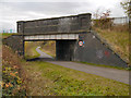
Fallowfield Loop Line, Bridge#14 (Nelstrop Road)
by David Dixon
geograph for square SJ8894
Bridge 14 on the former Fallowfield Loop Line (disused railway) now part of the... (more)
|
|
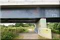
Graffiti on a bridge over the Derwent
by David Lally
geograph for square SK3934
|

|
Millennium milepost in West Park
by David Lally
for square SK4833
|
|
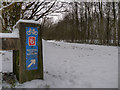
The Outwood Trail (National Cycle Route 6)
by David Dixon
geograph for square SD7706
The Outwood Trail is a route for walkers, cyclists and horseriders along the... (more)
|

|
Ringinglow Road heading east from Upper Burbage Bridge
by JThomas
geograph for square SK2682
|

|
Sustrans Millennium Milestone MP495 in Bestwood Country Park
by Alan Murray-Rust
for square SK5446
This is the Rowe design. The milepost has been repainted since being... (more)
|
|
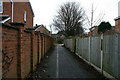
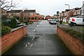
Sustrans Route 6 in Toton
by David Lally
geograph for square SK5034
Category: Cycle path
The route follows a quite convoluted path through the new estates in Toton to... (more)
|
|
Kindlewood Drive
by David Lally
geograph for square SK5034
Category: Cycle path
Taken from the end of a short path / cycleway between it and Norfolk Avenue.... (more)
|

|
Cattle grid on NCN Route 6
by David Lally
geograph for square SK6174
Approaching a road crossing.
|

|
Gated track
by David Lally
geograph for square SK6176
The track forms part of both NCN Route 6 (which leaves it a few metres further... (more)
|

|
Subway mural
by David Lally
for square SK5440
Painted last year and sponsored by Sustrans. This subway forms part of route 6... (more)
|
|
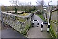
Access path to Route 6 (Cloud Trail)
by David Lally
geograph for square SK3925
|
|
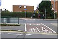
Cycle route crosses Station Road
by David Lally
geograph for square SK5336
Route 6
|

|
Woodland footpath in Bestwood Country Park
by Alan Murray-Rust
geograph for square SK5446
This is the overgrown railway trackbed of the former Great Northern Railway Leen... (more)
|

|
National Cycle Route 6 in Bestwood Country Park
by Alan Murray-Rust
geograph for square SK5447
The embankment and bridge which carried the Great Northern Railway Leen Valley... (more)
|

|
NCN Route 6 in Clumber Park
by David Lally
geograph for square SK6175
Mainly pine plantations in this part of the park.
|

|
Millennium milepost on Route 6
by David Lally
geograph for square SK6175
I wasn't planning to ride to either Dover or Inverness today!
|

|
Swancar Bridge over the Nottingham Canal -2
by Alan Murray-Rust
geograph for square SK4939
An original bridge from the creation of the Nottingham Canal, c.1795, Listed... (more)
|

|
National Cycle Network Marker, Avenham Park
by David Dixon
for square SD5428
Colourful cast iron marker by at the northern end of the old tram bridge where... (more)
|

|
Bird Cherry and Harrington Mill
by David Lally
geograph for square SK4833
|

|
Bridge over the Cloud Trail
by David Lally
geograph for square SK3926
|

|
Outwood Trail Approaching Radcliffe
by David Dixon
geograph for square SD7806
The Outwood Trail is a route for walkers, cyclists and horseriders along the... (more)
|

|
Course of Former Railway between Radcliffe and Outwood
by David Dixon
geograph for square SD7806
The Outwood Trail is a route for walkers, cyclists and horseriders along a... (more)
|

|
A footbridge has new fences and bollards
by David Lally
geograph for square SK4833
|

|
Barton Street
by David Lally
geograph for square SK5336
Running between Station Road and Dovecote Lane, this forms part of route 6 of... (more)
|

|
New path markings on new tarmac
by David Lally
geograph for square SK4833
The north path in west park
|

|
Temporary fencing on Route 6
by David Lally
geograph for square SK4833
The path along the northern edge of West Park in undergoing refurbishment. It... (more)
|

|
Swancar Bridge over the Nottingham Canal -3
by Alan Murray-Rust
geograph for square SK4939
An original bridge from the creation of the Nottingham Canal, c.1795, Listed... (more)
|
|
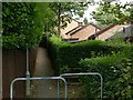
Footpath in Ravenshead
by Alan Murray-Rust
geograph for square SK5554
Running from the road junction at The Hutt to Sheepwalk Lane. It forms part of... (more)
|
|
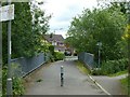
Footbridge over the Ock Brook
by Alan Murray-Rust
geograph for square SK4234
The sign on the right indicates that this is part of National Cycle Route 6... (more)
|

|
Sculpture at Outwood
by David Dixon
geograph for square SD7706
Ulrich Ruckriem has created one of his largest stone settings on the site of the... (more)
|

|
Triathlon route marker
by David Lally
geograph for square SK4833
In preparation for the race at the weekend.
|

|
This footpath will be closed
by David Lally
geograph for square SK5538
No mention of the fact that this "footpath" is part of the National... (more)
|

|
Dovecote Lane
by David Lally
geograph for square SK5336
|
|
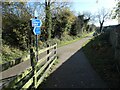
Signpost on the Cloud Trail, Melbourne
by Christine Johnstone
geograph for square SK3925
The former Derby - Ashby railway line is part of the national cycle route 6 here.
|
|
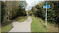
The NCN route 6 leaves the Cloud Trail
by Christine Johnstone
geograph for square SK3827
The signpost directs cyclists down onto the towpath of the Trent & Mersey Canal.
|

|
National Cycle route 6 Sherwood Forest Country Park
by Steve Fareham
geograph for square SK6066
|
|
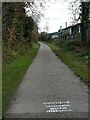
'Maintain social distance' by the site of Melbourne station
by Christine Johnstone
geograph for square SK3925
On the Cloud Trail / NCN route 6 - the former Derby - Ashby railway line.
|

|
Sustrans National Cycle Network Sign
by Mat Fascione
geograph for square SK4025
Along the Cloud Trail next to a bridge carrying Forty Foot Lane across the... (more)
|

|
Two miles to Tonge on the Cloud Trail
by Christine Johnstone
geograph for square SK3925
The former Derby - Ashby railway line, also now part of NCN 6.
|

|
The Cloud Trail, on the south bank of the River Trent
by Christine Johnstone
for square SK3827
The bench has become a monument to the Covid-19 pandemic - with a handwritten... (more)
|

|
Bridleway gate on NCN 6 near King John's Palace site
by Steve Fareham
geograph for square SK6064
|
