
|
Route 66
by David Dixon
for square SE3132
A signpost on the path next to the River Aire near the Royal Armouries Museum at... (more)
|

|
Harland Way, Wetherby
by E Gammie
geograph for square SE4048
The Harland Way is a foot and cycle path between Spofforth and Wetherby,... (more)
|

|
Parlington Lane heading north-east to Aberford
by Christine Johnstone
geograph for square SE4236
Formerly also the route of the Aberford Railway - see... (more)
|

|
Cycle path junction, Hull
by JThomas
geograph for square TA1030
On the Hornsea Rail Trail.
National cycle route 65 / National cycle route 66 junction.
|

|
Approaching the Dark Arch from the north-east
by Christine Johnstone
geograph for square SE4236
Built in 1813-14 to tunnel Parlington Lane under the gardens of Parlington Hall.... (more)
|

|
Approaching the Light Arch from the north-east
by Christine Johnstone
geograph for square SE4236
The Light Arch was built to separate Parlington Hall's carriage traffic... (more)
|

|
Parlington Lane, Aberford
by Christine Johnstone
geograph for square SE4336
Running south-west from the former Great North Road. The Aberford Railway ran... (more)
|

|
Log pile alongside Parlington Lane
by Christine Johnstone
geograph for square SE4135
The Parlington woodland is actively managed. Some felling had taken place recently.
|

|
Quad bike heading east on Parlington Lane
by Christine Johnstone
geograph for square SE4135
Driven by someone who works on Parlington Estate, as only private vehicle access... (more)
|

|
No left turn for ramblers and cyclists at Staith Cottage
by Christine Johnstone
geograph for square SE4135
Looking westwards along Parlington Lane [a public bridleway]. The track off to... (more)
|

|
Parlington Lane between the Staith Cottages
by Christine Johnstone
geograph for square SE4135
There were coal staithes just east of here, on the Aberford Railway.
|

|
69 metre spot height on Parlington Lane
by Christine Johnstone
geograph for square SE4135
Looking eastwards to the gentle low summit of the lane.
|

|
Parlington Lane passing Throstle Nest Farm
by Christine Johnstone
geograph for square SE4035
Heading east towards Aberford.
|
|
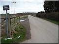
Private road, public bridleway
by Christine Johnstone
geograph for square SE4035
Parlington Lane, immediately east of Barwick Road.
|
|
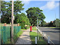
Molescroft Road, Beverley
by Ian S
geograph for square TA0240
|

|
Cyclist on route 66 near Lime Field Farm
by Ian S
geograph for square SE6953
|

|
Cycle route to Stamford Bridge
by Ian S
geograph for square SE6953
|

|
Cycle route to Stamford Bridge
by Ian S
geograph for square SE6953
|

|
Cycle route to Stamford Bridge
by Ian S
geograph for square SE6853
|

|
Cycle route to Stamford Bridge
by Ian S
geograph for square SE6853
|

|
Cycle route to Dunnington
by Ian S
geograph for square SE6853
|

|
Spring Road, Market Weighton
by JThomas
geograph for square SE8842
|

|
Oxton Lane, Tadcaster
by JThomas
geograph for square SE4943
|

|
Path leading to Walmgate Stray, York
by Ian S
geograph for square SE6150
|

|
Footpath marker near Lime Field Farm
by Ian S
geograph for square SE6953
|
|
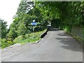
Millennium signpost, Hollins Mill Lane
by Humphrey Bolton
geograph for square SE0523
The path to the left leads down to the canal towpath.
|
