About tags on Geograph

Public Tags

Related Tags | Coverage Map
Tag:  North·Ayrshire  
Other tags: place:North Ayrshire    

Showing images tagged with North Ayrshire tag.

View all tagged images - In Browser
:

NS2943 : Peppe's fish, chip and pizza shop in Kilwinning, North Ayrshire, Scotland by Garry Cornes Peppe's fish, chip and pizza shop in Kilwinning, North Ayrshire, Scotland by Garry Cornes
geograph for square NS2943
Peppe's fish and chip shop takeaway in Kilwinning, North Ayrshire,... (more)
NS2059 : The Paddle Steamer Wetherspoons bar and restaurant at Largs sea front in Ayrshire by Garry Cornes The Paddle Steamer Wetherspoons bar and restaurant at Largs sea front in Ayrshire by Garry Cornes
geograph for square NS2059
The Paddle Steamer is a Wetherspoons bar and restaurant located directly on the... (more)
NS3436 : Industry at Shewalton by M J Richardson Industry at Shewalton by M J Richardson
for square NS3436
A view southwest from over Kilmaurs. The Ayrshire Coastal Path runs along the... (more)
NS3156 : North Ayrshire moorland by M J Richardson North Ayrshire moorland by M J Richardson
for square NS3156
A view looking northwest from over Kilbirnie Loch. The valley at lower right is... (more)
Tags: type:Aerial   Aerial Photograph   top:Coastal   type:Cross Grid   top:Estuary, Marine   Firth of Clyde   river:Garnock   subject:Landscape   top:Moorland   Near Kilbirnie   North Ayrshire   top:Rivers, Streams, Drainage   top:Uplands  
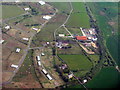
NS3045 : Ayrshire farmscape by M J Richardson Ayrshire farmscape by M J Richardson
for square NS3045
Dairy cattle grazing country, with two disused railway lines crossing. The farm... (more)
Tags: type:Aerial   Aerial Photograph   type:Cross Grid   top:Farm, Fishery, Market Gardening   subject:Farmland   Fields   river:Garnock   top:Grassland   top:Lowlands   place:North Ayrshire   former:Railway Line   top:Railways  
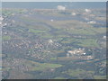
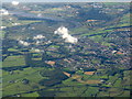
NS3241 : Irvine, the River Irvine and River Garnock by M J Richardson Irvine, the River Irvine and River Garnock by M J Richardson
for square NS3241
Viewed from the northeast. The R. Irvine is the loop to the left and the wider... (more)
NS2446 : Busbie Muir Reservoir by M J Richardson Busbie Muir Reservoir by M J Richardson
for square NS2446
North of Ardrossan, with a wind farm on Busbie Muir.
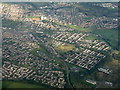
NS3155 : Kilbirnie from the air by M J Richardson Kilbirnie from the air by M J Richardson
for square NS3155
A view looking northwest four minutes after leaving Glasgow for France.
NS3655 : Trucks in waiting by M J Richardson Trucks in waiting by M J Richardson
for square NS3655
At Loanhead Quarry late on a Saturday afternoon.
Tags: type:Aerial   Aerial Photograph   near:Beith   type:Cross Grid   Lorries   top:Lowlands   place:North Ayrshire   subject:Quarry   top:Quarrying, Mining   top:Roads, Road Transport   top:Woodland, Forest  
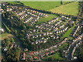
NS3453 : Beith, from above Kilbirnie Loch by M J Richardson Beith, from above Kilbirnie Loch by M J Richardson
for square NS3453
Looking southeast on the way to Glasgow Airport.
Tags: type:Aerial   Aerial Photograph   type:Cross Grid   top:Grassland   Housing Estate   top:Housing, Dwellings   top:Lowlands   place:North Ayrshire   subject:Village   top:Village, Rural Settlement  
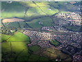
NS3451 : DM Beith from the air by M J Richardson DM Beith from the air by M J Richardson
for square NS3451
Looking southeast from over Glengarnock... (more)
NS3350 : Barkip Biogas Power Station by M J Richardson Barkip Biogas Power Station by M J Richardson
for square NS3350
An anaerobic digestion plant, the largest combined organic waste treatment and... (more)
NS3038 : Rivers at Irvine by M J Richardson Rivers at Irvine by M J Richardson
for square NS3038
The Garnock and Irvine meet just before they enter the Firth of Clyde. The jetty... (more)
Tags: type:Aerial   Aerial Photograph   top:City, Town Centre   subject:Coast   top:Coastal   type:Cross Grid   Firth of Clyde   river:Garnock   river:Irvine   place:Irvine   Irvine Bay   place:North Ayrshire   top:Rivers, Streams, Drainage  
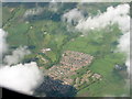
NS3049 : Housing estate at Dalry by M J Richardson Housing estate at Dalry by M J Richardson
for square NS3049
Handy for the Park & Ride in the adjacent square.
NS2947 : Car Auction Depot by M J Richardson Car Auction Depot by M J Richardson
for square NS2947
Wilson's Auctions at Dalry, near Kilwinning.
NS2944 : Kilwinning from the air by M J Richardson Kilwinning from the air by M J Richardson
for square NS2944
The northern outskirts.
Tags: type:Aerial   Aerial Photograph   type:Cross Grid   top:Farm, Fishery, Market Gardening   Fields   top:Grassland   top:Housing, Dwellings   place:Kilwinning   top:Lowlands   place:North Ayrshire   top:Suburb, Urban Fringe   subject:Town  
NS3040 : Bogside Race Course [disused] by M J Richardson Bogside Race Course [disused] by M J Richardson
for square NS3040
Seen from the air, between, the River Garnock and the River Irvine. Irvine Golf... (more)
Tags: type:Aerial   Aerial Photograph   Chemring   top:City, Town Centre   type:Cross Grid   top:Derelict, Disused   river:Garnock   Golf Course   near:Irvine   river:Irvine   top:Lowlands   place:North Ayrshire   Race Course (Disused)   subject:River   top:Rivers, Streams, Drainage   top:Sport, Leisure  
NS2938 : Irvine Bay and the Clyde coast by M J Richardson Irvine Bay and the Clyde coast by M J Richardson
for square NS2938
Looking east, across the estuaries of the Rivers Garnock and Irvine.
Tags: type:Aerial   Aerial Photograph   top:City, Town Centre   subject:Coast   top:Coastal   type:Cross Grid   top:Estuary, Marine   Firth of Clyde   river:Garnock   near:Irvine   river:Irvine   place:North Ayrshire   top:Rivers, Streams, Drainage  
NS2843 : Kilwinning from the air by M J Richardson Kilwinning from the air by M J Richardson
for square NS2843
Looking east along the A738 from over Ardrossan.
Tags: road:A738   type:Aerial   top:City, Town Centre   type:Cross Grid   Housing Estates   top:Housing, Dwellings   place:Kilwinning   top:Lowlands   place:North Ayrshire   top:Roads, Road Transport   subject:Town  
NS2740 : Industrial site and housing at Stevenston by M J Richardson Industrial site and housing at Stevenston by M J Richardson
for square NS2740
The bpi.visqueen plant, making heavy duty polythene packaging and, to the left,... (more)
NS3245 : Monkredding Quarry by M J Richardson Monkredding Quarry by M J Richardson
for square NS3245
Labelled on one map scale as a sand pit. Sevenacres Wood is below, and the B778... (more)
NS3143 : Kilwinning from the air by M J Richardson Kilwinning from the air by M J Richardson
for square NS3143
The large wood just left of lower centre, and above the curve of a disused... (more)
NS3238 : Irvine and Irvine Bay by M J Richardson Irvine and Irvine Bay by M J Richardson
for square NS3238
With the River Irvine running into the Firth of Clyde. Looking southwest from... (more)
NS2842 : Stevenston and Saltcoats from the air by M J Richardson Stevenston and Saltcoats from the air by M J Richardson
for square NS2842
Looking west. The River Garnock is at lower left.
Tags: type:Aerial   Aerial Photograph   subject:Coast   top:Coastal   type:Cross Grid   place:Cunninghame   top:Docks, Harbours   top:Farm, Fishery, Market Gardening   top:Lowlands   North Ayrshire   place:Saltcoats   place:Stevenston   top:Village, Rural Settlement  
NS2655 : Camphill and Muirhead Reservoirs by M J Richardson Camphill and Muirhead Reservoirs by M J Richardson
for square NS2655
Looking west from over Beith, to the Firth of Clyde.
NS2547 : Munnoch Reservoir by M J Richardson Munnoch Reservoir by M J Richardson
for square NS2547
And, just beyond, Busbie Muir Reservoir and a wind farm on Haupland Muir.
NS3751 : Balgray Bond. near Beith by M J Richardson Balgray Bond. near Beith by M J Richardson
for square NS3751
Labelled on the map as 'warehouses' - with a name like that, possibly... (more)
NS3655 : Loanhead Quarry, Beith by M J Richardson Loanhead Quarry, Beith by M J Richardson
for square NS3655
With the course of Beith Golf Club beyond.
NS3655 : Loanhead Quarry by M J Richardson Loanhead Quarry by M J Richardson
for square NS3655
An aerial view from near Beith.
Tags: type:Aerial   Aerial Photograph   near:Beith   type:Cross Grid   top:Farm, Fishery, Market Gardening   top:Lowlands   North Ayrshire   subject:Quarry   Quarry   top:Quarrying, Mining  
NS3550 : DM Beith by M J Richardson DM Beith by M J Richardson
for square NS3550
A view looking northeast over some of the buildings of the Ministry of Defence... (more)
NS3550 : DM Beith and Drumbuie Farm by M J Richardson DM Beith and Drumbuie Farm by M J Richardson
for square NS3550
A Ministry of Defence munitions depot at Barrmill near Beith... (more)
NS3451 : DM Beith by M J Richardson DM Beith by M J Richardson
for square NS3451
An MOD munitions depot... (more)
NR9743 : Arran skyline from the Tarbert-Portavadie ferry by M J Richardson Arran skyline from the Tarbert-Portavadie ferry by M J Richardson
geograph for square NR9743
The nick of Cir Mhòr, in the centre of Arran's mountains, is just visible... (more)
Tags: top:Air, Sky, Weather   Arran   top:Coastal   top:Estuary, Marine   subject:Island   top:Islands   Loch Fyne   North Ayrshire   top:Uplands   View From Ferry  
View more in the Image Search or in Browser
View images matching 'North Ayrshire' anywhere in the tags
Don't click these: PotMel 1 PotMel 2