Geograph - photograph every grid square
About tags on Geograph
Tags
Geographical Context
Subjects
Types
Other Prefixes
Public Tags
Related Tags
|
Coverage Map
Tag:
Northumberland·National·Park
Showing images tagged with
Northumberland National Park
tag.
View all tagged images
-
In Browser
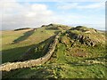
Hadrian's Wall, Cawfield Crags
by
Adrian Taylor
geograph for square
NY7166
Within the Northumberland National Park, Hadrian’s Wall follows the basalt... (
more
)
Tags:
type:
Geograph
Great Whin Sill
Hadrians Wall
ldp:
Hadrians Wall Path
long distance path:
Hadrians Wall Path
Hadrians Wall Path
top:
Historic Sites and Artefacts
national park:
Northumberland
Northumberland
Northumberland National Park
top:
Paths
top:
Uplands
subject:
Wall
Thirlwall Castle
by
Adrian Taylor
geograph for square
NY6566
This medieval Grade I listed fortified tower is beside the Hadrian’s Wall Path... (
more
)
Tags:
subject:
Castle
top:
Derelict, Disused
Fortified Tower House
type:
Geograph
Hadrians Wall
near:
Hadrians Wall
ldp:
Hadrians Wall Path
Hadrians Wall Path
top:
Historic Sites and Artefacts
Medieval Fortified Tower
Northumberland
Northumberland National Park
Pennine Way
ldp:
Pennine Way
Thirlwall Castle
Once Brewed
by
David Dixon
geograph for square
NY7566
Northumberland National Park visitor information centre at Once Brewed.
Tags:
Information Centre
National Park
Northumberland National Park
Northumbria
Tourist Information Centre
top:
Village, Rural Settlement
Visitor Centre
Housesteads Car Park
by
David Dixon
geograph for square
NY7968
The car park at the side of the B6318 is about 10 minutes walk from the... (
more
)
Tags:
Car Park
top:
Historic Sites and Artefacts
Housesteads
Northumberland National Park
top:
Roads, Road Transport
Vercovicium
You are entering Northumberland National Park
by
Russel Wills
geograph for square
NT9403
Approaching Harbottle.
Tags:
Northumberland National Park
top:
Uplands
top:
Woodland, Forest
Hadrian's Wall on Walltown Crags
by
Adrian Taylor
geograph for square
NY6766
West of this point on Walltown Crags Hadrian’s Wall has been quarried away by... (
more
)
Tags:
Dolerite
type:
Geograph
top:
Grassland
Hadrians Wall
long distance path:
Hadrians Wall Path
Hadrians Wall Path
ldp:
Hadrians Wall Path
top:
Historic Sites and Artefacts
National Trail
Northumberland
Northumberland National Park
top:
Rocks, Scree, Cliffs
Roman Wall
Turf
top:
Uplands
subject:
Wall
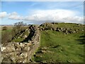
Hadrian's Wall near Thorny Doors
by
Adrian Taylor
geograph for square
NY7266
Hadrian’s Wall follows the basalt escarpment of the Great Whin Sill towards the... (
more
)
Tags:
type:
Geograph
Hadrians Wall
ldp:
Hadrians Wall Path
Hadrians Wall Path
top:
Historic Sites and Artefacts
Northumberland
Northumberland National Park
top:
Paths
subject:
Roman Remains
Roman Wall
top:
Uplands
Stile and Fence on top of Cheviot, Northumberland
by
Andrew Tryon
geograph for square
NT9120
The view facing southeast from the east end of the summit of Cheviot (815 m,... (
more
)
Tags:
Cheviot
England
GB
type:
Geograph
Great Britain
Northumberland National Park
subject:
Summit
UK
top:
Uplands
Hadrian’s Wall on Walltown Crags
by
Adrian Taylor
geograph for square
NY6766
Tags:
top:
Boundary, Barrier
Dolerite
type:
Geograph
Hadrians Wall
ldp:
Hadrians Wall Path
Hadrians Wall Path
top:
Historic Sites and Artefacts
Northumberland
Northumberland National Park
Rock Outcrop
top:
Rocks, Scree, Cliffs
subject:
Roman Remains
Roman Wall
top:
Uplands
Hadrian's Wall on Walltown Crags
by
Adrian Taylor
geograph for square
NY6766
Tags:
top:
Boundary, Barrier
type:
Geograph
Hadrians Wall
ldp:
Hadrians Wall Path
Hadrians Wall Path
Northumberland
Northumberland National Park
top:
Rocks, Scree, Cliffs
Rocky Outcrop
subject:
Roman Remains
Roman Wall
Wall
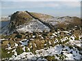
Hadrian’s Wall and Highshield Crags
by
Adrian Taylor
geograph for square
NY7667
Crag Lough is in the left background below the basalt cliff of Highshield Crags.
Tags:
top:
Boundary, Barrier
Crag
Crag Lough
top:
Defence, Military
type:
Geograph
Hadrians Wall
top:
Historic Sites and Artefacts
Northumberland
Northumberland National Park
top:
Rocks, Scree, Cliffs
Roman Wall
Snow
top:
Uplands
subject:
Wall
Youth Hostel and Information Centre, Once Brewed
by
David Dixon
geograph for square
NY7566
Tags:
Hostel
Information Centre
National Park
Northumberland National Park
Northumbria
Tourist Information Centre
top:
Village, Rural Settlement
Visitor Centre
Youth Hostel
B6318 at Housesteads
by
David Dixon
geograph for square
NY7968
Tags:
road:
B6318
Car Park
Housesteads
Northumberland National Park
top:
Roads, Road Transport
Vercovicium
Road to Steel Rigg
by
David Dixon
geograph for square
NY7566
The minor road towards the Steel Rigg car park, from the B6318 at Once Brewed.
Tags:
top:
Moorland
Northumberland National Park
top:
Roads, Road Transport
View more in the Image Search
or
in Browser
View images matching 'Northumberland National Park' anywhere
in
the tags
Don't click these:
PotMel 1
PotMel 2
☰
Home
View
Search
Marked Images
Maps
Browser
Explore
Showcase
New Images
Collections
Interact
Games
Discussions
Blog
Contributors
Submit
Statistics
Leaderboards
General
FAQ
Help Pages
Sitemap
Contact Us
Support Us
sponsored by
🔍︎
What to search:
Photos
Enter keywords or a location/postcode to search nearby images
Enter a Grid Reference
Placenames
Collections
Website Pages
Everything
Others:
Advanced Search
|
Image Browser
Or:
Coverage Map
|
Searchable Map
You are not logged in
|
login
|
register