About tags on Geograph

Public Tags

Related Tags | Coverage Map
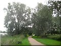
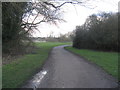
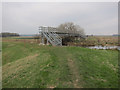
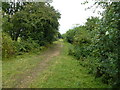
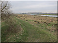
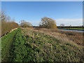
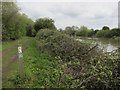
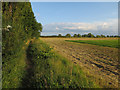
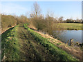
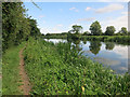
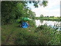
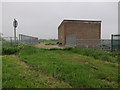
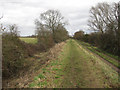
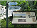
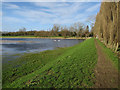
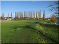
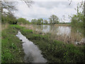
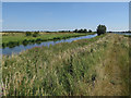
Tag:  Ouse·Valley·Way  
Other tags: ldp:Ouse Valley Way     long distance path:Ouse Valley Way    

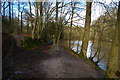
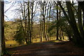
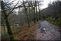
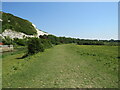
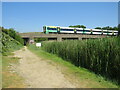
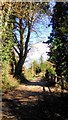
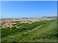
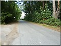
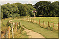
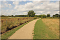
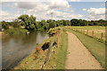
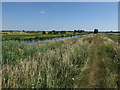
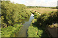
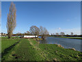
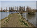
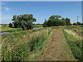
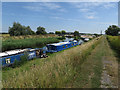
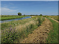
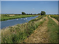
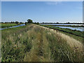
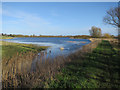
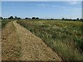
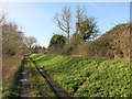
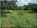
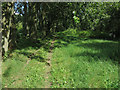
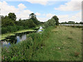
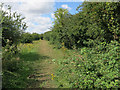
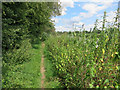
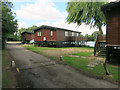
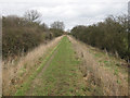
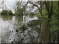
Showing latest 50 of 122 images tagged with Ouse Valley Way tag.

View all tagged images - In Browser
:

TQ2729 : Paths divide by Fish Pond, Nymans Wood by Christopher Hilton Paths divide by Fish Pond, Nymans Wood by Christopher Hilton
geograph for square TQ2729
Climbing up the side valley away from the lake is the Ouse Valley Way.
TQ2729 : Ouse Valley Way dropping towards Fish Pond, Nymans Woods by Christopher Hilton Ouse Valley Way dropping towards Fish Pond, Nymans Woods by Christopher Hilton
geograph for square TQ2729
Tags: Artificial LakeX   Lake (Artificial)X   National Trust LandX   National Trust PropertyX   place:NymansX   ldp:Ouse Valley Way   long distance path:Ouse Valley Way   PathX   top:PathsX   long distance path:Sussex Ouse Valley WayX   subject:TrackX   TrackX   top:Woodland, ForestX   WoodsX  
TQ2729 : Ouse Valley Way along Fish Pond, Nymans Wood by Christopher Hilton Ouse Valley Way along Fish Pond, Nymans Wood by Christopher Hilton
geograph for square TQ2729
Tags: Artificial LakeX   top:Country EstatesX   Lake (Artificial)X   National Trust LandX   National Trust PropertyX   place:NymansX   long distance path:Ouse Valley Way   ldp:Ouse Valley Way   PathX   top:PathsX   long distance path:Sussex Ouse Valley WayX   subject:TrackX   TrackX   top:Woodland, ForestX   WoodsX  
TQ4209 : Sussex Ouse Valley Way near Lewes by Malc McDonald Sussex Ouse Valley Way near Lewes by Malc McDonald
geograph for square TQ4209
This path near Lewes is on the route of the Sussex Ouse Valley Way. The River... (more)
Tags: county:East SussexX   type:GeographX   near:LewesX   river:Ouse (Sussex)X   subject:PathX   top:PathsX   River BankX   River OuseX   river:River OuseX   Sussex Ouse Valley WayX   long distance path:Sussex Ouse Valley WayX  
TQ4209 : Sussex Ouse Valley Way near Lewes by Malc McDonald Sussex Ouse Valley Way near Lewes by Malc McDonald
geograph for square TQ4209
A view of the Sussex Ouse Valley Way near Lewes. A Class 377... (more)
TQ2629 : Sussex Ouse Valley Way near Nymans by PAUL FARMER Sussex Ouse Valley Way near Nymans by PAUL FARMER
geograph for square TQ2629
Tags: top:Boundary, BarrierX   PathX   subject:PathX   top:PathsX   county:SussexX   long distance path:Sussex Ouse Valley WayX  
TV4699 : Looking towards Newhaven from the Vanguard Way by Marathon Looking towards Newhaven from the Vanguard Way by Marathon
geograph for square TV4699
This is at Bishopstone near the end of the Vanguard Way on its way from East... (more)
Tags: BeachX   top:CoastalX   type:GeographX   top:PathsX   long distance path:Sussex Ouse Valley WayX   long distance path:Vanguard WayX  
TQ4122 : Roadside waymarker for the Sussex Ouse Valley Way by Dave Spicer Roadside waymarker for the Sussex Ouse Valley Way by Dave Spicer
geograph for square TQ4122
The path emerges from Rotherfield Wood to the left onto Mill Lane and within a... (more)
Tags: top:PathsX   top:Roads, Road TransportX   long distance path:Sussex Ouse Valley WayX   top:Village, Rural SettlementX  
SP8042 : Wolverton: Ouse Valley Way by Nigel Cox Wolverton: Ouse Valley Way by Nigel Cox
geograph for square SP8042
The Ouse Valley Way is a 229 kilometre or 142 mile long source to sea walk.... (more)
Tags: Long Distance PathX   Ouse Valley Way   subject:PathX   top:PathsX  
SP8850 : The Ouse Valley Way by M J Richardson The Ouse Valley Way by M J Richardson
geograph for square SP8850
The long distance path, 264km [150mile] long, passes through Emberton Country... (more)
Tags: path:FootpathX   type:GeographX   top:LowlandsX   near:Milton KeynesX   near:OlneyX   long distance path:Ouse Valley Way   subject:PathX   top:PathsX   top:Sport, LeisureX   top:Woodland, ForestX  
TL5377 : Footbridge over Braham Dock by Hugh Venables Footbridge over Braham Dock by Hugh Venables
geograph for square TL5377
Carrying the Fen Rivers Way (and Ouse Valley Way) to Ely along the River Great Ouse.
Tags: top:Farm, Fishery, Market GardeningX   long distance path:Fen Rivers WayX   FensX   top:Flat LandscapesX   FootbridgeX   long distance path:Ouse Valley Way   top:PathsX   Public FootpathX   top:Rivers, Streams, DrainageX  
TL2571 : The Ouse Valley Way near Huntingdon by Richard Humphrey The Ouse Valley Way near Huntingdon by Richard Humphrey
geograph for square TL2571
A section of this Long Distance Footpath follows the route of a former railway... (more)
Tags: BushesX   FootpathX   Long Distance FootpathX   long distance path:Ouse Valley Way   subject:PathX   PathX   top:PathsX  
SP7941 : Ouse Valley Way by Richard Croft Ouse Valley Way by Richard Croft
geograph for square SP7941
Long distance footpath and cycleway by the Great River Ouse
Tags: Cycle RouteX   long distance path:Ouse Valley Way   top:PathsX  
SP8142 : Ouse Valley Way by Richard Croft Ouse Valley Way by Richard Croft
geograph for square SP8142
Long distance footpath and cycle route by the Great River Ouse near Wolverton
Tags: Cycle RouteX   top:LowlandsX   long distance path:Ouse Valley Way   top:Park and Public GardensX   top:PathsX  
SP7941 : River Great Ouse by Richard Croft River Great Ouse by Richard Croft
geograph for square SP7941
River Great Ouse and Ouse Valley Way near Wolverton
Tags: long distance path:Ouse Valley Way   top:PathsX   River Great OuseX   top:Rivers, Streams, DrainageX  
TL5072 : Ouse Valley Way by Hugh Venables Ouse Valley Way by Hugh Venables
geograph for square TL5072
Path along the bank of the Great Ouse.
Tags: FensX   long distance path:Ouse Valley Way   top:PathsX   River Great OuseX   top:Rivers, Streams, DrainageX  
SP8041 : River Great Ouse by Richard Croft River Great Ouse by Richard Croft
geograph for square SP8041
River Great Ouse and Ouse Valley Way from Wolverton Iron Trunk Aqueduct... (more)
Tags: Cycle RouteX   top:LowlandsX   long distance path:Ouse Valley Way   top:PathsX   River Great OuseX   top:Rivers, Streams, DrainageX  
TL3874 : Ouse Valley Way by Hugh Venables Ouse Valley Way by Hugh Venables
geograph for square TL3874
With slight flooding by the Great Ouse.
Tags: long distance path:Ouse Valley Way   top:PathsX   River Great OuseX   top:Rivers, Streams, DrainageX  
TL3874 : River Great Ouse bank by Hugh Venables River Great Ouse bank by Hugh Venables
geograph for square TL3874
The Ouse Valley Way follows the raised river bank between the floods.
Tags: top:Lakes, Wetland, BogX   long distance path:Ouse Valley Way   top:PathsX   Public FootpathX   River BankX   River Great OuseX  
TL5173 : Ouse Valley Way by Hugh Venables Ouse Valley Way by Hugh Venables
geograph for square TL5173
Following the bank of the River Great Ouse.
Tags: FensX   long distance path:Ouse Valley Way   top:PathsX   RiverX   River BankX   River Great OuseX   top:Rivers, Streams, DrainageX  
TL5477 : Washland by River Great Ouse by Hugh Venables Washland by River Great Ouse by Hugh Venables
geograph for square TL5477
Area between the river and river bank to give extra storage volume in wet periods.
Tags: long distance path:Fen Rivers WayX   long distance path:Ouse Valley Way   top:PathsX   Public FootpathX   RiverX   River BankX   top:Rivers, Streams, DrainageX   WashlandX  
TL3773 : Ouse Valley Way by Hugh Venables Ouse Valley Way by Hugh Venables
geograph for square TL3773
Following the Great Ouse towards Earith.
Tags: long distance path:Ouse Valley Way   top:PathsX  
TL2064 : Ouse Valley Way by Hugh Venables Ouse Valley Way by Hugh Venables
geograph for square TL2064
TL3874 : Ouse Valley Way by Hugh Venables Ouse Valley Way by Hugh Venables
geograph for square TL3874
Leading to the Great Ouse from Earith. Compare with TL3874 : Footpath to Earith.
Tags: Flood MeadowX   top:GrasslandX   long distance path:Ouse Valley Way   top:PathsX   Public FootpathX  
TL5374 : Ouse Valley Way by Hugh Venables Ouse Valley Way by Hugh Venables
geograph for square TL5374
Approaching the Fish and Duck Marina.
TL5274 : Ouse Valley Way by Hugh Venables Ouse Valley Way by Hugh Venables
geograph for square TL5274
Between the Great Ouse and Shropshire's Reservoir.
Tags: FensX   long distance path:Ouse Valley Way   top:PathsX   RiverX   River BankX   top:Rivers, Streams, DrainageX  
TL5273 : Ouse Valley Way by Hugh Venables Ouse Valley Way by Hugh Venables
geograph for square TL5273
Following the bank of the River Great Ouse.
Tags: FensX   top:Flat LandscapesX   long distance path:Ouse Valley Way   top:PathsX   RiverX   River BankX   top:Rivers, Streams, DrainageX  
TL5072 : Ouse Valley Way by Hugh Venables Ouse Valley Way by Hugh Venables
geograph for square TL5072
The field on the right is flooded as an organic pest control method, the field... (more)
TL3571 : Ouse Valley Way by Hugh Venables Ouse Valley Way by Hugh Venables
geograph for square TL3571
Following the river bank of the Great Ouse.
Tags: BridlewayX   top:GrasslandX   long distance path:Ouse Valley Way   top:PathsX   River BankX  
TL2168 : Ouse Valley Way by Hugh Venables Ouse Valley Way by Hugh Venables
geograph for square TL2168
Along the Great Ouse towards Godmanchester.
Tags: long distance path:Ouse Valley Way   top:PathsX   RiverX   top:Rivers, Streams, DrainageX  
TL2167 : Fishing the Great Ouse by Hugh Venables Fishing the Great Ouse by Hugh Venables
geograph for square TL2167
With the Ouse Valley Way following the river.
Tags: FishingX   long distance path:Ouse Valley Way   top:PathsX   Public FootpathX   RiverX   top:Rivers, Streams, DrainageX   top:Sport, LeisureX  
TL5476 : Pumping station by Hugh Venables Pumping station by Hugh Venables
geograph for square TL5476
Where Soham Lode reaches the River Great Ouse.
Tags: long distance path:Fen Rivers WayX   long distance path:Ouse Valley Way   Public FootpathX   Pumping StationX   top:Rivers, Streams, DrainageX  
TL3470 : Ouse Valley Way by Hugh Venables Ouse Valley Way by Hugh Venables
geograph for square TL3470
Following the riverbank of the River Great Ouse as it starts to go well north of... (more)
Tags: long distance path:Ouse Valley Way   top:PathsX   RiverbankX  
TL3071 : Ouse Valley Way sign by M J Richardson Ouse Valley Way sign by M J Richardson
for square TL3071
A sign for the public footpath along the Thicket to Houghton and Wyton. Also an... (more)
Tags: place:CambridgeshireX   type:Close LookX   Information BoardX   top:LowlandsX   long distance path:Ouse Valley Way   top:PathsX   subject:SignX   place:St IvesX   TreesX   top:Woodland, ForestX  
TL3874 : Ouse Valley Way towards Earith by Hugh Venables Ouse Valley Way towards Earith by Hugh Venables
geograph for square TL3874
Tags: Flood MeadowX   top:Lakes, Wetland, BogX   long distance path:Ouse Valley Way   top:PathsX  
TL3874 : Ouse Valley Way towards Earith by Hugh Venables Ouse Valley Way towards Earith by Hugh Venables
geograph for square TL3874
Tags: Flood MeadowX   long distance path:Ouse Valley Way   top:PathsX  
TL3773 : Ouse Valley Way past Berry Fen by Hugh Venables Ouse Valley Way past Berry Fen by Hugh Venables
geograph for square TL3773
TL5374 : Ouse Valley Way crossing the Fen Line by Hugh Venables Ouse Valley Way crossing the Fen Line by Hugh Venables
geograph for square TL5374
Tags: long distance path:Ouse Valley Way   top:PathsX   top:RailwaysX  
TL5274 : Ouse Valley Way by Hugh Venables Ouse Valley Way by Hugh Venables
geograph for square TL5274
With an area of rank vegetation between the river, railway and Shropshire's... (more)
Tags: long distance path:Ouse Valley Way   top:PathsX   top:RailwaysX  
TL3470 : Ouse Valley Way by Hugh Venables Ouse Valley Way by Hugh Venables
geograph for square TL3470
Following the river bank to Holywell.
Tags: BridlewayX   long distance path:Ouse Valley Way   top:PathsX   River BankX  
TL2672 : Ouse Valley Way by Hugh Venables Ouse Valley Way by Hugh Venables
geograph for square TL2672
Tags: long distance path:Ouse Valley Way   top:PathsX  
TL2572 : Ouse Valley Way by Hugh Venables Ouse Valley Way by Hugh Venables
geograph for square TL2572
Tags: long distance path:Ouse Valley Way   top:PathsX  
TL2571 : Ouse Valley Way by Hugh Venables Ouse Valley Way by Hugh Venables
geograph for square TL2571
Between Cook's Stream and a former gravel pit.
TL2571 : Ouse Valley Way by Hugh Venables Ouse Valley Way by Hugh Venables
geograph for square TL2571
Following a dismantled railway, see TL2571 : Trackbed of former railway east of Godmanchester for more details.
Tags: long distance path:Ouse Valley Way   top:PathsX   Public FootpathX   former:RailwayX   top:RailwaysX  
TL2168 : Ouse Valley Way by Hugh Venables Ouse Valley Way by Hugh Venables
geograph for square TL2168
Heading away from Buckden Marina.
Tags: long distance path:Ouse Valley Way   top:PathsX   RiverX   top:Rivers, Streams, DrainageX  
TL2167 : Ouse Valley Way through Buckden Marina by Hugh Venables Ouse Valley Way through Buckden Marina by Hugh Venables
geograph for square TL2167
Tags: Gravel Pit (Flooded)X   top:Housing, DwellingsX   top:Lakes, Wetland, BogX   MarinaX   long distance path:Ouse Valley Way   top:PathsX  
TL3571 : Ouse Valley Way by Hugh Venables Ouse Valley Way by Hugh Venables
geograph for square TL3571
Bridleway to Overcote Lane and the Pike and Eel pub.
Tags: HedgerowsX   long distance path:Ouse Valley Way   top:PathsX   RiverbankX  
TL2064 : Flooded path by the Great Ouse by Hugh Venables Flooded path by the Great Ouse by Hugh Venables
geograph for square TL2064
TL2064 : Wet footpath along the Great Ouse by Hugh Venables Wet footpath along the Great Ouse by Hugh Venables
geograph for square TL2064
After a very wet spring.
TL5072 : River Great Ouse by Hugh Venables River Great Ouse by Hugh Venables
geograph for square TL5072
Tags: FensX   long distance path:Ouse Valley Way   top:PathsX   River Great OuseX   top:Rivers, Streams, DrainageX  
View more in the Image Search or in Browser
View images matching 'Ouse Valley Way' anywhere in the tags
Don't click these: PotMel 1 PotMel 2
You are not logged in login | register