
|
Ynys Enlli (Bardsey Island) and the Lleyn Peninsula
by Phil Brandon Hunter
for square SH1121
The Lleyn Peninsula (Pen Llŷn) seen across Cardigan Bay (Bae Ceredigion)... (more)
|

|
Moel Hebog from Fairbourne
by Phil Brandon Hunter
for square SH5647
The mountains of Snowdonia National Park [Parc Cenedlaethol Eryri]
viewed from... (more)
|

|
Massif Yr Wyddfa from Fairbourne
by Phil Brandon Hunter
for square SH6115
The seaside town of Barmouth (Y Bermo), situated at the mouth of the River... (more)
|

|
Copa'r Mynydd Drws-y-coed a Y Garn, Eryri
by Phil Brandon Hunter
for square SH5552
The peaks Mynydd Drws-y-coed (695m) and Y Garn (633m) of the Crib Nantlle ridge... (more)
|

|
Yr Wyddfa, Eryri
by Phil Brandon Hunter
for square SH6054
Three peaks of the Yr Wyddfa "horseshoe" ridge of Eryri: Y Lliwedd... (more)
|

|
Yr Wyddfa, Crib Goch and Garnedd Ugain, Eryri
by Phil Brandon Hunter
for square SH6054
Three peaks of the Eryri mountains (l to r) Yr Wyddfa (centre of photo) (1085m),... (more)
|

|
Cwm Dyli Hydroelectric Power Station, Eryri
by Phil Brandon Hunter
for square SH6553
Cwm Dyli hydroelectric power station (built in 1905) at 100m and the pipelines... (more)
|

|
Yr Wyddfa Massif
by Phil Brandon Hunter
for square SH6155
The two highest peaks, Garnedd Ugain (1065m) and Yr Wyddfa (1085m) of the Yr... (more)
|

|
Garnedd Ugain a'r Wyddfa
by Phil Brandon Hunter
for square SH6155
The two highest peaks, Garnedd Ugain (1065m) and Yr Wyddfa (1085m) of the Yr... (more)
|

|
Two Peaks of the Yr Wyddfa Massif.
by Phil Brandon Hunter
for square SH6054
The two highest peaks, Garnedd Ugain (1065m) and Yr Wyddfa (1085m) of the Yr... (more)
|

|
Ochrolechia parella
by Phil Brandon Hunter
for square SH7042
Saucer Lichen (Ochrolechia parella) growing on a drystone wall in temperate... (more)
|

|
Blaenau Ffestiniog 2 Bala 18 milepost
by Phil Brandon Hunter
for square SH7043
Cast-iron milepost on the A470 Caerdydd (Cardiff) to Llandudno road.
Located... (more)
|

|
Craig y Garreg-lwyd
by Phil Brandon Hunter
for square SH7342
Eryri National Park (Snowdonia). View looking south from the Cwt-y-bugail slate... (more)
|

|
Moel Hebog, Eryri
by Phil Brandon Hunter
for square SH5646
Moel Hebog (782m) viewed from the B4418 road to the west of Rhyd-ddu. Ref:PC200078a3.
|

|
Eryri peaks
by Phil Brandon Hunter
for square SH6054
Three peaks of the Yr Wyddfa mountain range: Y Lliwedd (left) (898m), Yr Wyddfa... (more)
|

|
Llyn Gwynant in Nant Gwynant valley, Eryri
by Phil Brandon Hunter
for square SH6452
The Nant Gwynant valley and the Llyn Gwynant lake. Towering to the right is... (more)
|

|
The multiple peaks of Y Lliwedd, Eryri
by Phil Brandon Hunter
for square SH6253
The four peaks of Y Lliwedd (898m, 893m, 807m and 818m), with Yr Wyddfa... (more)
|

|
The Crib Nantlle Ridge from near Beddgelert, Eryri
by Phil Brandon Hunter
for square SH5451
The peaks Trum y Ddysgl (709m), Mynydd Drws-y-coed (695m) and Y Garn (633m) of... (more)
|

|
The Crib Nantlle Ridge from near Beddgelert, Eryri
by Phil Brandon Hunter
for square SH5451
The peaks Trum y Ddysgl (709m), Mynydd Drws-y-coed (695m) and Y Garn (633m) of... (more)
|

|
Mynydd Drws-y-coed, Y Garn and Mynydd Mawr, Eryri
by Phil Brandon Hunter
for square SH5552
The peaks Mynydd Drws-y-coed (695m), Y Garn (633m) of the Crib Nantlle ridge,... (more)
|

|
Bryn Gwyn and the Craig y Bera Cliffs, Eryri
by Phil Brandon Hunter
for square SH5553
Bryn Gwyn (291m), in front of the Craig y Bera Cliffs of Mynydd Mawr (698m),... (more)
|

|
Craig y Bera cliffs, Eryri
by Phil Brandon Hunter
for square SH5454
The Craig y Bera cliffs above the Dyffryn Nantlle valley. Ref:PC200077.
|

|
Dyffryn Nantlle, Eryri
by Phil Brandon Hunter
for square SH5353
Clogwyn y Barcut (438m), the Dyffryn Nantlle valley and the Craig y Bera cliffs.... (more)
|

|
The Crib Nantlle Ridge, Eryri
by Phil Brandon Hunter
for square SH5451
Four peaks Clogwyn y Barcut (438m), Y Garn (633m), Mynydd Drws-y-coed (695m) and... (more)
|
|
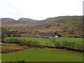
Tal-y-mignedd and Cwmyffynnon, Eryri
by Phil Brandon Hunter
geograph for square SH5253
Tal-y-mignedd Farm, below the peaks Mynydd Drws-y-coed, Trum y Ddysgl and Mynydd... (more)
|

|
Y Moelwynion
by Phil Brandon Hunter
for square SH6847
Y Moelwynion o Llan Ffestiniog, Cymru.
Four peaks of the Moelwyn mountains;... (more)
|

|
Y Moelwynion
by Phil Brandon Hunter
for square SH6544
Y Moelwynion o Llan Ffestiniog, Cymru.
Three peaks of the Moelwyn mountains... (more)
|

|
Llan Ffestiniog
by Phil Brandon Hunter
for square SH7041
The village of Llan Ffestiniog in front of the two peaks (L to R) Manod Bach... (more)
|

|
Yr Moelwyniau
by Phil Brandon Hunter
for square SH6645
Yr Moelwyniau oddi wrth Llan Ffestiniog, Cymru.
Moelwyn mountains viewed from... (more)
|

|
Llyn Gwynant and Moel Hebog
by Phil Brandon Hunter
for square SH6451
The lake Llyn Gwynant, with the peak Moel Hebog of Hebog Ridge in the distance.... (more)
|

|
Nant Gwynant, Moel Ddu and Moel Hebog
by Phil Brandon Hunter
for square SH5646
View of the peak Gallt y Wenallt on far right and the lake Llyn Gwynant, and in... (more)
|

|
Yr Wyddfa and Cwm Dyli Power Station
by Phil Brandon Hunter
for square SH6154
The Cwm Dyli Hydroelectric Power Station of 1905, at the foot of the... (more)
|

|
Cwm Dyli Hydroelectric
by Phil Brandon Hunter
for square SH6553
The Cwm Dyli Hydroelectric Power Station, constructed in 1905, at the foot of... (more)
|

|
Gallt y Wenallt
by Phil Brandon Hunter
for square SH6453
The snow-covered peak Gallt y Wenallt (619 metres above sea level) of the... (more)
|

|
Cwm Dyli Power Station
by Phil Brandon Hunter
for square SH6553
The Cwm Dyli Power Station, constructed in 1905, at the foot of the peaks (l to... (more)
|

|
Yr Wyddfa
by Phil Brandon Hunter
for square SH6153
Cwm Dyli Power Station and the snow-covered peaks Y Lliwedd and Yr Wyddfa of the... (more)
|

|
Yr Wyddfa and the Snowdon Ridge
by Phil Brandon Hunter
for square SH6054
The snow-covered peaks of Yr Wyddfa (Mount Snowdon) and the Snowdon Ridge as... (more)
|

|
Yr Wyddfa
by Phil Brandon Hunter
for square SH6054
Looking east from Llyn Cwellyn to the three peaks of the Snowdon Ridge (Garnedd... (more)
|

|
Minor road near Fairbourne
by Malc McDonald
geograph for square SH6313
A minor road leading to some rural housing on the edge of the Snowdonia National... (more)
|

|
Glasfryn Terrace, near Fairbourne
by Malc McDonald
geograph for square SH6313
Glasfryn Terrace is a row of houses in southern Snowdonia. The road passing is the A493.
|

|
Public footpath near Fairbourne
by Malc McDonald
geograph for square SH6213
A public footpath passes through a kissing gate in southern Snowdonia.
|

|
Footpath and gates near Fairbourne
by Malc McDonald
geograph for square SH6213
This image was taken from a public footpath in southern Snowdonia. The path... (more)
|

|
Public footpath near Fairbourne
by Malc McDonald
geograph for square SH6212
A public footpath in southern Snowdonia. The sea is just visible in the... (more)
|

|
Path near Fairbourne
by Malc McDonald
geograph for square SH6212
A public footpath in the Snowdonia National Park, with a view over a nearby farm.
|

|
Bend on a track near Fairbourne
by Malc McDonald
geograph for square SH6212
A sharp bend on a farm track in the Snowdonia National Park. The track is a... (more)
|

|
Lane and public footpath near Fairbourne
by Malc McDonald
geograph for square SH6212
A public footpath sign to the left of the image indicates that the track through... (more)
|

|
Bend in the lane, near Fairbourne
by Malc McDonald
geograph for square SH6212
A sharp bend in Ffordd Panteinion, a minor lane in the Snowdonia National Park.
|

|
Ffordd Panteinion, near Fairbourne
by Malc McDonald
geograph for square SH6212
Ffordd Panteinion is a minor lane in the Snowdonia National Park. To the left... (more)
|

|
Cottage near Friog
by Malc McDonald
geograph for square SH6212
A cottage in the Snowdonia National Park, near the village of Friog.
The lane... (more)
|

|
A496 near Barmouth
by Malc McDonald
geograph for square SH6316
A view of the A496 road near the seaside town of Barmouth in north Wales. This... (more)
|
