|
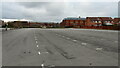
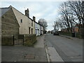
Pudsey Civic Hall Car Park, Farsley
by David Goodall
geograph for square SE2134
A view looking across Pudsey Civic Hall Car Park. Richmond Road and the Lloyds... (more)
|

|
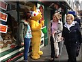
Pudsey at MediaCityUK
by David Dixon
for square SJ8097
"Pudsey Bear is the mascot which fronts the annual BBC Children in Need... (more)
|
|
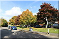
Autumn Trees Outside Pudsey Civic Hall
by David Goodall
geograph for square SE2134
Trees starting to turn to their autumn colours outside Pudsey Civic Hall,... (more)
|
|
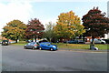
Autumn Trees Outside Pudsey Civic Hall
by David Goodall
geograph for square SE2134
Trees starting to turn to their autumn colours outside Pudsey Civic Hall,... (more)
|
|
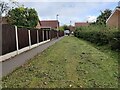
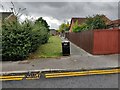
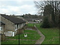
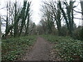
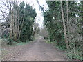
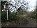
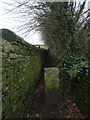
Footpath from Richmond Road to Pudsey Civic Hall, Farsley
by David Goodall
geograph for square SE2134
The view along a public footpath which provides a shortcut from Richmond Road to... (more)
|
|
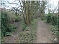
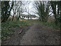
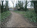
Footpath from Richmond Road to Pudsey Civic Hall, Farsley
by David Goodall
geograph for square SE2134
The view along a public footpath which provides a shortcut from Richmond Road to... (more)
|
|
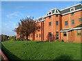
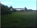
Lloyds Banking Group Pudsey Office near Dawsons Corner, Farsley
by David Goodall
for square SE2134
Photograph showing the signage outside the Lloyds Banking Group Pudsey office... (more)
|
|
Lloyds Banking Group Pudsey Office near Dawsons Corner, Farsley
by David Goodall
geograph for square SE2134
Photograph taken showing the side view of the Lloyds Banking Group Pudsey office... (more)
|
|
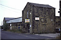
New Street Mills, Pudsey
by Chris Allen
geograph for square SE2232
Built in 1871 by Pudsey Worsted Mill Company, probably as a specialist weaving... (more)
|

|
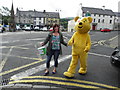
Pudsey visits Northallerton
by Paul Buckingham
for square SE3694
Pudsey outside the town council offices Wednesday 16th November 2011. He was... (more)
|
|
Bungalows, New Street Grove, Pudsey
by Christine Johnstone
geograph for square SE2232
Built on the route of a dismantled railway - the former GNR's Pudsey... (more)
|
|
Parallel paths off South Parade, Pudsey
by Christine Johnstone
geograph for square SE2232
The lower one is a dismantled railway line - the former GNR's Pudsey branch.
|
|
Low railway embankment, Pudsey
by Christine Johnstone
geograph for square SE2233
The former GNR Pudsey branch. It is now a well-used path, but only parts of the... (more)
|
|
Houses in Longfield Court, Pudsey
by Christine Johnstone
geograph for square SE2233
Built on the route of a disused a former railway, the GNR's Pudsey branch.
|
|
Railway path, by Ravens Mount, Pudsey
by Christine Johnstone
geograph for square SE2233
The former GNR Pudsey branch. It is now a well-used path, but only parts of the... (more)
|
|
The southern edge of Pudsey
by Christine Johnstone
geograph for square SE2132
The houses are where streets called Greentop and Fartown meet. These are both... (more)
|
|
Radcliffe Lane railway bridge, Pudsey
by Christine Johnstone
geograph for square SE2232
On the route of the former GNR Pudsey branch. The bridge has been infilled and... (more)
|
|
Lloyds Banking Group Pudsey Office near Dawsons Corner, Farsley
by David Goodall
geograph for square SE2134
The outside of the Lloyds Banking Group office near Dawsons Corner, Farsley.... (more)
|
|
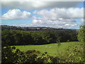
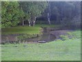
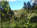
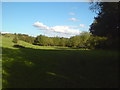
Pastures near Beulah Farm
by Schlosser67
geograph for square SE2432
Woodland along Pudsey Beck in the middle ground, Pudsey town in the background
|
|
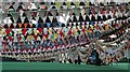
World record 10km of bunting, Malvern
by Bob Embleton
for square SO7842
Bunting for Pudsey.
An attempt to beat the world record for the longest line of... (more)
|

|
Bunting, Three Counties Showground, Malvern
by Bob Embleton
for square SO7842
Bunting for Pudsey.
An attempt to beat the world record for the longest line of... (more)
|
|
Gas pipeline marker, by Sycamore Chase, Pudsey
by Christine Johnstone
geograph for square SE2233
Probably invisible from a passing helicopter.
|
|
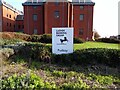
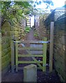
Public footpath, Pudsey
by Christine Johnstone
geograph for square SE2233
Linking Crawshaw Gardens and Robin Lane.
|
|
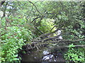
Pudsey Beck, downstream from the bridge
by Schlosser67
geograph for square SE2131
|
|
One of the meanders of Pudsey Beck
by Schlosser67
geograph for square SE2231
Seen from Leeds Country Way
|
|
Giving generously, Ballycastle
by Kenneth Allen
for square D1140
Pudsey Bear with his bucket in Ann Street
|
|
Pudsey on the loose, Ballycastle
by Kenneth Allen
geograph for square D1140
Pictured at The Diamond
|
|
Row of five houses, Greentop, Pudsey
by Christine Johnstone
geograph for square SE2132
These houses are shown on the large-scale OS map surveyed in 1847. Another map... (more)
|
|
Public footpath from Greentop to Bank House
by Christine Johnstone
for square SE2132
On the southern edge of Pudsey. This path is shown on the large scale OS map... (more)
|
|
Woodlands Avenue, seen across a parking lot near New Pudsey station
by Schlosser67
geograph for square SE2134
|
|
Looking across Pudsey Beck towards a house in Troydale
by Schlosser67
geograph for square SE2332
|
|
On Leeds Country Way alongside Pudsey Beck
by Schlosser67
geograph for square SE2331
|
|
Terraced Houses near South Park Farm, Pudsey
by Schlosser67
geograph for square SE2231
|
|
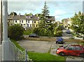
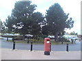
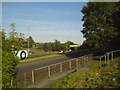
Roundabout and postbox at Owlcotes Centre near Pudsey
by Schlosser67
geograph for square SE2134
|
|
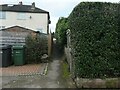
Alleyway off Cemetery Road, Pudsey
by Schlosser67
geograph for square SE2233
|
|
Carlton Terrace, Pudsey
by Schlosser67
geograph for square SE2233
|
|
Brunswick Road, Pudsey
by Schlosser67
geograph for square SE2233
|
|
Stanningley Bypass near Pudsey
by Schlosser67
geograph for square SE2233
|
|
Gate and alleyway behind Roker Lane
by Schlosser67
geograph for square SE2331
|
|
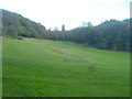
Fulneck golf course
by Schlosser67
geograph for square SE2231
|
|
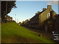
The Terrace, Fulneck Moravian Settlement
by Schlosser67
geograph for square SE2231
This row of buildings contains part of Fulneck School.
|
|
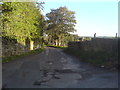
Hare Lane, Fulneck
by Schlosser67
geograph for square SE2232
|
|
Houses in Littlemoor Road
by Schlosser67
geograph for square SE2232
Near junction of Valley Road
|
|
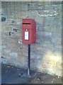
Pole-mounted postbox in Robin Lane near Spinners Chase
by Schlosser67
for square SE2233
|
|
Marks & Spencer, Owlcotes Centre
by Schlosser67
geograph for square SE2134
|
|
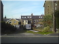
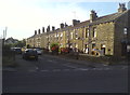
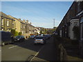
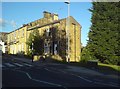
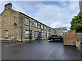
Printworks Row, Stanningley
by David Goodall
geograph for square SE2234
A row of terrace houses near the junction of Printworks Row and Sunfield Place... (more)
|