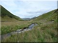
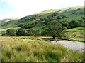
![NY4414 : Rampsgill Beck, looking upstream [south] by Christine Johnstone](https://s3.geograph.org.uk/geophotos/05/93/32/5933255_71169c90_120x120.jpg)
|
Rampsgill Beck, looking upstream [south]
by Christine Johnstone
geograph for square NY4414
Tumbling down from Rampsgill Head.
|
|
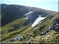
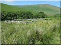
Looking over Rampsgill
by Michael Graham
geograph for square NY4313
Still a few large snow patches in the north east facing gulleys above Rampsgill.
|
|
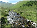
Rampsgill Beck, Ramps Gill
by Christine Johnstone
geograph for square NY4415
Looking upstream [locally south]. This water will form part of Ullswater within... (more)
|
|
Sheep and lamb, Ramps Gill
by Christine Johnstone
geograph for square NY4415
Alongside Rampsgill Beck.
|
|
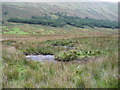
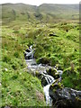
Rampsgill Beck, in Ramps Gill
by Christine Johnstone
geograph for square NY4315
Wiggling northwards, below a small wood.
|
|
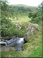
Rampsgill Beck, Ramps Gill
by Christine Johnstone
geograph for square NY4414
Looking downstream [locally north].
|
|
A tributary of Rampsgill Beck
by Christine Johnstone
geograph for square NY4414
Not coming down from the deep gully between High Raise and Raven Howe, but from... (more)
|
|
River cliff showing former route of Rampsgill Beck
by Christine Johnstone
geograph for square NY4415
Looking upstream [locally south].
|
|
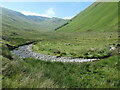
Rampsgill Beck, Martindale
by Christine Johnstone
geograph for square NY4316
With Gowk Hill on the horizon.
|
![NY4316 : A previous course of Rampsgill Beck [possibly] by Christine Johnstone](https://s3.geograph.org.uk/geophotos/04/69/78/4697811_292ed2ab_120x120.jpg)
|
A previous course of Rampsgill Beck [possibly]
by Christine Johnstone
geograph for square NY4316
Running west from the beck's west bank [by the rocks and trees].
|
|
Tree alongside Rampsgill Beck, Martindale
by Christine Johnstone
geograph for square NY4316
Bigger than the ones in Martindale Forest on the hillside beyond.
|
|
Restored sheepfold, Ramps Gill
by Christine Johnstone
geograph for square NY4315
|
|
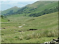
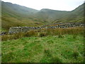
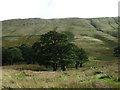
Sheep grazing in Ramps Gill
by Christine Johnstone
geograph for square NY4414
Low density upland sheep farming.
|
|
Rough grazing below woodland in Ramps Gill
by Christine Johnstone
geograph for square NY4415
Two days later all the sheep were shepherded out of this valley.
|
|
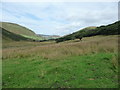
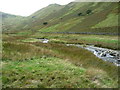
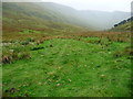
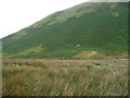
Ramps Gill, looking upstream
by Christine Johnstone
geograph for square NY4414
The four trees on the side of The Nab are mapped as a wood.
|
|
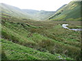
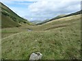
Ramps Gill, looking north
by Christine Johnstone
geograph for square NY4414
The lumpy ground in the valley bottom may be moraine?
|
|
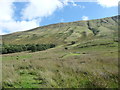
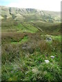
Dry gully below Red Crag
by Christine Johnstone
geograph for square NY4415
On the eastern side of Ramps Gill's U-shaped valley.
|
|
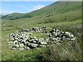
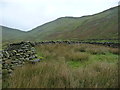
Ruined sheepfold, Ramps Gill
by Christine Johnstone
geograph for square NY4414
The other two in the valley have been fully restored, but this, the smallest, has not.
|
|
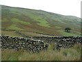
West entrance / exit, complex restored sheepfold, Ramps Gill
by Christine Johnstone
geograph for square NY4314
At the head of the valley. There are several entrances. This sheepfold has been... (more)
|
|
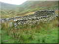
Interior and exterior walling, complex sheepfold, Ramps Gill
by Christine Johnstone
geograph for square NY4314
At the head of the valley. This sheepfold has been beautifully restored sometime... (more)
|
|
South entrance / exit, complex restored sheepfold, Ramps Gill
by Christine Johnstone
geograph for square NY4314
At the head of the valley. There are several entrances. This sheepfold has been... (more)
|
|
Walling within the complex sheepfold, Ramps Gill
by Christine Johnstone
geograph for square NY4314
At the head of the valley. This is an area within the sheepfold that can be... (more)
|
|
Post in the middle of the complex sheepfold, Ramps Gill
by Christine Johnstone
geograph for square NY4314
At the head of the valley. This sheepfold has been beautifully restored sometime... (more)
|
|
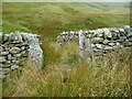
Entrance to the restored complex sheepfold, Ramps Gill
by Christine Johnstone
geograph for square NY4314
At the head of the valley. There are several entrances, this is the northern... (more)
|
|
Where a quad bike turned, in Ramps Gill
by Christine Johnstone
geograph for square NY4314
Earlier the same day, farmers had driven all the sheep out of the valley.
|
|
Faint quad bike tracks in Ramps Gill
by Christine Johnstone
geograph for square NY4415
Earlier the same day, farmers had driven all the sheep out of the valley.
|
|
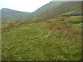
One of the stalkers' paths on the Nab
by Christine Johnstone
geograph for square NY4315
Ascending the eastern side of the hill, from Ramps Gill.
|
|
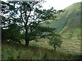
Northern end of woodland in Ramps Gill
by Christine Johnstone
geograph for square NY4415
Part of the Martindale deer forest.
|
|
Woodland below the Nab, in Ramps Gill
by Christine Johnstone
geograph for square NY4415
Part of the Martindale deer forest.
|
|
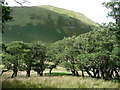
Deciduous wood in Ramps Gill
by Christine Johnstone
geograph for square NY4415
Part of the Martindale deer forest.
|
|
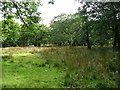
Clearing in the woodland in Ramps Gill
by Christine Johnstone
geograph for square NY4415
Slow-growing trees in wet beck-filled ground.
|
|
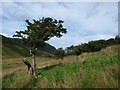
Damaged but surviving in Ramps Gill
by Christine Johnstone
geograph for square NY4415
Lone tree on the western edge of woodland.
|
|
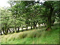
Southern end of woodland in Ramps Gill
by Christine Johnstone
geograph for square NY4415
Part of Martindale deer forest.
|
|
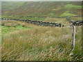
Remains of a drystone wall in Ramps Gill
by Christine Johnstone
geograph for square NY4415
The sheep are enjoying their last few days of freedom before being brought down... (more)
|