
|
Yellow as far as the eye can see
by Steve Fareham
for square SE4105
Looking from the A635 near to Darfield Ring across the Dearne Valley. The... (more)
|

|
Rape Seed Field
by Mike Smith
geograph for square SZ1598
In spring many fields are a blaze of yellow with rape seed. This has become a... (more)
|

|
Crop of rape seed near Horningsea
by Richard Humphrey
geograph for square TL4963
|

|
Path to Risley Lodge Farm
by David Lally
geograph for square SK4537
|

|
Farm field of rape, Methley, Leeds
by I Love Colour
geograph for square SE3725
Farm field with a crop of rape in full flower.
By the side of the M62 motorway... (more)
|

|
Rape Seed Path
by Gordon Griffiths
geograph for square SO8594
The reinstated footpath from Woodford Lane through the Rape Seed towards Trysull Church.
|

|
Grasshill Farm
by Mick Garratt
geograph for square NZ7815
|

|
Early flowering rape seed near Beal
by Steve Fareham
geograph for square NU0642
|

|
Reservoir near Field Barn, Wighton, Norfolk
by Richard Humphrey
geograph for square TF9239
For a view of it under construction in 2007 see Link |

|
Rape seed crop alongside the B1203 near Market Rasen
by Steve Fareham
geograph for square TF1390
|

|
Triangulation point near Lymington
by Malc McDonald
geograph for square SZ2992
A triangulation pillar (or trig point) in a field of rape in south west... (more)
|

|
Footpath through the Crop
by Nigel Mykura
geograph for square SP4647
This footpath through a flowering crop of rapeseed runs from Oxhey Hill just... (more)
|

|
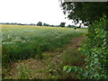
Rape seed fields seen from South Downs Way
by Paul Gillett
geograph for square TQ3906
|
|
Countryside near Bishops Tachbrook
by Nigel Mykura
geograph for square SP3061
Most of the fields in this area are arable wheat or rapeseed. These are just to... (more)
|

|
Amport - Field Of Rape Seed
by Chris Talbot
geograph for square SU2943
A field of the yellow peril with a fine tree raising above it.
|

|
Field meets caravan park
by Martin Dawes
geograph for square TA1969
The Rape Seed field has a large uncultivated margin. The static caravans are in... (more)
|
|
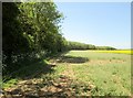
Wide uncultivated field margin alongside Crow Plantation
by Martin Dawes
geograph for square TA1969
Field of Rape Seed
|

|
Corner of Rape Seed field uncultivated
by Martin Dawes
geograph for square TA1970
Fir Tree Park caravan holiday park beyond
|

|
Field edge with large strip uncultivated
by Martin Dawes
geograph for square TA1970
Rape Seed field with Crow Plantation beyond
|

|
Oilseed rape crop near Goosetree Farm on the A605
by Richard Humphrey
geograph for square TF3701
The distant trees are alongside The Counter Drain just south of The Nene Washes.
|

|
A field of oilseed rape near Goosetree Farm
by Richard Humphrey
geograph for square TF3701
A view from a layby on the A605
|

|
Downland near Pickers Hill Farm
by Paul Gillett
geograph for square TQ3903
North of Saltdean, looking NW towards Woodingdean with fields of rape seed in... (more)
|

|
Fields between Tye Green Cressing and old Cressing
by David Morgan
geograph for square TL7821
Public footpath from Braintree road to Ashes road.
Off Braintree Road in Tye... (more)
|

|
Drain west of Goosetree Farm on the A605
by Richard Humphrey
geograph for square TF3701
The South Bank of The Nene Washes forms the horizon
|

|
Public Footpath through Field of Rapeseed
by Mick Garratt
geograph for square NZ1705
Almost impossible to get through. The farmer has made no attempt to leave a path... (more)
|

|
Ash tree in a field of rape
by David Lally
geograph for square SK5629
|

|
Mini roundabout sign and rape field
by David Lally
for square SK5330
At the end of Gypsum Way, Gotham.
|

|
Tree and rape field
by David Lally
geograph for square SK4948
Either beside or beyond New Road.
|

|
Rapeseed Field, near Allhallows
by Chris Whippet
geograph for square TQ8278
|

|
Over Rape field to The Dale
by Martin Dawes
geograph for square SE9042
The Dale comes into the Rape in the centre where the dark green and the bare... (more)
|

|
Farmland between Warmington and Morborne
by Richard Humphrey
geograph for square TL1091
|

|
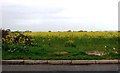
It's not raining!
by Steve Fareham
geograph for square SE4104
View over the rapeseed field damaged by incessant rain. In the distance ASOS warehouse.
|
|
Field of Rape near Pagham
by nick macneill
geograph for square SZ8999
|

|
View from the South Downs Way
by Chris Heaton
geograph for square TQ3708
Looking north east over a field of rape towards the environs of Lewes.
|

|
Field of Rape below Kingston Hill
by Chris Heaton
geograph for square TQ3708
Seen from the South Downs Way, the National Trail describes a semi circle to... (more)
|

|
View towards The Bosom
by Chris Heaton
geograph for square SU7619
"The Bosom" is marked on the Explorer Map at the far end of this field... (more)
|

|
Across the field to Sledmere Grange
by Peter Church
geograph for square SE9662
Category: Farm
This view is through the hedge alongside "York Road", an ancient... (more)
|

|
Disused chalk pit, Sledmere
by Peter Church
geograph for square SE9762
Category: Chalk quarry (disused)
This shallow quarry is seen by travellers along York Road from York to... (more)
|

|
Hereward Way beside the River Nene Old Course
by Chris Heaton
geograph for square TL4699
Following the river south westwards, opposite Stags Holt Wind Farm.
|

|
Signpost near Hewish Farm
by Becky Williamson
for square SY6483
|

|
Over fields to Goodmanham Dale
by Martin Dawes
geograph for square SE9042
From the Yorkshire Wolds Way
|
