Geograph - photograph every grid square
About tags on Geograph
Tags
Geographical Context
Subjects
Types
Other Prefixes
Public Tags
Related Tags
|
Coverage Map
Tag:
Rape·Flower
Showing images tagged with
Rape Flower
tag.
View all tagged images
-
In Browser
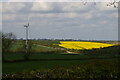
Looking west along Red Lane towards Sternfield
by
Christopher Hilton
geograph for square
TM3961
Tags:
top:
Farm, Fishery, Market Gardening
Field of Oil Seed Rape
Field of Oilseed Rape
Field of Rape
Fields
Fields of Oilseed Rape
Fields of Rape
Flowering Rape
type:
Geograph
Lane
subject:
Lane
Oil Seed Rape
crop:
Oil Seed Rape
Oil Seed Rape in Flower
crops:
Oilseed Rape
crop:
Oilseed Rape
Oilseed Rape
plant:
Oilseed Rape
crop:
Rape
Rape
Rape Crop
Rape Field
Rape Flower
top:
Roads, Road Transport
Looking down on Kelmarsh Wind Farm and the A14
by
Christopher Hilton
geograph for square
SP7278
Tags:
road:
A14
A14
Dual Carriageway
road:
Dual Carriageway
Dual Carriageway Road
top:
Energy Infrastructure
top:
Farm, Fishery, Market Gardening
Field of Oil Seed Rape
Field of Oilseed Rape
Field of Rape
Fields
type:
Geograph
Oil Seed Rape
Oil Seed Rape in Flower
crop:
Oilseed Rape
plant:
Oilseed Rape
Oilseed Rape
Rape
crop:
Rape
Rape Crop
Rape Field
Rape Flower
Rapeseed Crop
Road
top:
Roads, Road Transport
View
subject:
View
View Across Valley
Wind Turbine
Triangulation point near Lymington
by
Malc McDonald
geograph for square
SZ2992
A triangulation pillar (or trig point) in a field of rape in south west... (
more
)
Tags:
top:
Farm, Fishery, Market Gardening
Field of Rape
type:
Geograph
county:
Hampshire
near:
Lymington
OS Triangulation Pillar
crop:
Rape
Rape
Rape Field
Rape Flower
Rape Seed
Triangulation Pillar
Triangulation Point
Trig Point
subject:
Trig Point
Field of rape north of Clayhill Road
by
Christopher Hilton
geograph for square
TM4064
Tags:
top:
Farm, Fishery, Market Gardening
subject:
Field
Field
Field of Oil Seed Rape
Field of Oilseed Rape
Field of Rape
type:
Geograph
crop:
Oil Seed Rape
Oil Seed Rape
plant:
Oilseed Rape
crops:
Oilseed Rape
crop:
Oilseed Rape
Oilseed Rape
crop:
Rape
Rape
Rape Crop
Rape Field
Rape Flower
Oil-seed rape field north of Knodishall
by
Christopher Hilton
geograph for square
TM4262
On the right, the roofs of Leiston Hall Farm peeping over the yellow oil-seed rape.
Tags:
Farm
top:
Farm, Fishery, Market Gardening
subject:
Field
Field
Field of Oilseed Rape
Field of Rape
type:
Geograph
crop:
Oil Seed Rape
Oil Seed Rape
crops:
Oilseed Rape
crop:
Oilseed Rape
Oilseed Rape
Rape
crop:
Rape
Rape Crop
Rape Field
Rape Flower
Clayhill Road
by
Christopher Hilton
geograph for square
TM4064
Tags:
top:
Farm, Fishery, Market Gardening
Field
Field of Oil Seed Rape
Field of Oilseed Rape
Field of Rape
type:
Geograph
subject:
Lane
Lane
crop:
Oil Seed Rape
Oil Seed Rape
crops:
Oilseed Rape
crop:
Oilseed Rape
Oilseed Rape
plant:
Oilseed Rape
Rape
crop:
Rape
Rape Crop
Rape Field
Rape Flower
top:
Roads, Road Transport
Rape flower with flower beetles
by
David Pashley
for square
TG3828
Tags:
type:
Close Look
top:
Farm, Fishery, Market Gardening
subject:
Flower
top:
Lowlands
Rape Flower
top:
Wild Animals, Plants and Mushrooms
View more in the Image Search
or
in Browser
View images matching 'Rape Flower' anywhere
in
the tags
Don't click these:
PotMel 1
PotMel 2
☰
Home
View
Search
Marked Images
Maps
Browser
Explore
Showcase
New Images
Collections
Interact
Games
Discussions
Blog
Contributors
Submit
Statistics
Leaderboards
General
FAQ
Help Pages
Sitemap
Contact Us
Support Us
sponsored by
🔍︎
What to search:
Photos
Enter keywords or a location/postcode to search nearby images
Enter a Grid Reference
Placenames
Collections
Website Pages
Everything
Others:
Advanced Search
|
Image Browser
Or:
Coverage Map
|
Searchable Map
You are not logged in
|
login
|
register