
|
Looking down the River Alde from Snape Maltings, at low tide
by Christopher Hilton
geograph for square TM3957
|

|
The meandering River Alde at Sweffling
by Adrian S Pye
geograph for square TM3562
Category: River
... as it makes its way to Aldeburgh
|

|
River Alde at Snape Maltings
by Christopher Hilton
geograph for square TM3957
|
|
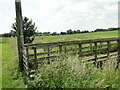
Footbridge over the River Alde
by Adrian S Pye
geograph for square TM3067
The gated bridge is on a public footpath
|

|
The River Alde just visible at Badingham
by Adrian S Pye
geograph for square TM3067
|

|
Panoramic view of the River Alde at Benhall
by Adrian S Pye
geograph for square TM3562
Category: River scene
|

|
View of the River Alde and marshes
by Adrian S Pye
geograph for square TM3561
Category: River scene
|
|
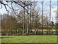
The River Alde meandering through the trees
by Adrian S Pye
geograph for square TM3561
Category: River
|

|
Swirling waters of the River Alde at Sweffling
by Adrian S Pye
geograph for square TM3563
Category: River
|

|
Long Reach
by Adrian S Pye
geograph for square TM3957
Category: River
The River Alde as it joins the western end of Long Reach from the footpath.
|

|
Low tide at Snape Maltings quayside
by Christopher Hilton
geograph for square TM3957
The barge moored at the quayside, the Alkmaar, is used as a holiday let.
|

|
Looking down the River Alde from Snape Maltings
by Christopher Hilton
geograph for square TM3957
|

|
River Alde from the bridge at Sweffling
by Christopher Hilton
geograph for square TM3563
The view upriver towards Rendham.
|

|
River Alde, downstream of Snape Maltings
by Christopher Hilton
geograph for square TM3957
|

|
Flooding in the valley of the River Alde, Stratford St Andrew
by Christopher Hilton
geograph for square TM3560
The rivers in the area all had high water levels as a result of the storm that... (more)
|

|
River Alde at Snape Maltings
by Christopher Hilton
geograph for square TM3957
|

|
Looking down the River Alde at Snape Maltings
by Christopher Hilton
geograph for square TM3957
|

|
Langham Bridge over the River Alde
by Adrian S Pye
geograph for square TM3758
|

|
The River Alde at Langham Bridge
by Adrian S Pye
geograph for square TM3758
|

|
The River Alde at Langham Bridge
by Adrian S Pye
geograph for square TM3758
A gentle stream making its way to the sea.
|

|
Panoramic view of the River Alde at Benhall
by Adrian S Pye
geograph for square TM3562
Category: Marshland
|

|
Dead tree lying beside the River Alde at Benhall
by Adrian S Pye
geograph for square TM3561
Category: Dead tree
|
|
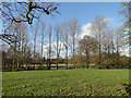
The River Alde behind the poplar trees at Benhall
by Adrian S Pye
geograph for square TM3561
Category: Country scene
|

|
Road bridge over the River Alde and footbridge
by Adrian S Pye
geograph for square TM3166
Category: Bridge
... for when it floods.
|

|
River Alde upstream of Stratford St Andrew
by Christopher Hilton
geograph for square TM3561
|

|
High tide from the quay at Snape Maltings
by Christopher Hilton
geograph for square TM3957
|

|
River Alde at Snape Maltings
by Christopher Hilton
geograph for square TM3957
|

|
River Alde downstream of Snape
by Christopher Hilton
geograph for square TM3957
The wide area of muddy marsh on the far side of the river was, until the... (more)
|

|
Snape Maltings, the quayside
by Christopher Hilton
geograph for square TM3957
|
|
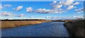
High tide, Snape Maltings
by Christopher Hilton
geograph for square TM3957
|

|
High tide at Snape Maltings quayside
by Christopher Hilton
geograph for square TM3957
|

|
River Alde upstream of Stratford St Andrew
by Christopher Hilton
geograph for square TM3561
|

|
River Alde and Iken church from Iken Cliff
by Christopher Hilton
geograph for square TM4056
In the middle distance, long thin islands mark stretches of former river-wall:... (more)
|

|
Heathland and a view of the River Alde, Aldeburgh Golf Club
by Christopher Hilton
geograph for square TM4457
|

|
Heathland and a view of the River Alde, Aldeburgh Golf Club
by Christopher Hilton
geograph for square TM4457
|

|
Iken church from Troublesome Reach in the River Alde
by Christopher Hilton
for square TM4156
The Alde estuary below Snape was narrowed over the centuries by the reclamation... (more)
|

|
Footpath closure on the river wall, Aldeburgh
by Christopher Hilton
geograph for square TM4555
The path along the River Alde wall is closed whilst work goes on to raise the... (more)
|

|
River Alde, downstream of Snape Maltings, low tide
by Christopher Hilton
geograph for square TM3957
|

|
High tide on the River Alde, Snape Maltings
by Christopher Hilton
geograph for square TM3957
|

|
River Alde at high tide, Snape Maltings
by Christopher Hilton
geograph for square TM3957
Snape village is on the higher ground in the distance, beyond the marshes.
|

|
Looking down the River Alde from Snape Maltings
by Christopher Hilton
geograph for square TM3957
|

|
Footbridge over the River Alde
by Christopher Hilton
geograph for square TM3561
|

|
Watermeadows along the River Alde
by Christopher Hilton
for square TM3563
|

|
Snape Maltings, the quayside
by Christopher Hilton
geograph for square TM3957
|

|
River wall, Aldeburgh
by Christopher Hilton
geograph for square TM4655
The wall here keeps the River Alde out of the marshes that have been reclaimed... (more)
|

|
View onto Orford Ness
by Christopher Hilton
geograph for square TM4654
Taken at the gate into the Orford Ness nature reserve. The widening shingle... (more)
|

|
Saltmarsh, shingle and Martello Tower at Slaughden
by Christopher Hilton
geograph for square TM4654
Taken at the gate into the Orford Ness nature reserve (behind the photographer).... (more)
|

|
Saltmarsh and Martello Tower, Slaughden
by Christopher Hilton
geograph for square TM4654
Taken at the gate into the Orford Ness nature reserve (behind the photographer).... (more)
|

|
Martello Tower, Slaughden
by Christopher Hilton
geograph for square TM4654
Taken on the narrow isthmus that leads to Orford Ness (behind the photographer):... (more)
|

|
Aldeburgh and the River Alde, from the Slaughden Martello Tower
by Christopher Hilton
geograph for square TM4655
|
