Public Tags
Tag: River·Beauly
Other tags: river:River Beauly
Showing images tagged with River Beauly tag.

|
River Beauly
by valenta geograph for square NH5246 Narrow precarious path carved in the snow by the Beauly
Tags:
top:Air, Sky, Weather
place:Beauly
type:Geograph
top:Lowlands
top:Paths
subject:River Bank
river:River Beauly
top:Rivers, Streams, Drainage
subject:Snow
top:Village, Rural Settlement
|
|
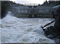
Aigas Power Station
by Craig Wallace geograph for square NH4743 Plenty of water in the river today, it is pouring down the spillway, and... (more)
|
|
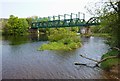
Beauly Viaduct
by Craig Wallace geograph for square NH5245 This bridge carries the Far North Line across the River Beauly. It is about 500m... (more)
Tags:
railway:Far North Line
top:Lowlands
Railway Viaduct
top:Railways
River Beauly
top:Rivers, Streams, Drainage
|

|
Downie fishing hut
by Bill Kasman geograph for square NH4943 This fishing hut and car park can be found on the banks of the River Beauly not... (more)
|

|
River Beauly
by valenta geograph for square NH5143 Angler's boat padlocked to the bank of the Beauly at Groam of Annat
Tags:
type:Geograph
top:Lowlands
subject:River Bank
river:River Beauly
top:Rivers, Streams, Drainage
top:Sport, Leisure
|
|
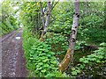
River Beauly
by valenta geograph for square NH5144 Small side flow on the River Beauly, separated from the main river by a small island
Tags:
type:Geograph
top:Lowlands
river:River Beauly
top:Rivers, Streams, Drainage
subject:Riverside
top:Roads, Road Transport
|

|
River Beauly
by valenta for square NH5243 The Beauly is a much-prized salmon river, presumably to stop unauthorized use... (more)
Tags:
type:Cross Grid
top:Lowlands
subject:River
river:River Beauly
top:Rivers, Streams, Drainage
top:Sport, Leisure
top:Woodland, Forest
|

|
Collapsed bridge, on the River Beauly
by Craig Wallace geograph for square NH4140 This footbridge connected to a small wooded island in the River Beauly,... (more)
Tags:
ruin:Footbridge
Island in River
top:Paths
River Beauly
top:Rivers, Streams, Drainage
top:Woodland, Forest
|

|
Track by the River Beauly
by Craig Wallace geograph for square NH5244 The river level was fairly high today.
A couple of power lines cross the river... (more)
Tags:
top:Energy Infrastructure
top:Lowlands
River Beauly
top:Rivers, Streams, Drainage
top:Roads, Road Transport
Track
|

|
River Beauly
by valenta geograph for square NH4844 Looking down on the Beauly by an old Scots pine
Tags:
type:Geograph
top:Lowlands
river:River Beauly
top:Rivers, Streams, Drainage
subject:Riverside
tree:Scots Pine
top:Woodland, Forest
|

|
Fields by the River Beauly
by Craig Wallace geograph for square NH4340 Grassy fields at Knocknashalavaig, by the bank of the River Beauly. A few sheep... (more)
Tags:
top:Farm, Fishery, Market Gardening
Fields
type:Geograph
top:Grassland
Grazing
top:Lowlands
Rainbow
River Beauly
top:Rivers, Streams, Drainage
|
|
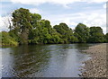
River Beauly, by Lovat Bridge
by Craig Wallace geograph for square NH5145 A short distance downstream from Lovat Bridge, next to Beauly Holiday Park. This... (more)
|

|
Southern end of the Cruives, River Beauly
by Craig Wallace geograph for square NH5043 This is the view from a small island, in the middle of the River Beauly. Looking... (more)
Tags:
Cruive
top:Lowlands
River Beauly
top:Rivers, Streams, Drainage
place:The Cruives
top:Woodland, Forest
|

|
Wide bends in the River Beauly, by Aigas
by Craig Wallace geograph for square NH4540 The river meanders as it flows down the broad, flat strath. A variety of trees... (more)
|

|
River Beauly flowing over the cruives
by Craig Wallace geograph for square NH5043 There was quite a lot of water in the River Beauly today, and it was flowing... (more)
|

|
Black Bridge, Kilmorack
by Craig Wallace geograph for square NH4944 A road bridge across the River Beauly, just downstream from Kilmorack Dam.... (more)
|
|
SEPA gauging station by the River Beauly
by Craig Wallace geograph for square NH4240 This building didn't seem to have any sort of sign on it, but I think it is... (more)
Tags:
Gauging Station
River Beauly
top:Rivers, Streams, Drainage
SEPA
top:Water Resources
top:Woodland, Forest
|

|
Power lines above the River Beauly
by valenta geograph for square NH5144 These power lines radiate out of the nearby Balblair Switching Station,... (more)
Tags:
top:Energy Infrastructure
type:Geograph
Giant Pylons
top:Lowlands
subject:River
river:River Beauly
top:Rivers, Streams, Drainage
top:Sport, Leisure
top:Woodland, Forest
|

|
River Beauly Sunset
by valenta geograph for square NH5246 Tags:
top:Air, Sky, Weather
type:Geograph
top:Lowlands
subject:River
river:River Beauly
top:Rivers, Streams, Drainage
Snow at Sunset
top:Village, Rural Settlement
|

|
River Beauly, near Aigas
by Craig Wallace geograph for square NH4642 This is a short distance downstream from Eilean Aigas. This part of the river is... (more)
|

|
Submerged bridge by the River Beauly
by Craig Wallace geograph for square NH5143 This is usually a nice riverside path, but the river level was quite high today.... (more)
|

|
Path beide the River Beauly
by Bill Harrison geograph for square NH5144 |

|
More trees beside the River Beauly
by Bill Harrison geograph for square NH5144 Tags:
type:Geograph
river:River Beauly
top:Rivers, Streams, Drainage
Riverside Trees
top:Woodland, Forest
|

|
Trees beside the River Beauly
by Bill Harrison geograph for square NH5244 Tags:
type:Geograph
river:River Beauly
top:Rivers, Streams, Drainage
Riverside Trees
top:Woodland, Forest
|

|
Boat on the River Beauly
by Bill Harrison geograph for square NH5143 Tags:
type:Geograph
river:River Beauly
top:Rivers, Streams, Drainage
Rowing Boat
top:Woodland, Forest
|

|
Fishing bothy beside the River Beauly
by Bill Harrison geograph for square NH5043 Tags:
Fishing Bothy
type:Geograph
top:Paths
river:River Beauly
top:Rivers, Streams, Drainage
Riverside Track
top:Sport, Leisure
|

|
Glimpse of Beauly River from near Cruives Lodge
by Bill Harrison geograph for square NH5043 |

|
Trees by the River Beauly
by Craig Wallace for square NH4943 A mixture of trees along the north bank of the river. Plenty of birch and beech,... (more)
Tags:
type:Aerial
Aerial Photograph
quadcopter:DJI Phantom 4 Pro
woodland:Mixed
River Beauly
top:Rivers, Streams, Drainage
Water Level Gauge
top:Woodland, Forest
|

|
Over the River Beauly
by Craig Wallace for square NH5043 A view down the river. The Cruives below, plenty of water flowing over them.... (more)
Tags:
type:Aerial
Aerial Photograph
quadcopter:DJI Phantom 4 Pro
top:Lowlands
River Beauly
top:Rivers, Streams, Drainage
place:The Cruives
top:Woodland, Forest
|

|
Easter Lovat Farmhouse
by valenta for square NH5446 Viewed from the high ground at the Wardlaw Mausoleum, the River Beauly and... (more)
Tags:
type:Cross Grid
top:Farm, Fishery, Market Gardening
Farmhouse
top:Housing, Dwellings
top:Lowlands
river:River Beauly
top:Rivers, Streams, Drainage
Steading
subject:View
top:Woodland, Forest
|

|
River Beauly below Kilmorack Dam
by valenta geograph for square NH4944 Tags:
Dam
top:Energy Infrastructure
type:Geograph
place:Kilmorack
top:Lowlands
subject:River
river:River Beauly
top:Rivers, Streams, Drainage
SSE Hydro
top:Woodland, Forest
|

|
The Black Bridge over the River Beauly
by valenta geograph for square NH4944 Just downstream of the dam and power station complex.
Tags:
top:Energy Infrastructure
type:Geograph
place:Kilmorack
top:Lowlands
river:River Beauly
top:Rivers, Streams, Drainage
subject:Riverside
top:Roads, Road Transport
The Black Bridge
top:Woodland, Forest
|

|
Kilmorack Power Station
by valenta geograph for square NH4944 The River Beauly below the dam and power station
Tags:
top:Energy Infrastructure
type:Geograph
Hydroelectric Power Station
place:Kilmorack
top:Lowlands
subject:Power Station
river:River Beauly
top:Rivers, Streams, Drainage
SSE Power Distribution
|

|
Wood Anemones
by valenta for square NH5243 On the west bank of the River Beauly by Croiche Wood
Tags:
type:Close Look
subject:Flower
top:Lowlands
river:River Beauly
top:Rivers, Streams, Drainage
top:Wild Animals, Plants and Mushrooms
|
|
Path by the River Beauly, Kilmorack
by Craig Wallace geograph for square NH4943 This path runs through rough grassland on the south bank of the river, just... (more)
Tags:
type:Geograph
top:Grassland
place:Kilmorack
top:Paths
River Beauly
top:Rivers, Streams, Drainage
|

|
Power Lines above the River Beauly
by valenta geograph for square NH5144 These power lines radiate out from the massive SSE switching station at Wester Balblair
Tags:
top:Energy Infrastructure
type:Geograph
top:Lowlands
river:River Beauly
top:Rivers, Streams, Drainage
subject:Riverside
SSE Power Distribution
|

|
River Beauly
by valenta geograph for square NH5143 Tags:
type:Geograph
top:Lowlands
river:River Beauly
top:Rivers, Streams, Drainage
top:Sport, Leisure
top:Woodland, Forest
|

|
Private level crossing to Ferry Cottage
by Craig Wallace geograph for square NH5345 This level crossing is on the driveway to Ferry Cottage. Presumably this was... (more)
Tags:
Driveway
railway:Far North Line
Level Crossing
top:Railways
River Beauly
top:Rivers, Streams, Drainage
top:Roads, Road Transport
User-Worked Level Crossing
|
|
Along the Cruives, on the River Beauly
by Craig Wallace geograph for square NH5043 The cruives are a sort of weir or dam to trap passing salmon. There are small... (more)
Tags:
Cruive
Footbridge
Lodge
top:Lowlands
River Beauly
top:Rivers, Streams, Drainage
place:The Cruives
|

|
Black bridge
by Bill Kasman for square NH4944 On the River Beauly just downstream from Kilmorack Power Station.
|

|
Anglers in the River Beauly
by Bill Kasman geograph for square NH4943 These two fly fishermen were a few hundred metres downstream from the Kilmorack... (more)
Tags:
Anglers
Fly Fishing
type:Geograph
Kilmorack Power Station
River Beauly
top:Rivers, Streams, Drainage
top:Sport, Leisure
|

|
Mature Oaks
by valenta geograph for square NH5143 A fine stand of mature oaks mark the fence line beside the River Beauly
Tags:
type:Geograph
top:Grassland
top:Lowlands
tree:Oak
trees:Oak
river:River Beauly
top:Rivers, Streams, Drainage
top:Roads, Road Transport
top:Sport, Leisure
subject:Tree
|
|
The Cruives from above
by Craig Wallace for square NH5043 An aerial view of the Cruives on the River Beauly, on a snowy day. Cruives Lodge... (more)
Tags:
type:Aerial
Aerial Photograph
Cruive
quadcopter:DJI Phantom 3 SE
Lodge
top:Lowlands
River Beauly
top:Rivers, Streams, Drainage
Snow
place:The Cruives
|

|
Protest sign
by Bill Kasman geograph for square NH4944 This sign was affixed to Black Bridge on the River Beauly. It refers to Scottish... (more)
|

|
Old building
by Bill Kasman geograph for square NH4944 Partially hidden by vegetation this derelict hut is on the banks of the River... (more)
Tags:
Car Park
top:Derelict, Disused
type:Geograph
Kiltarlity
Old Building
River Beauly
top:Roads, Road Transport
|

|
Angler in the River Beauly
by Bill Kasman geograph for square NH4944 The building is Kilmorack Power Station.
|

|
View of mansion on Eilean Aigas
by Craig Wallace geograph for square NH4742 Eilean Aigas is an island in the River Beauly.
I don't think this mansion... (more)
Tags:
top:Country Estates
place:Eilean Aigas
top:Grassland
top:Housing, Dwellings
top:Islands
Mansion
River Beauly
top:Woodland, Forest
|

|
Lovat Bridge
by Bill Harrison geograph for square NH5144 This fine bridge was designed by Thomas Telford and is A-listed:... (more)
Tags:
road:A862
Arched Bridge
type:Geograph
top:People, Events
river:River Beauly
top:Rivers, Streams, Drainage
top:Roads, Road Transport
engineer:Thomas Telford
|

|
Kilmorack Dam Spillway
by valenta geograph for square NH4944 The other end of the spillway gate on the dam NH4944 : Kilmorack Dam Spillway
Tags:
top:Energy Infrastructure
type:Geograph
place:Kilmorack
top:Lowlands
river:River Beauly
top:Rivers, Streams, Drainage
subject:Spillway
SSE Hydro
|
