Public Tags
Tag: River·Tees
Showing latest 50 of 94 images tagged with River Tees tag.
|
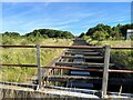
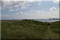
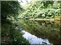
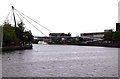
Old River Tees
by Adrian Taylor geograph for square NZ4618 Tidal at this point, narrowed and heavily constrained by concrete retaining... (more)
Tags:
ChannelX
top:Flat LandscapesX
type:GeographX
Old River ChannelX
Railway BridgeX
subject:RiverX
River Tees
top:Rivers, Streams, DrainageX
river:TeesX
Tees Marshalling YardX
Tees YardX
place:Thornaby-on-TeesX
TidalX
Tidal ChannelX
|
|
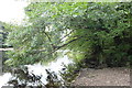
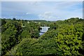
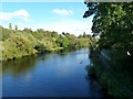
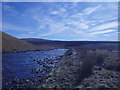
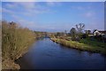
Downstream from the banks of the Tees
by Bob Harvey geograph for square NZ0615 |
|
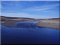
The River Tees, looking upstream
by Bob Harvey geograph for square NZ0615 |
|
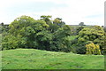
The river valley
by Bob Harvey geograph for square NZ0615 The Tree-lined valley of the Tees looking over the tip of the Abbey site
Tags:
Egglestone AbbeyX
type:GeographX
top:Historic Sites and ArtefactsX
River Tees
top:Rivers, Streams, DrainageX
top:UplandsX
subject:ValleyX
|
|
|
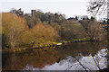
Egglestone Abbey in the landscape
by Bob Harvey geograph for square NZ0615 This is a panorama with the ruins of Egglestone Abbey at the centre. It is... (more)
|
|
The valley of the Tees
by Bob Harvey geograph for square NZ0416 The view from NZ0416 : Barnard Castle: the window of the great chamber
Tags:
Barnard CastleX
type:GeographX
subject:RiverX
River Tees
top:Rivers, Streams, DrainageX
top:UplandsX
|
|
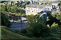
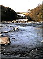
Tees Bridge from the castle
by Bob Harvey geograph for square NZ0416 Member Stanley Howe wrote of an earlier photo of this bridge "The river was... (more)
Tags:
subject:BridgeX
type:GeographX
River Tees
top:Rivers, Streams, DrainageX
top:Roads, Road TransportX
top:UplandsX
|
|
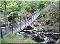
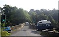
Wynch Bridge
by Adrian Taylor geograph for square NY9027 This suspension bridge crosses the River Tees below Low Force and carries a... (more)
Tags:
subject:BridgeX
type:GeographX
top:Historic Sites and ArtefactsX
Low ForceX
top:PathsX
Public FootpathX
River Tees
top:Rivers, Streams, DrainageX
Suspension BridgeX
Suspension FootbridgeX
river:TeesX
TeesdaleX
|

|
Downstream River Tees, Whorlton Bridge (1971)
by Stanley Howe geograph for square NZ1014 Confluence of Whorlton beck with the River Tees occurs at the far reach (L) of... (more)
Tags:
postcode area:DL12X
type:GeographX
LidoX
subject:RiverX
River Tees
top:Rivers, Streams, DrainageX
top:Roads, Road TransportX
top:Sport, LeisureX
place:WhorltonX
|
|
|
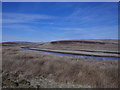
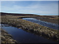
An Ancient flood plain
by Bob Harvey for square NZ0614 Before the Tees cut its present steep sided valley here, it created a wide flood... (more)
Tags:
type:Cross GridX
top:Farm, Fishery, Market GardeningX
Glacial Meltwater ChannelX
Glacial TerraceX
River Tees
top:Rivers, Streams, DrainageX
top:UplandsX
subject:ValleyX
|
|
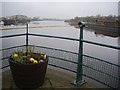
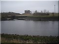
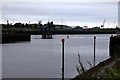
Flower Tub at Tees Barrage
by Stanley Howe geograph for square NZ4619 At the eastern tip of the north pier. Upstream the arches of The Infinity... (more)
Tags:
River Tees
top:Rivers, Streams, DrainageX
place:StocktonX
top:Suburb, Urban FringeX
Tees BarrageX
|
|
Upstream River Tees
by Stanley Howe geograph for square NZ4619 From the north pier of the Tees Barrage. The boom is to keep flotsam away from... (more)
Tags:
BoomX
River Tees
top:Rivers, Streams, DrainageX
place:StocktonX
top:Suburb, Urban FringeX
Tees BarrageX
|
|
Confluence of the Old Tees with the new cut
by Stanley Howe geograph for square NZ4619 Seen across the present day waterway from the Teesside White Water Course. The... (more)
Tags:
River Tees
Rivers ConfluenceX
top:Rivers, Streams, DrainageX
place:StocktonX
top:Suburb, Urban FringeX
|

|
Downstream River Tees
by Stanley Howe geograph for square NZ4619 From the Tees Barrage area, past the Portrack Marshes and Maze Park (left and... (more)
Tags:
River Tees
top:Rivers, Streams, DrainageX
place:StocktonX
top:Suburb, Urban FringeX
Tees BarrageX
|
|
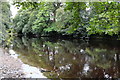
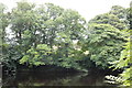
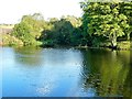
Tree lined river
by Bob Harvey geograph for square NZ0615 |
|
River Tees, Yarm
by Paul Buckingham geograph for square NZ4113 View of River Tees looking downstream, from Yarm bridge
|
|
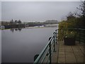
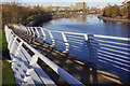
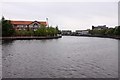
River Tees, Stockton-on-Tees
by Stephen McKay geograph for square NZ4418 The ramp in the foreground connects to the Teesquay Millennium Footbridge.
Tags:
FootbridgeX
type:GeographX
top:PathsX
subject:RiverX
River Tees
top:Rivers, Streams, DrainageX
|
|
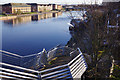
River Tees, Stockton-on-Tees
by Stephen McKay geograph for square NZ4418 Looking upstream towards Victoria Bridge; the structure in the foreground is... (more)
Tags:
BridgeX
top:City, Town CentreX
type:GeographX
subject:RiverX
River Tees
top:Rivers, Streams, DrainageX
|
|
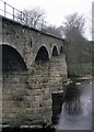
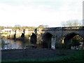
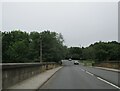
West Tees Bridge, Gainford (1971)
by Stanley Howe for square NZ1517 Upstream face of a former railway bridge over the River Tees.
Tags:
subject:BridgeX
Bridge Over RiverX
type:Close LookX
postcode area:DL2X
Railway Bridge (Former)X
top:RailwaysX
River Tees
top:Rivers, Streams, DrainageX
|
|
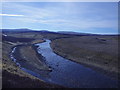
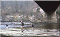
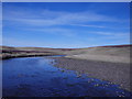
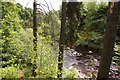
River Tees
by Michael Graham geograph for square NY7633 Approaching Troutbeck Foot. The river and its feeders are full of small trout.... (more)
|
|
Bridge over the River Tees
by Maigheach-gheal geograph for square NZ2809 The bridge over River Tees probably dates from the 15th century. It was... (more)
|
|
River Tees
by Michael Graham geograph for square NY7732 The banks are pathless and rarely trod but the Tees is delightful. The area has... (more)
|
|
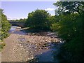
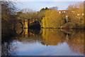
Confluence of Hudeshope Beck and River Tees
by Paul Buckingham geograph for square NY9425 The main bridge over the Tees at Middleton in Teesdale is in the background
|

|
Windows 10: the first customer reviews are in
by Christopher Hilton geograph for square NZ5328 Taken on North Gare Sands, where across the river Redcar steelworks dominates... (more)
Tags:
BeachX
subject:BeachX
top:CoastalX
ComputerX
top:Estuary, MarineX
top:IndustryX
LaptopX
Mouth of the TeesX
River Tees
SteelworksX
river:TeesX
WasteX
top:Waste, Waste ManagementX
|
|
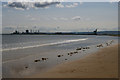
Teesmouth industries, from North Gare Sands
by Christopher Hilton geograph for square NZ5327 On the left, Redcar steel works on the river's south bank; on the right,... (more)
Tags:
BeachX
subject:BeachX
top:CoastalX
top:Defence, MilitaryX
top:Estuary, MarineX
Mouth of the TeesX
River Tees
SteelworksX
river:TeesX
|
|
Path through the dunes, North Gare, Teesmouth
by Christopher Hilton geograph for square NZ5328 Across the river, Redcar steel works looms over the South Gare, with wind... (more)
Tags:
top:CoastalX
Coastal DunesX
DunesX
top:Estuary, MarineX
top:IndustryX
Mouth of the TeesX
River Tees
Sand DunesX
SteelworksX
river:TeesX
Wind TurbinesX
|
|
The Confluence of the River Leven and the River Tees
by Paul Buckingham geograph for square NZ4312 |
|
River Tees, Yarm
by Stephen McKay geograph for square NZ4113 Looking towards Yarm Bridge. Some historical notes about the bridge are given... (more)
Tags:
type:GeographX
subject:RiverX
River BridgeX
River Tees
top:Rivers, Streams, DrainageX
place:YarmX
|
|
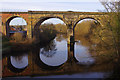
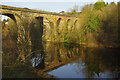
Yarm Viaduct
by Stephen McKay geograph for square NZ4113 Seen here from Yarm Bridge, Yarm Viaduct carries the Northallerton -... (more)
Tags:
type:GeographX
top:RailwaysX
ReflectionX
River Tees
top:Rivers, Streams, DrainageX
subject:ViaductX
|
|
Yarm Viaduct
by Stephen McKay geograph for square NZ4113 Seen here from Yarm Bridge, Yarm Viaduct carries the Northallerton -... (more)
Tags:
type:GeographX
top:RailwaysX
ReflectionX
River Tees
top:Rivers, Streams, DrainageX
subject:ViaductX
|
|
River Tees at Whorlton (1971)
by Stanley Howe geograph for square NZ1014 Underneath the road bridge. The old toll booth can be seen in the centre rear.
Tags:
postcode area:DL12X
type:GeographX
Old Toll HouseX
subject:RiverX
River Tees
River Under Road BridgeX
top:Rivers, Streams, DrainageX
top:Roads, Road TransportX
place:WhorltonX
|
|
River Tees
by Michael Graham geograph for square NY7633 Another grassy island in the River near where Dodgen Pot Sike joins the River
Tags:
IslandX
top:Lakes, Wetland, BogX
top:MoorlandX
River Tees
top:Rivers, Streams, DrainageX
top:UplandsX
|

|
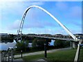
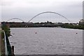
River Tees upstream from the Infinity Bridge
by Eirian Evans geograph for square NZ4519 Tags:
top:City, Town CentreX
type:GeographX
top:PathsX
subject:RiverX
River Tees
top:Rivers, Streams, DrainageX
|
|
Infinity Bridge over the River Tees
by Eirian Evans geograph for square NZ4519 The distinctive curve of this footbridge creates a reflection in the river below... (more)
Tags:
subject:BridgeX
top:City, Town CentreX
FootbridgeX
type:GeographX
top:PathsX
River Tees
top:Rivers, Streams, DrainageX
|
|
River Tees
by Sandy Gerrard geograph for square NZ0714 Tags:
type:GeographX
top:PathsX
subject:RiverX
River Tees
top:Rivers, Streams, DrainageX
top:Woodland, ForestX
|
|
The A67 crossing Yarm Bridge over River Tees northbound
by Martin Dawes geograph for square NZ4113 Pevsner states that it is still the bridge built by Bishop Skirlaw of Durham... (more)
Tags:
A67X
type:GeographX
top:LowlandsX
River Tees
top:Rivers, Streams, DrainageX
Road Bridge Over RiverX
top:Roads, Road TransportX
top:Suburb, Urban FringeX
|
|
River Tees, Yarm
by Stephen McKay geograph for square NZ4113 Looking downstream from Yarm Bridge; the scene is overlooked by the Church of St... (more)
Tags:
Church of St. John the BaptistX
type:GeographX
top:Religious SitesX
subject:RiverX
River Tees
top:Rivers, Streams, DrainageX
|
|
River Tees
by Michael Graham geograph for square NY7733 Looking towards Crookburn Foot from an island in the river
Tags:
top:IslandsX
top:Lakes, Wetland, BogX
top:MoorlandX
River Tees
top:Rivers, Streams, DrainageX
top:UplandsX
|
|
River Tees
by Michael Graham geograph for square NY7732 I was completely blown away by the quiet majesty of the river here. A big... (more)
|
|
River Tees
by Michael Graham geograph for square NY7732 At High Crag Foot. The river gets big very quickly despite being only a few... (more)
|
|
Downstream River Tees (1975)
by Stanley Howe geograph for square NZ1416 Looking towards Winston Bridge (see... (more)
Tags:
place:DarlingtonX
looking:DownstreamX
River Tees
top:Rivers, Streams, DrainageX
Road Bridge Over RiverX
|
|
Downstream River Tees
by Stanley Howe geograph for square NY9923 From Eggleston Bridge.
Tags:
Bridge Over RiverX
looking:DownstreamX
place:EgglestonX
River Tees
top:Rivers, Streams, DrainageX
|
|
Eggleston Bridge
by Stanley Howe geograph for square NY9923 Traffic light control for vehicles crossing the River Tees, on Collingwood Bank... (more)
|
|
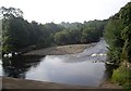
River Tees, Piercebridge
by Paul Buckingham geograph for square NZ2115 The view looking downstream from the road bridge
|

|
The River Tees at High Force
by Steve Daniels geograph for square NY8828 Tags:
River Tees
top:Rivers, Streams, DrainageX
|
|
The River Tees downstream from High Force
by Steve Daniels geograph for square NY8828 Tags:
River Tees
top:Rivers, Streams, DrainageX
|
|
The River Tees in Stockton
by Steve Daniels geograph for square NZ4419 Tags:
River Tees
top:Rivers, Streams, DrainageX
|
|
The River Tees in Stockton
by Steve Daniels geograph for square NZ4419 |
|
Infinity Bridge over the River Tees
by Steve Daniels for square NZ4519 |
|
The River Tees by Dock Point
by Steve Daniels geograph for square NZ5020 Tags:
River Tees
top:Rivers, Streams, DrainageX
|